world.wikisort.org - Canada
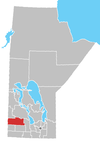
Rosedale is a rural municipality in the province of Manitoba in Western Canada. The southeast corner of Riding Mountain National Park overlaps the northwest corner of the RM, and comprises about one-sixth of Rosedale's territory.[citation needed] The Town of Neepawa borders the municipality.
Rural Municipality of Rosedale | |
|---|---|
Rural municipality | |
 Rural Municipality of Rosedale Location of Rural Municipality of Rosedale in Manitoba | |
| Coordinates: 50°26′23″N 99°32′20″W | |
| Country | Canada |
| Province | Manitoba |
| Area | |
| • Land | 864.55 km2 (333.80 sq mi) |
| Population (2016)[1] | |
| • Total | 1,672 |
| Time zone | UTC-6 (CST) |
| • Summer (DST) | UTC-5 (CDT) |
| Area codes | 204 and 431 |
Communities
- Birnie
- Eden
- Franklin
- Kelwood
- Mountain Road
- Polonia
- Riding Mountain
Demographics
In the 2021 Census of Population conducted by Statistics Canada, Rosedale had a population of 1,524 living in 507 of its 587 total private dwellings, a change of -8.9% from its 2016 population of 1,672. With a land area of 864.68 km2 (333.85 sq mi), it had a population density of 1.8/km2 (4.6/sq mi) in 2021.[2]
Tourism
Mountain Road Hall hosts a spring and fall craft sale[3]
Churches
- Living Hope Fellowship Church – Eden
- Mountainview Church of God – Eden
- Kingdom Hall of Jehovah Witness – Kelwood
- St Johns Anglican Church – Kelwood
- St. Elizabeth's Roman Catholic Church – Polonia
- St. Mary's Ukrainian Catholic Church – Mountain Road (Ukrainian: Церква)
Monuments
- Big Valley School No. 2109
- Birnie Memorial Park
- Birnie Methodist Church
- Clarkesville School No. 1396
- Coldstream School No. 435
- Eden Consolidated School No. 1661
- Franklin School No. 780
- Iroquois School No. 303
- Kelwood Centennial Monument
- Kelwood War Memorial
- Kenilworth School / Riding Mountain School No. 1439
- Knox United Church
- Mountain Road School No. 1432
- Mountain Road Stores
- Mountain View School No. 244
- Patronage of the Blessed Virgin Mary Ukrainian Catholic Church
- Polonia School No. 732
- Riding Mountain War Memorial
- Roskeen School No. 1058
- Springhill Church
- Springhill School No. 374
- Tobarmore School No. 616
References
- "Population and dwelling counts, for Canada, provinces and territories, and census subdivisions (municipalities), 2016 and 2011 censuses – 100% data (Manitoba)". Statistics Canada. February 7, 2018. Retrieved January 15, 2022.
- "Population and dwelling counts: Canada, provinces and territories, and census subdivisions (municipalities), Manitoba". Statistics Canada. February 9, 2022. Retrieved February 20, 2022.
- "Recreation | RM of Rosedale".
External links
- Official website
- Map of Rosedale R.M. at Statcan
- Patronage of the Blessed Virgin Mary Ukrainian Catholic Church (Mountain Road, RM of Rosedale) and Mountain Road Church Fire
Текст в блоке "Читать" взят с сайта "Википедия" и доступен по лицензии Creative Commons Attribution-ShareAlike; в отдельных случаях могут действовать дополнительные условия.
Другой контент может иметь иную лицензию. Перед использованием материалов сайта WikiSort.org внимательно изучите правила лицензирования конкретных элементов наполнения сайта.
Другой контент может иметь иную лицензию. Перед использованием материалов сайта WikiSort.org внимательно изучите правила лицензирования конкретных элементов наполнения сайта.
2019-2025
WikiSort.org - проект по пересортировке и дополнению контента Википедии
WikiSort.org - проект по пересортировке и дополнению контента Википедии
