world.wikisort.org - Canada
The Municipality of Souris – Glenwood is a rural municipality (RM) in the Canadian province of Manitoba.
Souris – Glenwood | |
|---|---|
Rural municipality | |
| Municipality of Souris – Glenwood | |
 Souris – Glenwood Location of Souris – Glenwood in Manitoba | |
| Coordinates: 49°37′15″N 100°15′29″W | |
| Country | Canada |
| Province | Manitoba |
| Incorporated (amalgamated) | January 1, 2015[1] |
| Government | |
| • Mayor | Darryl Jackson |
| • Chief Administrative Officer | Charlotte Parham |
| Area | |
| • Total | 579.69 km2 (223.82 sq mi) |
| Population (2021) | |
| • Total | 2,547 |
| • Density | 4.4/km2 (11/sq mi) |
| Time zone | UTC-6 (CST) |
| • Summer (DST) | UTC-5 (CDT) |
History

The RM was incorporated on January 1, 2015 via the amalgamation of the RM of Glenwood and the Town of Souris.[1] It was formed as a requirement of The Municipal Amalgamations Act, which required that municipalities with a population less than 1,000 amalgamate with one or more neighbouring municipalities by 2015.[2] The Government of Manitoba initiated these amalgamations in order for municipalities to meet the 1997 minimum population requirement of 1,000 to incorporate a municipality.[3]
Demographics
In the 2021 Census of Population conducted by Statistics Canada, Souris-Glenwood had a population of 2,547 living in 1,028 of its 1,128 total private dwellings, a change of -0.6% from its 2016 population of 2,562. With a land area of 579.69 km2 (223.82 sq mi), it had a population density of 4.4/km2 (11.4/sq mi) in 2021.[4]
Attractions
The Souris Sand Hills (49°39′34″N, 100°21′42″W)[5] are located west of Souris and north of Plum Creek on the western side of the municipality of Souris – Glenwood. The sand hills are glacial deposits left from glacial lakes and deltas from the last ice age.[6]
References
- "The Municipal Amalgamations Act (C.C.S.M. c. M235): Rural Municipality of Glenwood and Town of Souris Amalgamation Regulation" (PDF). Government of Manitoba. Retrieved October 4, 2014.
- "The Municipal Amalgamations Act (C.C.S.M. c. M235)". Government of Manitoba. October 2, 2014. Retrieved October 4, 2014.
- "Speech from the Throne: At the Opening of the Second Session of the 40th Legislature of the Province of Manitoba". Government of Manitoba. November 19, 2012. Retrieved October 4, 2014.
- "Population and dwelling counts: Canada, provinces and territories, and census subdivisions (municipalities), Manitoba". Statistics Canada. February 9, 2022. Retrieved February 20, 2022.
- Government of Canada, Natural Resources Canada. "Place names - Souris Sand Hills". www4.rncan.gc.ca.
- "Souris Sand Hills". Mindat.org. Mindat. Retrieved October 31, 2021.
Places adjacent to Municipality of Souris – Glenwood | ||||||||||||||||
|---|---|---|---|---|---|---|---|---|---|---|---|---|---|---|---|---|
| ||||||||||||||||
Division No. 7, Manitoba (Brandon Area) | |||
|---|---|---|---|
| Cities | 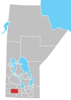 | ||
| Towns |
| ||
| Villages |
| ||
| Rural municipalities |
| ||
| Unincorporated communities |
| ||
| |||
Subdivisions of Manitoba | |||
|---|---|---|---|
| Subdivisions |
| ||
| Cities | |||
| Towns |
| ||
| Villages |
| ||
| Rural municipalities |
| ||
| |||
Другой контент может иметь иную лицензию. Перед использованием материалов сайта WikiSort.org внимательно изучите правила лицензирования конкретных элементов наполнения сайта.
WikiSort.org - проект по пересортировке и дополнению контента Википедии