world.wikisort.org - Canada
The Rural Municipality of St. François Xavier is a rural municipality in Manitoba, Canada, lying west-northwest of Winnipeg. It is part of the Central Plains Region as well as the Winnipeg Metro Region. It had a population of 1,411 in the 2016 census.
St. François Xavier | |
|---|---|
Rural municipality | |
| Rural Municipality of St. François Xavier | |
 The statue of the White Horse describing the legend and the meaning behind the name White Horse Plains. | |
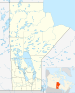 St. François Xavier Location of St. François Xavier in Manitoba | |
| Coordinates: 49°59′25″N 97°40′20″W | |
| Country | Canada |
| Province | Manitoba |
| Region | Central Plains and Winnipeg Metro |
| First settled | 1824 |
| Incorporated as a municipality | February 14, 1880 |
| Founded by | Cuthbert Grant |
| Named for | St François-Xavier |
| Government | |
| • Type | Reeve–council |
| • Reeve | Rick Van Wyk[1] |
| Area | |
| • Land | 204.56 km2 (78.98 sq mi) |
| • Metro | 5,306.79 km2 (2,048.96 sq mi) |
| Elevation | 242 m (794 ft) |
| Population (2016 Census)[2] | |
| • Rural municipality | 1,411 |
| • Density | 6.9/km2 (18/sq mi) |
| • Metro | 778,489 |
| Time zone | UTC-6 (CST) |
| • Summer (DST) | UTC-5 (CDT) |
| Website | rm-stfrancois |
It is home to the community of St. François Xavier, the second oldest settlement in Manitoba.[3]
History
The area around current-day St. François, commonly known as White Horse Plain (named after a local legend; French: La Prairie du Cheval Blanc), was inhabited by First Nations peoples such as the Cree and Sioux.[4] Around 1824, Métis leader Cuthbert Grant received a land grant on White Horse Plain and founded a settlement. He was soon joined by a number of Métis families. The settlement was originally called Grantown.[4][5]
In 1828, the Parish of St. François Xavier (named for St. François-Xavier) was established at White Horse Plain by priests from the mission at Saint-Boniface as the second parish in the North West. The Grantown settlement subsequently took its name from the parish, and St. François Xavier became a municipality in 1880.[5]
The focal point for the municipality was the community of St. François Xavier, which was established in 1824 by Reverend Father Boucher.
The present St. Francois Xavier Roman Catholic Church was designed by former St. Francois Xavier architect Joseph-Azarie Senecal.
The Grey Nuns also had an educational and religious presence in the area for 118 years, ending their involvement in 1968 after their nunnery fell in disrepair.[4]
Demographics
In the 2021 Census of Population conducted by Statistics Canada, St. François Xavier had a population of 1,449 living in 494 of its 514 total private dwellings, a change of 2.7% from its 2016 population of 1,411. With a land area of 205.14 km2 (79.20 sq mi), it had a population density of 7.1/km2 (18.3/sq mi) in 2021.[6]
Notable people
- Cuthbert Grant — a Métis leader
- Pascal Breland — a Métis political leader, landowner, and negotiator
- Patrice Breland — reeve for the RM of St. François Xavier from 1891 to 1892 and from 1895 to 1900
- Pierre Falcon — a Métis songwriter
See also
References
- "Council & Administration". Rural Municipality of St. Francois Xavier. Retrieved November 23, 2021.
- "Population data for Hanover". Statistics Canada. Retrieved February 20, 2017.
- "Rural Municipality of St. François Xavier | Visiting". www.rm-stfrancois.mb.ca. Retrieved 2021-08-13.
- "Rural Municipality of St. François Xavier | About". www.rm-stfrancois.mb.ca. Retrieved 2021-08-13.
- Morton, William. "Memorable Manitobans: Cuthbert James Grant (1793-1854)", Manitoba Historical Society
- "Population and dwelling counts: Canada, provinces and territories, and census subdivisions (municipalities), Manitoba". Statistics Canada. February 9, 2022. Retrieved February 20, 2022.
- R.M. of St. Francois Xavier Community Profile
- Community Profile: St. François Xavier Rural Municipality, Manitoba; Statistics Canada
External links
Places adjacent to Rural Municipality of St. François Xavier | ||||||||||||||||
|---|---|---|---|---|---|---|---|---|---|---|---|---|---|---|---|---|
| ||||||||||||||||
Division No. 10, Manitoba (Whitehorse Plains) | ||
|---|---|---|
| Rural municipalities |  | |
| Unincorporated communities |
| |
| ||
Subdivisions of Manitoba | |||
|---|---|---|---|
| Subdivisions |
| ||
| Cities | |||
| Towns |
| ||
| Villages |
| ||
| Rural municipalities |
| ||
| |||
На других языках
[de] St. François Xavier
St. François Xavier, ursprünglich Grantown, ist eine ländliche Gemeinde am Assiniboine River, westlich von Winnipeg in der kanadischen Provinz Manitoba. 1824 gründete Cuthbert Grant mit einigen anderen Métis-Familien die neue Siedlung Grantown in der als White Horse Plain bekannten Gegend. Schon wenige Jahre nach der Gründung erhielt der Ort den Namen des Schutzheiligen der örtlichen Kirche, Francisco de Xavier. 1870 wurde die Provinz Manitoba gegründet und in ihr St. François Xavier als Gemeinde etabliert. 2006 lebten dort 1087 Einwohner.[1]- [en] Rural Municipality of St. François Xavier
Другой контент может иметь иную лицензию. Перед использованием материалов сайта WikiSort.org внимательно изучите правила лицензирования конкретных элементов наполнения сайта.
WikiSort.org - проект по пересортировке и дополнению контента Википедии