world.wikisort.org - Canada
The Municipality of McCreary is a rural municipality (RM) in the Parkland Region of Manitoba, Canada.
McCreary | |
|---|---|
Rural municipality | |
| Municipality of McCreary | |
| Nickname(s): The Ski and Maple Syrup Capital of Manitoba[1] | |
 McCreary Location of McCreary in Manitoba | |
| Coordinates: 50°44′58″N 99°29′06″W | |
| Country | Canada |
| Province | Manitoba |
| Region | Parkland |
| Census division | No. 17 |
| Incorporated (amalgamated) | January 1, 2015[2] |
| Government | |
| • Reeve | Mike Gawaziuk |
| Elevation | 302 m (991 ft) |
| Time zone | UTC-6 (CST) |
| • Summer (DST) | UTC-5 (CDT) |
| Postal code | R0J 1B0 |
| Website | exploremccreary |
Geographically located between Riding Mountain National Park and Lake Manitoba, the majority of the municipal lands are within the drainage basin of the Turtle River.[3]
It is the self-proclaimed "Ski and Maple Syrup Capital of Manitoba."[1]
History
The RM was incorporated on January 1, 2015 via the amalgamation of the RM of McCreary and the Village of McCreary.[2] It was formed as a requirement of The Municipal Amalgamations Act, which required that municipalities with a population less than 1,000 amalgamate with one or more neighbouring municipalities by 2015.[4] The Government of Manitoba initiated these amalgamations in order for municipalities to meet the 1997 minimum population requirement of 1,000 to incorporate a municipality.[5]
Communities
- Glencairn
- McCreary (unincorporated urban community)
- Norgate
- Reeve
Demographics
In the 2021 Census of Population conducted by Statistics Canada, McCreary had a population of 748 living in 345 of its 396 total private dwellings, a change of -16.1% from its 2016 population of 892. With a land area of 527.77 km2 (203.77 sq mi), it had a population density of 1.4/km2 (3.7/sq mi) in 2021.[6]
References
- "Municipality".
- "The Municipal Amalgamations Act (C.C.S.M. c. M235): Rural Municipality of McCreary and Village of McCreary Amalgamation Regulation" (PDF). Government of Manitoba. Retrieved October 4, 2014.
- "location". exploremccreary.com. Retrieved August 5, 2021.
- "The Municipal Amalgamations Act (C.C.S.M. c. M235)". Government of Manitoba. October 2, 2014. Retrieved October 4, 2014.
- "Speech from the Throne: At the Opening of the Second Session of the 40th Legislature of the Province of Manitoba". Government of Manitoba. November 19, 2012. Retrieved October 4, 2014.
- "Population and dwelling counts: Canada, provinces and territories, and census subdivisions (municipalities), Manitoba". Statistics Canada. February 9, 2022. Retrieved February 20, 2022.
Places adjacent to Municipality of McCreary | ||||||||||||||||
|---|---|---|---|---|---|---|---|---|---|---|---|---|---|---|---|---|
| ||||||||||||||||
Division No. 17, Manitoba (Dauphin Area) | |||
|---|---|---|---|
| Cities | 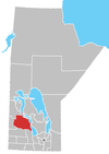 | ||
| Towns |
| ||
| Villages |
| ||
| Rural municipalities |
| ||
| First Nations |
| ||
| Indian reserves |
| ||
| Unorganized areas |
| ||
| Unincorporated communities |
| ||
| |||
Subdivisions of Manitoba | |||
|---|---|---|---|
| Subdivisions |
| ||
| Cities | |||
| Towns |
| ||
| Villages |
| ||
| Rural municipalities |
| ||
| |||
Другой контент может иметь иную лицензию. Перед использованием материалов сайта WikiSort.org внимательно изучите правила лицензирования конкретных элементов наполнения сайта.
WikiSort.org - проект по пересортировке и дополнению контента Википедии