world.wikisort.org - Canada
Paulson is a locality in Manitoba, Canada.[1] It is located 9 kilometres (6 mi) southeast of Dauphin and 186 miles (299 km) northwest of Winnipeg.
Paulson | |
|---|---|
 Paulson Location of Paulson in Manitoba | |
| Coordinates: 51°6′55″N 99°55′58″W[1] | |
| Country | Canada |
| Province | Manitoba |
| Municipality | RM of Dauphin |
| Region | Parkland |
| Elevation | 287 m (942 ft) |
| Time zone | UTC-6 (CST) |
| • Summer (DST) | UTC-5 (CDST) |
| Area code(s) | 204 |
Paulson lies within the Rural Municipality of Dauphin.
Royal Canadian Air Force
RCAF Station Paulson was the site of British Commonwealth Air Training Plan No. 7 Bombing & Gunnery School during World War II.[3]
References
- "Paulson". Geographical Names Data Base. Natural Resources Canada. Retrieved 2012-06-13.
- At geographic coordinates, per Google Earth
- Hatch, F. J. (1983). The Aerodrome of Democracy: Canada and the British Commonwealth Air Training Plan, 1939-1945 (PDF). Ottawa: Directorate of History, Department of National Defence. p. 205. ISBN 0-660-11443-7.
Division No. 17, Manitoba (Dauphin Area) | |||
|---|---|---|---|
| Cities | 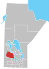 | ||
| Towns |
| ||
| Villages |
| ||
| Rural municipalities |
| ||
| First Nations |
| ||
| Indian reserves |
| ||
| Unorganized areas |
| ||
| Unincorporated communities |
| ||
| |||
Текст в блоке "Читать" взят с сайта "Википедия" и доступен по лицензии Creative Commons Attribution-ShareAlike; в отдельных случаях могут действовать дополнительные условия.
Другой контент может иметь иную лицензию. Перед использованием материалов сайта WikiSort.org внимательно изучите правила лицензирования конкретных элементов наполнения сайта.
Другой контент может иметь иную лицензию. Перед использованием материалов сайта WikiSort.org внимательно изучите правила лицензирования конкретных элементов наполнения сайта.
2019-2026
WikiSort.org - проект по пересортировке и дополнению контента Википедии
WikiSort.org - проект по пересортировке и дополнению контента Википедии