world.wikisort.org - Armenia
Drakhtik (Armenian: Դրախտիկ) is a village in the Gegharkunik Province of Armenia.[2]
Drakhtik
Դրախտիկ | |
|---|---|
 A view of Drakhtik | |
 Drakhtik  Drakhtik | |
| Coordinates: 40°33′54″N 45°14′16″E | |
| Country | Armenia |
| Province | Gegharkunik |
| Municipality | Chambarak |
| Elevation | 1,981 m (6,499 ft) |
| Population (2011)[1] | |
| • Total | 909 |
| Time zone | UTC+4 (AMT) |
| Postal code | 1311 |
| Drakhtik at GEOnet Names Server | |
Etymology
The village was previously known as Tokhluja[3][4] (Azerbaijani: Toxluca;[5] Russian: Тохлуджа;[6][7] Armenian: Թոխլուջա[8]). The current name of the village, Drakhtik, means "little paradise" in Armenian.[5]
History
Drakhtik, then known as Tokhluja, was part of the Nor Bayazet uezd of the Erivan Governorate within the Russian Empire.[6] Bournoutian presents the statistics of the village in the early 20th century as follows:[4]
| Ownership | Treasury |
|---|---|
| Inhabited space | 21 desyatinas (0.34 sq km) |
| Vegetable gardens | 3 desyatinas (0.05 sq km) |
| Irrigated plowed fields | 24 desyatinas (0.39 sq km) |
| Unirrigated plowed fields | 1,156 desyatinas (18.94 sq km) |
| Unirrigated fodder fields | 460 desyatinas (7.54 sq km) |
| Yaylaks | 362 desyatinas (5.93 sq km) |
| Total land | 2,026 desyatinas (33.20 sq km) |
| Total households | 155 (All Tatar (later known as Azerbaijani)) |
| Total income | 7,291 rubles |
| Total land taxes | 1,624.83 rubles |
| Army tax | 255 rubles |
| Upkeep of officials | 526.36 rubles |
| Total revenue | 2,406.19 rubles |
| Large livestock | 1,490 |
| Small livestock | 1,309 |
Economy
The population is engaged in animal husbandry, vegetable growing and grain cultivation.[9]
Demographics
The population of the village since 1829 is as follows:
| Year | Population | Note |
|---|---|---|
| 1829[9] | 296 | |
| 1831[8] | 100% Muslim | |
| 1873[8] | 466 | 100% Tatar (later known as Azerbaijani) |
| 1886[8] | 681 | |
| 1897[8] | 935 | 100% Muslim. 495 men and 440 women.[7] |
| 1904[8] | 1,170 | |
| 1914[8] | 1,373 | Mainly Tatar. Also recorded as 1,285 |
| 1916[8] | 1,330 | |
| 1919[8] | 1,199 | Mainly Turkish |
| 1922[8] | 1,176 | 100% Turkish-Tatar |
| 1926[8] | 1,413 | 1,403 Turks, 5 Armenians, 5 Russians. Also recorded as 1,417[9] |
| 1931[8] | 1,723 | 100% Turkish |
| 1939[9] | 1,840 | |
| 1959[9] | 1,528 | |
| 1970[9] | 2,469 | |
| 1979[9] | 2,664 | |
| 2001[9] | 1,044 | |
| 2004[9] | 871 | |
| 2011[1] | 909 |
Gallery
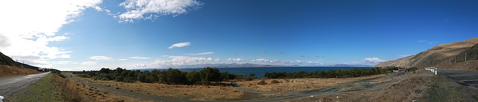 Panorama of Lake Sevan from near Drakhtik.

References
- Statistical Committee of Armenia. "The results of the 2011 Population Census of Armenia" (PDF).
- Kiesling, Brady; Kojian, Raffi (2005). Rediscovering Armenia: Guide (2nd ed.). Yerevan: Matit Graphic Design Studio. p. 83. ISBN 99941-0-121-8.
- Kiesling, Brady (June 2000). "An Archaeological/Touristic Gazetteer and Map Set for the Historical Monuments of Armenia" (PDF). p. 48. Archived (PDF) from the original on 6 November 2021. Retrieved 16 February 2021.
- Bournoutian, George A. (2018). Armenia and Imperial Decline: The Yerevan Province, 1900-1914. Milton Park, Abingdon, Oxon. p. 369. ISBN 978-1-351-06260-2. OCLC 1037283914.
- Nişanyan, Sevan. "Draxtik yerleşimleri". Index Anatolicus (in Turkish). Retrieved 11 October 2022.
- Кавказский календарь на 1910 год [Caucasian calendar for 1910] (in Russian) (65th ed.). Tiflis: Tipografiya kantselyarii Ye.I.V. na Kavkaze, kazenny dom. 1910. p. 382. Archived from the original on 15 March 2022.
- Troinitsky, N. A. (1905). Населенные места Российской империи в 500 и более жителей с указанием всего наличного в них населения и числа жителей преобладающих вероисповеданий, по данным первой всеобщей переписи населения 1897 г. [Populated areas of the Russian Empire with 500 or more inhabitants, indicating the total population in them and the number of inhabitants of the predominant religions, according to the first general population census of 1897.] (in Russian). Saint Petersburg: Tipografiya Obshchestvennaya polza. p. 55. Archived from the original on 10 August 2022.
- Korkotyan, Zaven (1932). Խորհրդային Հայաստանի բնակչությունը վերջին հարյուրամյակում (1831-1931) [The population of Soviet Armenia in the last century (1831-1931)] (PDF) (in Armenian). Yerevan: Pethrat. pp. 30–31, 114–115. Archived from the original (PDF) on 2 February 2022.
- Հայաստանի Հանրապետության բնակավայրերի բառարան [Republic of Armenia settlements dictionary] (PDF) (in Armenian). Yerevan: Cadastre Committee of the Republic of Armenia. 2008. pp. 70–71. Archived from the original (PDF) on 11 March 2018.
External links
- Report of the results of the 2001 Armenian Census, Statistical Committee of Armenia
- Brady Kiesling, Rediscovering Armenia, p. 48; original archived at Archive.org, and current version online on Armeniapedia.org.
Capital: Gavar | ||
| Urban communities |  | |
| Rural communities |
| |
| Non-community settlements | ||
| Abandoned settlements | ||
This article about a location in Gegharkunik Province, Armenia is a stub. You can help Wikipedia by expanding it. |
Другой контент может иметь иную лицензию. Перед использованием материалов сайта WikiSort.org внимательно изучите правила лицензирования конкретных элементов наполнения сайта.
WikiSort.org - проект по пересортировке и дополнению контента Википедии