world.wikisort.org - Armenia
Chambarak (Armenian: Ճամբարակ, lit. 'small camp') is a town and urban municipal community in the Gegharkunik Province of Armenia. Per the 2011 census, the population of the town was 5,850.[1] The munucipal community of Chambarak has a population of 12,416 people.[2] The current Chambarak town was formed by amalgamation of three settlements: Krasnoselsk, Lower Chambarak (Nerkin Chambarak) and Upper Chambarak (Verin Chambarak).[2]
Chambarak
Ճամբարակ | |
|---|---|
 From top left: Khndzorkut Mountain • Chambarak Chapel Chambarak landscape and Mountains Town Panorama • Verin Chambarak | |
 Coat of arms | |
 Chambarak  Chambarak | |
| Coordinates: 40°35′43″N 45°20′51″E | |
| Country | |
| Province | Gegharkunik |
| Municipality | Chambarak |
| Founded | 1830s |
| Area | |
| • Total | 6 km2 (2 sq mi) |
| Population (2011)[1] | |
| • Total | 5,850 |
| • Density | 980/km2 (2,500/sq mi) |
| Time zone | UTC+4 (AMT) |
| Chambarak at GEOnet Names Server | |
Toponymy
The town was known as Mikhaylovka until 1920, Karmir Gyugh between 1920 and 1971, and Krasnoselsk between 1972 and 1991, after which the town has been known as Chambarak. Karmir Gyugh and Krasnoselsk both mean "Red Village" in Armenian and Russian respectively.[3]
History


A settlement existed in the area of Chambarak during the Middle Ages, remains of the 11th-century St. Grigor Church and many khachkars (cross-stones) dating back to the 13th century can be found in the town.
The modern town was founded in 1835-40 as Mikhaylovka on the place of the older Armenian settlement of Chambarak on the Getik River by Russian Molokan immigrants, from the areas of Samara and Saratov of the Russian Empire.[3]
With the sovietization of Armenia in 1920, Mikhaylovka was renamed Karmir Gyugh (Red Village). In December 1937, the Krasnoselsk Raion was formed as an administrative division of the Armenian Soviet Socialist Republic, with the village of Karmir Gyugh as its centre.
In 1971, Karmir Gyugh was enlarged with the merger of the nearby settlements of Verin (upper) and Nerkin (lower) Chambarak, and turned into an urban-type settlement. The following year, the settlement was officially renamed Krasnoselsk.
As the USSR imploded, so the majority of Krasnoselsk's Molokan-Russian population left to return to Russia. Many of their vacated homes were given to IDPs from Artsvashen, an Armenian exclave within Azerbaijan which had been captured by Azerbaijani forces on August 8, 1992.[4] The same year, after the independence of Armenia, Krasnoselsk was renamed Chambarak and became an urban community (municipality).
In 2009, former residents of Artsvashen village, still resident in Chambarak, were promised six billion drams of Armenian government compensation for their lost property. Two payments of 50 million drams then, in 2011, a bigger one of 708 million drams was given out in 2011, with around 2,000 people getting about 360 thousand drams each. However, further payments stalled, leading to protests in September 2018 and December 2019, demanding further funds to repair the dilapidated housing stock in Chambarak. Armenian premier Pashinyan claimed that the state had fulfilled all its obligations to refugees with money already disbursed, and with the provision of housing certificates to about 112 families.[5]
In July 2020, Chambarak became a site for clashes with Azerbaijan.[6]
Economy
The population of Chambarak is mainly involved in agriculture and animal husbandry. It used to have small farms for cheese production. However, in an interview in 2011, ArmeniaNow correspondent Gayane Mkrtchyan interviewed the mayor who said "Agriculture isn't profitable here because the soil is arid, and businesses don't invest because the region is considered to be at risk. It's termed a border zone, but it doesn't get specific privileges".[7]
Gallery
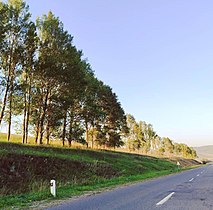 Highway in Chambarak
 Scenery
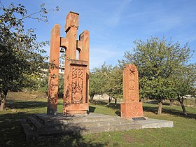 Khachkar monument
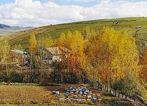 Beekeeping in the town
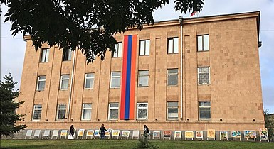 Municipal building in Chambarak


References
- Statistical Committee of Armenia. "2011 Armenia census, Gegharkunik Province" (PDF).
- "Նշված չէ". chambarak.am. Retrieved 2022-09-14.
- Kiesling, Brady; Kojian, Raffi (2005). Gegharkunik Marz. Rediscovering Armenia : an archaeological/touristic gazetteer and map set for the historical monuments of Armenia (2 ed.). Yerevan: Matit. pp. 48–49. ISBN 9994101218.
- ArmInfo report 2019
- Naira Badalian's 2019 article on protests
- Harutyunyan, Sargis; Danielyan, Emil. "Armenia-Azerbaijan Border 'Calm' After Deadly Clashes". azatutyun.am. RFE/RL. Archived from the original on 5 August 2020. Retrieved 5 August 2020.
...the border between Armenia’s northern Tavush province and the Tovuz district in Azerbaijan, the scene of the clashes.
- REF-World article 2011
Capital: Gavar | ||
| Urban communities |  | |
| Rural communities |
| |
| Non-community settlements |
| |
| Abandoned settlements | ||
Cities and towns in Armenia | ||
|---|---|---|
| Aragatsotn |
|   |
| Ararat | ||
| Armavir |
| |
| Gegharkunik | ||
| Kotayk |
| |
| Lori | ||
| Shirak | ||
| Syunik | ||
| Tavush |
| |
| Vayots Dzor |
| |
| Capital city |
| |
This article about a location in Gegharkunik Province, Armenia is a stub. You can help Wikipedia by expanding it. |
На других языках
- [en] Chambarak
[ru] Чамбарак
Чамбара́к (арм. Ճամբարակ) — город в Армении в Гехаркуникской области в верховьях реки Гетик. Расположен в 125 км от Еревана недалеко от границы с Азербайджаном. Через город проходят автомагистрали Берд-Чамбарак и Дилижан-Чамбарак.Другой контент может иметь иную лицензию. Перед использованием материалов сайта WikiSort.org внимательно изучите правила лицензирования конкретных элементов наполнения сайта.
WikiSort.org - проект по пересортировке и дополнению контента Википедии