world.wikisort.org - Armenia
Geghamavan (Armenian: Գեղամավան) is a village in the Gegharkunik Province of Armenia.
Geghamavan
Գեղամավան | |
|---|---|
 A view of Geghamavan and St. Hovhannes Church | |
 Geghamavan  Geghamavan | |
| Coordinates: 40°33′43″N 44°53′15″E | |
| Country | |
| Province | Gegharkunik |
| Founded | 1830s |
| Area | |
| • Total | 29.48 km2 (11.38 sq mi) |
| Elevation | 1,842 m (6,043 ft) |
| Population (2011)[1] | |
| • Total | 1,721 |
| • Density | 58/km2 (150/sq mi) |
| Time zone | UTC+4 (AMT) |
| Postal code | 1507 |
| Geghamavan at GEOnet Names Server | |
History
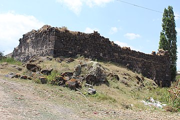
The village was founded in the 1830s by migrants from the Maku region of Persia. There are church/shrine ruins in the eastern part of the village.[2]
Gallery
 St. Hovhannes Church
 Ruined church in Geghamavan
 WWII monument
 Cemetery in Geghamavan


References
- Statistical Committee of Armenia. "The results of the 2011 Population Census of Armenia" (PDF).
- Kiesling, Brady; Kojian, Raffi (2005). Rediscovering Armenia: Guide (2nd ed.). Yerevan: Matit Graphic Design Studio. pp. 74–75. ISBN 99941-0-121-8.
External links
Wikimedia Commons has media related to Geghamavan.
- Report of the results of the 2001 Armenian Census, Statistical Committee of Armenia
- Brady Kiesling, Rediscovering Armenia, p. 41; original archived at Archive.org, and current version online on Armeniapedia.org.
Capital: Gavar | ||
| Urban communities |  | |
| Rural communities |
| |
| Non-community settlements |
| |
| Abandoned settlements | ||
This article about a location in Gegharkunik Province, Armenia is a stub. You can help Wikipedia by expanding it. |
Текст в блоке "Читать" взят с сайта "Википедия" и доступен по лицензии Creative Commons Attribution-ShareAlike; в отдельных случаях могут действовать дополнительные условия.
Другой контент может иметь иную лицензию. Перед использованием материалов сайта WikiSort.org внимательно изучите правила лицензирования конкретных элементов наполнения сайта.
Другой контент может иметь иную лицензию. Перед использованием материалов сайта WikiSort.org внимательно изучите правила лицензирования конкретных элементов наполнения сайта.
2019-2026
WikiSort.org - проект по пересортировке и дополнению контента Википедии
WikiSort.org - проект по пересортировке и дополнению контента Википедии