world.wikisort.org - Armenia
Vardenik (Armenian: Վարդենիկ) is a village in the Gegharkunik Province of Armenia, that sits along the Vardenis River. The cyclopean fort ruins of Kaftarli are located 3 km south of the village, with petroglyphs being present downhill along the bank of the river. Some churches and shrines can be found in the vicinity.[2] The village is the largest rural community in Armenia by population.
Vardenik
Վարդենիկ | |
|---|---|
 The entrance to Vardenik | |
 Vardenik  Vardenik | |
| Coordinates: 40°07′59″N 45°26′12″E | |
| Country | |
| Province | Gegharkunik |
| Founded | 1828-29 |
| Elevation | 1,994 m (6,542 ft) |
| Population (2011)[1] | |
| • Total | 9,880 |
| Time zone | UTC+4 (AMT) |
| Postal code | 1418 |
| Vardenik at GEOnet Names Server | |
Toponymy
The village was previously known as Gezeldara, Nerkin Gezaldara, Gyuzeldara and Nizhnyaya Gezaldara.
History
The village was founded in 1828-29 by emigrants from Mush.[2]
Gallery
 St. Astvatsatsin Church
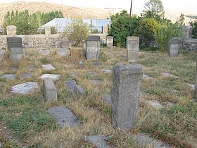 The medieval cemetery of St. Astvatsatsin Church
 Ishkhanavank Church
 Medieval cemetery, Ishkhanavank
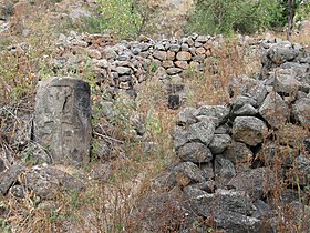 Ruins of the Tsaghkavank Church
 Khachkars
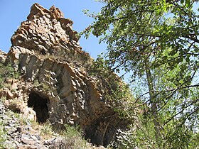 Natural monument "Stone Fortress"


References
- Statistical Committee of Armenia. "The results of the 2011 Population Census of Armenia" (PDF).
- Kiesling, Brady; Kojian, Raffi (2005). Rediscovering Armenia: Guide (2nd ed.). Yerevan: Matit Graphic Design Studio. p. 80. ISBN 99941-0-121-8.
External links
Wikimedia Commons has media related to Vardenik (Armenia).
- Report of the results of the 2001 Armenian Census, Statistical Committee of Armenia
- Brady Kiesling, Rediscovering Armenia, p. 46; original archived at Archive.org, and current version online on Armeniapedia.org.
Capital: Gavar | ||
| Urban communities |  | |
| Rural communities |
| |
| Non-community settlements |
| |
| Abandoned settlements | ||
This article about a location in Gegharkunik Province, Armenia is a stub. You can help Wikipedia by expanding it. |
На других языках
- [en] Vardenik
[ru] Варденик
Варденик (арм. Վարդենիկ) — село в Гехаркуникской области Армении. Расположено в 143 км от Еревана, в 2 км от юго-западного берега озера Севан и в 10 км на восток от Мартуни, на берегах реки Варденис. Крупнейшее село Армении по численности населения.Текст в блоке "Читать" взят с сайта "Википедия" и доступен по лицензии Creative Commons Attribution-ShareAlike; в отдельных случаях могут действовать дополнительные условия.
Другой контент может иметь иную лицензию. Перед использованием материалов сайта WikiSort.org внимательно изучите правила лицензирования конкретных элементов наполнения сайта.
Другой контент может иметь иную лицензию. Перед использованием материалов сайта WikiSort.org внимательно изучите правила лицензирования конкретных элементов наполнения сайта.
2019-2026
WikiSort.org - проект по пересортировке и дополнению контента Википедии
WikiSort.org - проект по пересортировке и дополнению контента Википедии