world.wikisort.org - Turkey
Muş (pronounced [muʃ]; Armenian: Մուշ; Kurdish: Mûş)[3] is a city and the provincial capital of Muş Province in Turkey. Its population is mostly Kurds.[4][5]
Muş
Մուշ | |
|---|---|
Municipality | |
 | |
 Muş | |
| Coordinates: 38°44′00″N 41°29′28″E | |
| Country | Turkey |
| Province | Muş |
| Government | |
| • Mayor | Feyat Asya (AKP) |
| Area | |
| • District | 2,604.14 km2 (1,005.46 sq mi) |
| Elevation | 1,350 m (4,430 ft) |
| Population (2012)[2] | |
| • Urban | 81,764 |
| • District | 179,534 |
| • District density | 69/km2 (180/sq mi) |
| Website | www.mus.bel.tr |
Etymology
Various explanations of the origin of Muş's name exist. Its name is sometimes associated with the Armenian word mshush (Armenian: մշուշ), meaning fog, explained by the fact that the town and the surrounding plain are frequently covered in fog in the mornings.[6] The 17th-century explorer Evliya Çelebi relates a myth where a giant mouse created by Nemrud (Nimrod) destroys the city and its inhabitants, after which the city was named Muş (muš means "mouse" in Persian).[7] Others have proposed a connection with the names of different ancient Anatolian peoples, the Mushki or the Mysians, or the toponyms Mushki and Mushuni mentioned in Assyrian and Hittite sources, respectively.[7][8]
History

Ancient and medieval
The date of foundation of Mush is unknown, although a settlement is believed to have been around by the time of Menua, the king of Urartu (c. 800 BC), whose cuneiform inscription was found in the city's vicinity.[9] During the Middle Ages, Mush was the center of the Taron region of Armenia. It is first mentioned as a city in Armenian manuscripts of the 9th and 10th centuries. In the late 8th century Mush, along with the Taron region, came under control of the Armenian Bagratid (Bagratuni) dynasty, who reconquered it from the Arabs. Mush and the Taron region was captured and annexed to the Byzantine Empire in 969.[10]
After the 11th century, the town was ruled by Islamic dynasties such as the Ahlatshahs, Ayyubids, Ilkhanids and Kara Koyunlu. In the 10th-13th centuries Mush developed into a major city with an estimated population of 20 to 25 thousand people.[11] In 1387 the central Asian ruler Timur crossed the area and apparently captured Mush town without a battle.[12] Later the Akkoyunlu ruled the area and in the 16th the Ottomans took control over the town and region in the 16th century from the Persian Safavids. Mush remained part of the Ottoman Empire till the early 20th century and during these times retained a large Armenian population. In 1821 a Persian invasion reached Mush.[12]


Modern

At the turn of the twentieth century, the city had around 20,000 inhabitants, of which 11,000 were Muslims, while 9,000 were Christian Armenians.[13] According to the Catholic Encyclopedia (1913) the town had 27,000 inhabitants, of whom 13,300 were Muslims and 13,700 Armenians.[14] According to the Encyclopædia Britannica (1911) the population was nearly equally divided between Kurds and Armenians.[15]
During the Armenian genocide of 1915 the indigenous Armenian population of the region was exterminated.[16][17][18] Over 140,000 Armenians of the Mush sanjak (living in 234 villages and towns)[19] were targeted in June and July 1915.[20] Military-aged Armenian men were conscripted to serve in World War I. The Armenian population was largely defenseless to these threats.[21] The massacre of the Armenian population of the city of Mush came only after the surrounding villages were destroyed.[21]
The town was captured during by the forces of the Russian Empire in February 1916 during the World War I.[22]
Demographics
Population of the municipality of Muş numbers 72,774 according to a 2009 estimate.[23] Kurds make up the majority of the population.[4][5] The rest are Arabs[24] and Crypto-Armenians.[25]
Main sights
The area of Muş has several ruined castles. Under the rule of the medieval Armenian dynasties monasteries and churches were built in localities near Mush such as the Arakelots Monastery, Surp Marineh Church, Mush, Surb Karapet Monastery most of which are now ruins.
Under the rule of the Muslim dynasties, other type of buildings were built as well. There are mosques from the Ottoman and pre-Ottoman period which show influences of Seljuk architecture. Mosques like the Alaeddin Bey (18th century),[12] Haci Seref (17th century),[12] and Ulu Mosque (14th century).[12] Caravanserais like the "Yıldızlı Han" (13th century) destroyed in 1916, the now almost completely ruined "Arslanli Han"[12] and also bathhouse and fountain of Alaeddin Bey and tombs of Muslim saints.
Gallery
 Muş Alaeddin Pasha Camii
 Muş Alaeddin Pasha Camii
 Muş Ulu Cami
 Muş Ulu Cami
 Muş Ulu Cami
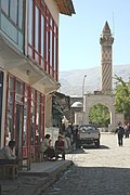 Muş Hacı Şeref Camii
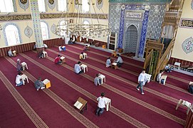 Muş Tuba Camii
 Muş Street scene
 Muş Street scene
 Muş Street scene
 Muş Old house
 Muş Old house
 Muş Hospital
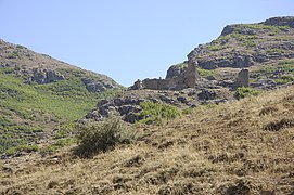 Muş Castle
 Muş Castle
 Muş view


Notable locals
- Armenak Shahmuradyan,[26] Armenian operatic tenor
- Zafer Çağlayan, Turkish politician and former Minister
- Sabahattin Oğlago, four-time Olympian cross-country skier
- Zeki Eker, Turkish politician of Kurdish origin
- Kürşat Duymuş, Turkish football defender
Climate
Muş has a humid continental climate (Köppen climate classification: Dsa, Trewartha climate classification: Dc) with cold, snowy winters and hot, very dry and very sunny summers.
| Climate data for Muş (1991–2020, extremes 1964–2020) | |||||||||||||
|---|---|---|---|---|---|---|---|---|---|---|---|---|---|
| Month | Jan | Feb | Mar | Apr | May | Jun | Jul | Aug | Sep | Oct | Nov | Dec | Year |
| Record high °C (°F) | 10.2 (50.4) |
15.0 (59.0) |
22.8 (73.0) |
30.0 (86.0) |
31.2 (88.2) |
37.4 (99.3) |
41.6 (106.9) |
41.2 (106.2) |
37.0 (98.6) |
30.6 (87.1) |
21.6 (70.9) |
16.0 (60.8) |
41.6 (106.9) |
| Average high °C (°F) | −2.8 (27.0) |
−0.7 (30.7) |
6.8 (44.2) |
15.4 (59.7) |
21.7 (71.1) |
28.3 (82.9) |
33.6 (92.5) |
33.9 (93.0) |
28.6 (83.5) |
20.5 (68.9) |
10.2 (50.4) |
1.0 (33.8) |
16.4 (61.5) |
| Daily mean °C (°F) | −6.5 (20.3) |
−4.9 (23.2) |
2.1 (35.8) |
9.8 (49.6) |
15.1 (59.2) |
20.8 (69.4) |
25.6 (78.1) |
25.7 (78.3) |
20.5 (68.9) |
13.4 (56.1) |
4.9 (40.8) |
−2.4 (27.7) |
10.3 (50.5) |
| Average low °C (°F) | −9.9 (14.2) |
−8.5 (16.7) |
−1.8 (28.8) |
4.9 (40.8) |
9.2 (48.6) |
13.4 (56.1) |
17.8 (64.0) |
17.9 (64.2) |
12.9 (55.2) |
7.6 (45.7) |
0.6 (33.1) |
−5.3 (22.5) |
4.9 (40.8) |
| Record low °C (°F) | −32.6 (−26.7) |
−34.4 (−29.9) |
−31.4 (−24.5) |
−10.2 (13.6) |
−2.4 (27.7) |
2.2 (36.0) |
3.6 (38.5) |
8.0 (46.4) |
0.0 (32.0) |
−3.0 (26.6) |
−25.8 (−14.4) |
−32.0 (−25.6) |
−34.4 (−29.9) |
| Average precipitation mm (inches) | 93.9 (3.70) |
106.0 (4.17) |
112.2 (4.42) |
102.1 (4.02) |
73.9 (2.91) |
28.5 (1.12) |
10.0 (0.39) |
4.8 (0.19) |
17.2 (0.68) |
59.7 (2.35) |
81.6 (3.21) |
92.0 (3.62) |
781.9 (30.78) |
| Average precipitation days | 12.47 | 11.70 | 13.90 | 15.27 | 15.30 | 6.77 | 2.43 | 1.80 | 3.53 | 9.80 | 8.53 | 11.37 | 112.9 |
| Mean monthly sunshine hours | 55.8 | 73.5 | 133.3 | 171.0 | 235.6 | 288.0 | 313.1 | 310.0 | 258.0 | 179.8 | 99.0 | 46.5 | 2,163.6 |
| Mean daily sunshine hours | 1.8 | 2.6 | 4.3 | 5.7 | 7.6 | 9.6 | 10.1 | 10.0 | 8.6 | 5.8 | 3.3 | 1.5 | 5.9 |
| Source: Turkish State Meteorological Service[27] | |||||||||||||
References
- "Area of regions (including lakes), km²". Regional Statistics Database. Turkish Statistical Institute. 2002. Retrieved 2013-03-05.
- "Population of province/district centers and towns/villages by districts - 2012". Address Based Population Registration System (ABPRS) Database. Turkish Statistical Institute. Retrieved 2013-02-27.
- Adem Avcıkıran (2009). Kürtçe Anamnez Anamneza bi Kurmancî (in Turkish and Kurdish). p. 56.
- Saracoglu, Cenk (2010). Kurds of Modern Turkey: Migration, Neoliberalism and Exclusion in Turkish Society. I.B.Tauris. p. 194.
- Tas, Latif (2014). Legal Pluralism in Action: Dispute Resolution and the Kurdish Peace Committee. Ashgate Publishing. p. 33.
- Hakobyan, Tadevos Kh.; Melik-Bakhshyan, Stepan T.; Barseghyan, Hovhannes Kh. (1991). Հայաստանի և հարակից շրջանների տեղանունների բառարան [Dictionary of toponymy of Armenia and adjacent territories] (in Armenian). Vol. 3. Yerevan: Yerevan State University Press. p. 892.
- Petrosyan, Armen (2002), The Indo-European and Ancient Near Eastern Sources of the Armenian Epic, Washington, D.C: Institute for the Study of Man, pp. 140–142, ISBN 9780941694810.
- Hakobyan 1987, p. 198.
- Hakobyan 1987, p. 199.
- Thomas, David Richard (2001). Syrian Christians Under Islam: The First Thousand Years. BRILL. p. 160. ISBN 9789004120556.
- Hakobyan 1987, pp. -199-200.
- Sinclair, T.A. (1989). Eastern Turkey: An Architectural & Archaeological Survey, Volume I. Pindar Press. pp. 293–294–333–335. ISBN 9780907132325.
- Hakobyan 1987, p. 200.
- Herbermann, Charles, ed. (1913). . Catholic Encyclopedia. New York: Robert Appleton Company.
- Chisholm, Hugh, ed. (1911). . Encyclopædia Britannica. Vol. 19 (11th ed.). Cambridge University Press.
- Walker, Christopher J. (1990) [1980]. Armenia: The Survival of a Nation (2nd ed.). New York: St. Martin's Press. pp. 211–212. ISBN 978-0-312-04230-1.
- Dadrian, Vahakn N.; Akçam, Taner (2011). Judgment At Istanbul: The Armenian Genocide Trials. Berghahn Books. p. 37. ISBN 9780857452863.
- Kévorkian 2011, pp. 339–345.
- Kévorkian 2011, p. 345.
- Kévorkian 2011, p. 339.
- Suny, Ronald G. (2015). "They Can Live in the Desert but Nowhere Else": A History of the Armenian Genocide. Princeton University Press. p. 289. ISBN 9781400865581.
- Tucker, Spencer C. (2013-12-16). The European Powers in the First World War: An Encyclopedia. Routledge. p. 175. ISBN 978-1-135-50694-0.
- Adrese Dayalı Nüfus Kayıt Sistemi (ADNKS) Sonuçları Archived 2015-09-20 at the Wayback Machine
- Gündoğdu, Raşit; Demir, Esra (11 April 2014). "The Arabs in Turkey". impr.org. International Middle East Peace Research Center. Archived from the original on 24 September 2015. Retrieved 7 March 2015.
- Gültekin, Uygar (23 September 2014). "Muş Ermenileri derneklerine kavuştu Paylaş". Agos (in Turkish).
- Hakobyan 1987, p. 203.
- "Resmi İstatistikler: İllerimize Ait Mevism Normalleri (1991–2020)" (in Turkish). Turkish State Meteorological Service. Retrieved 2 May 2021.
Sources and external links
- Bibliography
- Hakobyan, Tadevos (1987). "(Mush)". Պատմական Հայաստանի քաղաքները [Cities of historic Armenia] (in Armenian). Yerevan: "Hayastan" Publishing. pp. 196–203.
- Kévorkian, Raymond H. (2011). The Armenian Genocide: A Complete History. London: I. B. Tauris. ISBN 9781848855618.
Muş in Muş Province of Turkey | |||||||||||||||||||||||||||
|---|---|---|---|---|---|---|---|---|---|---|---|---|---|---|---|---|---|---|---|---|---|---|---|---|---|---|---|
| Districts |   | ||||||||||||||||||||||||||
|
Metropolitan municipalities are bolded. | |||||||||||||||||||||||||||
Authority control | |
|---|---|
| General | |
| National libraries | |
На других языках
[de] Muş
Muş (armenisch Մուշ .mw-parser-output .Latn{font-family:"Akzidenz Grotesk","Arial","Avant Garde Gothic","Calibri","Futura","Geneva","Gill Sans","Helvetica","Lucida Grande","Lucida Sans Unicode","Lucida Grande","Stone Sans","Tahoma","Trebuchet","Univers","Verdana"}Musch; kurdisch Mûş) ist eine türkische Stadt und Hauptort des gleichnamigen Landkreises (İlçe) im Osten von Anatolien. Die Stadt liegt etwa 750 km östlich von Ankara und etwa 80 km westlich des Vansees. Sie hat über 100.000 Einwohner und ist Hauptstadt der gleichnamigen Provinz Muş. Die Bevölkerung besteht mehrheitlich aus Kurden. Bis zum Völkermord an den Armeniern im Jahre 1915 lebten 25.000 Armenier in Muş.[2] Die Stadt war armenischer Bischofssitz.- [en] Muş
[ru] Муш
Муш (тур. Muş, арм. Մուշ, курд. Mûş) — город в Турции, столица одноимённой провинции.Другой контент может иметь иную лицензию. Перед использованием материалов сайта WikiSort.org внимательно изучите правила лицензирования конкретных элементов наполнения сайта.
WikiSort.org - проект по пересортировке и дополнению контента Википедии