world.wikisort.org - Turkey
Osmaniye Province (Turkish: Osmaniye ili) is a province in south-central Turkey. It was named Cebel-i Bereket (lit. 'Fertile Mountain') in the early republic until 1933, when it was incorporated into Adana Province. It was made a province again in 1996. It covers an area of 3,767 km2 and has a population of 479,221 (2010 est). The province is situated in Çukurova, a geographical, economical and cultural region. The capital of the province is Osmaniye. Other major towns include Kadirli and Düziçi.
This article needs additional citations for verification. (March 2018) |
Osmaniye Province
Osmaniye ili | |
|---|---|
Province of Turkey | |
 Karatepe historic site | |
 Location of Osmaniye Province in Turkey | |
| Country | Turkey |
| Region | Mediterranean |
| Subregion | Hatay |
| Largest City | Osmaniye |
| Government | |
| • Electoral district | Osmaniye |
| • Governor | Erdinç Yılmaz |
| Area | |
| • Total | 3,767 km2 (1,454 sq mi) |
| Population (2018)[1] | |
| • Total | 534,415 |
| • Density | 140/km2 (370/sq mi) |
| Area code | 0328 |
| Vehicle registration | 80 |
| Website | http://osmaniye-bld.gov.tr |
Districts

Osmaniye province is divided into 7 districts (capital district in bold):
Historical sites and ruins
- Karatepe
- Karatepe
Notable people
- Yaşar Kemal, Turkish writer and human rights activist
- Devlet Bahçeli, Turkish politician and current leader of Nationalist Movement Party
- Samet Aybaba, Football manager
- Ahmet Yıldırım, Football manager
Festivals
- Karakucak Wrestling Festival - Kadirli (25–26 May)
Gallery
 Ancient city of Hierapolis Castabala in Osmaniye
 A view from the city of Osmaniye
 Corn field and irrigation canal


See also
Çukurova
References
- "Population of provinces by years - 2000-2018". Turkish Statistical Institute. Retrieved 9 March 2019.
External links
Wikimedia Commons has media related to Osmaniye Province.
- (in Turkish) Osmaniye governor's official website
- (in Turkish) Osmaniye municipality's official website
- (in Turkish) Osmaniye Haber
- (in English) Osmaniye weather forecast information
Osmaniye Province of Turkey | |||||||||||||||||||||||||||
|---|---|---|---|---|---|---|---|---|---|---|---|---|---|---|---|---|---|---|---|---|---|---|---|---|---|---|---|
| Districts |  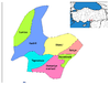 | ||||||||||||||||||||||||||
|
Metropolitan municipalities are bolded. | |||||||||||||||||||||||||||
This article about a Mediterranean Region of Turkey location is a stub. You can help Wikipedia by expanding it. |
На других языках
[de] Osmaniye (Provinz)
Osmaniye ist eine Provinz der Türkei. Sie liegt im Norden der Mittelmeerregion und ihre Hauptstadt ist das gleichnamige Osmaniye.- [en] Osmaniye Province
[ru] Османие (ил)
Османие (тур. Osmaniye) — ил на юге Турции.Текст в блоке "Читать" взят с сайта "Википедия" и доступен по лицензии Creative Commons Attribution-ShareAlike; в отдельных случаях могут действовать дополнительные условия.
Другой контент может иметь иную лицензию. Перед использованием материалов сайта WikiSort.org внимательно изучите правила лицензирования конкретных элементов наполнения сайта.
Другой контент может иметь иную лицензию. Перед использованием материалов сайта WikiSort.org внимательно изучите правила лицензирования конкретных элементов наполнения сайта.
2019-2026
WikiSort.org - проект по пересортировке и дополнению контента Википедии
WikiSort.org - проект по пересортировке и дополнению контента Википедии