world.wikisort.org - Armenia
Khachaghbyur (Armenian: Խաչաղբյուր) is a village in the Gegharkunik Province of Armenia. The village is located immediately to the south of the Lusakunk village and to the west of Vardenis.
Khachaghbyur
Խաչաղբյուր | |
|---|---|
 A view of Khachaghbyur from Murad Khach | |
 Khachaghbyur  Khachaghbyur | |
| Coordinates: 40°10′20″N 45°41′19″E | |
| Country | |
| Province | Gegharkunik |
| Population (2011)[1] | |
| • Total | 1,064 |
| Time zone | UTC+4 (AMT) |
| Khachaghbyur at GEOnet Names Server | |
Toponymy
The village was previously known as Chakhyrlu, Chakhrlu, Chakhirlu, Sovietakert and Sovetakert.
History
Near the village is a ruined Iron Age fort, Murad Khach, as well as a 13th-century church.[2]
Gallery
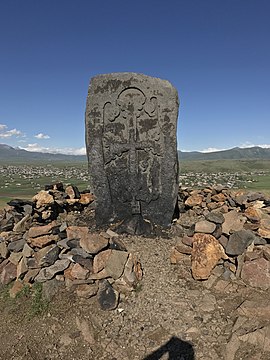 Khachkar on Murad Khach
 Murad Khach


References
- Statistical Committee of Armenia. "The results of the 2011 Population Census of Armenia" (PDF).
- Kiesling, Brady; Kojian, Raffi (2005). Rediscovering Armenia: Guide (2nd ed.). Yerevan: Matit Graphic Design Studio. p. 81. ISBN 99941-0-121-8.
External links
Wikimedia Commons has media related to Khachaghbyur.
- Report of the results of the 2001 Armenian Census, Statistical Committee of Armenia
- Brady Kiesling, Rediscovering Armenia, p. 47; original archived at Archive.org, and current version online on Armeniapedia.org.
Capital: Gavar | ||
| Urban communities |  | |
| Rural communities |
| |
| Non-community settlements |
| |
| Abandoned settlements | ||
This article about a location in Gegharkunik Province, Armenia is a stub. You can help Wikipedia by expanding it. |
Текст в блоке "Читать" взят с сайта "Википедия" и доступен по лицензии Creative Commons Attribution-ShareAlike; в отдельных случаях могут действовать дополнительные условия.
Другой контент может иметь иную лицензию. Перед использованием материалов сайта WikiSort.org внимательно изучите правила лицензирования конкретных элементов наполнения сайта.
Другой контент может иметь иную лицензию. Перед использованием материалов сайта WikiSort.org внимательно изучите правила лицензирования конкретных элементов наполнения сайта.
2019-2026
WikiSort.org - проект по пересортировке и дополнению контента Википедии
WikiSort.org - проект по пересортировке и дополнению контента Википедии