world.wikisort.org - USA
Ventura, officially named San Buenaventura (Spanish for "Saint Bonaventure"),[10] is a city on the Central Coast of California and the county seat of Ventura County. The population was 110,763 at the 2020 census.[11] Ventura is a popular tourist destination, owing to its historic landmarks, beaches, and resorts.
Ventura
San Buenaventura | |
|---|---|
| City of San Buenaventura | |
    Clockwise: Mission San Buenaventura from the Plaza Figueroa; Elizabeth Bard Memorial Hospital; view of the city from Ventura Pier; Father Serra statue in front of Ventura City Hall | |
 Seal | |
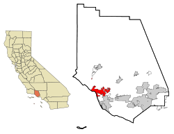 Location in Ventura County | |
 Ventura Location in Southern California  Ventura Location in California  Ventura Location in the United States | |
| Coordinates: 34°16′30″N 119°13′40″W | |
| Country | United States |
| State | California |
| County | Ventura |
| Mission | March 31, 1782 |
| Incorporated | April 2, 1866[1] |
| Named for | Saint Bonaventure |
| Government | |
| • Mayor | Sofia Rubalcava[2] |
| • City manager | Alex McIntyre[3] |
| • CA Senate | Monique Limón (D)[4] |
| • CA Assembly | Steve Bennett (D)[4] |
| • U.S. Congress[5] | CA-24: Salud Carbajal (D) CA-26: Julia Brownley (D) |
| Area | |
| • Total | 32.29 sq mi (83.63 km2) |
| • Land | 21.89 sq mi (56.68 km2) |
| • Water | 10.41 sq mi (26.95 km2) 32.53% |
| Elevation | 36 ft (11 m) |
| Population (2020)[8] | |
| • Total | 110,763 |
| • Rank | 4th in Ventura County 60th in California |
| • Density | 3,400/sq mi (1,300/km2) |
| Demonym | Venturan |
| Time zone | UTC−8 (Pacific) |
| • Summer (DST) | UTC−7 (PDT) |
| ZIP codes[9] | 93001–93007, 93009 |
| Area code | 805 |
| FIPS code | 06-65042 |
| GNIS feature IDs | 1667934, 2411779 |
| Website | www |
Ventura was founded by the Spanish in 1782, when Saint Junípero Serra established Mission San Buenaventura. Following the Mexican secularization of the Californian missions, San Buenaventura was granted by Governor Pío Pico to Don José de Arnaz as Rancho Ex-Mission San Buenaventura and a small community arose. Following the American Conquest of California, San Buenaventura eventually incorporated as a city in 1866. The 1920s brought a major oil boom, which along with the post–World War II economic expansion, significantly developed and expanded Ventura.
History

Archaeological discoveries in the area suggest that humans have populated the region for at least 10,000–12,000 years.[12] Archaeological research demonstrates that the Chumash people have deep roots in central and southern coastal regions of California, and has revealed artifacts from their culture.[13]: 11 Shisholop Village, designated Historic Point of Interest #18 by the city at the foot of nearby Figueroa Street, was the site of a Chumash village.[14] They had keen oceanic navigational skills made use of the abundant local resources from sea and land.[13]: 36 The Ventura Chumash were in contact with the Channel Islands Chumash; both mainland and island Chumash utilized large plank-sewn seagoing canoes, called Tomol, with the island people bringing shell bead money, island chert, and sea otter pelts to trade for mainland products like acorns and deer meat.[15][16]
Spanish era


In 1769, the Spanish Portolà expedition, first recorded European visitors to inland areas of California, came down the Santa Clara River Valley from the previous night's encampment near today's Saticoy and camped near the outlet of the Ventura River on August 14. Fray Juan Crespi, a Franciscan missionary traveling with the expedition, noted that "we saw a regular town, the most populous and best laid-out of all that we had seen on the journey up to the present time."[17] Archaeological records found that the Chumash village they encountered was settled sometime around 1000 A.D. Junípero Serra, first leader of the Franciscans in California, founded Mission San Buenaventura in 1782 as his ninth and last mission established near the Chumash village as part of Spain's colonization of Alta California.[18] The mission was named for St. Bonaventure, a Thirteenth Century Franciscan saint and a Doctor of the Church. San Miguel Chapel was the first outpost and center of operations while the first Mission San Buenaventura was being constructed. The first mission burned in 1801 and a replacement building of brick and stone was completed in 1809. The bell tower and facade of the new mission was destroyed by an 1812 earthquake.[19][20] The Mission was rebuilt and functions as a parish church.
Mexican era
The Mexican secularization act of 1833 was passed twelve years after Mexico won independence from Spain in 1821. Mission land was sold or given away in large grants called ranchos. Rancho Ex-Mission San Buenaventura was a 48,823-acre (197.58 km2) grant that included downtown Ventura. The Battle of San Buenaventura was fought in 1838 between competing armies from northern and southern California. Governor Juan Bautista Alvarado granted Rancho San Miguel to Felipe Lorenzana and Raymundo Olivas, whose Olivas Adobe on the banks of the Santa Clara River was the most magnificent hacienda south of Monterey. Fernando Tico also received a Mexican land grant for Ojai and a parcel near the river in downtown Ventura.[21]
American era


Following the American Conquest of California in the Mexican-American War, California became a U.S. territory in 1848 and a U.S. state in 1850. After the American Civil War, settlers came to the area, buying land from the Mexicans, or simply as squatters. Vast holdings were later acquired by Easterners, including railroad magnate Thomas A. Scott. He sent Thomas R. Bard to handle Scott's property.
Ventura had a flourishing Chinese settlement in the early 1880s. The largest concentration of activity, known as China Alley, was just across Main Street from the Mission San Buenaventura.[22]
Ventura Pier was built in 1872 at a cost of $45,000 and was the longest wooden pier in California. By 1917, it had been rebuilt to a length of 1,700 feet (520 m). Much of the pier was destroyed by a storm in 1995, but it was subsequently rebuilt.[23][24][25][26]
In 1913, the Rincon Sea Level Road and the Ventura River Bridge opened.[27]

The large Ventura Oil Field was first drilled in 1919 and at its peak produced 90,000 barrels per day (14,000 m3/d).[28][29] The development of the oil fields in the 1920s, along with the building of better roads to Los Angeles and the affordability of automobiles, enabled a major real estate boom. Contemporary downtown Ventura is defined by extant buildings from this period.[30][31] Landmarks built during the oil boom include Ventura Theatre (1928), the First Baptist Church of Ventura (1926), the Ventura Hotel (1926), and the Mission Theatre (1928).[32][30]
On March 12, 1928, the St. Francis Dam, 54 miles (87 km) inland, failed catastrophically, creating a flood that took over 600 lives as it flowed down the Santa Clara River to the ocean.
From the south, travel by auto was slow and hazardous, until the completion of a four-lane freeway (US Highway 101) over the Conejo Grade in 1959. This route, which was widened and improved by 1969, is known as the Ventura Freeway, which directly links Ventura with the rest of the Greater Los Angeles.
In 2017, the Thomas Fire started north of Ventura in Santa Paula, but with the Santa Ana Winds the fire spread into hillside neighborhoods of Ventura and into the area above downtown, and 504 residences burned down in the city.[33]
Geography


Ventura is located northwest of Los Angeles on the California coast. The western portion of the city stretches north along the Ventura River which is characterized by a narrow valley with steeply sloped areas along both sides. The steep slopes of the Ventura foothills abut the northern portion of the community. Much of the eastern portion is on a relatively flat alluvial coastal plain lying along the western edge of the Oxnard Plain. Several Barrancas extend from the foothills to the Santa Clara River which forms the city's southerly boundary.[34] The city extends up to the beginning of the Santa Clara River Valley at the historic community of Saticoy.[35]
Ventura is within a seismically active region like much of California and is crossed by several potentially active fault systems.[36] The Ventura Fault is capable of an 8.0 earthquake and a local tsunami up to 23 feet in height.[37][38][39] According to the United States Census Bureau, Ventura has a total area of 32.1 square miles (83 km2), of which 21.7 square miles (56 km2) is land and 10.4 square miles (27 km2), comprising 32.53%, is water.
Climate
| Ventura, California | ||||||||||||||||||||||||||||||||||||||||||||||||||||||||||||
|---|---|---|---|---|---|---|---|---|---|---|---|---|---|---|---|---|---|---|---|---|---|---|---|---|---|---|---|---|---|---|---|---|---|---|---|---|---|---|---|---|---|---|---|---|---|---|---|---|---|---|---|---|---|---|---|---|---|---|---|---|
| Climate chart (explanation) | ||||||||||||||||||||||||||||||||||||||||||||||||||||||||||||
| ||||||||||||||||||||||||||||||||||||||||||||||||||||||||||||
| ||||||||||||||||||||||||||||||||||||||||||||||||||||||||||||
Ventura has a Mediterranean climate, typical of most coastal California cities, with the sea breeze off the Pacific Ocean moderating temperatures. It is not uncommon for the city to be affected by Santa Ana winds off the Transverse Ranges on occasion, which increase temperatures dramatically.
| Climate data for Ventura, California | |||||||||||||
|---|---|---|---|---|---|---|---|---|---|---|---|---|---|
| Month | Jan | Feb | Mar | Apr | May | Jun | Jul | Aug | Sep | Oct | Nov | Dec | Year |
| Record high °F (°C) | 90 (32) |
89 (32) |
99 (37) |
100 (38) |
101 (38) |
101 (38) |
103 (39) |
101 (38) |
105 (41) |
105 (41) |
98 (37) |
89 (32) |
105 (41) |
| Average high °F (°C) | 66.5 (19.2) |
66.6 (19.2) |
67.4 (19.7) |
69.3 (20.7) |
70.9 (21.6) |
72.7 (22.6) |
76.0 (24.4) |
77.0 (25.0) |
76.7 (24.8) |
74.5 (23.6) |
70.7 (21.5) |
66.7 (19.3) |
71.3 (21.8) |
| Average low °F (°C) | 44.0 (6.7) |
45.0 (7.2) |
46.7 (8.2) |
48.1 (8.9) |
52.1 (11.2) |
55.6 (13.1) |
58.7 (14.8) |
58.4 (14.7) |
57.0 (13.9) |
52.8 (11.6) |
47.4 (8.6) |
43.6 (6.4) |
50.8 (10.4) |
| Record low °F (°C) | 28 (−2) |
27 (−3) |
33 (1) |
34 (1) |
35 (2) |
39 (4) |
41 (5) |
46 (8) |
41 (5) |
33 (1) |
31 (−1) |
27 (−3) |
27 (−3) |
| Average rainfall inches (mm) | 3.59 (91) |
3.81 (97) |
2.81 (71) |
0.92 (23) |
0.27 (6.9) |
0.04 (1.0) |
0.09 (2.3) |
0.01 (0.25) |
0.07 (1.8) |
0.73 (19) |
1.09 (28) |
2.63 (67) |
16.06 (408) |
| Source 1: [40] | |||||||||||||
| Source 2: [41] | |||||||||||||
Demographics
| Historical population | |||
|---|---|---|---|
| Census | Pop. | %± | |
| 1880 | 1,370 | — | |
| 1890 | 2,320 | 69.3% | |
| 1900 | 2,470 | 6.5% | |
| 1910 | 2,901 | 17.4% | |
| 1920 | 4,156 | 43.3% | |
| 1930 | 11,603 | 179.2% | |
| 1940 | 13,264 | 14.3% | |
| 1950 | 16,534 | 24.7% | |
| 1960 | 29,114 | 76.1% | |
| 1970 | 57,964 | 99.1% | |
| 1980 | 73,774 | 27.3% | |
| 1990 | 92,575 | 25.5% | |
| 2000 | 100,916 | 9.0% | |
| 2010 | 106,433 | 5.5% | |
| 2020 | 110,763 | 4.1% | |
| U.S. Decennial Census[42] | |||


2010
The 2010 United States Census[43] reported that Ventura had a population of 106,433. The population density was 3,316.2 inhabitants per square mile (1,280.4/km2). The racial makeup of Ventura was 76.6% White, 1.6% African American, 1.2% Native American, 3.4% Asian (0.9% Filipino, 0.6% Chinese, 0.4% Indian, 0.4% Korean, 0.4% Japanese, 0.3% Vietnamese, 0.5% Other), 0.2% Pacific Islander, 5.2% from two or more races. Hispanic or Latino of any race were 31.8% of the population.
The Census reported that 103,940 people (97.7% of the population) lived in households, 755 (0.7%) lived in non-institutionalized group quarters, and 1,738 (1.6%) were institutionalized.
There were 40,438 households, out of which 13,014 (32.2%) had children under the age of 18 living in them, 18,907 (46.8%) were opposite-sex married couples living together, 4,936 (12.2%) had a female householder with no husband present, 2,153 (5.3%) had a male householder with no wife present. There were 2,621 (6.5%) unmarried opposite-sex partnerships, and 371 (0.9%) same-sex married couples or partnerships. 10,959 households (27.1%) were made up of individuals, and 4,271 (10.6%) had someone living alone who was 65 years of age or older. The average household size was 2.57. There were 25,996 families (64.3% of all households); the average family size was 3.14.
The population was spread out, with 23,918 people (22.5%) under the age of 18, 9,581 people (9.0%) aged 18 to 24, 28,814 people (27.1%) aged 25 to 44, 29,957 people (28.1%) aged 45 to 64, and 14,163 people (13.3%) who were 65 years of age or older. The median age was 39.0 years. For every 100 females, there were 97.7 males. For every 100 females age 18 and over, there were 95.6 males.
There were 42,827 housing units at an average density of 1,334.4 per square mile (515.2/km2), of which 22,600 (55.9%) were owner-occupied, and 17,838 (44.1%) were occupied by renters. The homeowner vacancy rate was 1.3%; the rental vacancy rate was 5.5%. 59,330 people (55.7% of the population) lived in owner-occupied housing units and 44,610 people (41.9%) lived in rental housing units.
2000

As of the census[44] of 2000, there were 100,916 people, 38,524 households, and 25,233 families residing in the city. The population density was 4,790.6 inhabitants per square mile (1,849.3/km2). There were 39,803 housing units at an average density of 1,889.5 per square mile (729.5/km2). The racial makeup of the city was 78.8% White, 1.4% African American, 1.2% Native American, 3.0% Asian, 0.2% Pacific Islander, 11.1% from other races, and 4.3% from two or more races. Hispanic or Latino of any race were 30.4% of the population.
There were 38,524 households, out of which 32.1% had children under the age of 18 living with them, 49.2% were married couples living together, 11.7% had a female householder with no husband present, and 34.5% were non-families. 26.5% of all households were made up of individuals, and 9.7% had someone living alone who was 65 years of age or older. The average household size was 2.56 and the average family size was 3.12.
In the city, the population was spread out, with 25.0% under the age of 18, 7.8% from 18 to 24, 31.5% from 25 to 44, 22.8% from 45 to 64, and 12.8% who were 65 years of age or older. The median age was 37 years. For every 100 females, there were 96.9 males. For every 100 females age 18 and over, there were 93.8 males.
The median income for a household in the city was $52,297, and the other income for a family was $60,466. Males had a median income of $43,828 versus $31,793 for females. The per capita income for the city was $25,065. About 6.4% of families and 9.0% of the population were below the poverty line, including 12.2% of those under age 18 and 5.3% of those age 65 or over.
Economy


Ventura is a popular tourist destination in Southern California, owing to its historic landmarks, beaches, and the local leisure economy.[45] Businesses related to tourism and hospitality account for a significant portion of Ventura's economic activity.[citation needed]
The outdoor clothing manufacturer Patagonia is based in Ventura.[46] Diaper bag manufacturer Petunia Pickle Bottom was founded in Ventura.[47] Research and resource company The Barna Group is located near downtown Ventura.[citation needed]
In 2009 the City of Ventura created Ventura Ventures Technology Center,[48] a business incubator with a high-tech focus. Ventura Ventures Technology Center was created as an economic engine to develop jobs and companies locally, as well as attract entrepreneurs to the area. The Trade Desk was started in the incubator.[49]
Following the legalization of Cannabis in California, Ventura City Council council last adopted a resolution allowing a maximum number of cannabis businesses in the city in February 2021.[50] The ordinances allow up to three retail permits and up to 10 distribution permits.[51]
Top employers

According to the city's 2020 Comprehensive Annual Financial Report,[52] the top employers in the city are:
| # | Employer | Number of Employees | % of Total City Employment |
|---|---|---|---|
| 1 | County of Ventura | 8,232 | 15.08% |
| 2 | Ventura Unified School District | 2,650 | 4.85% |
| 3 | Community Memorial Health System | 2,176 | 3.99% |
| 4 | Employer's Depot Inc. | 820 | 1.50% |
| 5 | Patagonia Works (Lost Arrow Corp.) | 665 | 1.22% |
| 6 | Kaiser Permanente | 656 | 1.20% |
| 7 | Ventura County Community College District | 653 | 1.20% |
| 8 | City of San Buenaventura | 615 | 1.13% |
| 9 | Target | 495 | 0.91% |
| 10 | Ventura Superior Court | 305 | 0.56% |
Arts and culture

The Ventura County Fairgrounds is the home of the annual Ventura County Fair, and over the years has hosted such acts as Jimi Hendrix, The Grateful Dead, Phish, Smokey Robinson, All American Rejects, Smash Mouth, and Sugar Ray, as well as the Vans Warped Tour. The train station for Amtrak's Pacific Surfliner route is adjacent to the fairgrounds.
The Majestic Ventura Theater is an early 20th-century landmark in the downtown. It has been a venue for concerts such as The Doors, Pearl Jam, Van Halen, X, Ray Charles, Red Hot Chili Peppers, Social Distortion, Bad Religion, Fugazi, Incubus, Tom Petty, They Might Be Giants, and Johnny Cash, as well as homegrown artists like KYLE, Big Bad Voodoo Daddy and Army of Freshmen.[53][54]
Ventura is famed for the quality and frequency of the surfing conditions at spots such as Surfer's Point near the Ventura County Fairgrounds.[55]
Ventura is the home to the soccer clubs Ventura County Football Club[56] and Ventura County Fusion, of the USL Premier Development League.
Points of interest


Downtown Ventura is home to the Mission San Buenaventura, museums, galleries, dining, and shopping. Located in downtown is the historic Ortega Adobe, once home to the Ortega family known for chili products. Downtown Ventura is home to Ventura's ornate city hall with its statue of Junipero Serra.[57] Downtown includes restaurants, wine bars, breweries, and the Rubicon Theatre Company.
In Plaza Park (Chestnut and Santa Clara streets, downtown) stands a large Moreton Bay fig tree. Across the street, the main post office has murals on interior walls commissioned by the Section of Painting and Sculpture of the U.S. Treasury Department as New Deal art.[58]
Ventura Harbor has fishing boats, seafood restaurants and a retail center, the Ventura Harbor Village. The Channel Islands National Park Headquarters is also located at the harbor, and boats to the Channel Islands depart daily.
The Olivas Adobe, one of the early "California Rancho"-styled homes, is operated today as a museum and performing arts venue. Located adjacent to the Olivas Park Golf Course. Living history reenactments, demonstrations of Rancho life and wonderful ghost stories are presented. A summer music series of performances held in the courtyard features an eclectic assortment of artists from blues to jazz to country.
One of the most recognizable landmarks in Ventura is "Two Trees" – two prominent lone trees on a hilltop, visible from most of Ventura. Access to the hill is private property. In early October 2017, one of the trees was destroyed by high winds.[59][60]
Libraries

There are three branches of the Ventura County Library in the City of Ventura: E.P. Foster Library[61][62] on Main Street, Avenue Library[63] on Ventura Avenue, and Hill Road Library on the east side of the city.[64] Saticoy Library[65] is in the unincorporated area of Saticoy outside the east end of the city of Ventura.
The Evelyn and Howard Boroughs Library of Ventura College, dedicated in 2005, serves the students, faculty and staff of the college as well as the general public of Ventura County.[66]
The Research Library of the Museum of Ventura County holds books and archival materials related to the history of the county and surrounding regions. Its holdings are catalogued in the Ventura County Library system and the Central Coast Museum Consortium, and the library is open to the public.[67]
Ventura County Law Library, located in the Ventura County Government Center, makes current legal resources available to judges, lawyers, government officials, and other users.[68]
Government

Ventura had an at-large system of electing council members[69] but changed to seven council districts in 2018 due to threatened legal action based on the California Voting Rights Act.[70] Council members have 4-year terms and their elections are staggered so three or four are up for re-election every two years.[71] The council elects from among its own members a mayor and deputy mayor who serve two-year terms.[72]
Sofia Rubalcava has served as Mayor of San Buenaventura since 2020. Ventura is located within California's 26th congressional district, with Julia Brownley currently serving as its representative in the U.S. Congress.
Education
Ventura has four college campuses: Ventura College of Law, Southern California Institute of Law, Santa Barbara Business College and Ventura College. Ventura College of Law is a non-profit law school founded in 1969. Ventura College is a community college, part of the Ventura County Community College District.[73] The Brooks Institute of Photography shut down in 2016 after many years in the community.
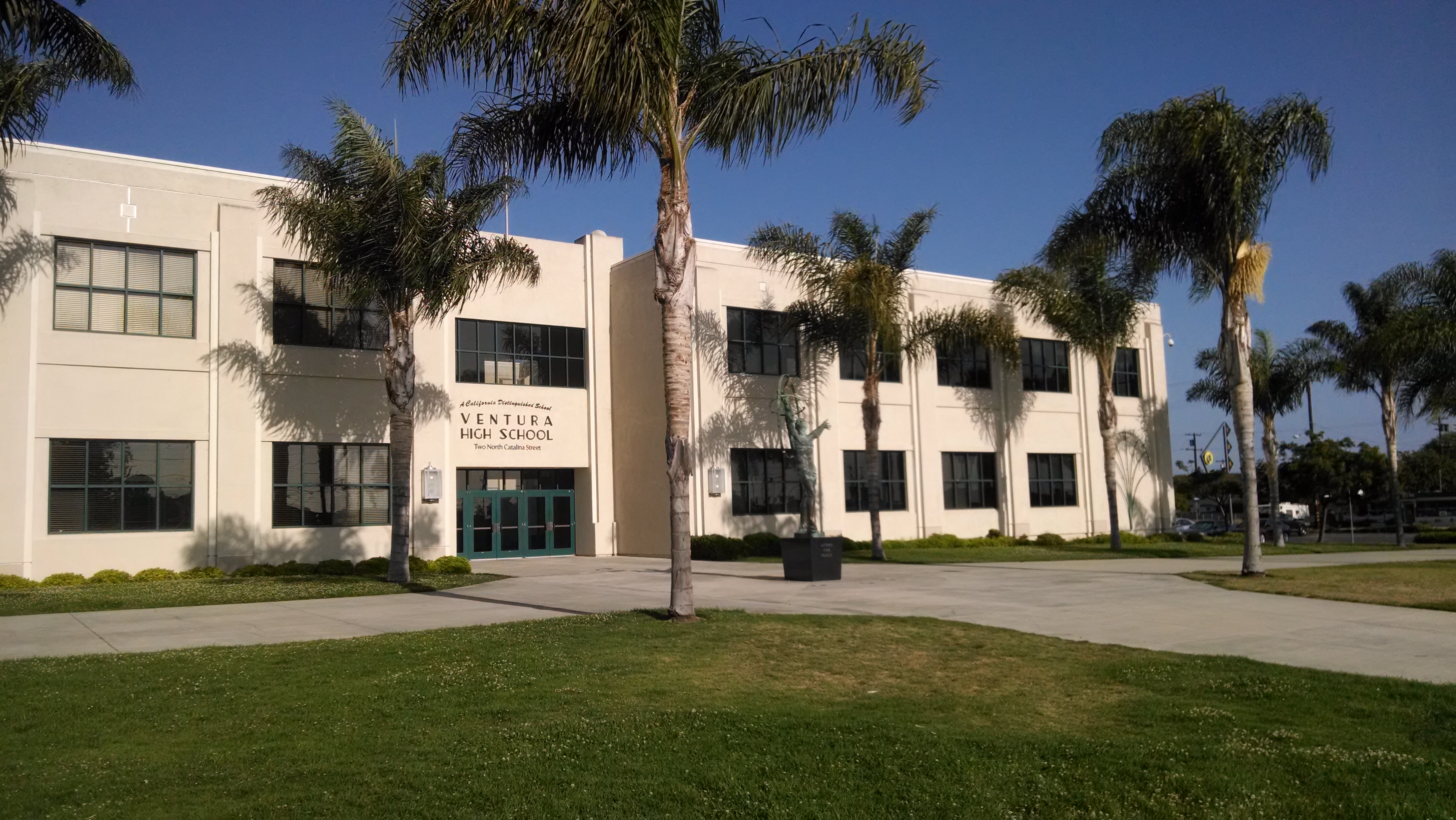
Public school students from kindergarten through 12th grade attend schools in the Ventura Unified School District. The district has five high schools: Ventura High in the midtown area, Buena High in east Ventura, Foothill Technology High School, Pacific High School[74] and El Camino High School, an independent study program located on the Ventura College campus. Private schools include St. Bonaventure High School, a Catholic school, Ventura County Christian School,[75] Ventura Missionary School,[76] evangelical Christian schools, and Holy Cross School, Sacred Heart, and Our Lady of the Assumption, Roman Catholic schools for grades pre-kindergarten through 8.
Infrastructure

Transportation
The major road through Ventura is the Ventura Freeway (U.S. Route 101), connecting the California Central Coast and San Francisco to the north, and Los Angeles to the south. State Route 33, the Ojai Freeway, heads north to Ojai. State Route 126 and State Route 118 head east to Santa Clarita and Simi Valley, respectively.
The East Ventura Station, in the historic Montalvo neighborhood, serves as the western terminus of the Ventura County Line of the Metrolink commuter rail system, which extends to Los Angeles' Union Station. The downtown Ventura Amtrak Station is served by Amtrak's Pacific Surfliner from San Luis Obispo to San Diego.
Local bus service is provided by Gold Coast Transit. Commuter and intercity bus services are provided by VISTA and by MTD to Santa Barbara.
The Downtown - Harbor Trolley began its free service on July 3, 2013. The Trolley makes loops from Downtown to Ventura Harbor.[77]
Utilities

Ventura provides water to its residents and some unincorporated areas near the city. Water sources are Lake Casitas, the Ventura River, and groundwater.[78] The water system includes 3 treatment plants, 10 wells, and 27 reservoirs.
Sanitary sewer services are treated at a single plant in 1955.[79] The plant, within a former portion of the estuary of the Santa Clara River, has ponds of treated water that attract birds.[80][81] Some recycled water from the plant is used for landscaping and other non potable uses.[82][83][84]
The Montalvo Community Services District looked at the cost of a new treatment plant in 2014 and considered having the city take over their service area and dissolve the district. The Montalvo Municipal Improvement District had been formed 60 years prior to bringing sewer service to what was then a remote unincorporated area southeast of Ventura. The city of Ventura annexed the last unincorporated portions of Montalvo in 2012[85] and had already begun to provide water to the community before the annexation.[86]
Neighborhoods
- Arundell
- College
- Downtown
- Hillsides
- Hobson Heights
- Juanamaria
- Midtown
- North Bank
- Olivias
- Pierpoint
- Poinsettia
- Saticoy
- Serra
- Taylor Ranch
- Thille
- Wells
- Westside
In popular culture

- Film
The movies Swordfish, Little Miss Sunshine and Erin Brockovich were partially filmed in Ventura.[87]
The comedy film The Bet was filmed entirely in the city of Ventura and was written by Ventura residents Chris Jay and Aaron Goldberg, both members of the band Army of Freshmen.
- Books
Ventura was fictionalized as "Madison City" by long-time resident Erle Stanley Gardner in his D.A. series of crime novels featuring Doug Selby, the crusading district attorney of a rural California county.
Ventura is the setting for Julie Carobini's 2007 book Chocolate Beach.
- Other
The macOS Ventura operating system was presented at Apple's Worldwide Developers Conference (WWDC2022) on June 6, 2022 after having been named after the city.[88]
The America song "Ventura Highway" was inspired by the feel of the coastal highway running through Ventura, when the songwriter saw the sign to Ventura on a childhood family trip.
Ventura is a course in Tony Hawk's Pro Skater 2. It was called "Skatestreet Ventura".
Notable people
- Kevin Costner, actor, attended Buena High School.
- Zachary Levi, actor, attended Buena High School.
- Natasha Halevi, actress and director, attended Saint Bonaventure High School. She is married to actor Sean Gunn.
- James Ennis III, basketball player for the Philadelphia 76ers, was born in Ventura.
- Frank Churchill, composer for Disney, began his career in Ventura.
- Theodosia Burr Shepherd (1845–1906) was an American botanist, horticulturist and pioneer in plant breeding. She was called the “Flower Wizard of California”,[89] and "The Pioneer Seed-grower", as she was the first woman in California and possibly in the United States to hybridize flowers.[90][89] Her seed and bulb business, the Theodosia B. Shepherd Company, is considered to be the foundation of the California seed industry and is listed as number 34 in the City of Ventura Historic Landmarks and Districts. She was compared favorably to Luther Burbank.[91]
- Erle Stanley Gardner (1889–1970) created the fictional lawyer Perry Mason, who appeared first in novels and then later in a television series from 1957 to 1966, followed by several "made-for-TV" movies in the 1980s. Gardner himself was a lawyer and did much of his early writing in Downtown Ventura. The First National Bank building at California and Main streets, where Gardner's law office was located, bears his name on a state historical marker and is also identified as the "Erle Stanley Gardner Building" over the front entrance.
- Cirith Ungol, an influential heavy metal band who formed in Ventura in 1972 and are still active.
Sister cities
 Loreto, Baja California Sur (Mexico)[92]
See also
- Foster Park Bowl
- City of Ventura Historic Landmarks and Districts
References
- "California Cities by Incorporation Date". California Association of Local Agency Formation Commissions. Archived from the original (Word) on November 3, 2014. Retrieved August 25, 2014.
- "City Council". City of Ventura. Retrieved December 7, 2017.
- "City Manager Mark Watkins". City of Ventura. Archived from the original on December 7, 2014. Retrieved January 11, 2015.
- "Statewide Database". UC Regents. Retrieved November 23, 2014.
- "Communities of Interest - City". California Citizens Redistricting Commission. Retrieved September 27, 2014.
- "2019 U.S. Gazetteer Files". United States Census Bureau. Retrieved July 1, 2020.
- "Ventura". Geographic Names Information System. United States Geological Survey, United States Department of the Interior. Retrieved December 3, 2014.
- "QuickFacts: San Buenaventura (Ventura) city, California". U.S. Census Bureau. Retrieved January 5, 2022.
- "ZIP Code(tm) Lookup". United States Postal Service. Retrieved December 3, 2014.
- Erwin G. Gudde, California Place Names: The Origin and Etymology of Current Geographical Names, 4th ed., rev. and enlarged by William Bright (University of California Press, 1998), p. 410.
- "San Buenaventura (Ventura), CA". Data USA. Retrieved November 29, 2017.
- Clerici, Kevin (July 17, 2007). "Artifacts are found at site". Ventura County Star. Archived from the original on December 3, 2013.
- McCall, Lynne; Perry, Rosalind (2002). California's Chumash Indians : a project of the Santa Barbara Museum of Natural History Education Center (Revised ed.). San Luis Obispo, Calif: EZ Nature Books. ISBN 978-0936784151.
- Landmark #18: Shisholop Village Site Archived December 8, 2014, at the Wayback Machine accessed October 7, 2013 from link on City Map with Historic Landmarks
- Anderson, John (1999). "The Chumash Indians Who Live in Ventura County California: The Ventura Chumash". Retrieved May 7, 2013.
- "Santa Cruz Island History and Culture". National Park Service. Retrieved November 24, 2019.
- Bolton, Herbert E. (1927). Fray Juan Crespi: Missionary Explorer on the Pacific Coast, 1769-1774. HathiTrust Digital Library. pp. 159–160.
- Murphy, Arnold L. (ed.) (1979). A Comprehensive Story of Ventura County, California. Oxnard, CA: M & N Printing. p. 8.
{{cite book}}:|first=has generic name (help) - Hogle, Gene NAC Green Book of Pacific Coast Touring (1931) National Automobile Club p.25
- Stolz, Kit (January 5, 2014). "Ventura earthquake fault more dangerous than previously thought, geologists say". Ventura County Star. Retrieved January 5, 2016.
- "Spanish and Mexican Land Grants". Ventura County Genealogical Society. Archived from the original on March 18, 2007. Retrieved March 17, 2007.
- "Point of Interest Number: 91 | Historic Name: China Alley Historic Area" (PDF). City of San Buenaventura Historic Landmarks, Districts, and Points of Interest. City of Ventura.
- Scheibe, John (January 24, 2014). "Ventura Pier closed after piling gives way". Ventura County Star. Retrieved October 26, 2015.
- Young, Don (2009). Southern California Adventure Guide. Hunter Publishing, Inc.
- Gorman, Anna (February 8, 1999). "Landmark Pier Readies for Latest Renovation Project". Los Angeles Times. Retrieved July 6, 2016.
- Langlois, Roseann (July 19, 1999). "Pier Renovation Begins This Week". Los Angeles Times. Retrieved July 6, 2016.
- Gyllstrom, Paul. "Rincon Sea-Level Road Soon Completed" Motor Age, Volume XXII, 17 October 1912, p. 25
- Stolz, Kit (April 16, 2009). "Tar on your foot". Ventura County Reporter. Retrieved April 7, 2016.
- Martinez, Arlene (April 6, 2016). "Ventura Oil Field celebrates 100 years". Ventura County Star. Retrieved April 7, 2016.
- "The Swift & Company Building" (PDF). Historic Landmark Designation Application. City of Ventura. March 24, 2014. Archived from the original (PDF) on April 13, 2014. Retrieved April 7, 2016.
- "Historic Landmark #108" (PDF). City of Ventura. Retrieved April 7, 2016.
- Hamilton, Denise (June 9, 1988) "A New Life Awaits Ventura Theater : Restaurateur Has Big Plans to Book Jazz, Country, Salsa Acts at Ornate Ex-Movie House" Los Angeles Times
- Rode, Erin (December 10, 2020). "Tale of two apartment buildings burned in Thomas Fire: One nearly done; other yet to start". Ventura County Star. Retrieved December 13, 2020.
- Carlson, Cheri (December 20, 2021). "Ventura may broaden closures of barrancas during red-flag fire conditions". Ventura County Star. Retrieved December 21, 2021.
{{cite news}}: CS1 maint: url-status (link) - Rincon Consultants, Inc. (June 2014). "Olivas Park Drive Extension Project Final Environmental Impact Report SCH # 1995081004"" (PDF). City of Ventura. Archived from the original (PDF) on July 13, 2014.
- "What do the experts say about Ventura earthquakes?". Ventura County Star. November 9, 2019. Retrieved November 10, 2019.
- Lloyd, Jonathan (August 20, 2015). "Ventura, Oxnard Might Be at Greater Tsunami Risk: Study". Associated Press. Retrieved November 20, 2019 – via NBC Southern California.
- LIN II, RONG-GONG (November 8, 2019). "Swarm of earthquakes hits Ventura". Los Angeles Times. Retrieved November 10, 2019.
- Lin II, Rong-Gong (April 20, 2015). "Earthquake fault heightens California tsunami threat, experts say". Los Angeles Times. Retrieved July 31, 2016.
- "Ventura, California Climate". www.bestplaces.net. Retrieved August 9, 2021.
- "NOAA NCEI U.S. Climate Normals Quick Access". National Oceanic and Atmospheric Administration. Retrieved August 10, 2021.
- "Census of Population and Housing". Census.gov. Retrieved June 4, 2015.
- "2010 Census Interactive Population Search: CA - San Buenaventura (Ventura) city". U.S. Census Bureau. Archived from the original on July 15, 2014. Retrieved July 12, 2014.
- "U.S. Census website". United States Census Bureau. Retrieved January 31, 2008.
- Hersko, Tyler (May 25, 2017). "Beaches and trails lure tourists to Ventura County". Ventura County Star. Retrieved May 27, 2017.
- "Patagonia Job Listing for Ventura, CA, Reno, NV, and worldwide". Patagonia.com. Retrieved May 12, 2014.
- McKinnon, Lisa (July 13, 2013). "In the bag: Ventura-based Petunia Pickle Bottom branches out". Ventura County Star. Retrieved November 6, 2020.
- "v2tc.com". v2tc.com. Archived from the original on May 12, 2014. Retrieved May 12, 2014.
- "The Trade Desk Plans Expansion In Ventura". socaltech. July 25, 2019. Retrieved November 23, 2020.
- Orozco, Lance (November 4, 2020). "Marijuana-Related Tax Proposals Approved By South Coast Voters". KCLU News. Retrieved November 5, 2020.
- Woods II, Wes (July 22, 2022). "Potential Ventura cannabis businesses make their case". Ventura County Star. Retrieved August 3, 2022.
- "Comprehensive Annual Financial Report Fiscal Year Ended June 30, 2020" (PDF). City of San Buenaventura.
- McAlpine, Ken (January 3, 2017). "Exclusive Interview | For Big Bad Voodoo Daddy lead singer Scotty Morris, Ventura is home sweet home". Visit Ventura. Ventura Visitors & Convention Bureau. Retrieved August 11, 2020.
- Locey, Bill (April 17, 2008). "Tom Petty takes a run at the charts with his first band". Ventura County Star. Retrieved August 11, 2020.
- Thompson, Doug (February 25, 2016). "Stand-up paddleboarders hit Ventura's big waves". Ventura County Star. Retrieved March 23, 2016.
- "Ventura County FC". Ventura County Football Club. Retrieved December 1, 2016.
- ""Father Junipero Serra" Sculpture – Ventura CA". Department of Geography. Living New Deal. University of California, Berkeley. Archived from the original on March 22, 2015. Retrieved March 3, 2014.
- Department of Geography, University of California, Berkeley "Ventura Post Office "Agriculture and Industries of Ventura" – Ventura CA" Living New Deal Accessed March 3, 2014
- Cason, Colleen (October 14, 2017). "Rest in peace, Two Tree; you will be missed but not forgotten". Ventura County Star. Retrieved March 30, 2021.
{{cite news}}: CS1 maint: url-status (link) - Martinez, Christian (October 9, 2017). "Windy weather takes out one of Ventura's 'Two Trees'". Ventura County Star. Retrieved March 30, 2021.
{{cite news}}: CS1 maint: url-status (link) - MacGregor, Hilary E. (April 1, 1997). "E. P. Foster Is Deemed Top Candidate for Main Library". Los Angeles Times. Retrieved June 18, 2017.
- "E. P. Foster Library | Ventura County Library". Vencolibrary.org. Retrieved May 12, 2014.
- "Avenue Library | Ventura County Library". Vencolibrary.org. Retrieved May 12, 2014.
- "Hill Road Library Grand Opening – Ventura Friends of the Library". venturafriendsofthelibrary.org. Retrieved December 7, 2017.
- "Saticoy Library — Serving Saticoy, Somis and Ventura's East End | Ventura County Library". Vencolibrary.org. Retrieved May 12, 2014.
- "About the Library | Ventura College". www.venturacollege.edu. Retrieved December 7, 2017.
- "Research Library - Museum of Ventura County". Museum of Ventura County. Retrieved December 7, 2017.
- "About the Library". Ventura County Law Library. November 10, 2012. Retrieved December 7, 2017.
- Martinez, Arlene (September 6, 2017). "Ventura faces threat of voting rights suit". Ventura County Star. Retrieved November 11, 2017.
- "District Elections | Ventura, CA".
- "City Council | Ventura, CA".
- "Selection of Mayor | Ventura, CA". www.cityofventura.ca.gov. Retrieved December 7, 2017.
- "Ventura County Community College District". vcccd.edu. Retrieved May 12, 2014.
- "Pacific". www.venturausd.org.
- "Ventura County Christian School". Ventura County Christian School.
- https://www.venturamissionaryschool.com/.
{{cite web}}: Missing or empty|title=(help) - "venturatrolley.com". venturatrolley.com. Retrieved May 12, 2014.
- Martinez, Arlene (September 30, 2019). "Who gets Ventura River water? Ventura agrees to track, potentially reduce its usage". Ventura County Star. Retrieved October 1, 2019.
- Holland, Brooke (August 19, 2021). "EPA chief visits Ventura, talks drought, water infrastructure". Pacific Coast Business Times. Retrieved August 20, 2021.
{{cite news}}: CS1 maint: url-status (link) - Kisken, Tom (November 24, 2017). "These Ventura ponds are for the birds (and birders)". Ventura County Star. Retrieved August 16, 2020.
- Heitmann, Cheryl (November 19, 2014) "Ventura mayor defines full-service city" Ventura County Star
- Martinez, Arlene (September 14, 2019). "Ventura's awash in water litigation. This time, the target is state water". Ventura County Star. Retrieved September 14, 2019.
- Martinez, Arlene (September 5, 2019). "A look inside Ventura's wastewater operations. What's the future of its estuary discharge?". Ventura County Star. Retrieved September 6, 2019.
- Biasotti, Tony (October 15, 2019). "Ventura OKs $200 million-plus plan to remove wastewater from estuary. Here's what's next". Ventura County Star. Retrieved October 16, 2019.
- Biasotti, Tony (October 19, 2011). "Agency approves Parklands annexation in east Ventura". Ventura County Star.
- Biasotti, Tony (November 14, 2014) "'End of an era' in Montalvo, as sewer district prepares to hand off services" Ventura County Star
- Clerici, Kevin (October 2, 2010) "Ventura launches campaign to promote film, television" Ventura County Star
- Salgado, Cytlalli (June 21, 2022). "macOS Ventura: Apple's new operating system named after city". Ventura County Star. Retrieved June 21, 2022.
- Kallas, Anne (May 14, 2014). "Ventura garden harkens to historic woman's contributions to hybridize flowers". Ventura County Star. Retrieved September 14, 2018.
- Gray, Lillian (July 7, 1905). "Women who do things: Theodosia Burr Shepherd". The Wilkes-Barre Record. Wilkes-Barre, Pennsylvania. Retrieved September 15, 2018.
this quiet indefatigable woman floriculturist was the first person to grow flower seed for the eastern states' trade. Her seeds have found their way throughout Europe. She is the pioneer flower seed grower of California.
- "Women of the Horticultural World". The Pacific Garden. 5 (1): 6–7. December 1911. Retrieved September 14, 2018.
On the foundation which she laid is builded the great seed industry of California.
- Staff (March 30, 2015). "Ventura, Loreto discuss new sister city program during binational visit". Ventura County Star. Retrieved March 1, 2016.
External links
- Official website

- Ventura, California on City Data
- Movies and televisions shows filmed in Ventura
- Ventura Visitor's and Convention Bureau
- Ventura Port District
- Ventura Chamber of Commerce
Places adjacent to Ventura, California | ||||||||||||||||
|---|---|---|---|---|---|---|---|---|---|---|---|---|---|---|---|---|
| ||||||||||||||||
Municipalities and communities of Ventura County, California, United States | ||
|---|---|---|
County seat: Ventura | ||
| Cities |  | |
| CDPs |
| |
| Unincorporated communities |
| |
| Footnotes | ‡This populated place also has portions in an adjacent county or counties | |
| ||
Greater Los Angeles Area | ||
|---|---|---|
| Central city |  | |
| Counties | ||
| Cities >200k | ||
| Cities and towns 100k−200k | ||
| Other towns | ||
| Other communities |
| |
| Area regions |
| |
| Landforms |
| |
| Bodies of water |
| |
Sacramento (capital) | ||
| Topics |
|  |
| Regions |
| |
| Metro regions |
| |
| Counties |
| |
| Most populous cities | ||
|  | |
^* Mayor selected from city council | ||
Southern California megaregion | ||||||||||||
|---|---|---|---|---|---|---|---|---|---|---|---|---|
Metropolitan areas and cities in italics are located outside of California | ||||||||||||
|  | |||||||||||
Megapolitan areas of California | ||||||||||||
Authority control | |
|---|---|
| General | |
| National libraries | |
| Other |
|
На других языках
[de] Ventura (Kalifornien)
Ventura (ursprünglich San Buenaventura) ist eine Stadt im US-Bundesstaat Kalifornien und Verwaltungssitz von Ventura County. Sie hatte 2010 etwa 106.433 Einwohner auf einer Fläche von 84,6 km².- [en] Ventura, California
[es] Ventura (California)
San Buenaventura (usualmente llamada Ventura) es una ciudad estadounidense del estado de California, sede del condado de Ventura, desde su incorporación en 1866. Ventura tiene una población total de 106.744 habitantes.[1] Las vías principales que van a Ventura son la Ruta Federal 101, la Ruta Estatal 33 y la Ruta Estatal 126.[ru] Вентура (Калифорния)
Вентура (англ. Ventura), ранее (до 1891 года) Сан-Бонавентура (англ. San Buenaventura) — город и окружной центр одноименного округа в штате Калифорния. Население города, по данным[1] переписи 2000 года, составляет 100 916 человек. По территории города проходят автомагистрали US 101, SR 33 и SR 126.Другой контент может иметь иную лицензию. Перед использованием материалов сайта WikiSort.org внимательно изучите правила лицензирования конкретных элементов наполнения сайта.
WikiSort.org - проект по пересортировке и дополнению контента Википедии