world.wikisort.org - USA
Ladera Heights is a community and unincorporated area in Los Angeles County, California. The population was 6,634 at the 2020 census.[3] Culver City lies to its west, the Baldwin Hills neighborhood to its north, the View Park-Windsor Hills community to its east, the Westchester neighborhood to its south and southwest and the city of Inglewood to its southeast. With an average household income of $132,824, Ladera Heights ranks third amongst the ten wealthiest Black communities in the United States.
Ladera Heights, California | |
|---|---|
Unincorporated community Census-designated place | |
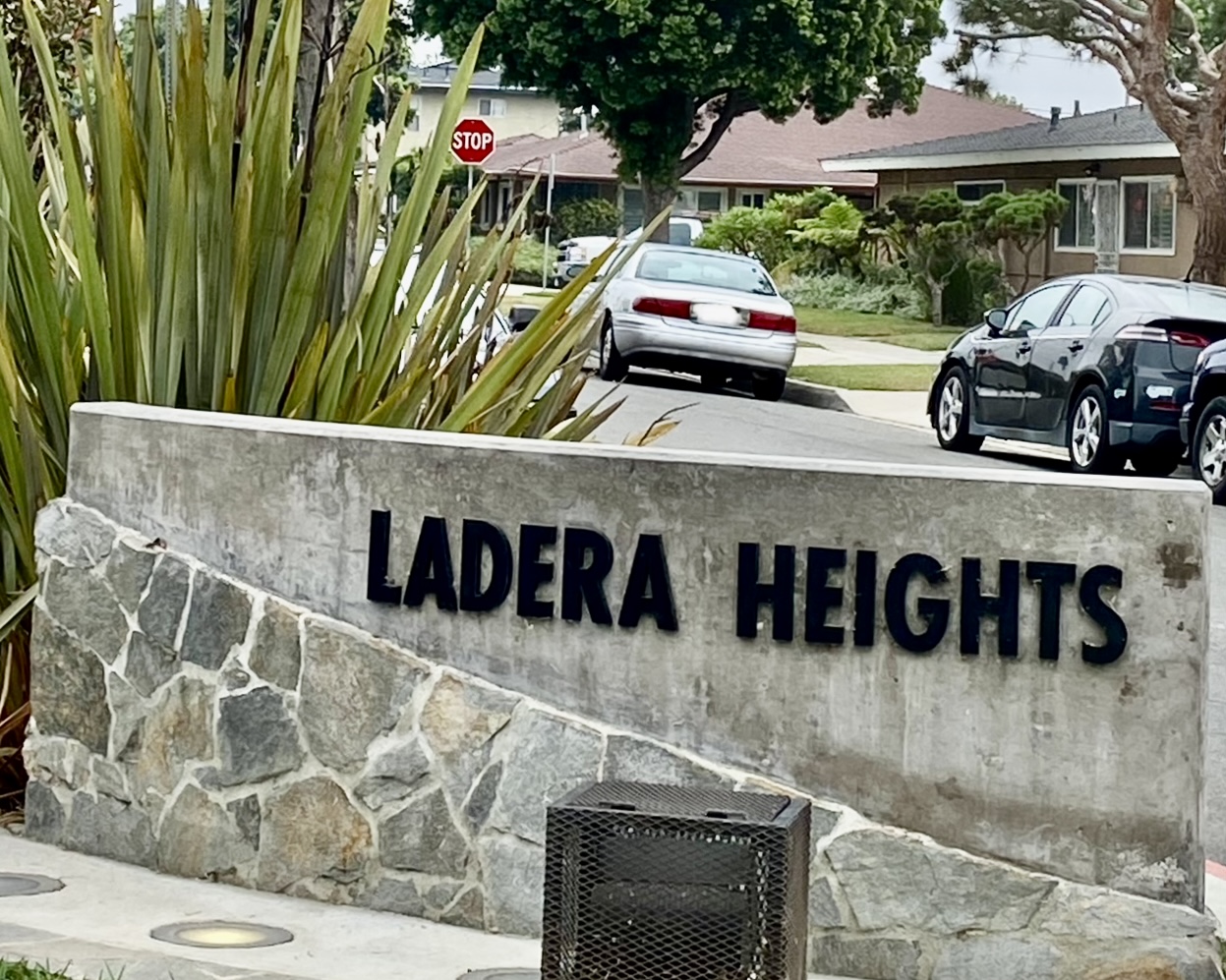 Ladera Heights community sign | |
| Nickname: “The Black Beverly Hills” | |
 Location of Ladera Heights in Los Angeles County, California. | |
 Ladera Heights, California Location in the United States | |
| Coordinates: 33°59′20″N 118°22′27″W | |
| Country | |
| State | |
| County | |
| Area | |
| • Total | 2.966 sq mi (7.681 km2) |
| • Land | 2.966 sq mi (7.681 km2) |
| • Water | 0 sq mi (0 km2) 0% |
| Elevation | 305 ft (93 m) |
| Population (2010) | |
| • Total | 6,498 |
| • Density | 2,200/sq mi (850/km2) |
| Time zone | UTC−8 (PST) |
| • Summer (DST) | UTC−7 (PDT) |
| ZIP Code | 90056 |
| Area code(s) | 310/424/323 |
| FIPS code | 06-39108 |
| GNIS feature IDs | 1867032, 2408521 |
History
Ladera Heights originated in the late 1940s with the development of "Old Ladera". In the 1960s, custom homes were built in "New Ladera". Prominent architect builders included Valentine and Gallant. Robert Earl, who designed many of the Valentine homes, went on to build large multimillion-dollar estates throughout Southern California and in other countries. Neighboring Fox Hills contained a golf course with rolling hills that backed up to Wooster Avenue. Valentine built Robert Earl designed homes on Wooster overlooking the Fox Hills golf course. Years later, Donald Trump asked Earl to design estate homes with panoramic views of his Palos Verdes golf course.
Baseball player Frank Robinson and other sports players began moving to Ladera Heights in the early 1970s.[4] Many celebrities have lived in Ladera Heights over the years, including Peter Vidmar, Vanessa Williams, Chris Darden, Chris Strait, Lisa Leslie, Olympia Scott, Ken Norton, Arron Afflalo, Tyler, The Creator, Michael Cooper and Byron Scott.[5] Ladera Heights is known as a residence for affluent African Americans.[6][7]
Retail
Ladera Heights Shopping Center (at the northwest side of the junction of La Tijera, La Cienega, and Centinela boulevards) hosted a Henshey's Department Store from 1966 to 1990[8] and what was popularly known as Magic Johnson Starbucks, a Starbucks owned by Magic Johnson from 1998 to 2018.[6] The center is currently anchored by Ross Dress for Less and a Ralphs supermarket.[9]
Geography
According to the United States Census Bureau, the CDP has a total area of 3.0 square miles (7.8 km2), all of it land.
Most of the area is in unincorporated Los Angeles County, with a small section in the neighborhood of Ladera, Los Angeles, within the City of Los Angeles.[10]
Ladera Heights is portioned into three sections, known as "Upper Ladera," "Lower Ladera" and "Old Ladera". Upper Ladera includes all houses north of Slauson in between La Cienega Boulevard and Shenandoah Avenue, while Lower Ladera (the larger of the two) consists of all houses south of Slauson in between Wooster and La Cienega. Old Ladera is the small area just east of La Cienega and south of Slauson. The Ladera Center, located in Lower Ladera just west of La Cienega Boulevard, hosts a number of local franchise stores and eateries.
Demographics
| Historical population | |||
|---|---|---|---|
| Census | Pop. | %± | |
| 1970 | 6,079 | — | |
| 1980 | 6,647 | 9.3% | |
| 1990 | 6,316 | −5.0% | |
| 2000 | 6,568 | 4.0% | |
| 2010 | 6,498 | −1.1% | |
| 2020 | 6,654 | 2.4% | |
| U.S. Decennial Census[11] 2010[12] 2020[13] | |||
2020 census
As of end of 2020, Ladera Heights ranks #3 among the top 10 richest black communities in US, with an average family income of $132,824.[14]
| Race / Ethnicity | Pop 2010[12] | Pop 2020[13] | % 2010 | % 2020 |
|---|---|---|---|---|
| White alone (NH) | 863 | 1,014 | 13.28% | 15.24% |
| Black or African American alone (NH) | 4,704 | 4,231 | 72.39% | 63.59% |
| Native American or Alaska Native alone (NH) | 14 | 14 | 0.22% | 0.21% |
| Asian alone (NH) | 228 | 351 | 3.51% | 5.28% |
| Pacific Islander alone (NH) | 1 | 2 | 0.02% | 0.03% |
| Some Other Race alone (NH) | 33 | 85 | 0.51% | 1.28% |
| Mixed Race/Multi-Racial (NH) | 300 | 451 | 4.62% | 6.78% |
| Hispanic or Latino (any race) | 355 | 506 | 4.46% | 7.60% |
| Total | 6,498 | 6,654 | 100.00% | 100.00% |
Note: the US Census treats Hispanic/Latino as an ethnic category. This table excludes Latinos from the racial categories and assigns them to a separate category. Hispanics/Latinos can be of any race.
2010 Census
The 2010 US Census[15] reported that Ladera Heights had a population of 6,498. The population density was 2,191.1 inhabitants per square mile (846.0/km2). The racial makeup of Ladera Heights was 4,786 (73.7%) African American, 979 (15.1%) White (13.3% Non-Hispanic White),[16] 20 (0.3%) Native American, 231 (3.6%) Asian, 2 (0.0%) Pacific Islander, 134 (2.1%) from other races, and 346 (5.3%) from two or more races. Hispanic or Latino of any race were 355 people (5.5%).
The census reported that 6,486 people (99.8% of the population) lived in households, 8 (0.1%) lived in non-institutionalized group quarters, and 4 (0.1%) were institutionalized.
There were 2,751 households, 702 (25.5%) had children under the age of 18 living in them, 1,240 (45.1%) were opposite-sex married couples living together, 462 (16.8%) had a female householder with no husband present, 113 (4.1%) had a male householder with no wife present. There were 93 (3.4%) unmarried opposite-sex partnerships, and 20 (0.7%) same-sex married couples or partnerships. 778 households (28.3%) were one person and 351 (12.8%) had someone living alone who was 65 or older. The average household size was 2.36. There were 1,815 families (66.0% of households); the average family size was 2.88.
The age distribution was 1,122 people (17.3%) under the age of 18, 401 people (6.2%) aged 18 to 24, 1,264 people (19.5%) aged 25 to 44, 2,183 people (33.6%) aged 45 to 64, and 1,528 people (23.5%) who were 65 or older. The median age was 49.0 years. For every 100 females, there were 79.7 males. For every 100 females age 18 and over, there were 75.1 males.
There were 2,867 housing units at an average density of 966.7 per square mile, of the occupied units 2,027 (73.7%) were owner-occupied and 724 (26.3%) were rented. The homeowner vacancy rate was 1.1%; the rental vacancy rate was 6.7%. 4,891 people (75.3% of the population) lived in owner-occupied housing units and 1,595 people (24.5%) lived in rental housing units.
During 2009–2013, Ladera Heights had a median household income of $99,563, with 4.7% of the population living below the federal poverty line.[16]
2000 Census
At the 2000 census there were 6,568 people, 2,691 households, and 1,883 families residing in the census-designated place (CDP). The population density was 2,230.6 inhabitants per square mile (861.2/km2). There were 2,755 housing units at an average density of 935.7 per square mile (361.3/km2). The racial makeup of the CDP was 70.8% African American, 7.0% White, 2.9% Asian, 0.3% Native American, 0.1% Pacific Islander, 1.4% from other races, and 4.5% from two or more races. Hispanic or Latino of any race were 3.4%.[17]
Of the 2,691 households 26.5% had children under the age of 18 living with them, 51.0% were married couples living together, 15.7% had a female householder with no husband present, and 30.0% were non-families. 24.8% of households were one person and 9.1% were one person aged 65 or older. The average household size was 2.44 and the average family size was 2.89.
The age distribution was 20.7% under the age of 18, 5.4% from 18 to 24, 24.5% from 25 to 44, 29.8% from 45 to 64, and 19.5% 65 or older. The median age was 44 years. For every 100 females, there were 81.9 males. For every 100 females age 18 and over, there were 77.7 males.
The median household income was $90,233 and the median family income was $103,174. Males had a median income of $64,643 versus $52,750 for females. The per capita income for the CDP was $47,798. About 1.1% of families and 3.7% of the population were below the poverty line, including 2.5% of those under age 18 and 5.9% of those age 65 or over.
- In the year 2000, these were the ten neighborhoods in Los Angeles County with the largest percentage of black residents:[18]
- View Park-Windsor Hills, California, 86.5%
- Gramercy Park, Los Angeles, 86.4%
- Leimert Park, Los Angeles, 79.6%
- Manchester Square, Los Angeles, 78.6%
- Baldwin Hills/Crenshaw, Los Angeles, 71.3%
- Ladera Heights, California, 71%
- Hyde Park, Los Angeles, 66%
- Chesterfield Square, Los Angeles, 58.6%
- West Rancho Dominguez, California, 57.6%
- Westmont, California, 57.5%
Education
Primary and secondary schools
Most of Ladera Heights is served by the Inglewood Unified School District.[19] The schools serving Ladera Heights are in the Inglewood city limits. As of 2006 fewer than 400 Ladera Heights residents attended Inglewood USD schools.[20] La Tijera School (K-8) and Parent School (K-8) serve Ladera Heights.[21] La Tijera and Parent feed into Inglewood High School.[22][23]
In 2006, a group of residents petitioned to move the area into the Culver City Unified School District of Culver City. Both the Culver City USD and the Inglewood USD opposed the move.[24]
As of 2014 the Wiseburn School District allows parents in Ladera Heights to send their children to Wiseburn schools on inter-district transfers.[25]
Colleges and universities
West Los Angeles College, a community college, is in Ladera Heights.[26]
Services
Ladera Heights receives fire protection from the Los Angeles County Fire Department.
The Los Angeles County Sheriff's Department (LASD) operates the Marina del Rey Station in Marina del Rey, serving Ladera Heights.[27]
The Los Angeles County Department of Health Services SPA 5 West Area Health Office serves Ladera Heights.[28]
Government
In the California State Legislature, Ladera Heights is in the 30th Senate District, represented by Democrat Sydney Kamlager, and in the 54th Assembly District, represented by Democrat Isaac Bryan.[29]
In the United States House of Representatives, Ladera Heights is in California's 37th congressional district, represented by Democrat Karen Bass.[30]
Parks and recreation
Ladera Park is adjacent to the View Park-Windsor Hills and the City of Inglewood.[31][32] The park has an outdoor amphitheatre, a baseball–softball diamond field, a basketball court, children's play areas, a community recreation center, water fountains, picnic areas with barbecue grills and tennis courts.[32]
Notable people from Ladera Heights
- Arron Afflalo
- Maia Campbell
- Chris Darden
- Randy Gardner
- Lisa Leslie
- Ken Norton
- Byron Scott
- Olympia Scott
- Chris Strait
- Tyler, The Creator
- Peter Vidmar
- Frank Ocean
See also
- Notable people from Ladera Heights
References
- "2010 Census U.S. Gazetteer Files – Places – California". United States Census Bureau.
- "Ladera Heights". Geographic Names Information System. United States Geological Survey, United States Department of the Interior. Retrieved October 23, 2014.
- "Ladera Heights CDP, California". United States Census Bureau. Retrieved March 13, 2022.
- Ladera Heights Community Association Newsletter Archived 2011-04-27 at the Wayback Machine. Retrieved on May 18, 2010.
- Ryan, Ruth (September 15, 1996). "In His Book It's Ladera Heights". Los Angeles Times.
- "When a Starbucks closes in L.A., does anyone notice?", Sabrina Ford, USA TODAY, Oct. 19, 2018
- "See the 10 Most Affluent African-American Neighborhoods in America". BET. July 7, 2017. Retrieved 2020-06-09.
- Kelleher, Kathleen (12 July 1992). "Henshey's, the Westside's First Department Store, Falls Victim to the Economy After 67 Years. : All Sales Final". Los Angeles Times. Retrieved 29 April 2019.
- Google Maps. Accessed 26 April 2019.
- Ladera Heights Community Information. Retrieved on November 30, 2017.
- "Decennial Census of Population and Housing by Decades". US Census Bureau.
- "P2 HISPANIC OR LATINO, AND NOT HISPANIC OR LATINO BY RACE – 2010: DEC Redistricting Data (PL 94-171) – Darling CDP, Mississippi". United States Census Bureau.
- "P2 HISPANIC OR LATINO, AND NOT HISPANIC OR LATINO BY RACE – 2020: DEC Redistricting Data (PL 94-171) – Darling CDP, Mississippi". United States Census Bureau.
- "10 Richest Black Communities in America". Retrieved November 12, 2020.
- "2010 Census Interactive Population Search: CA - Ladera Heights CDP". U.S. Census Bureau. Archived from the original on July 15, 2014. Retrieved July 12, 2014.
- "Census". Census.gov. Archived from the original on 2012-07-02.
- "U.S. Census website". United States Census Bureau. Retrieved 2008-01-31.
- , Mapping L.A. at Los Angeles Times
- "2020 CENSUS - SCHOOL DISTRICT REFERENCE MAP: Los Angeles County, CA" (PDF). U.S. Census Bureau. p. 11. Retrieved 2021-01-08.
- Merl, Jean. "Parents Want to Ditch City's Schools." Los Angeles Times. January 23, 2006. 2. Retrieved on March 22, 2010.
- Merl, Jean. "Parents Want to Ditch City's Schools." Los Angeles Times. January 23, 2006. 3. Retrieved on March 22, 2010.
- "Home." Parent K-8 School. Retrieved on March 22, 2010.
- "School Accountability Report Card 2004-2005." Inglewood Unified School District. Retrieved on March 23, 2010. "Students enter Inglewood High School from four feeder schools. The highest percentage of ninth grade students formerly attended Crozier Middle School, one of the District’s two middle schools. Other students attended the District’s K-8 schools: La Tijera, Warren Lane, and Parent."
- Merl, Jean. "Parents Want to Ditch City's Schools." Los Angeles Times. January 23, 2006. 1. Retrieved on March 22, 2010.
- "Home Archived 2014-04-07 at the Wayback Machine" (Archive). Wiseburn School District. Retrieved on April 4, 2014. "Also serving the children of employees from the surrounding aerospace, technology, travel, and entertainment industries, as well as families living in the Westchester, Playa del Rey, Playa Vista, Mar Vista, and Ladera Heights area on an interdistrict permit transfer."
- "Map, Parking & Transportation". West Los Angeles College. Retrieved 2021-01-09.
9000 Overland Avenue Culver City, CA 90230
- Compare with the U.S. Census Bureau map of Ladera Heights. Note it is not in the City of Culver City despite the postal address. Compare: "City Map" (Archive). City of Culver City. Retrieved on June 28, 2015. - "Marina del Rey Station Archived 2010-01-21 at the Wayback Machine." Los Angeles County Sheriff's Department. Retrieved on January 21, 2010.
- "About Us." Los Angeles County Department of Health Services. Retrieved on March 18, 2010.
- "Statewide Database". Regents of the University of California. Archived from the original on February 1, 2015. Retrieved April 12, 2015.
- "California's 37th Congressional District - Representatives & District Map". Civic Impulse, LLC.
- "View Park Windsor Hills CDP, California Archived 2011-06-06 at the Wayback Machine." U.S. Census Bureau. Retrieved on March 22, 2010.
- "Ladera Park." County of Los Angeles. Retrieved on March 22, 2010.
External links

Westside region, Los Angeles | ||
|---|---|---|
| Districts and neighborhoods |
|  |
| Points of interest |
| |
| Neighboring cities and communities | ||
| ||

| Authority control |
|
|---|
Другой контент может иметь иную лицензию. Перед использованием материалов сайта WikiSort.org внимательно изучите правила лицензирования конкретных элементов наполнения сайта.
WikiSort.org - проект по пересортировке и дополнению контента Википедии