world.wikisort.org - USA
Murrieta /mjʊəriˈɛtə/ is a city in southwestern Riverside County, California, United States. The population of Murrieta was 110,949 as of the 2020 census.[6] Murrieta experienced a 133.7% population increase between 2000 and 2010, making Murrieta one of the fastest-growing cities in the state during that period. Largely residential in character, Murrieta is typically characterized as a bedroom community. Murrieta is bordered by the city of Temecula to the south, the cities of Menifee and Wildomar to the north, and the unincorporated community of French Valley to the east. Murrieta is located in the center of the Los Angeles-San Diego mega-region. Murrieta is named for Juan Murrieta, a Californio ranchero who founded the town.[7]
Murrieta, California | |
|---|---|
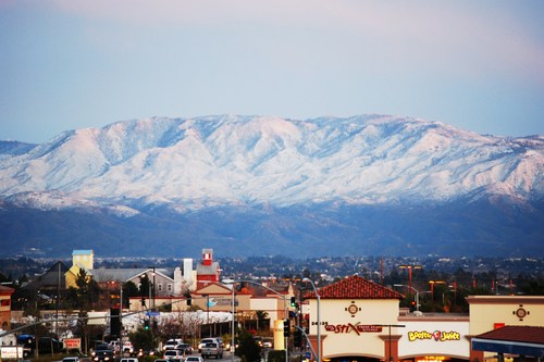 Murrieta skyline, toward Palomar Mountain | |
 Seal | |
| Motto: "The Future of Southern California" | |
 Location in Riverside County and the State of California | |
 Murrieta, California Location in the contiguous United States | |
| Coordinates: 33°34′10″N 117°12′09″W | |
| Country | |
| State | |
| County | |
| Incorporated | July 1, 1991[1] |
| Named for | Juan Murrieta |
| Government | |
| • Type | Council–manager[2] |
| • Mayor | Jonathan Ingram |
| • Mayor Pro Tem | Lisa DeForest |
| • City council[3] | Christi White Lori Stone Cindy Warren |
| • City manager | Kim Summers[2] |
| Area | |
| • Total | 33.65 sq mi (87.15 km2) |
| • Land | 33.61 sq mi (87.06 km2) |
| • Water | 0.04 sq mi (0.09 km2) 0.11% |
| Elevation | 1,175 ft (334 m) |
| Population (2020)[6] | |
| • Total | 110,949 |
| • Rank | 4th in Riverside County 59th in California |
| • Density | 3,301.07/sq mi (1,274.55/km2) |
| Time zone | UTC−8 (Pacific) |
| • Summer (DST) | UTC−7 (PDT) |
| ZIP codes | 92562–92564 |
| Area code | 951 |
| FIPS code | 06-50076 |
| GNIS feature IDs | 1667919, 2411199 |
| Website | www |
History
For most of its history, Murrieta was not heavily populated. On June 9, 1873,[8] Domingo Pujol, Francisco Sanjurjo, and Juan and Ezequiel Murrieta purchased the Rancho Pauba and Rancho Temecula Mexican land grants, comprising 52,000 acres (210 km2) in the area. Ezequiel returned to Spain and turned the land over to his younger brother, Juan Murrieta (1844–1936), who brought 7,000 sheep[9] to the valley in 1873, using the meadows to feed his sheep. The partnership dissolved in 1876 and Ezequiel and Juan Murrieta retained 15,000 acres of the northern half of the Temecula Rancho.[10] Ezequiel and Juan Murrieta granted a right-of-way, one hundred feet wide to the California Southern Railroad through the Temecula Rancho on April 28, 1882 so that the railroad could be constructed through the valley.[11]

In 1884, the Temecula Land and Water Company purchased about 14,500 acres from Juan Murrieta and mapped a townsite along the California Southern Railroad.[12] Others discovered the valley after the construction of a depot in 1887[13] that connected Murrieta to the Southern California Railroad's transcontinental route. By 1890, some 800 people lived in Murrieta.[14] Today much of the site (about 50 acres) is home to a Bible college and conference center, owned by Calvary Chapel Costa Mesa, which has invested millions of dollars into restoring and rebuilding the old resort rooms.[15] When the trains stopped in 1935, tourists—the lifeblood of the town—were much harder to come by. The boom that Murrieta had experienced due to the train and the hot springs gradually died, leaving Murrieta as a small country town.[16]
Although US Route 395 passed through Murrieta, it was not until Interstate 15 was built in the early 1980s that another boom began to take hold. By the late 1980s, suburban neighborhoods were being constructed, and people began moving to the Murrieta area from cities and towns in San Diego and Orange Counties, as well as other parts of Riverside County.[17]
In 1990, residents began a campaign for city status which resulted in the incorporation of the City of Murrieta on July 1, 1991. By then the population was 24,000, a major increase from 2,200 in 1980. Between 1991 and 2007, the city's population further increased to an estimated 97,257 residents, and at the 2010 United States Census[update] the city's population was 103,466, making it the largest city in southwestern Riverside County at that time.[14]
In July 2014, Murrieta garnered national attention following days of citizen protests of detained immigrants.[18] Murrieta residents successfully blocked busloads of illegal immigrant detainees.[19] They were en route to a temporary relocation and detention facility, which the federal government had planned to establish in the town.[20]
Geography
According to the United States Census Bureau, the city has a total area of 33.6 sq mi (87.1 km2), of which 99.89% of it is land and 0.11% is covered by water. Murrieta Creek runs southeasterly through the Murrieta Valley.
Climate
| Climate data for Murrieta, California | |||||||||||||
|---|---|---|---|---|---|---|---|---|---|---|---|---|---|
| Month | Jan | Feb | Mar | Apr | May | Jun | Jul | Aug | Sep | Oct | Nov | Dec | Year |
| Average high °F (°C) | 67 (19) |
66 (19) |
72 (22) |
73 (23) |
78 (26) |
83 (28) |
91 (33) |
91 (33) |
89 (32) |
79 (26) |
74 (23) |
66 (19) |
77.4 (25.2) |
| Average low °F (°C) | 41 (5) |
41 (5) |
45 (7) |
48 (9) |
52 (11) |
55 (13) |
62 (17) |
61 (16) |
57 (14) |
52 (11) |
46 (8) |
40 (4) |
50 (10) |
| Average precipitation inches (mm) | 3.22 (82) |
4.16 (106) |
.94 (24) |
.73 (19) |
.24 (6.1) |
.01 (0.25) |
.07 (1.8) |
.01 (0.25) |
.14 (3.6) |
1.32 (34) |
1.18 (30) |
3.54 (90) |
15.56 (395) |
| Source: weathercurrents.com[21] | |||||||||||||
Murrieta has a Mediterranean climate or dry-summer subtropical (Köppen climate classification Csa). Murrieta has an average of 263 sunshine days and 35 days with measurable precipitation annually.[22] April through November is warm to hot and dry with average high temperatures of 77–91 °F (25–33 °C) and lows of 44–60 °F (7–16 °C). The period of November through March is somewhat rainy. The city is also subject to the phenomenon typical of a microclimate: temperatures can vary as much as 18 °F (10 °C) between inland areas and the coast, with a temperature gradient over 1 °F per mile (0.3 °C/km) from the coast inland. Murrieta gets on average 31 days a year of some type of precipitation. Murrieta averages 15 inches (380 millimetres) of precipitation annually, which mainly occurs during the winter and spring (November through April) with generally light rain showers, but sometimes heavy rainfall and thunderstorms. Snowfall is rare in the city basin, but nearby mountains slopes typically receive snowfall each winter.[citation needed]
Demographics
| Historical population | |||
|---|---|---|---|
| Census | Pop. | %± | |
| 1990 | 1,628 | — | |
| 2000 | 44,282 | 2,620.0% | |
| 2010 | 103,466 | 133.7% | |
| 2020 | 110,949 | 7.2% | |
| U.S. Decennial Census[23][24] | |||
2010
The 2010 United States Census[25] reported that Murrieta had a population of 103,466. The population density was 3,078.1 inhabitants per square mile (1,188.5/km2). The racial makeup of Murrieta was 72,137 (69.7%) White (55.7% non-Hispanic White),[26] 5,601 (5.4%) African American, 741 (0.7%) Native American, 9,556 (9.2%) Asian, 391 (0.4%) Pacific Islander, 8,695 (8.4%) from other races, and 6,345 (6.1%) from two or more races. Hispanics or Latinos of any race were 26,792 persons (25.9%). The census reported 103,037 people (99.6% of the population) lived in households, 291 people (0.3%) lived in noninstitutionalized group quarters, and 138 people (0.1%) were institutionalized.
Of the 32,749 households, 48.4% had children under the age of 18 living in them, 62.8% were opposite-sex married couples living together, 3,814 (11.6%) had a female householder with no husband present, and 1,642 (5.0%) had a male householder with no wife present, with 1,626 (5.0%) unmarried opposite-sex partnerships and 192 (0.6%) same-sex married couples or partnerships. About 5,208 households (15.9%) were made up of individuals, and 2,248 (6.9%) had someone living alone who was 65 years of age or older. The average household size was 3.15. There were 26,033 families (79.5% of all households); the average family size was 3.51.
The population was distributed as 31,471 people (30.4%) under the age of 18, 9,891 people (9.6%) aged 18 to 24, 28,144 people (27.2%) aged 25 to 44, 23,555 people (22.8%) aged 45 to 64, and 10,405 people (10.1%) who were 65 years of age or older. The median age was 33.4 years. For every 100 females, there were 95.2 males. For every 100 females age 18 and over, there were 91.2 males.
The 35,294 housing units averaged 1,050.0 per square mile (405.4/km2), of which 23,110 (70.6%) were owner-occupied and 9,639 (29.4%) were occupied by renters. The homeowner vacancy rate was 3.1%; the rental vacancy rate was 7.8%; 73,518 people (71.1% of the population) lived in owner-occupied housing units and 29,519 people (28.5%) lived in rental housing units.
2000
As of the census[27] of 2000, 44,282 people, 14,320 households, and 11,699 families resided in the city. The population density was 1,560.0 inhabitants per square mile (602.3/km2). The 14,921 housing units averaged 525.6 per square mile (202.9/km2). The racial makeup of the city was 81.6% White, 3.4% African American, 0.7% Native American, 4.0% Asian, 6.0% from other races, and 4.3% from two or more races. Hispanics or Latinos of any race were 17.5% of the population.
Of the 14,320 households, 47.5% had children under the age of 18 living with them, 70.2% were married couples living together, 8.1% had a female householder with no husband present, and 18.3% were not families. About 14.5% of all households were made up of individuals, and 6.7% had someone living alone who was 65 years of age or older. The average household size was 3.1 and the average family size was 3.4; 33.7% of the population of the city was under the age of 18, 6.4% were from 18 to 24, 30.8% were from 25 to 44, 17.6% were from 45 to 64, and 11.4% were 65 years of age or older. The median age was 34 years. For every 100 females, there were 96.1 males. For every 100 females age 18 and over, there were 92.7 males.
According to a 2007 estimate, the median income for a household in the city was $78,883, and the median income for a family was $90,930.[28][29] Men had a median income of $49,107 versus $32,468 for women. The per capita income for the city was $23,290. About 3.0% of families and 4.3% of the population were below the poverty line, including 4.3% of those under age 18 and 5.4% of those age 65 or over.
Crime
Murrieta was the safest city in Riverside County in 2012,[30] and in 2009, Murrieta was listed as the second-safest city (over 100,000 in population) in the United States, behind Irvine, California.[citation needed]
Economy

Top employers
According to the city's 2021 Comprehensive Annual Financial Report,[31] the top non-military employers in the city are:
| # | Employer | # of Employees |
|---|---|---|
| 1 | Murrieta Valley Unified School District | 2,207 |
| 2 | Southwest Healthcare System | 1,467 |
| 3 | Loma Linda University Medical Center | 1,190 |
| 4 | County of Riverside | 923 |
| 5 | Target | 415 |
| 6 | City of Murrieta | 384 |
| 7 | Walmart | 339 |
| 8 | Oak Grove Center | 317 |
| 9 | Sam's Club | 215 |
| 10 | Murrieta Health & Rehab Center | 203 |
Arts and culture
The Town Square is the location of the Murrieta Police Department, Murrieta Public Library, City Hall, a senior center, and $2 million veterans memorial.[32]
Parks and recreation
Bear Creek Golf and Country Club was designed by Jack Nicklaus, and Presidents Ronald Reagan and Gerald Ford have played there. The Golf Club at Rancho California was designed by Robert Trent Jones, Sr.[33]
Government
| Year | Democratic | Republican | Third Parties |
|---|---|---|---|
| 2020[35] | 42.46% 23,184 | 55.52% 30,316 | 2.02% 1,103 |
| 2016[36] | 36.42% 14,887 | 57.35% 23,441 | 6.22% 2,543 |
| 2012[37] | 36.52% 13,520 | 61.58% 22,799 | 1.91% 706 |
| 2008[38] | 40.01% 14,573 | 58.49% 21,306 | 1.50% 548 |
| 2004[39] | 29.60% 8,988 | 69.61% 21,136 | 0.78% 238 |
| 2000[40] | 32.70% 5,690 | 64.75% 11,268 | 2.56% 445 |
| 1996[41] | 32.43% 4,317 | 57.52% 7,658 | 10.05% 1,338 |
| 1992[42] | 25.94% 2,874 | 45.97% 5,093 | 28.09% 3,112 |
In the United States House of Representatives, Murrieta is in California's 42nd congressional district, represented by Republican Ken Calvert.[43] In the United States Senate, California is represented by Democrats Dianne Feinstein and Alex Padilla.
In the California State Legislature, Murrieta is in the 28th Senate District, represented by Republican Melissa Melendez, and in the 67th Assembly District, represented by Republican Kelly Seyarto.[44]
In the Riverside County Board of Supervisors, Murrieta is in the Third District, represented by Chuck Washington.[45]
Education
The city of Murrieta is served by the Murrieta Valley Unified School District (MVUSD). The district contains eleven elementary (K-5) schools, four middle (6-8) schools, three comprehensive high (9-12) schools (Murrieta Valley High School, Vista Murrieta High School, Murrieta Mesa High School), one continuation school (Creekside High School), and one independent study school.
Calvary Chapel Bible College operated at the Murrieta Hot Springs Resort site from 1994 until 2022. Its affiliated private comprehensive (K-9) school at Calvary Chapel Murrieta also serves the Murrieta community. There had been a senior high school in the Calvary Chapel Murrieta system, but it closed in 2019.[46] Mt. San Jacinto College is the nearest community college (with locations in Temecula and Menifee) and the University of California, Riverside (UCR) is the nearest public university. The city is also home to a University of Phoenix learning center and an Azusa Pacific University satellite campus.[47][48]
Media
The area of southwest Riverside County is served by television station Channel 27, broadcast from a hilltop in Murrieta.[49]
Infrastructure
Transportation
Murrieta is served by two major Interstate highways: I-15 runs through the western portion of the city while I-215 runs through the eastern portion. Historic U.S. Route 395 (Jefferson Avenue/Ivy Street/Washington Avenue) passes through the city's downtown and State Route 79 (Winchester Road) defines much of the city's eastern border.
The Riverside Transit Agency (RTA)'s Routes 23, 61, 205, and 206 provide bus transit to Murrieta.[50]
The French Valley Airport, used for general aviation, is located just east of the city limits.[51]
The city may become host to the high-speed rail (HSR) that voters approved in 2008 with Prop 1A.[52] The proposed HSR station is projected to handle 8,000 daily riders. The program-level HSR route alignment has placed this station between Murrieta and Temecula near the I-15 and I-215 freeway interchange.[53]
Public safety
This section does not cite any sources. (September 2022) |
The Murrieta Fire Department was an all-volunteer fire department for 38 years. In 1987, it became a municipal fire protection district. It has been the city's primary paramedic service provider since 2000, and changed its name in 2017 to Murrieta Fire and Rescue. As of 2022, the department has five stations throughout the city, and operates a primary fleet of four type-1 engines, one quint-style truck, and two type-6 engines.
The Murrieta Police Department was founded in 1992. As of 2022, the department had about 100 sworn officers and approximately 50 support staff.
Hospitals
Murrieta is served by two hospitals: Loma Linda University Medical Center and Rancho Springs Medical Center.
Notable people
This section needs additional citations for verification. (December 2012) |
- Barry Bonds, formerly of the San Francisco Giants, is a former resident of Bear Creek.[54]
- Ambyr Childers, actress, was raised in Murrieta.
- Charlotte Rose Craig, Taekwondo Olympic Medalist in 2008.
- Lindsay Davenport, professional tennis player and Olympic gold medalist, graduated from Murrieta Valley High School in 1994.[55]
- Rickie Fowler, professional golfer[56]
- Tyler Glenn and Christopher Allen of Neon Trees[57]
- Ben Jackson, professional Major League Gaming player, originally from Murrieta[58]
- Floyd Landis, disgraced cyclist, disqualified participant of the 2006 Tour de France, lives in Murrieta with his family when not racing or training.[59]
- Ryan Navarro, American football player, raised in Murrieta and played football at Vista Murrieta High School
- Inbee Park, professional golfer. Winner of five LPGA major championships.
- Tom Pernice Jr., professional golfer and two-time winner on the PGA Tour, lives in Murrieta.[60]
- Olivia Rodrigo, singer-songwriter and actress[61]
- Kelly Seyarto, Firefighter and politician. Former mayor of Murrieta. Member of the California State Assembly from the District 67.[62]
- Tyler Wade, Major League Baseball player
- Tyree Washington, track athlete, world record holder in the 4 × 400 m relay and five-event IAAF World Championship gold medalist (1997, 2003 world; 2006 – world indoor)
- Patrick Wisdom, Major League Baseball player
See also
Further reading
- Boyce, Mary Alice Rail (1995). Murrieta Old Town, New Town: A Community History (illustrated ed.). Rosemar Pub. ISBN 978-0-96486-340-8.
References
- "California Cities by Incorporation Date". California Association of Local Agency Formation Commissions. Archived from the original (Word) on November 3, 2014. Retrieved August 25, 2014.
- "City Manager's Office". City of Murrieta. Archived from the original on December 20, 2014. Retrieved January 4, 2015.
- "City Council". Murrieta, CA. Retrieved August 29, 2020.
- "2019 U.S. Gazetteer Files". United States Census Bureau. Retrieved July 1, 2020.
- "Murrieta". Geographic Names Information System. United States Geological Survey, United States Department of the Interior. Retrieved October 16, 2014.
- "Murrieta city, California". United States Census Bureau. Retrieved November 7, 2021.
- "Developers Look to Juan Murrieta's Birthplace for Inspiration". San Diego Union-Tribune. November 5, 2005.
- "Chain of title for Rancho Temecula and Rancho Pauba, ca.1920". California Historical Society. University of Southern California Libraries.
- San Diego Union, June 5, 1873
- Temecula at the Crossroads of History; ISBN 1-886483-14-0
- Boyce 1995, p. 22.
- Boyce 1995, p. 16.
- Boyce 1995, p. 30.
- "City of Murrieta - Murrieta History". www.murrieta.org. Archived from the original on September 24, 2010. Retrieved August 31, 2017.
- Murrieta, California (Images of America Series); ISBN 0-7385-4669-0
- "City of Murrieta - Murrieta History". murrieta.org. Archived from the original on September 24, 2010. Retrieved August 31, 2017.
- "California Highways (www.cahighways.org): Routes 9 through 16". www.cahighways.org. Retrieved August 31, 2017.
- Medina, Jennifer (July 3, 2014). "Influx of Central American Migrants Roils Murrieta, Calif". The New York Times. Retrieved August 29, 2020.
- Greg Grandin (February 28, 2019). "How violent American vigilantes at the border led to Trump's wall". The Guardian.
- Murphy, Kathy (September 30, 2014). "UC Berkeley celebrates free speech movement's 50th anniversary". San Jose Mercury News. Retrieved October 4, 2014.
- Murrieta California Climate Summary Weather Currents Retrieved 2009-06-03
- "Weatherbase: Historical Weather for Los Angeles, California, United States of America". Weatherbase.com. Retrieved January 8, 2009.
- "Census of Population and Housing". Census.gov. Retrieved June 4, 2015.
- "Murrieta (city) QuickFacts". United States Census Bureau. Retrieved May 24, 2019.
- "2010 Census Interactive Population Search: CA – Murrieta city". United States Census Bureau. Archived from the original on July 15, 2014. Retrieved July 12, 2014.
- "Murrieta Non-Hispanic White population in 2010". United States Census Bureau. Archived from the original on December 26, 2011. Retrieved July 8, 2014.
- "U.S. Census website". United States Census Bureau. Retrieved January 31, 2008.
- "Murrieta median income for household". United States Census Bureau. Archived from the original on February 12, 2020. Retrieved July 8, 2014.
- "Murrieta median income for a family". United States Census Bureau. Archived from the original on February 12, 2020. Retrieved July 8, 2014.
- "Police: FBI Report Shows Murrieta Among Safest Cities". June 16, 2012. Retrieved August 31, 2017.
- "2021 Comprehensive Annual Financial Report, Fiscal Year Ended June 30, 2021". City of Murrieta. Retrieved August 17, 2022.
- "Murrieta Veterans Memorial website". Archived from the original on April 27, 2010. Retrieved August 31, 2017.
- "The Golf Club at Rancho California Details".
- "Statewide Election Results :: California Secretary of State". www.sos.ca.gov.
- "Results" (PDF). elections.cdn.sos.ca.gov. 2020. Retrieved August 23, 2022.
- "Results" (PDF). elections.cdn.sos.ca.gov. 2016. Retrieved August 23, 2022.
- "Results" (PDF). elections.cdn.sos.ca.gov. 2012. Retrieved August 23, 2022.
- "Results" (PDF). elections.cdn.sos.ca.gov. 2008. Retrieved August 23, 2022.
- "Results" (PDF). elections.cdn.sos.ca.gov. 2004. Retrieved August 23, 2022.
- "Results" (PDF). elections.cdn.sos.ca.gov. 2000. Retrieved August 23, 2022.
- "Results" (PDF). elections.cdn.sos.ca.gov. 1996. Retrieved August 23, 2022.
- "Results" (PDF). elections.cdn.sos.ca.gov. 1992. Retrieved August 23, 2022.
- "California's 42nd Congressional District - Representatives & District Map". Civic Impulse, LLC.
- "Statewide Database". UC Regents. Archived from the original on February 1, 2015. Retrieved November 30, 2014.
- "Our District". Chuck Washington - Riverside County 3rd District Website.
- Kristoffersen, Matt (June 2, 2019). "Calvary Murrieta Christian Schools' high school closes after 25 years". The Press-Enterprise. Retrieved July 25, 2022.
- "Visit University of Phoenix - Murrieta Learning Center". www.phoenix.edu. Retrieved June 4, 2019.
- "Murrieta Regional Campus - Azusa Pacific University". www.apu.edu. Retrieved June 4, 2019.
- "Channel 27 TV station cuts back". Archived from the original on January 29, 2010. Retrieved August 31, 2017.
- "Maps & Schedules". Riverside Transit Agency. Riverside Transit Agency. Retrieved August 23, 2022.
- "AirNav: F70 - French Valley Airport". www.airnav.com. Retrieved August 31, 2017.
- "We're transforming LA County". www.metro.net. Retrieved August 31, 2017.
- "HSR Station Concepts through the Inland Empire". Archived from the original on July 20, 2011. Retrieved August 31, 2017.
- "Barry Bonds profile". Retrieved August 31, 2017.
- "Lindsay Davenport". CNN. September 13, 1993.
- "Rickie Fowler". PGA Tour. Retrieved December 10, 2012.
- "Neon Trees returns to Murrieta, Calif., for benefit concert, hasn't forgotten roots". Deseret News. July 12, 2013. Retrieved April 23, 2017.
- "Ben Jackson Gamer". World News. Retrieved August 31, 2017.
- Nicole Sack (December 31, 2006). "Floyd Landis' short-lived glory: Murrieta cyclist still under a cloud". North County Times. Archived from the original on September 4, 2012. Retrieved July 8, 2014.
- "Tom Pernice Jr". PGA Tour. Retrieved December 10, 2012.
- "Clipped From The Californian". The Californian. March 30, 2003. p. 14. Retrieved December 8, 2021.
- "Kelly Seyarto". asmrc.org. Archived from the original on April 25, 2021. Retrieved April 25, 2021.
External links
Places adjacent to Murrieta, California | |
|---|---|


| Authority control |
|
|---|
На других языках
[de] Murrieta
Murrieta ist eine Stadt im Riverside County im US-Bundesstaat Kalifornien mit etwa 110.000 Einwohnern (Stand 2020) und einer Größe von 87,058 km². Sie ist eine der am schnellsten wachsenden Städte in Kalifornien.- [en] Murrieta, California
[ru] Марриета
Марриета[3] (англ. Murrieta) — город в округе Риверсайд, штат Калифорния, США. Занимает 4-е место по количеству жителей в округе, 61-е по этому показателю в Калифорнии и 263-е в США (по оценкам 2013 года).Другой контент может иметь иную лицензию. Перед использованием материалов сайта WikiSort.org внимательно изучите правила лицензирования конкретных элементов наполнения сайта.
WikiSort.org - проект по пересортировке и дополнению контента Википедии