world.wikisort.org - USA
Chino Hills (Chino, Spanish for "Curly") is a city located in the southwestern corner of San Bernardino County, California, United States. The city borders Los Angeles County on its northwest side, Orange County to its south and southwest, and Riverside County to its southeast.
This article uses bare URLs, which are uninformative and vulnerable to link rot. (September 2022) |
Chino Hills, California | |
|---|---|
 Chino Hills, with the San Gabriel Mountains in background | |
 Seal | |
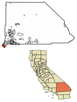 Location of Chino Hills in San Bernardino County, California | |
 Chino Hills, California Location in the United States | |
| Coordinates: 33°59′38″N 117°45′32″W[1] | |
| Country | United States |
| State | California |
| County | San Bernardino |
| Incorporated (city) | December 1, 1991[2] |
| Government | |
| • Type | Council-Manager |
| • Mayor | Peter Rogers[3] |
| Area | |
| • Total | 44.70 sq mi (115.77 km2) |
| • Land | 44.65 sq mi (115.64 km2) |
| • Water | 0.05 sq mi (0.12 km2) 0.15% |
| Elevation | 860 ft (262 m) |
| Population (2020) | |
| • Total | 78,411 |
| • Rank | 100th in California |
| • Density | 1,756.13/sq mi (678.05/km2) |
| Time zone | UTC-8 (Pacific) |
| • Summer (DST) | UTC-7 (PDT) |
| ZIP code | 91709 |
| Area code | 909 |
| FIPS code | 06-13214 |
| GNIS feature IDs | 1668255, 2409454 |
| Website | www |
History
Indigenous
Prior to the colonization of the area by the Spanish Empire in the late 18th century, the Tongva village of Wapijanga was the major point of influence in what would become referred to as Chino Hills. The village was an important point of connection between the Tongva and Serrano.[5][6]
Spanish and Mexican eras
After the Spanish founded Mission San Gabriel in 1771, the Chino Hills region was used extensively for grazing by mission cattle. During the Mexican Republic era, the hills were used as spillover grazing from such surrounding Mexican ranchos as Santa Ana del Chino and Rancho La Sierra (Yorba).
Early American era
After Mexico ceded California to the United States it was, and still is, a swamp and subject to flooding annually. Most historical dwellings were demolished in the rush to develop the modern city. A local state monument is present in the grass lawn area of the local fire department.[citation needed] Casa Colina, a well-known rehabilitation center now situated in Pomona California, began as a tubercular clinic in the Los Serranos sector.[citation needed]
This land was sold to Richard Gird, the founder of nearby Chino subdivision and from which the town of Chino sprung in 1910.[7] With the building of the Carbon Canyon Mineral Springs in the modern-day Sleepy Hollow region of the city and the new Los Serranos Country Club in Los Serranos, Chino Hills, California, the area became a destination for both Los Angeles tourists and bootleggers during the prohibition because of its isolation. For the same reason, Sleepy Hollow became a destination for hippies and artists during the 1960s.[8] During the late 1980s, an incorporation effort began and in 1991, the city was incorporated with a population of 42,000.[9]
Development
Due to its topography of rolling hills, Chino Hills was primarily rural prior to the mid-1970s; most land was utilized for equestrian purposes and for dairies, except for the multi-use purposes of the State of California, promoting jobs for the community through day labor from the Chino Institute for Men on Central Avenue. Rapid and extensive housing developments followed throughout the 1980s and early 1990s, only slowing down in recent years. Most neighborhoods are arranged in a village-type format with strategically placed shopping centers and parks designed to be within walking distance of nearby homes.
Chino Hills is home to the Vellano Country Club, a private golf course and housing development designed by golf champion Greg Norman, his first project in the Greater Los Angeles area.[10]
Chino Hills also includes the developed golf course development neighborhood of Los Serranos. Other large master-planned subdivisions without amenities include Woodview/Village Crossing, Gordon Ranch, LaBand Village, Butterfield Ranch,[11] Rolling Ridge, Fairfield Ranch, and Payne Ranch.[12]
Contemporary era
On July 29, the 2008 Chino Hills earthquake, a 5.4 magnitude earthquake, occurred at approximately 11:42:15 am PDT (18:42:15 UTC). Some incidents of damage were reported, but no fatalities or severe injuries occurred as a result. The earthquake was felt as far south as San Diego and as far north as Las Vegas. The quake was reported to have interrupted a taping of the show Judge Judy, as well as a first-day taping of the new show Judge Penny. The epicenter was located in the southeast portion of the Yorba Linda Fault.
Chino Hills was ranked 21st in Money magazine's "Best places to live 2012."[13] It is also the 5th highest income place in the United States (with population 65,000 to 250,000)[14] and was ranked as the 7th safest city in the United States in 2011 by the FBI., and 4th safest city in the U.S. overall in 2016, also according to FBI crime data.[15] Chino Hills is a part of the Chino Valley.
Chino Hills' reputation is known in the national arena as well, as it was featured on the list of 57 of America's hottest towns in the January 2004 issue of Money magazine.[16] Chino Hills was ranked 3rd on the list of "best places in the west with a population under 100,000." The magazine reviewed a decade of data for communities with above average population growth, income, and home prices "to see where people were most willing to devote a high multiple of their annual income to live happily ever after."
Geography
| Chino Hills, California | ||||||||||||||||||||||||||||||||||||||||||||||||||||||||||||
|---|---|---|---|---|---|---|---|---|---|---|---|---|---|---|---|---|---|---|---|---|---|---|---|---|---|---|---|---|---|---|---|---|---|---|---|---|---|---|---|---|---|---|---|---|---|---|---|---|---|---|---|---|---|---|---|---|---|---|---|---|
| Climate chart (explanation) | ||||||||||||||||||||||||||||||||||||||||||||||||||||||||||||
| ||||||||||||||||||||||||||||||||||||||||||||||||||||||||||||
| ||||||||||||||||||||||||||||||||||||||||||||||||||||||||||||
Physical geography
According to the United States Census Bureau, the city has a total area of 44.8 square miles (116 km2), much of which is undeveloped rolling hills, including the Chino Hills State Park. 44.7 square miles (116 km2) of it is land and 0.1 square miles (0.26 km2) of it (0.15%) is water.
City layout
The city of Chino Hills is bounded by the Los Angeles County cities of Pomona and Diamond Bar to the north and to the northwest, the Los Angeles County unincorporated area of South Diamond Bar to the west, the San Bernardino County city of Chino to the east, unincorporated Riverside County near Corona to the southeast, and the Orange County cities of Brea and Yorba Linda to the west and southwest, respectively, as well as an unincorporated area of Orange County between Brea and Yorba Linda and a small unincorporated area between Yorba Linda and Anaheim commonly mistaken as part of the city of Anaheim, to the southwest and south, respectively.
The eastern border of Chino Hills roughly follows the Chino Valley Freeway (SR 71), which offers access to the Pomona Freeway (SR 60) to the north and the Riverside Freeway (SR 91) to the south. Undeveloped hills form the western border, which also serves as the San Bernardino – Orange County line. Because this area is mostly undeveloped, there is only one road directly connecting Chino Hills and Orange County, Carbon Canyon Road (SR 142), which is long, winding, and prone to landslides.[17][18]
Destinations from Chino Hills | |
|---|---|
Demographics
| Historical population | |||
|---|---|---|---|
| Census | Pop. | %± | |
| 1990 | 27,608 | — | |
| 2000 | 66,787 | 141.9% | |
| 2010 | 74,799 | 12.0% | |
| 2020 | 78,411 | 4.8% | |
| U.S. Decennial Census[19] | |||
2010
The 2010 United States Census[20] reported that Chino Hills had a population of 74,799. The population density was 1,671.5 inhabitants per square mile (645.4/km2). The racial makeup of Chino Hills was 38,035 (50.8%) White (33.4% Non-Hispanic White),[21] 3,415 (4.6%) African American, 379 (0.5%) Native American, 22,676 (30.3%) Asian, 115 (0.2%) Pacific Islander, 6,520 (8.7%) from other races, and 3,659 (4.9%) from two or more races. Hispanic or Latino of any race were 21,802 persons (29.1%).
The Census reported that 74,644 people (99.8% of the population) lived in households, 8 (0%) lived in non-institutionalized group quarters, and 147 (0.2%) were institutionalized.
There were 22,941 households, out of which 11,026 (48.1%) had children under the age of 18 living in them, 15,840 (69.0%) were opposite-sex married couples living together, 2,381 (10.4%) had a female householder with no husband present, 1,101 (4.8%) had a male householder with no wife present. There were 834 (3.6%) unmarried opposite-sex partnerships, and 142 (0.6%) same-sex married couples or partnerships. 2,713 households (11.8%) were made up of individuals, and 717 (3.1%) had someone living alone who was 65 years of age or older. The average household size was 3.25. There were 19,322 families (84.2% of all households); the average family size was 3.54.
The population was spread out, with 20,291 people (27.1%) under the age of 18, 7,147 people (9.6%) aged 18 to 24, 20,207 people (27.0%) aged 25 to 44, 21,889 people (29.3%) aged 45 to 64, and 5,265 people (7.0%) who were 65 years of age or older. The median age was 36.6 years. For every 100 females, there were 97.7 males. For every 100 females age 18 and over, there were 94.7 males.
There were 23,617 housing units at an average density of 527.8 per square mile (203.8/km2), of which 18,421 (80.3%) were owner-occupied, and 4,520 (19.7%) were occupied by renters. The homeowner vacancy rate was 1.0%; the rental vacancy rate was 5.4%. 61,152 people (81.8% of the population) lived in owner-occupied housing units and 13,492 people (18.0%) lived in rental housing units. The median household income was $106,099 and the mean household income was $122,788. For families, the median income was $109,106 and the mean was $127,755.[20]
2000
As of the census[22] of 2000, there were 66,787 people, 20,039 households, and 17,073 families residing in the city. The population density was 575.5/km2 (1,490.6/mi2). There were 20,414 housing units at an average density of 175.9/km2 (455.6/mi2). The racial makeup of the city was 56.4% White, 5.5% African American, 0.6% Native American, 22.1% Asian, 0.1% Pacific Islander, 10.6% from other races, and 4.7% from two or more races. 25.7% of the population were Hispanic or Latino of any race. The average house cost was $654,250.
There were 20,039 households, out of which 53.8% had children under the age of 18 living with them, 72.6% were married couples living together, 8.5% had a female householder with no husband present, and 14.8% were non-families. 10.8% of all households were made up of individuals, and 1.6% had someone living alone who was 65 years of age or older. The average household size was 3.33 and the average family size was 3.61. The average home price (excluding the unincorporated area of Los Serranos) was approximately $716,900, and the median home price was $659,900.
In the city, the population was spread out, with 32.9% under the age of 18, 7.4% from 18 to 24, 35.6% from 25 to 44, 19.9% from 45 to 64, and 4.2% who were 65 years of age or older. The median age was 32 years. For every 100 females, there were 98.9 males. For every 100 females age 18 and over, there were 95.1 males.
The median income for a household in the city was $83,550, and the median income for a family was $81,794. Males had a median income of $55,272 versus $38,620 for females. The per capita income for the city was $26,182. The average income for the city was $95,990. 4.1% of the population and 2.7% of families were below the poverty line. Out of the total population, 4.7% of those under the age of 18 and 3.9% of those 65 and older were living below the poverty line.
Political affiliation
Chino Hills reliably supports the Democratic Party, though by smaller margins compared to other regions such as the more-northerly Pomona. Chino Hills' most pro-Republican areas are in the southern and eastern regions.[23]
Economy
Top employers
According to the city's 2020 Comprehensive Annual Financial Report,[24] the top employers in the city are:
| # | Employer | # of Employees |
|---|---|---|
| 1 | Chino Valley Unified School District | 3,350 |
| 2 | Costco | 340 |
| 3 | Lowe's | 265 |
| 4 | Boys Republic | 264 |
| 5 | City of Chino Hills | 229 |
| 6 | Albertsons | 226 |
| 7 | Kaiser Permanente Laboratory | 220 |
| 8 | Chino Valley Fire District | 140 |
| 9 | 99 Ranch Market | 124 |
| 10 | Harkins Theaters | 123 |
Arts and culture
Library
The Chino Hills Library is a branch of the San Bernardino County Library System. The current library opened in 2009 and is part of the government center on City Center Drive, adjacent to The Shoppes shopping center and Boys Republic.
In film
The area was the fictionalized location of the initial Martian spacecraft's landing in 1953's The War of the Worlds. In the film, Pastor Collins, a resident of nearby Corona, California, refers to the meteor as having landed "halfway to Pomona".[25] Subsequent geographical references by Colonel Heffner indicate the landing place as somewhere near "Carbon Canyon".[26]
Parks and recreation
The city of Chino Hills has several municipal parks. One such example is Overlook Park, which spans 1.5 acres (0.61 ha) and features scenic views of the Pomona Valley, Chino Hills, and San Gabriel Mountains. It has picnic tables, barbecue grills, and a seating area.[27]
Government
Local
Chino Hills follows the Council-Manager model of government.[3] The city is governed by a city council which establishes all city ordinances, approves plans, adopts budgets, etc. The council appoints the city manager who enforces laws and, in essence, runs the city's day-to-day operations.[28]
City council
The city council is elected by city residents and, within the council, rotates the position of mayor. Once elected, the city council members serve a four-year term. The five city council members meet on the second and fourth Tuesday of each month, with opportunity for residents to voice their opinion during the open forum. The meetings are broadcast via the city's television station and streaming via the city's website.[3]
The current mayor and council members are:[3]
- Mayor: Peter J. Rogers
- Vice mayor: Cynthia Moran
- Council Members: Art Bennett, Brian Johsz, and Ray Marquez
List of mayors
The City Council selects one member to serve as Mayor for a one-year term. This is a list of Chino Hills mayors by year.[3]
- 2009 Peter Rogers[29]
- 2012 Art Bennett[30]
- 2013 Peter Rogers[29]
- 2015 Cynthia Moran[31]
- 2016 Art Bennett[30]
- 2017 Ray Marquez
- 2018 Peter Rogers[29]
- 2019 Cynthia Moran[32]
- 2020 Art Bennett[30]
State and federal representation
In the state legislature following the 2020 elections, Chino Hills is located in the 29th Senate District, represented by Democrat Josh Newman (politician), and in the 55th Assembly District, represented by Republican Phillip Chen.
In the United States House of Representatives, Chino Hills is located in California's 39th congressional district, represented by Republican Young Kim.[33]
Education
Chino Hills is served by the Chino Valley Unified School District.
Elementary schools
- Hidden Trails
- Country Springs
- Eagle Canyon
- Oak Ridge
- Butterfield Ranch
- Michael G. Wickman
- Chaparral
- Gerald F. Litel
- Glenmeade
- Rolling Ridge
- Edwin Rhodes
Junior high schools
- Canyon Hills Junior High
- Robert O. Townsend Junior High
High schools
- Ruben S. Ayala High School[34]
- Chino Hills High School
- Boys Republic - a treatment center for boys ages 12 to 18[35]
Independent schools
- Loving Savior of the Hills
- Chino Hills Christian School
- Chino Hills Montessori School
Charter schools
- Mirus Secondary School
- Sycamore Academy of Science and Cultural Arts
Infrastructure
Police and fire
Law enforcement services in Chino Hills are provided by the San Bernardino County Sheriff's Department. The Chief of Police is Sheriff’s Captain Garth Goodell. Chino Hills has contracted with the sheriff's department for law enforcement services since its incorporation in 1991.[36]
The city contracts with the Chino Valley Independent Fire District (CVIFD) for fire protection services. The CVIFD serves the Chino Valley, serving Chino Hills and the city of Chino. The CVIFD is a separate political entity from either Chino Hills or Chino and is managed by its own elected board. The department has three stations located throughout Chino Hills.[37]
Transportation
Local highways
- State Route 60
- State Route 71
- State Route 91
- State Route 142
Public transportation
Chino Hills is served by Omnitrans' OmniLink demand-response service open to the general public. For $2.50 each way, one can travel throughout the city and transfer for free to the Omnitrans public bus at the Chino Hills Marketplace and the Chino Hills Civic Center. The dial-a-ride service operates five days a week, mostly during daytime hours.[38]
Notable people
- A Static Lullaby, major label-signed post-hardcore band
- A Thorn for Every Heart, major label-signed post-hardcore band
- LaMelo Ball, point guard for the Charlotte Hornets
- Lavar Ball, American businessman and former professional football player[39]
- LiAngelo Ball, basketball player
- Lonzo Ball, point guard for the Chicago Bulls, drafted by the Los Angeles Lakers in the 2017 NBA Draft as the Number 2 overall pick after playing his freshmen year of college basketball for UCLA
- Cory Harkey, Los Angeles Rams tight end
- Mike Harkey, former Major League pitcher and pitching coach, 1987 first-round draft pick Chicago Cubs
- Danny Lopez, Hall of Fame boxer
- Steve McQueen (1930–80), actor, spent some of his teen years at Boys Republic High School
- Ricky Minor, American Idol music director
- Mat Mladin, AMA Superbike champion
- Tracy Murray, retired NBA Champion
- Leah O'Brien-Amico, U.S. Olympic softball group gold medalist[40]
- Tony Pedregon, NHRA Funny Car champion[41]
- Rafael Pérez, former Los Angeles Police Department officer, convicted in relation to the Rampart scandal
- Mike Randolph, Los Angeles Galaxy soccer player
- Ron Roenicke, MLB player and manager
- Jaclyn Swedberg, Playboy Playmate of the Month for April 2011
- Brianne Tju, actress
- Kwame Watson-Siriboe, Real Salt Lake City soccer player
- Tyler Wilson, soccer player
- Del Worsham, NHRA Top Fuel dragster driver[42]
See also
- BAPS Shri Swaminarayan Mandir Chino Hills
References
- "Chino Hills". Geographic Names Information System. United States Geological Survey, United States Department of the Interior. Retrieved November 18, 2014.
- "California Cities by Incorporation Date". California Association of Local Agency Formation Commissions. Archived from the original (Word) on November 3, 2014. Retrieved August 25, 2014.
- "Chino Hills - City Council". chinohills.org. Retrieved May 24, 2020.
- "2020 U.S. Gazetteer Files". United States Census Bureau. Retrieved October 30, 2021.
- "Chino Hills State Park Road and Trail Management Plan" (PDF). California State Parks Inland Empire District Chino Hills State Park: 156. 2020.
- Lewinnek, Elaine (2022). A people's guide to Orange County. Gustavo Arellano, Thuy Vo Dang. Oakland, California. p. 127. ISBN 978-0-520-97155-4. OCLC 1226813397.
- "Los Serranos Country Club History". Los Serranos Golf and Country Club. Archived from the original on 2006-09-08. Retrieved 2006-10-18.
- Sullivan, Susan (2004-02-08). "Room to Roam, Family Style". Los Angeles Times. Archived from the original on 2012-10-21. Retrieved 2007-01-18.
- "Chino Hills - Demographics". City of Chino Hills. Retrieved 2006-10-18.
- Rappaport, Michael. "Buyers Lining Up To Live in Vellano". Inland Valley Daily Bulletin. Archived from the original on 2006-10-17. Retrieved 2007-01-18.
- http://sbsentinel.com/2014/03/chino-hills-allows-high-density-units-at-butterfield/
- Greene, A. C. (July 2006). 900 Miles on the Butterfield Trail. ISBN 9781574412130.
- "MONEY Magazine: Best places to live 2005 Top 100 (3)". CNN. Retrieved 2007-01-16.
- "Chino Hills Official Web-Site". Retrieved 2007-10-29.
- "2007 FBI Crime Statistics". Retrieved 2009-10-26.
- .Money
- "1998 Landslide Inventory". Department of Conservation. Archived from the original on 2011-07-09. Retrieved 2007-01-18.
- "Southern California Landslide Localities". California Geological Survey. 2006-10-30. Archived from the original on 2006-09-24. Retrieved 2007-01-18.
- "Census of Population and Housing". Census.gov. Retrieved June 4, 2015.
- "2010 Census Interactive Population Search: CA - Chino Hills city". U.S. Census Bureau. Archived from the original on July 15, 2014. Retrieved July 12, 2014.
- "Chino Hills (City) QuickFacts from the US Census Bureau". Archived from the original on 2015-02-23. Retrieved 2015-02-23.
- "U.S. Census website". United States Census Bureau. Retrieved 2008-01-31.
- Park, Alice; Smart, Charlie; Taylor, Rumsey; Watkins, Miles (2021-02-02). "An Extremely Detailed Map of the 2020 Election". The New York Times. ISSN 0362-4331. Retrieved 2022-11-03.
- "Archived copy". Archived from the original on 2021-08-02. Retrieved 2021-08-02.
{{cite web}}: CS1 maint: archived copy as title (link) - http://www.scifiscripts.com/scripts/WARWORLDS.txt [bare URL plain text file]
- California State Route 142
- "Overlook Park". Chino Hills California. Retrieved 19 August 2015.
- Fahim, Mayraj (2005-12-18). "Council managers are running more and more American cities". City Mayors. Retrieved 2007-01-18.
- Napoles, Marianne (December 2, 2017). "Rogers is Chino Hills mayor for 2018". championnewspapers.com. Retrieved May 24, 2020.
- Napoles, Marianne (December 7, 2019). "Art Bennett is new mayor of Chino Hills". championnewspapers.com. Retrieved May 24, 2020.
- "Cynthia Moran". wcmagazines.com. 30 April 2016. Retrieved May 24, 2020.
- "Women Mayors in U.S. Cities 2019". cawp.rutgers.edu. 2019. Retrieved May 24, 2020.
- "California's 39th Congressional District - Representatives & District Map". Civic Impulse, LLC.
- "2011 Distinguished Middle and High Schools - California Distinguished Schools Program (CA Department of Education)". California Department of Education.
- "Boys Republic: Who We Are". Boys Republic. Archived from the original on 2007-02-03. Retrieved 2007-01-19.
- "Chino Hills Sheriff Station". San Bernardino County Sheriff. Archived from the original on 2011-07-12. Retrieved 2011-05-08.
- "CVIFD: Locations" (PDF). Chino Valley Independent Fire District. Archived from the original (PDF) on 2007-09-28. Retrieved 2007-01-18.
- "Omnitrans: Omnilink". Omnitrans. Archived from the original on 2007-01-06. Retrieved 2007-01-18.
- Stephens, Mitch (March 26, 2016). "The Architect: Father of the Ball brothers speaks about growth of Chino Hills". MaxPreps.com. Retrieved March 16, 2017.
- "Leah O'Brien-Amico bio". www.usasoftball.com. Archived from the original on 12 September 2006. Retrieved 13 January 2022.
- http://www.nhra.com/drivers/driver.asp?driverid=34&CatCd=2 [dead link]
- http://www.nhra.com/drivers/driver.asp?driverid=37&CatCd=2 [dead link]
External links
 Chino Hills travel guide from Wikivoyage
- Official website

Places adjacent to Chino Hills, California | |
|---|---|


Authority control | |
|---|---|
| General | |
| National libraries | |
| Other | |
На других языках
[de] Chino Hills
Chino Hills ist eine Stadt im San Bernardino County im US-Bundesstaat Kalifornien und ein wohlhabender Vorort von Los Angeles. Die Einwohnerzahl beträgt 74.799 (Stand: 2010).- [en] Chino Hills, California
[fr] Chino Hills
Chino Hills est une municipalité du comté de San Bernardino, en Californie, aux États-Unis. Située dans la vallée de Chino et faisant partie de l'aire urbaine du Grand Los Angeles, c'est une ville-dortoir de 80 897 habitants jouxtant le comté de Los Angeles au nord-ouest, le comté d'Orange au sud et le comté de Riverside au sud-est. Ses habitants font majoritairement partie des classes moyennes supérieures : Chino Hills est classée au sixième rang des villes les plus riches du pays[1] et est considérée par le FBI comme la 21e ville la plus sûre des États-Unis[2]. En outre le magazine Money l'a classée au 68e rang des "meilleurs lieux où vivre en 2005"[3].[it] Chino Hills
Chino Hills è una città situata nell'angolo sud-occidentale della contea di San Bernardino, California, Stati Uniti. La città confina con la contea di Los Angeles sul lato nord-occidentale, con la contea di Orange a sud e con la contea di Riverside a sud-est.[ru] Чино-Хилс
Чи́но-Хилс (англ. Chino Hills) — город в округе Сан-Бернардино, штат Калифорния, США. Является пригородом Лос-Анджелеса. Население по данным переписи 2010 года составляет 74 799 человек.Другой контент может иметь иную лицензию. Перед использованием материалов сайта WikiSort.org внимательно изучите правила лицензирования конкретных элементов наполнения сайта.
WikiSort.org - проект по пересортировке и дополнению контента Википедии