world.wikisort.org - USA
Jurupa Valley (Serrano: Hurumpa) is a city in the northwest corner of Riverside County, California. It was the location of one of the earliest non-native settlements in the county, Rancho Jurupa. The Rancho was initially an outpost of the Mission San Gabriel Arcángel, then a Mexican land grant in 1838. The name is derived from a Native American village that existed in the area prior to the arrival of Europeans.
Jurupa Valley, California | |
|---|---|
| City of Jurupa Valley | |
 | |
 Seal | |
| Nickname: "Jurupa"[citation needed] | |
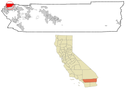 Location of Jurupa Valley in Riverside County, California. | |
 Jurupa Valley Location in the United States  Jurupa Valley Jurupa Valley (California)  Jurupa Valley Jurupa Valley (the United States) | |
| Coordinates: 34°00′N 117°29′W | |
| Country | |
| State | |
| County | |
| Incorporated (city) | July 1, 2011[1] |
| Government | |
| • Type | Council–manager |
| • Mayor | Chris Barajas |
| • Mayor Pro Tem | Leslie Altamirano |
| • City Council | Council members |
| • City Manager | Rod Butler |
| • Assistant City Manager | Michael Flad |
| Area | |
| • City | 43.68 sq mi (113.13 km2) |
| • Land | 42.94 sq mi (111.22 km2) |
| • Water | 0.74 sq mi (1.91 km2) |
| Population (2020)[3] | |
| • City | 105,053 |
| • Rank | 6th in Riverside County 69th in California 304th in the United States |
| • Density | 2,446.51/sq mi (944.60/km2) |
| • Metro | 4,527,837 |
| Time zone | UTC−8 (PST) |
| • Summer (DST) | UTC−7 (PDT) |
| ZIP codes | 91752, 92509 |
| Area code | 951 |
| FIPS code | 06-37692 |
| GNIS feature ID | 2702867 |
| Website | jurupavalley |
On March 8, 2011, voters approved a ballot measure, Measure A, to incorporate and form the city of Jurupa Valley. The effective date of incorporation was July 1, 2011.[4] Residents of the area had previously voted on incorporation in 1992, but rejected that measure, along with a competing ballot measure that would have incorporated Mira Loma.[4]
The city of Jurupa Valley covers approximately 43.5 square miles (113 km2), and had a population of 105,053 as of the 2020 census. It is bordered by the cities of Eastvale, Norco, and Riverside in Riverside County and the cities of Ontario, Fontana, Rialto, and Colton in neighboring San Bernardino County.
History

Etymology
Although there was no geographic feature or town officially named Jurupa Valley prior to the establishment of the city in 2011, the term Jurupa Valley is known to have been used as early as 1887 when referring to lands along the northeast side of the Santa Ana River opposite the city of Riverside.[5] The name Jurupa was derived from the 1838 Mexican land grant Rancho Jurupa, which the Jurupa Valley area had been part of. The Rancho in turn derived its name from a previous Jurupa rancho operated by the Mission San Gabriel Arcángel, until the mission was disbanded through the Mexican secularization act of 1833.[6] The first rancho was named for the Native American village Jurupa that existed in the area prior to the arrival of European colonizers.[7] Both Serrano and Gabrieleño Indians lived in the area. The Gabrieleño referred to the village as Jurungna or Hurungna.[8]
The exact meaning of the word Jurupa is disputed. The 1890 book, An Illustrated History of Southern California, states that the word Jurupa was a greeting, meaning ″peace and friendship″, used by the Native Americans when the first Catholic priest visited the area.[9] In 1902 Father Juan Caballeria, in his History of San Bernardino Valley; From the Padres to the Pioneer, states that the word was derived from Jurumpa, meaning watering place.[6] Later linguistic studies concluded that the name likely refers to Juru, the Artemisia californica (California sagebrush), common in the area.[10]
Incorporation
On June 2, 1992, under measures E, F, and G, the first effort to form a city was voted down by the electorate. Measure E, whether or not to incorporate Jurupa and Mira Loma, lost 76% to 24%. Measure F, whether to vote city council members by district or at large, if incorporation passed, was 69% district, and 31% at large. Measure G, the selection of a city name, had the following results; Jurupa 40%, Rancho Jurupa 23%, West Riverside 21%, and Camino Real 16%.[11] At the time Jurupa was described as including the neighborhoods of Rubidoux, Pedley and Glen Avon.[12]
On March 8, 2011, a second proposal for incorporation was put before the voters. This time the measure passed with 54% voting yes, 46% voting no, and with an effective date of July 1, 2011. At the time the new city was estimated to have a population of 88,000, and included the communities of Mira Loma, Glen Avon, Sky Country, Indian Hills, Pedley, Rubidoux, Belltown, Jurupa, Jurupa Hills, and Sunnyslope.[13]
The city immediately faced the possibility of disincorporation when the State of California passed Senate Bill 89, which shifted millions of dollars of vehicle license fees away from cities.[14] The new city struggled for several years, and in 2014 notified the Riverside County Local Agency Formation Commission that it might be necessary to disincorporate. In September 2015, Senate Bill 25 was passed by the California Assembly and Senate to restore funding to cities, but was vetoed by then Governor Jerry Brown.[15] Later in the month Senate Bill 107 was signed by the governor. It remediated many of the outstanding debts of Jurupa Valley, as well as three other recently incorporated cities in Riverside County.[16]
Historic events
- Between 1926 and 1928 the Wineville Chicken Coop Murders, a series of abductions and murders of young boys, took place within Jurupa Valley city limits. At the time the community of Wineville was unincorporated. Today it is the Jurupa Valley neighborhood of Mira Loma.[17]
- The Stringfellow Acid Pits, a toxic waste dump, and a Superfund site, became the center of national news coverage in the early 1980s.
Demographics
| Historical population | |||
|---|---|---|---|
| Census | Pop. | %± | |
| 2010 | 94,234 | — | |
| 2020 | 105,053 | 11.5% | |
| U.S. Decennial Census[18][3] | |||
This section needs expansion. You can help by adding to it. (June 2020) |
According to the United States Census Bureau, as of July 1, 2021, the estimated population was 105,053 with 71.4% of the population of Jurupa Valley being Hispanic or Latino, 20.6% of the population being White non-Hispanic, 3.2% of the population being Black or African American, 3.6% of the population being Asian, and 3.6% of the population is of two races or more.[19]
Government
Federal:
- In the House of Representatives, the vast majority of Jurupa Valley is part of the 41st Congressional District, represented by Democrat Mark Takano.
- A small portion of the city is located in 42nd Congressional District, represented by Republican Ken Calvert.
- California is represented in the United States Senate by Democrats Dianne Feinstein and Alex Padilla.
State:
- In the California State Legislature, Jurupa Valley is located in the 31st Senate District, represented by Democrat Richard Roth, and in the 60th Assembly District, represented by Democrat Sabrina Cervantes.
Local:
- Jurupa Valley is the Second District in Riverside County and is represented by Board of Supervisor Karen Spiegel.[20]
- The area parks are served and maintained by the Jurupa Area Recreation and Parks District.
Utilities:
- Water and Sanitation is provided by the Jurupa Community Services District and Rubidoux Community Services District.
Education
Jurupa Valley is home to the Jurupa Unified School District. The district operates 16 elementary schools, four middle schools, three continuation schools, and four high schools, including:[21]
- Jurupa Valley High School
- Rubidoux High School
- Patriot High School
- Rivercrest Preparatory


Transportation
Public transportation in Jurupa Valley is provided by Riverside Transit Agency.[22] Also, Jurupa Valley/Pedley station (formerly Pedley Station) is served by Metrolink. Jurupa Valley is home to Flabob Airport, a small public-use airport. However, commercial flights are served by the nearby Ontario International Airport.
The major freeways in Jurupa Valley are Interstate 15, which serves as the city's western border, and California State Route 60, which runs along the northern side of the city.

Culture, sports & recreation
Notable sites include:
- Galleano Winery
- Jensen Alvarado Ranch
- Jurupa Mountains Discovery Center
- Rancho Jurupa Regional Park
- The Cove Waterpark
- Golf facilities:
- Goose Creek Golf Club
- Indian Hills Country Club
- Jurupa Hills Country Club
- Oak Quarry Golf Club
- Paradise Knolls Golf Course
Geography
Jurupa Valley is located north and west of the Santa Ana River across from Riverside, California, south of the Riverside–San Bernardino county line, and east of Interstate 15. It includes the nine distinct neighborhoods, or communities, of Belltown, Crestmore Heights, Glen Avon, Indian Hills, Jurupa Hills, Pedley, Rubidoux, Sunnyslope, and Mira Loma.[23]
Climate
| Climate data for Jurupa Valley, California | |||||||||||||
|---|---|---|---|---|---|---|---|---|---|---|---|---|---|
| Month | Jan | Feb | Mar | Apr | May | Jun | Jul | Aug | Sep | Oct | Nov | Dec | Year |
| Record high °F (°C) | 91 (33) |
92 (33) |
100 (38) |
101 (38) |
107 (42) |
110 (43) |
110 (43) |
112 (44) |
115 (46) |
108 (42) |
99 (37) |
92 (33) |
115 (46) |
| Average high °F (°C) | 67 (19) |
68 (20) |
71 (22) |
77 (25) |
80 (27) |
88 (31) |
93 (34) |
95 (35) |
91 (33) |
83 (28) |
74 (23) |
69 (21) |
80 (27) |
| Average low °F (°C) | 42 (6) |
44 (7) |
46 (8) |
48 (9) |
53 (12) |
58 (14) |
64 (18) |
66 (19) |
62 (17) |
53 (12) |
45 (7) |
42 (6) |
52 (11) |
| Record low °F (°C) | 24 (−4) |
27 (−3) |
28 (−2) |
31 (−1) |
32 (0) |
44 (7) |
49 (9) |
48 (9) |
42 (6) |
31 (−1) |
26 (−3) |
23 (−5) |
22 (−6) |
| Average precipitation inches (mm) | 3.45 (88) |
3.62 (92) |
2.91 (74) |
.88 (22) |
.26 (6.6) |
.03 (0.76) |
.05 (1.3) |
.15 (3.8) |
.27 (6.9) |
.56 (14) |
1.34 (34) |
2.72 (69) |
16.24 (412) |
| Average precipitation days | 6.6 | 7.2 | 5.3 | 3.5 | 1.4 | 0.3 | 0.8 | 1.0 | 1.3 | 2.5 | 4.4 | 6.4 | 40.7 |
| [citation needed] | |||||||||||||
References
Bibliography
- Caballería y Collell, Juan (1902). History of San Bernardino Valley from the Padres to the Pioneers, 1810-1851. San Bernardino, CA: Times-Index Press. Retrieved March 15, 2021.
- Johnston, Bernice Eastman (1962). California's Gabrielino Indians. Los Angeles, CA: Southwest Museum. ISBN 978-0-8357-2758-7. Retrieved March 24, 2021.
- Lewis (1890). An Illustrated history of southern California: embracing the counties of San Diego, San Bernardino, Los Angeles and Orange, and the peninsula of lower California, from the earliest period of occupancy to the present time, together with glimpses of their prospects, also, full-page portraits of some of their eminent men, and biographical mention of many of their pioneers and of prominent citizens of today (Public domain ed.). Chicago, IL: The Lewis Publishing Company. ISBN 978-5-87987-880-6. Retrieved March 15, 2021.
- Patterson, Tom (1971). A Colony for California: Riverside's First Hundred Years (1st ed.). Riverside, CA: Press-Enterprise Company. LCCN 73-172819. Retrieved February 1, 2021.
Citations
- Stokley, Sandra (March 10, 2011). "Vote-by-mail ballot tally reaffirms Jurupa results". The Press-Enterprise. Archived from the original on September 13, 2012. Retrieved March 29, 2021.
- "2019 U.S. Gazetteer Files". United States Census Bureau. Retrieved July 1, 2020.
- "Jurupa Valley city, California". United States Census Bureau. United States Census Bureau. Retrieved November 13, 2021.
- Stokley, Sandra (March 9, 2011). "Jurupa: Cityhood is approved". The Press-Enterprise. Archived from the original on December 5, 2012. Retrieved March 29, 2021.
- "Fruit Growers; Annual State Convention". Riverside Daily Press. Vol. II, no. 88. Riverside, CA: L. M. Holt. April 15, 1887. p. 2.
- Caballería, pp. 38-39
- Patterson, p. 120.
- Johnston, p.21.
- Lewis, p.410.
- Patterson, p. 121.
- "Final Election Returns; Riverside County". The Los Angeles Times. Vol. CXI, no. 184. Los Angeles, CA: The Times Mirror Company. June 4, 1992. p. 21. Retrieved February 11, 2021.
- "Mira Loma and Jurupa to vote for cityhood". Chino Champion. Chino, CA: Allan P. McCombs. February 21, 1992. p. 29. Retrieved February 11, 2021.
- "Jurupa Valley Incorporation Election, Measure A (March 2011)". Ballotpedia. Ballotpedia. Archived from the original on February 13, 2021. Retrieved February 13, 2021.
- Sangree, Hudson (July 2, 2011). "Cities Fear Loss of Public Safety Aid". The Sacramento Bee. Sacramento, CA: McClatchey Company. pp. 13, 16. Retrieved February 12, 2021.
- "Assembly OKs bill to provide financial relief to local cities". The Desert Sun. Vol. 88, no. 325. Palm Springs, CA: The Desert Sun Publishing Co. September 6, 2015. p. 14. Retrieved February 13, 2021.
- McGreevy, Patrick; Mason, Melanie (September 23, 2015). "Brown OKs plan to target blight". Los Angeles Times. Vol. CXXXIV, no. 294. Los Angeles, CA. p. 11. Retrieved February 13, 2021.
- "Mira Loma California History - Key to the City". www.usacitiesonline.com. Retrieved June 28, 2020.
- "Census of Population and Housing". census.gov. Retrieved June 24, 2017.
- "QuickFacts: Jurupa Valley city, California". census.gov. Retrieved March 12, 2022.
- "You are being redirected..." rivcodistrict2.org. Retrieved October 14, 2021.
- "Error". Archived from the original on October 2, 2011. Retrieved March 24, 2011.
- "City of Jurupa Valley > Residents > Transportation". jurupavalley.org. Retrieved September 24, 2018.
- "City of Jurupa Valley California 2017 General Plan". JurupaValley.org. Jurupa Valley, CA: Planning Department, City of Jurupa Valley. September 2017. p. 17. Archived from the original (pdf) on February 11, 2021. Retrieved February 11, 2021.
External links
Places adjacent to Jurupa Valley, California | |
|---|---|

| Authority control |
|
|---|
На других языках
- [en] Jurupa Valley, California
[ru] Джурупа-Валли
Джурупа-Валли (англ. Jurupa Valley) — город в округе Риверсайд, штат Калифорния, США. Согласно переписи 2020 года, население составляет 105 053 человека.Другой контент может иметь иную лицензию. Перед использованием материалов сайта WikiSort.org внимательно изучите правила лицензирования конкретных элементов наполнения сайта.
WikiSort.org - проект по пересортировке и дополнению контента Википедии