world.wikisort.org - USA
Oceanside is a city on the South Coast of California, located in San Diego County. The city had a population of 167,086 at the 2010 census. The city is a popular tourist destination, owing to its historic landmarks, beaches, and architecture.
Oceanside, California | |
|---|---|
| City of Oceanside | |
     Clockwise: Mission San Luis Rey de Francia; Oceanside City Hall; Oceanside Strand; Mount Ecclesia | |
 Flag  Seal | |
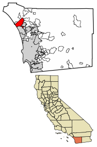 Location of Oceanside within San Diego County, California | |
 Oceanside, California Location in the United States | |
| Coordinates: 33°12′42″N 117°19′33″W | |
| Country | |
| State | |
| County | |
| Incorporated | July 3, 1888[1] |
| Government | |
| • Type | Council–manager[2] |
| • Mayor | Esther Sanchez |
| Area | |
| • Total | 42.16 sq mi (109.19 km2) |
| • Land | 41.26 sq mi (106.85 km2) |
| • Water | 0.90 sq mi (2.33 km2) 2.23% |
| Elevation | 66 ft (20 m) |
| Population (2010)[5] | |
| • Total | 167,086 |
| • Estimate (2019)[6] | 175,742 |
| • Rank | 3rd in San Diego County 28th in California 148th in the United States |
| • Density | 4,259.79/sq mi (1,644.73/km2) |
| Demonym(s) | Oceansider O'sider |
| Time zone | UTC−8 (Pacific) |
| • Summer (DST) | UTC−7 (PDT) |
| ZIP Codes | 92049, 92051, 92052, 92054, 92056–92058 |
| Area codes | 442/760 |
| FIPS code | 06-53322 |
| GNIS feature IDs | 1652761, 2411301 |
| City flower | Crimson Lake Bougainvillea |
| Website | www |
Oceanside's origins date to 1798, when the Spanish founded the village of San Luis Rey with the establishment of Mission San Luis Rey de Francia by Fermín de Lasuén. During the Spanish period, Mission San Luis Rey grew to be the largest of all the Californian missions, but following the Mexican secularization act of 1833 the mission and its community declined. Following the U.S. conquest of California, the former mission lands were developed into an oceanfront resort and the community's name gradually changed to Oceanside.
History


Originally inhabited by Native Americans, Oceanside was first settled by the Luiseño peoples, or the Payomkawichum. The city of Oceanside sits on the locality on the San Luis Rey River that the Luiseno called Tacayme, which contained the villages of Qée'ish (Keish) and 'ikáymay (Ikamal), in the San Luis Rey Mission area, Wiyóoya (Wiawio) at the mouth of the river, and Wi'áasamay (Wiasamai) and Waxáwmay (Wahaumai) at Guajome.[7]
Spanish era
The first European explorers arrived in 1769. Spanish missionaries under Father Junípero Serra founded Mission San Luis Rey de Francia on a former site of a Luiseño Indian village on the banks of the San Luis Rey River called Keish according to the Portolà expedition who visited in the 1769.
In the early 19th century, the introduction of farming and grazing changed the landscape of what would become Oceanside.
Mexican era

Following the Mexican secularization act of 1833, the Californian missions were nationalized, transferring their ownership from the Franciscan Order of the Catholic Church to the Mexican Government. A mission administrator was appointed to each mission to oversee the process of secularization, the removal of the priests, and the selling or granting of the mission lands to private citizens.
At Mission San Luis Rey, Padre Antonio Peyrí had presided over the mission for 34 years when soldiers forced his removal in late 1833. Captain Pablo de la Portillà was appointed as administrator of San Luis Rey. Following the departure of Padre Peyrí, relations between the Luiseños and the new civilian administration hugely deteriorated, resulting in their famed refusal to work for Captain Portillà in 1835.
American era

![The Americanization School was built in 1931 as a segregated school which aimed at Americanizing Oceanside's Hispanic community.[8]](http://upload.wikimedia.org/wikipedia/commons/6/69/Ocean_Americanization_%28cropped%29.jpg)
In the late 1850s, Andrew Jackson Myers lived in San Joaquin County, but he returned in the late 1880s and lived in San Luis Rey. In 1882 Myers moved on the land that was the original town site for Oceanside. A patent for the land was issued in 1883 by the federal government.[9] It was incorporated on July 3, 1888. The city hall as of the early 21st century stands on the former Myers homestead.[9]
The town post office contains an oil-on-canvas mural, Air Mail, painted in 1937 by Elsie Seeds. Federally commissioned murals were produced from 1934 to 1943 in the United States through the Section of Painting and Sculpture, later called the Section of Fine Arts, of the Treasury Department.[10]
In the 20th century, Oceanside was a beach town devoted to activities on a 6-mile (10 km) stretch of beaches. Residential areas like downtown (built in the 1890s), South Oceanside (built in the 1920s and 1930s), and developments east of Interstate 5 (built after World War II) are preserved and remodeled when these houses are considered to have historical value.[citation needed] Since the establishment of Marine Corps Base Camp Pendleton in 1942, Oceanside has been home to U.S. armed forces personnel, and the wartime industry of WWII and the 1950s had an ammunition manufacturing facility in the city.[citation needed]
After 1970, the main focus[citation needed] of Oceanside was suburban development. Oceanside continues to be known as a vacation home market.[11]
In the 2010s, several mid-rise and high-rise housing and lodging projects were completed in the downtown area, with more to come. In 2021, two large Hyatt resorts were completed, bringing more tourists to the city.[12]
Geography


Oceanside is at 33°12′42″N 117°19′33″W (33.211566, -117.325701).[13]
According to the United States Census Bureau, the city has a total area of 42.2 square miles (109 km2), of which 41.2 square miles (107 km2) is land and 0.9 square miles (2.3 km2) (2.23%) is water.
Traveling north on Interstate 5, Oceanside is the last city before Orange County. As the crow flies, it is roughly the same distance from Aliso Viejo as it is to downtown San Diego.
Together with Carlsbad and Vista, it forms a tri-city area.
Climate
Oceanside experiences a semi-arid climate (Köppen climate classification BSh) that is significantly tempered by maritime winds and the cool currents off the shoreline. The average high temperatures range from 64 to 77 °F (18 to 25 °C), while the average low temperatures range from 45 to 64 °F (7 to 18 °C).
| Climate data for Oceanside Municipal Airport, California (normals 1999–2022; extremes 1999–present) | |||||||||||||
|---|---|---|---|---|---|---|---|---|---|---|---|---|---|
| Month | Jan | Feb | Mar | Apr | May | Jun | Jul | Aug | Sep | Oct | Nov | Dec | Year |
| Record high °F (°C) | 92 (33) |
91 (33) |
92 (33) |
98 (37) |
89 (32) |
89 (32) |
94 (34) |
93 (34) |
105 (41) |
106 (41) |
98 (37) |
87 (31) |
106 (41) |
| Mean maximum °F (°C) | 82.0 (27.8) |
80.1 (26.7) |
81.3 (27.4) |
83.2 (28.4) |
80.0 (26.7) |
79.6 (26.4) |
85.4 (29.7) |
85.9 (29.9) |
92.5 (33.6) |
91.0 (32.8) |
87.0 (30.6) |
79.1 (26.2) |
96.4 (35.8) |
| Average high °F (°C) | 66.7 (19.3) |
66.0 (18.9) |
66.3 (19.1) |
68.9 (20.5) |
69.8 (21.0) |
72.7 (22.6) |
76.5 (24.7) |
78.3 (25.7) |
77.8 (25.4) |
75.0 (23.9) |
70.9 (21.6) |
66.1 (18.9) |
71.2 (21.8) |
| Daily mean °F (°C) | 53.6 (12.0) |
54.1 (12.3) |
56.2 (13.4) |
58.3 (14.6) |
62.1 (16.7) |
65.5 (18.6) |
69.3 (20.7) |
70.2 (21.2) |
68.5 (20.3) |
63.8 (17.7) |
57.4 (14.1) |
52.9 (11.6) |
61.0 (16.1) |
| Average low °F (°C) | 40.5 (4.7) |
42.1 (5.6) |
46.2 (7.9) |
47.6 (8.7) |
54.4 (12.4) |
58.2 (14.6) |
62.1 (16.7) |
62.1 (16.7) |
59.2 (15.1) |
52.6 (11.4) |
43.8 (6.6) |
39.8 (4.3) |
50.7 (10.4) |
| Mean minimum °F (°C) | 31.7 (−0.2) |
33.0 (0.6) |
37.3 (2.9) |
40.3 (4.6) |
45.3 (7.4) |
49.8 (9.9) |
54.8 (12.7) |
54.7 (12.6) |
50.0 (10.0) |
42.0 (5.6) |
34.0 (1.1) |
30.0 (−1.1) |
28.5 (−1.9) |
| Record low °F (°C) | 25 (−4) |
28 (−2) |
29 (−2) |
37 (3) |
38 (3) |
45 (7) |
51 (11) |
50 (10) |
45 (7) |
34 (1) |
28 (−2) |
25 (−4) |
25 (−4) |
| Average precipitation inches (mm) | 2.37 (60) |
2.90 (74) |
1.68 (43) |
0.87 (22) |
0.30 (7.6) |
0.11 (2.8) |
0.05 (1.3) |
0.04 (1.0) |
0.13 (3.3) |
0.64 (16) |
0.79 (20) |
1.98 (50) |
11.86 (301) |
| Average precipitation days (≥ 0.01 in) | 6.4 | 8.9 | 7.8 | 4.9 | 3.7 | 1.5 | 0.7 | 0.7 | 1.6 | 4.7 | 5.8 | 7.3 | 55.2 |
| Source: NOAA[14] | |||||||||||||
Demographics
| Historical population | |||
|---|---|---|---|
| Census | Pop. | %± | |
| 1900 | 330 | — | |
| 1910 | 673 | 103.9% | |
| 1920 | 1,161 | 72.5% | |
| 1930 | 3,508 | 202.2% | |
| 1940 | 4,651 | 32.6% | |
| 1950 | 12,881 | 177.0% | |
| 1960 | 24,971 | 93.9% | |
| 1970 | 40,494 | 62.2% | |
| 1980 | 76,698 | 89.4% | |
| 1990 | 128,398 | 67.4% | |
| 2000 | 161,029 | 25.4% | |
| 2010 | 167,086 | 3.8% | |
| 2020 | 174,068 | 4.2% | |
| U.S. Decennial Census[15][16] | |||
2010

The 2010 United States Census[17] reported that Oceanside had a population of 167,086. The population density was 3,961.8 inhabitants per square mile (1,529.7/km2). The racial makeup of Oceanside was 109,020 (65.2%) White, 7,873 (4.7%) African American, 1,385 (0.8%) Native American, 11,081 (6.6%) Asian (3.4% Filipino, 0.7% Japanese, 0.7% Vietnamese, 0.6% Chinese, 0.4% Korean, 0.2% Indian), 2,144 (1.3%) Pacific Islander, 25,886 (15.5%) from other races, and 9,697 (5.8%) from two or more races. Hispanic or Latino of any race were 59,947 persons (35.9%).
The Census reported that 166,150 people (99.4% of the population) lived in households, 802 (0.5%) lived in non-institutionalized group quarters, and 134 (0.1%) were institutionalized.
There were 59,238 households, out of which 20,486 (34.6%) had children under the age of 18 living in them, 30,201 (51.0%) were opposite-sex married couples living together, 6,947 (11.7%) had a female householder with no husband present, 3,111 (5.3%) had a male householder with no wife present. There were 3,504 (5.9%) unmarried opposite-sex partnerships, and 472 (0.8%) same-sex married couples or partnerships. Of the households 14,117 (23.8%) were made up of individuals, and 6,161 (10.4%) had someone living alone who was 65 years of age or older. The average household size was 2.80. There were 40,259 families (68.0% of all households); the average family size was 3.32.
The population was spread out, with 39,817 people (23.8%) under the age of 18, 19,028 people (11.4%) aged 18 to 24, 45,797 people (27.4%) aged 25 to 44, 40,943 people (24.5%) aged 45 to 64, and 21,501 people (12.9%) who were 65 years of age or older. The median age was 35.2 years. For every 100 females, there were 97.4 males. For every 100 females age 18 and over, there were 95.0 males.
There were 64,435 housing units at an average density of 1,527.8 per square mile (589.9/km2), of which 34,986 (59.1%) were owner-occupied, and 24,252 (40.9%) were occupied by renters. The homeowner vacancy rate was 2.2%; the rental vacancy rate was 6.2%. Of the population 97,645 people (58.4%) lived in owner-occupied housing units and 68,505 people (41.0%) lived in rental housing units.
2000


As of the census[18] of 2000, there were 161,029 people, 56,488 households, and 39,259 families residing in the city. The population density was 3,967.2 inhabitants per square mile (1,531.7/km2). There were 59,581 housing units at an average density of 1,467.9 per square mile (566.8/km2). The racial makeup of the city was 66.4% White, 6.3% African American, 5.5% Asian, 1.2% Pacific Islander, 0.4% Native American or Alaskan Native, 0.1% from another race alone, and 3.2% from two or more races. Hispanic or Latino of any race was 30.2%.
In 2000, there were 56,488 households, out of which 35.0% had children under the age of 18 living with them, 54.1% were married couples living together, 11.0% had a female householder with no husband present, and 30.5% were non-families. Of all households 22.7% were made up of individuals, and 10.2% had someone living alone who was 65 years of age or older. The average household size was 2.83 and the average family size was 3.33.
The age distribution of Oceanside in 2000 was as follows: 27.6% under the age of 18, 10.2% from 18 to 24, 31.0% from 25 to 44, 17.6% from 45 to 64, and 13.6% who were 65 years of age or older. The median age was 33 years. For every 100 females, there were 98.0 males. For every 100 females age 18 and over, there were 96.1 males.
The median income for a household in the city was $46,301, and the median income for a family was $52,232. Males had a median income of $34,772 versus $27,962 for females. The per capita income for the city was $20,329. About 8.2% of families and 11.6% of the population were below the poverty line, including 16.2% of those under age 18 and 5.7% of those age 65 or over.
Economy


According to the city's 2017 Comprehensive Annual Financial Report,[19] the top employers in the city are:
| # | Employer | # of Employees |
|---|---|---|
| 1 | Oceanside Unified School District | 2,957 |
| 2 | Tri-City Hospital District | 2,423 |
| 3 | Mira Costa College | 1,605 |
| 4 | City of Oceanside | 1,029 |
| 5 | West Coast Tomato Growers | 751 |
| 6 | North County Transit District | 737 |
| 7 | Genentech, Inc. | 462 |
| 8 | TE Connectivity | 426 |
| 9 | Hydranautics | 358 |
| 10 | Oceans Eleven Casino | 344 |
Arts and culture


- The Oceanside Pier, first built in 1888 (and now in its sixth incarnation), is one of the longest wooden piers on the western United States coastline, at 1,942 feet (592 m).[20]
- The historic district of Mount Ecclesia, home to the Rosicrucian Fellowship, is noted for its singular architecture and the preservation of nature grounds and gardens, offering a unique meditative walking experience.
- The California Surf Museum is located in downtown Oceanside.
- Oceanside is home to the World's Largest Women's Surf Competition, the Supergirl Pro Jam event, which has been held yearly since 2007.[21] Each Thursday evening, downtown Oceanside hosts the Sunset Market, a gathering of local vendors, hot food and live entertainment.[22]
- Founded in 2006, the Frontwave Credit Union O'side Turkey Trot hosts approximately 9,000 runners and walkers from 46 states and 8 countries. The O'Side Turkey Trot has been voted one of the top trots in the country several times.
- Since 2006, Oceanside has played host to the official start of the annual 3,000-mile (4,800 km) bicycle race, Race Across America, which is usually held during the second week of June. It is considered the world's toughest sporting event by many experts.
- Oceanside has hosted the Beach Soccer Championships since 2007. The festival is the largest on the west coast and takes place the third weekend in May. The event has a PRO side to the event called The Beach Soccer USA Cup and it is considered to host the toughest competition of its kind in the United States.
- The Oceanside International Film Festival was founded in 2009 by the Oceanside Cultural Arts Foundation.[23]
- The famous house in the film Top Gun, where Kelly McGillis and Tom Cruise shot a romantic scene. In 2019 the house was moved from its original site and extensively restored; it will become a free-standing attraction as part of a $180 million beachfront hotel project scheduled to open in Spring 2021.[24]
- Oceanside is home to a harbor which contains a lighthouse, several shops and restaurants, the Oceanside Sign, and hundreds of boats.
- The TV series Animal Kingdom, based on the 2010 film of the same name, is set in Oceanside.
Government


The city operates under the council-manager form of government. The city council consists of four members elected from districts and one mayor[25] elected at large. The current council is composed of: Esther Sanchez (mayor), Ryan Keim (deputy mayor), Peter Weiss, Kori Jensen, and Christopher Rodriguez.[26]
The current city treasurer is Victor Roy.[27] The current city clerk is Zeb Navarro.[28]
The City of Oceanside is a full-service city. It provides its own police and fire safety, library, water and sewer services. In addition, the city has a municipal airport, a small craft harbor, one of the longest wooden piers in the west, golf courses, swimming pools, numerous parks, community centers, and extensive palm-lined beaches.
State and federal representation
In the California State Legislature, Oceanside is in the 36th Senate District, represented by Republican Patricia Bates, and in the 76th Assembly District, represented by Democrat Tasha Boerner Horvath.[29]
In the United States House of Representatives, Oceanside is in California's 49th congressional district, represented by Democrat Mike Levin.[30]
Education

Residents of Oceanside may attend schools in the Oceanside Unified School District, Vista Unified School District, Bonsall Union School District, Carlsbad Unified School District, Fallbrook Union High School District, or Fallbrook Union Elementary School District, depending on their address. The Oceanside Unified School District provides instrumental music programs in grades 4-12.
The Oceanside Unified School District has two comprehensive high schools, El Camino High School off Rancho Del Oro and Oceanside High School off Mission Avenue. High school students are also served by Ocean Shores Continuation High School and Clair Burgener Academy. OUSD has 24 schools plus three charter schools, including the School of Business and Technology, and two brand new schools, Louise Foussat Elementary School and Cesar Chavez Middle School, that opened in the Fall of 2007. Cesar Chavez Middle School, which is on the corner of Frazee and Oleander, will be built on 14 acres (5.7 ha), house 11 buildings totaling 84,000 square feet (7,800 m2), and will serve 1,000 6th–8th grade students.
The other school, Louise Foussat Elementary School, located on Pala Road, is built on 12.6 acres (5.1 ha) of land with 35 classrooms totaling 54,490 square feet (5,062 m2) and can accommodate 800 students.
A free, independent public charter school, Scholarship Prep, is a new TK-8th grade school which was authorized to open in August 2017 and is sited at the historic San Luis Rey Mission. It offers a full educational experience for Oceanside students.
Transportation

Rail and air
The Oceanside Transit Center is a major railway interchange for long distance and commuter rail services. Amtrak's Pacific Surfliner provides service to San Luis Obispo via Los Angeles and San Diego. Metrolink's commuter rail service connects Oceanside to many parts of Greater Los Angeles, while Coaster commuter rail serves northern and central San Diego County. The Sprinter light rail service connects Oceanside to Escondido.
Oceanside Municipal Airport (OCN) is mainly used a general aviation field. The nearest international airport is San Diego International Airport, connected to Oceanside via Amtrak and Coaster rail services.
Interstate and highways
Interstate 5 (I-5) travels through Oceanside, connecting to California State Route 76 (SR 76) and California State Route 78 (SR 78) within the city.
Notable people
Sister cities
References
- "California Cities by Incorporation Date". California Association of Local Agency Formation Commissions. Archived from the original (Word) on October 17, 2013. Retrieved August 25, 2014.
- "City At A Glance". City of Oceanside, California. Retrieved January 28, 2015.
- "2019 U.S. Gazetteer Files". United States Census Bureau. Retrieved July 1, 2020.
- "Oceanside". Geographic Names Information System. United States Geological Survey, United States Department of the Interior. Retrieved January 3, 2015.
- "Oceanside (city) QuickFacts". United States Census Bureau. Archived from the original on January 2, 2012. Retrieved March 11, 2015.
- "Population and Housing Unit Estimates". Retrieved May 21, 2020.
- CULTURAL RESOURCES SURVEY AND ASSESSMENT, MISSION/ACADEMY PLANNED DEVELOPMENT PLAN OCEANSIDE, SAN DIEGO COUNTY, CALIFORNIAhttps://www.ci.oceanside.ca.us/civicax/filebank/blobdload.aspx?blobid=39420
- "Americanization School - GEM IN THE CENTER OF CROWN HEIGHTS". Oceanside Chamber of Commerce.
- "Image:Oceanside plaque". July 17, 2006. Retrieved July 17, 2006.
- Arnesen, Eric (2007). Encyclopedia of U.S. Labor and Working-Class History. Vol. 1. New York: Routledge. p. 1540. ISBN 9780415968263.
- Fletcher, June (June 13, 2005). "The Hottest Vacation-Home Markets: Second homes are sizzling; We tell you where—and why". The Wall Street Journal. p. R1.
- Tan, Michael (March 5, 2019). "San Diego's Oceanside to open two upscale resorts operated by Hyatt". Hotel Management. Retrieved June 22, 2021.
- "US Gazetteer files: 2010, 2000, and 1990". United States Census Bureau. February 12, 2011. Retrieved April 23, 2011.
- "Oceanside Municipal AP - NWS San Diego NOAA Online Weather Data". NOAA. Retrieved February 8, 2021.
- "Census of Population and Housing". Census.gov. Retrieved June 4, 2015.
- "U.S. Census Bureau QuickFacts". Census.gov. Retrieved June 16, 2022.
- "2010 Census Interactive Population Search: CA - Oceanside city". U.S. Census Bureau. Archived from the original on July 15, 2014. Retrieved July 12, 2014.
- "U.S. Census website". United States Census Bureau. Retrieved January 31, 2008.
- City of Oceanside CAFR Retrieved August 13, 2009
- "Oceanside Pier".
- "Welcome". Super Girl Jam.
- "Sunset Market". Main Street Oceanside.
- Kragen, Pam (October 11, 2009). "Oceanside launches first film festival". Hartford Courant. Retrieved March 17, 2022.
- Hyard, Ray (June 4, 2020). "'Top Gun' House Restored, Moved To Hotel Site". San Diego Business Journal. Retrieved June 5, 2020.
- "Esther C. Sanchez". City of Oceanside.
- "City Council". City of Oceanside, CA. Retrieved December 30, 2014.
- "City Treasurer". City of Oceanside, CA. Retrieved December 18, 2017.
- "City Clerk". City of Oceanside, CA. Retrieved January 14, 2015.
- "Statewide Database". UC Regents. Archived from the original on February 1, 2015. Retrieved November 30, 2014.
- "California's 49th Congressional District - Representatives & District Map". Civic Impulse, LLC.
External links
| Counties | ||
|---|---|---|
| Major city | ||
| Cities 100k+ | ||
| Cities 20k–99k | ||
| Cities less than 20k | ||
| CDPs 20k+ | ||
| Bodies of water | ||
| Regions |
| |
| Parks and monuments |
| |
History Culture Transportation (MTS NCTD Roads) Economy Education Government | ||
Municipalities and communities of San Diego County, California, United States | ||
|---|---|---|
County seat: San Diego | ||
| Cities |  | |
| CDPs |
| |
| Unincorporated communities |
| |
| Indian reservations |
| |
| Ghost towns |
| |
| ||
Southern California megaregion | ||||||||||||
|---|---|---|---|---|---|---|---|---|---|---|---|---|
Metropolitan areas and cities in italics are located outside of California | ||||||||||||
|  | |||||||||||
Megapolitan areas of California | ||||||||||||
Authority control | |
|---|---|
| General | |
| National libraries | |
| Other |
|
На других языках
[de] Oceanside (Kalifornien)
Oceanside ist eine Stadt im San Diego County im US-Bundesstaat Kalifornien. Sie ist mit 167.086 Einwohnern (Stand der Volkszählung 2010) die drittgrößte Stadt im San Diego County. Das Stadtgebiet hat eine Größe von 107,7 km². Oceanside liegt etwa 55 Kilometer nördlich von San Diego und 130 Kilometer südlich von Los Angeles an der Interstate 5 und der California State Route 76.- [en] Oceanside, California
[ru] Ошенсайд (Калифорния)
Ошенсайд (англ. Oceanside) — третий по величине город в округе Сан-Диего, штат Калифорния, США. В городе проживает около 183 095 человек[1]. Город расположен к югу от корпуса морской пехоты базы Кэмп-Пендлтон, военной базы Соединенных Штатов[2]. Ошенсайд пережил значительный рост населения с 1970 года, когда его население составляло 45 000 человек. Большая часть территории города была построена в течение 1970-х и 1980-х годов.Другой контент может иметь иную лицензию. Перед использованием материалов сайта WikiSort.org внимательно изучите правила лицензирования конкретных элементов наполнения сайта.
WikiSort.org - проект по пересортировке и дополнению контента Википедии