world.wikisort.org - USA
National City is a city located in the South Bay region of the San Diego metropolitan area, in southwestern San Diego County, California.
This article uses bare URLs, which are uninformative and vulnerable to link rot. (August 2022) |
National City, California | |
|---|---|
| City of National City | |
 Welcome sign in 2012. | |
 Seal | |
| Motto: "In the Center of It All"[1] | |
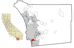 Location within San Diego County | |
 National City Location in the United States  National City National City (San Diego County, California)  National City National City (southern California)  National City National City (California)  National City National City (the United States) | |
| Coordinates: 32°40′41″N 117°05′57″W | |
| Country | |
| State | |
| County | San Diego |
| Founded | July 7, 1868 |
| Incorporated | September 17, 1887[2] |
| Government | |
| • Type | Council–manager |
| • Mayor | Alejandra Sotelo-Solis[3] |
| • City council[3] | Marcus Bush Ron Morrison Jose Rodriguez Mona Rios |
| • City clerk | Luz Molina |
| • City treasurer | R. Mitchel Beauchamp |
| • City manager | Brad Raulston |
| Area | |
| • Total | 9.12 sq mi (23.61 km2) |
| • Land | 7.29 sq mi (18.89 km2) |
| • Water | 1.82 sq mi (4.73 km2) 20.17% |
| Elevation | 66 ft (20 m) |
| Population (2010) | |
| • Total | 58,582 |
| • Estimate (2019)[6] | 61,394 |
| • Density | 8,419.36/sq mi (3,250.66/km2) |
| Time zone | UTC-8 (Pacific) |
| • Summer (DST) | UTC-7 (PDT) |
| ZIP code | 91950 |
| Area code | 619 |
| FIPS code | 06-50398 |
| GNIS feature IDs | 1661090, 2411216 |
| Website | www |
The population was 58,582 at the 2010 census, up from 54,260 at the 2000 census. National City is the second-oldest city in San Diego County, having been incorporated in 1887.[7]
History
| Historical affiliations | Spanish Empire 1769–1821 | First Mexican Empire 1821–1823 | United Mexican States 1823–1848 | United States 1848–present |
|---|
Human presence within the modern city limits of National City may have begun as early as 130,000 years ago, as allegedly evidenced at the Cerutti Mastodon site.[8] Archaic period sites have been found along Sweetwater River which runs through the city limits of modern-day National City.[9] Before the entry of Spanish into the area which modern day National City occupies was part of the territory of the Diegueño tribe, also known as Kamai, and later Kumeyaay.[10] Later in the late eighteenth and early nineteenth century there was a Kumeyaay village, north of the modern National City boundaries, on Chollas Creek.[11]
The Spanish named the 26,000 acres (11,000 ha) of land El Rancho del Rey (the Ranch of the King), used by Spanish soldiers to graze horses. After independence from Spain, in 1810, the Mexican government renamed it Rancho de la Nación (Ranch of the Nation). Governor Pío Pico granted Rancho de la Nación to his brother-in-law John (Don Juan) Forster in 1845. President Andrew Johnson, in issuing the land patent, listed the name as simply "The National Ranch",[12] the English translation of the land grant name, "Rancho de la Nación".[13]
In 1868, Frank Kimball and his brothers Warren and Levi, contractors and builders from San Francisco, purchased the entire rancho and thus began the foundation of the city, retaining the National name.[citation needed]
Frank Kimball first brought novelty and change to the area by building his personal residence. His home included a bathtub as well as hot running water, making it the first modern house in the entire county. However, it was more than his personal innovative endeavors that allowed the region to flourish. By constructing the first roads and railroad in what is now National City, Frank and his brothers most notably were responsible for introducing modern transportation to the residents of the community. The brothers also implemented the area's first post office and a wharf for sea-bound imports and exports. These large ventures, coupled with smaller personal missions, both contributed to the overall goal of creating a community unparalleled to the times. A lasting mark of the Kimballs was the trees they imported and planted from Europe and Asia, accomplished via a partnership with the U.S. Department of Agriculture. These trees can be found dotted throughout the city to this very day. It was the passion and influence of the Kimballs as well as other early pioneers that made way for the city's incorporation on September 17, 1887.[14]
In the mid-20th century, businesses on National Avenue catered to the entertainment of sailors stationed at Naval Base San Diego, and became known as the "Mile of Bars". In the late 20th century, the city, seeking to end the association of the street with drinking culture, urged the growth of automobile dealerships, transforming the area to be known as the "Mile of Cars".[15] Part of the change of business types was the closure of a Pussycat Theater in 1999.[16] The last of the bars that was on the "Mile of Bars" was the Trophy Lounge, which lasted until at least 2004.[17] In the early 21st century, the city began to utilize eminent domain to create new developments;[18] this met some criticism, to include on Reason TV in a video narrated by Drew Carey.[19]
Immigrant sanctuary
National City is home to an estimated 25,000 immigrants and refugees, or two out of every five residents.[20]
Former Mayor Nick Inzunza declared National City an immigrant sanctuary city on September 30, 2006 in a proclamation he presented to immigrants' rights activists during dueling rallies that brought about 400 people to City Hall.[21] This was the result of a statement Mayor Inzunza made on National Public Radio on September 8, 2006. This proclamation divided the city between the stance of the ex-mayor and the federal and state regulations regarding this matter.
On November 7, 2006, Ron Morrison was elected mayor of National City. On November 28, 2006, Mayor Morrison appeared on the KPBS program Full Focus with Gloria Penner and was asked if National City will continue to be a sanctuary city for illegal immigrants. Morrison responded, "absolutely not."
More recently, on June 19, 2017, the National City Council voted unanimously to adopt a Compassionate City resolution in support of immigrants, a reversal of former Mayor Ron Morrison's stance, and a callback to former Mayor Nick Inzunza's position on the issue.[20]
Geography
According to the United States Census Bureau, the city has a total area of 9.1 square miles (24 km2). 7.3 square miles (19 km2) of it is land and 1.8 square miles (4.7 km2) of it (20.17%) is water. National City is bounded by San Diego to the north and northeast, Bonita to the southeast, and Chula Vista to the south across the Sweetwater River. San Diego Bay lies to the immediate west of the city. Also, within the boundaries of National City on the eastern side of town is the unincorporated area of San Diego County known as Lincoln Acres. National City is 15 minutes away from the US–Mexico Border (Tijuana).
National City has road access by the Interstate 5, Interstate 805, and California State Route 54, in addition to surface streets. National City Blvd, which once served as part of the historic U.S. Route 101, still serves as a north–south arterial street parallel to Highland Ave. Plaza Blvd and 30th Street/Sweetwater Road serve as east–west arterial routes. It has rail access through the San Diego Trolley's Blue Line. The nearest commercial airport is San Diego International Airport.
In 2012, National City was honored as the most walkable city in San Diego County.[22] It currently holds a walk score of 71,[23] among the highest scores for cities of similar size.[23] However, its current score also puts National City among bigger cities like Seattle, Washington (74) and Portland, Oregon (66). San Diego's current walk score is 56.[24]
Communities

Although there are no specific communities identified by the city of National City, certain areas have self-identified as communities. The Old Town[25] community is bordered by McKinley Ave. (to the west) and National City Blvd. (to the east), and 24th Street (to the south) and 8th Street (to the north). While Lincoln Acres is an unincorporated area of San Diego County, it is located wholly within the boundaries of the incorporated city of National City and both share the postal code (91950). The South Port Business Center, an industrial park in which many businesses operate, is bordered by I-5 to the west, National City Blvd. to the east Mile of Cars Way (24th St.) to the north, and W. 28th St. to the south. The residents near Las Palmas[26] and El Toyon Parks[27] have neighborhood councils where they can voice their concerns with the city's elected officials.
The Neighborhood Council Program was developed in an effort to improve communication with the community and to bring services directly to National City residents.[28] The program helps to unify neighbors to further enhance the image of the city, instilling civic pride into neighborhoods. Regular monthly meetings are held in each of the three Neighborhood Councils. Agenda topics are driven by resident requests, current events, and a desire by city officials to keep residents abreast of new programs and upcoming developments. Meetings are usually attended by police and fire officials, as well as members of the City Council.
Besides attending regular meetings, Neighborhood Council participants assist the city in improving their neighborhoods by volunteering during clean-up and beautification events and by helping to reduce crime. Residents also participate in family events sponsored by the Neighborhood Council Program such as National Night Out and Movies in the Park, as well as other city-sponsored events.
Climate
| National City, California | ||||||||||||||||||||||||||||||||||||||||||||||||||||||||||||
|---|---|---|---|---|---|---|---|---|---|---|---|---|---|---|---|---|---|---|---|---|---|---|---|---|---|---|---|---|---|---|---|---|---|---|---|---|---|---|---|---|---|---|---|---|---|---|---|---|---|---|---|---|---|---|---|---|---|---|---|---|
| Climate chart (explanation) | ||||||||||||||||||||||||||||||||||||||||||||||||||||||||||||
| ||||||||||||||||||||||||||||||||||||||||||||||||||||||||||||
| ||||||||||||||||||||||||||||||||||||||||||||||||||||||||||||
National City's climate is characterized by warm, dry summers and mild winters, with most of the annual precipitation falling between December and March.[30] The city has a mild climate year-round, with an average of 201 days above 72 °F (22 °C) and low rainfall (9–13 inches [23–33 centimetres] annually). Frequently, particularly during the "May gray/June gloom" period, a thick "marine layer" of cloud cover will keep the air cool and damp within a few miles of the coast.
On average, the warmest month is August. The highest recorded temperature was 108 °F in September 1988. On average, the coolest month is December. The lowest recorded temperature was 15 °F in April 2003. The maximum average precipitation occurs in February.[30]
Ecology
Like most of Southern California and the San Diego County region, the majority of National City's current area was originally occupied by chaparral, a plant community made up mostly of drought-resistant shrubs. National City's broad city limits encompass the San Diego National Wildlife Refuge and the most northern area of the Sweetwater Marsh National Wildlife Refuge. The Sweetwater River runs from the Cuyamaca Mountains, through National City and Chula Vista via a flood control channel (natural route as opposed to a canal) and empties into the San Diego Bay. Most of west National City is flat with an average elevation of 72 feet (22 m), which made it historically desirable and well suited for the Spanish to graze their horses. The eastern areas of National City tend to have canyons and ridges with an existing wildlife.
Demographics
| Historical population | |||
|---|---|---|---|
| Census | Pop. | %± | |
| 1880 | 248 | — | |
| 1890 | 1,353 | 445.6% | |
| 1900 | 1,086 | −19.7% | |
| 1910 | 1,733 | 59.6% | |
| 1920 | 3,116 | 79.8% | |
| 1930 | 7,301 | 134.3% | |
| 1940 | 10,344 | 41.7% | |
| 1950 | 21,199 | 104.9% | |
| 1960 | 32,771 | 54.6% | |
| 1970 | 43,184 | 31.8% | |
| 1980 | 48,772 | 12.9% | |
| 1990 | 54,249 | 11.2% | |
| 2000 | 54,260 | 0.0% | |
| 2010 | 58,582 | 8.0% | |
| 2020 | 56,173 | −4.1% | |
| U.S. Decennial Census[31] | |||
2020
Most recent data from the 2020 United States census[32] reported that National City had a population estimate of 61,394, with a population density of 8,050 people per square mile (3,108.1/km2). Recent demographic breakdown estimates are as follows: 7,122 (11.6%) are non-Hispanic White, 2,947 (4.8%) African American, 307 (0.5%) Native American, 11,358 (18.5%) Asian, 307 (0.5%) Pacific Islander, and 1,842 (3.0%) from two or more races. Hispanic or Latino of any race were 38,985 (63.5%). The median household income (in 2019 dollars) is $47,119, and persons living in poverty was estimated at 18.3%
2010
The 2010 United States Census[33] reported that National City had a population of 58,582. The population density was 6,426.7 inhabitants per square mile (2,481.4/km2). The racial makeup of National City was 24,725 (42.2%) White (11.7% non-Hispanic White), 3,054 (5.2%) African American, 618 (1.1%) Native American, 12,402 (20.2%) Asian, 482 (0.8%) Pacific Islander, 3,638 (6.2%) from other races, 2,829 (4.8%) from two or more races and 16,175 (27.6%) Other. Hispanic or Latino of any race were 36,911 persons (63.0%).
The Census reported that 52,830 people (90.2% of the population) lived in households, 5,341 (9.1%) lived in non-institutionalized group quarters, and 411 (0.7%) were institutionalized.
There were 15,502 households, out of which 7,402 (47.7%) had children under the age of 18 living in them, 7,376 (47.6%) were opposite-sex married couples living together, 3,437 (22.2%) had a female householder with no husband present, 1,300 (8.4%) had a male householder with no wife present. There were 959 (6.2%) unmarried opposite-sex partnerships, and 83 (0.5%) same-sex married couples or partnerships. 2,694 households (17.4%) were made up of individuals, and 1,226 (7.9%) had someone living alone who was 65 years of age or older. The average household size was 3.41. There were 12,113 families (78.1% of all households); the average family size was 3.79.
The population was spread out, with 14,939 people (25.5%) under the age of 18, 9,472 people (16.2%) aged 18 to 24, 15,892 people (27.1%) aged 25 to 44, 12,076 people (20.6%) aged 45 to 64, and 6,203 people (10.6%) who were 65 years of age or older. The median age was 30.2 years. For every 100 females, there were 105.5 males. For every 100 females age 18 and over, there were 106.5 males.
There were 16,762 housing units at an average density of 1,838.9 per square mile (710.0/km2), of which 5,197 (33.5%) were owner-occupied, and 10,305 (66.5%) were occupied by renters. The homeowner vacancy rate was 2.1%; the rental vacancy rate was 5.6%. 19,165 people (32.7% of the population) lived in owner-occupied housing units and 33,665 people (57.5%) lived in rental housing units.
2000
As of the census[34] of 2000, there were 54,260 people, 15,018 households, and 11,804 families residing in the city.
- Mexican – 53%
- Filipino – 19%
- Black or African American - 6%
- Other Hispanic or Latino - 5%
- German - 3%
- Irish - 2%
- English - 2%
- Italian - 1%
- American Indian tribes, specified - 1%
- French (except Basque) - 1%
- Puerto Rican - 1%
- Japanese - 1%
- Scottish-Irish - 1%
- Subsaharan African - 1%
- Polish - 1%
- Russian - 1%
- Central American: - 1%
- Greek -1%
As of 2007, 19.5% of National City residents have incomes listed below the poverty level, a figure above the 12.4% California state average.[35] In 2000, the estimated household income was $29,826. As of 2009[update], the estimated household income is $39,158, which is below the California state average of $59,958.[36]
Crime
National City had, at some point through the 1980s, one of the highest homicide rates in all of Southern California.[37] In 1993, the city had the second-highest violent crime rate in all of California.[38] Crime was, in large part, one reason the city earned the moniker "Nasty City" and, through the late 1980s and early 1990s, it averaged roughly one homicide per month, which was significant, for a city of barely 50,000.[39]
Although crime has dropped dramatically since the 1980s and 1990s, National City still has significant gang and drug activity, and has led San Diego County in crime through the 2000s.[40] In a recent study among California cities with the highest violent and property crime rates over 2014–2016, National City ranked 9th, with a violent crime rate of 299.0 over that three-year period.[41] More recent data from 2016 to 2020 shows that National City was at or near the top in overall crime, and at the top in violent crime per FBI Index Crime rate data by jurisdiction in San Diego County.[42]
Economy
Tourism
With tourism being a major industry in San Diego County, in January 2012, the National City Chamber of Commerce and National City lodging businesses formed the National City Tourism Marketing District as a benefit assessment district to help fund marketing and sales promotion efforts for city lodging businesses.[43] The NCTMD includes all lodging business (hotels, motels and inns), existing and in the future, available for public occupancy located within the city limits boundaries. These include the Best Western Marina Gateway, Carlill Auto Court, Clarion South Bay, Grand Plaza Inn, Holiday Inn Express, Howard Johnson Express, National City Motel, Paradise Motel, Rodeway Inn, Stardust Inn, Super 8 Motel and Sweetwater Inn. An annual assessment of 2.5% of gross short-term room rental revenue collected by lodging business goes to fund the NCTMD and its activities of promoting the safety and enhanced image of National City in order to increase tourism as well as to market National City as a tourist, meeting and event destination.
Top employers
According to the city's 2010 Comprehensive Annual Financial Report,[44] the top employers in the city were:
| # | Employer | # of employees |
|---|---|---|
| 1 | Paradise Valley Hospital | 1,138 |
| 2 | National Elementary School District | 462 |
| 3 | Sweetwater Union High School District | 400 |
| 4 | Wal-Mart | 400 |
| 5 | NMS Management | 300 |
| 6 | Dixieline Lumber | 285 |
| 7 | City of National City | 275 |
| 8 | Ball Automotive Group | 250 |
| 9 | Macy's | 250 |
| 10 | Motivational Systems, Inc. | 245 |
| 11 | Mossy Nissan | 298 |
Arts and culture


Museums and other points of interest
- The National City Mile of Cars is recognized as one of the first "auto malls" in the world.
- National City's three-mile port area (4.8 km) along the San Diego Bay is part of Naval Base San Diego, the largest U.S. Naval base on the west coast.
- National City Depot - The National City California Southern Railroad Depot, built in 1882, served as the first Pacific Coast terminus station of the Santa Fe Railway system's transcontinental railroad. The station was the West Coast general office and figured prominently in Santa Fe's effort to break the economic and transportation monopoly of California held by the Central/Southern Pacific Railroads. The first transcontinental trains arrived in November 1885, resulting in one of the largest land booms in the history of California. Of the original five transcontinental railroad terminus stations, this unique Italianate designed station is the lone survivor. Location: 900 West 23rd St, National City. Listed as California Historical Landmark no. 1023.
- Westfield Plaza Bonita is a shopping mall in National City that attracts customers from all around the South Bay region of San Diego County. It is one of the only completely enclosed (all indoor) shopping malls in the county.
- Paradise Valley Hospital, a 301-bed acute care facility founded by Ellen White, an Adventist, in 1902 as Paradise Valley Sanitarium. The hospital is owned and operated by Prime Healthcare Services.
- Cafe La Maze (est. 1941) is recognized as one of National City's most historic restaurants.[45][46]
- Highland Avenue - Car cruising route.[47]
- Olivewood Gardens, the old Victorian style house that John T. Walton lived in.[48]
- Brick Row on Heritage Square, 909 A Avenue; Designed by San Diego architect R. C. Ball (who designed Folsom Prison), it was constructed by Frank Kimball in 1887 for $30,000. These 10 individual row houses were to be used by the executives of the Santa Fe Railroad. This architectural style is unique to this region and was molded after the row houses of Philadelphia and similar eastern cities. It was hoped that the railroad VIPs would not only feel at home surrounded by familiar architecture, but also be impressed by the cosmopolitan appearance of the young city. All the apartments have a formal dining room with fireplace, a kitchen, a parlor with fireplace, a butler's pantry, and four bedrooms upstairs. Twelve-inch-thick (300 mm) interlocking brick walls divide the units. The brickwork on the row houses was laid with an artistic eye to break the severe lines of the long walls. The bricks above the second story are set upright at an angle. A one-story wooden porch runs the length of the building. Listed on the National Register of Historic Places, it now is an integral part of National City's Heritage Square. Each of the 10 units is privately owned and maintained; however, there is a protective covenant on the facade, so the exterior will always be in keeping with the Victorian surroundings.
Government
In the California State Senate, National City is in the 40th Senate District, represented by Democrat Ben Hueso.[49] In the California State Assembly, it is split between the 79th Assembly District, represented by Democrat Akilah Weber, and the 80th Assembly District, represented by Democrat David Alvarez.[50]
In the United States House of Representatives, National City is in California's 51st congressional district, represented by Democrat Juan Vargas.[51]
Beginning in 2022, the city council will be elected by a district system rather that at-large, which was favored by Filipino American residents who believed their vote was diluted in the at-large system.[52]
Education
National City's 10 public elementary schools are within the National School District [53]
- Elementary schools
- Central
- El Toyon
- Ira Harbison — Blue Ribbon School 2006; California Distinguished School 2004
- John Otis
- Kimball — California Distinguished School 2004
- Las Palmas
- Lincoln Acres
- Olivewood
- Palmer Way
- Rancho de la Nación (formerly New Horizons School)
- Charter school
- Integrity Charter School, a K–8 Charter school
- The Charter School of San Diego (Plaza Bonita Mall)
National City's public middle and high schools are within the Sweetwater Union High School District
- Middle school
- National City Middle School
- Junior High school
- Granger Junior High School — California's 2010, 2013, 2016, 2019, 2020 Schools To Watch
- High school
- Sweetwater High School
- Private schools
- San Diego Academy — A Seventh-day Adventist K–12 school
- Faithful Ambassadors Bible Baptist Academy — PreK–12
- Gospel Light Christian School — PreK–12
Libraries
In August 2005, the National City Public Library opened the doors of its newly built, 49,508 sq ft (4,599.4 m2) state-of-the art facility. The library offers more than 160,000 books and has one of the largest computer centers in the State of California's public library system with over 60 computer units.[54]
On December 18, 1884, Frank Kimball opened the city's first public library in his own home. In April 1884, the library was moved to the downstairs room of Granger Hall on National Avenue. In 1895, it was moved to the Boyd Block, currently McKinley and visually, 16th Street. From 1911 to 1954, National City operated its Carnegie Public Library in the present site of the National City Civic Center. The library operated in the present day Art Center since 1954 until the opening of the new location in 2005.
The National City Public Library houses the Kile Morgan Local History Room which houses a significant number of original archives and manuscripts of the National City founding families, as well as maps, artifacts, high school year books and scrapbooks.[55]
Notable people


- John Baldessari — conceptual artist known for his work featuring found photography and appropriated images; born in National City.[56]
- Joe Corona — soccer player for Club Tijuana and the United States, Joe attended Sweetwater High School.[57]
- Andrew Cunanan - born in National City, a serial killer who claimed five people, most notably including Gianni Versace,[58][circular reference] in 1997.
- Gail Devers — three-time Olympic gold medalist
- Donnie Edwards — San Diego Chargers 2002–2006 National Football League player
- Benji Gil — former Major League Baseball player, first-round pick
- Rosie Hamlin — singer, 1960s song "Angel Baby"
- Joe Orrell - former Major League Baseball pitcher, born in National City
- Anna M. Longshore Potts — established the Paradise Hotel and Sanitarium in National City in 1889
- Skid Roper — musician
- Dan Saleaumua — former player in the National Football League; born in National City.[59]
- Juan Vargas — Representative of California's 51st congressional district, born in National City
- Tom Waits — singer/songwriter and musician
- Lukas Walton - billionaire heir, grandson of Sam Walton, the founder of Walmart
In popular culture
- The film Return of the Killer Tomatoes (1988) was filmed in National City.[60]
- Scenes from the film South of 8 (2016) were shot in National City.[61]
Sister cities
National City has two sister cities as designated by Sister Cities International:
References
- "City of National City California Website". City of National City California Website. Retrieved September 14, 2012.
- "California Cities by Incorporation Date". California Association of Local Agency Formation Commissions. Archived from the original (Word) on October 17, 2013. Retrieved August 25, 2014.
- "Mayor Alejandra Sotelo-Solis". National City. Retrieved December 28, 2018.
- "2019 U.S. Gazetteer Files". United States Census Bureau. Retrieved July 1, 2020.
- "National City". Geographic Names Information System. United States Geological Survey, United States Department of the Interior. Retrieved November 5, 2014.
- "Population and Housing Unit Estimates". United States Census Bureau. May 24, 2020. Retrieved May 27, 2020.
- "UT-South County: National City". Retrieved January 4, 2009.
- Greshko, Michael (April 26, 2017). "Humans in California 130,000 Years Ago? Get the Facts". Culture. Retrieved April 26, 2017.
Wagner, David (April 26, 2017). "Mastodon Bones Found Near San Diego Freeway Rewrite History Of Humans In North America". KPBS News. San Diego. Retrieved April 26, 2017.
Sample, Ian (April 26, 2017). "Could history of humans in North America be rewritten by broken bones?". The Guardian. United Kingdom. Retrieved April 26, 2017.
Lepage, Andrew (November 26, 1992). "Puzzle Pieces : Paleontology: Fossils from freeway construction site reveal what San Diego County was like during the Ice Age". Los Angeles Times. Retrieved April 26, 2017.Remains of a camel, a mastodon and other mammals unearthed during freeway construction in National City this week are helping scientists understand what San Diego County was like during the Ice Age.
Curwen, Thomas (December 22, 2017). "Archaeology as blood sport: How an ancient mastodon ignited debate over humans' arrival in North America". Los Angeles Times. Retrieved May 14, 2019.
"Story of the Discovery". Cerutti Mastodon. San Diego Natural History Museum. Retrieved May 14, 2019.What does this mean? It means that some hominin species was living in North America 130,000 years ago, 115,000 years earlier than previously thought. This makes the Cerutti Mastodon site the oldest in situ, well-documented archaeological site in the Americas. Its discovery rewrites our understanding of when and how hominins populated this hemisphere.
Ferrell, Patrick M. (March 22, 2019). "The Cerutti Mastodon Site Reinterpreted with Reference to Freeway Construction Plans and Methods". PaleoAmerica. 5 (1): 1–7. doi:10.1080/20555563.2019.1589663. S2CID 167172979.
"The Extraordinary Case of the San Diego Mastodon". Popular Archaeology. Morgantown, West Virginia. June 14, 2017. Retrieved May 14, 2019.
Craig Childs (April 9, 2019). Atlas of a Lost World: Travels in Ice Age America. Knopf Doubleday Publishing Group. p. 107. ISBN 978-0-345-80631-4. - Noel D. Justice (2002). Stone Age Spear and Arrow Points of the Southwestern United States. Indiana University Press. p. 351. ISBN 978-0-253-33912-6.
- Jennifer R. Kraft; Brian F. Smith (August 12, 2013). A Phase I Cultural Resources Study For The 3364 Randy Lane Project (PDF) (Report). San Diego County. p. 5. Retrieved April 26, 2017.
Leslie Spier (1923). Southern Diegueno Customs (PDF) (Report). University of California Berkeley. Retrieved April 26, 2017.
"Our Heritage". sycuan tribe. Sycuan Band of the Kumeyaay Nation. 2011. Archived from the original on April 4, 2012. Retrieved April 26, 2017.
Alfred Louis Kroeber (1925). Handbook of the Indians of California. Courier Corporation. pp. 709–712. ISBN 978-0-486-23368-0. - Rebecca Apple; Stacey Jordan-Connor; Cheryl Bowden-Renna; Stehanie Jow; Andrew York (January 7, 2015). Community Plan Update for the Communities of Southeastern San Diego and Encanto Prehistoric Cultural Resources City of San Diego, California (PDF) (Report). City of San Diego. p. 15. Retrieved April 26, 2017.
- "Journal of San Diego History (July 1962; vol. 8, num. 2)". Retrieved May 18, 2009.
- "Profile for National City, California, CA". ePodunk. Retrieved September 14, 2012.
- "National City History - About National City". May 29, 2012. Retrieved February 8, 2013.
- Jenkins, Logan (May 7, 2001). "National Avenue: A mile of bars, cars, fading history". San Diego Union-Tribune. Retrieved May 14, 2019.
Schoenherr, Steven. "National City in Pictures" (PDF). The Journal of San Diego History. 54 (3): 162–183. Retrieved May 14, 2019. - Sanford, Jay Allen (July 14, 2008). "Pussycat Theater History: When Cathouses Ruled CA (NEW!), plus Confessions of a Local Pornographer, the Mafia & Deep Throat, and more". San Diego Reader. Retrieved May 14, 2019.
Sanford, Jay Allen (June 21, 2007). "Vince Miranda and the Balboa, Aztec, Cabrillo, Plaza, Bijou, and Pussycat theaters". San Diego Reader. Retrieved May 14, 2019. - Santana Jr., Norberto (February 22, 2004). "Downtown lounge to serve meals with side of memories". San Diego Union-Tribune. Retrieved May 14, 2019.
- Raulston, Brad (March 28, 2007). "South County Q&A". San Diego Union-Tribune. Retrieved May 14, 2019.
Peterson-Perlman, Nina (July 18, 2007). "National City Extends Eminent Domain". Voice of San Diego. Retrieved May 14, 2019. - "National City". Reason. November 15, 2007. Retrieved May 14, 2019.
"Eminent Domain Abuse in National City, California". Reason. March 15, 2011. Retrieved May 14, 2019.
Jacobs, Ashley (December 5, 2014). "National City loses battle over boxing gym". KSWB. San Diego. Retrieved May 14, 2019. - Sheila Pell (June 24, 2017). "National City — in reversal — moves closer to sanctuary city". San Diego Reader. Retrieved December 27, 2020.
- National City named sanctuary city | The San Diego Union-Tribune
- McVicker, Nicholas (October 31, 2012). "National City Honored As Most 'Walkable' City". KPBS. Retrieved November 30, 2015.
- "1516 G Avenue, National City CA". Walk Score. Retrieved November 30, 2015.
- "San Diego Apartments for Rent and San Diego Rentals". Walk Score. Retrieved November 30, 2015.
- "National City : Westside Specific Plan". Ci.national-city.ca.us. October 16, 2013. Archived from the original on October 17, 2013. Retrieved November 30, 2015.
- "National City : Calendar of Events : Las Palmas Neighborhood Council Meeting". Ci.national-city.ca.us. October 16, 2013. Archived from the original on October 17, 2013. Retrieved November 30, 2015.
- "National City : Calendar of Events : El Toyon Neighborhood Council Meeting". Ci.national-city.ca.us. November 7, 2013. Archived from the original on October 17, 2013. Retrieved November 30, 2015.
- "National City : Neighborhood Councils". Ci.national-city.ca.us. August 19, 2015. Archived from the original on October 17, 2013. Retrieved November 30, 2015.
- "National City, CA (91950) Weather". Weather.com. Retrieved November 30, 2015.
- "National City, CA (91950) Weather". Weather.com. Retrieved November 30, 2015.
- "Census of Population and Housing". Census.gov. Retrieved June 4, 2015.
- "QuickFacts - National City, California". U.S. Census Bureau. Retrieved December 25, 2020.
- "2010 Census Interactive Population Search: CA - National City city". U.S. Census Bureau. Archived from the original on July 15, 2014. Retrieved July 12, 2014.
- "U.S. Census website". United States Census Bureau. Retrieved 2008-01-31.
- "National City, California (CA) poverty rate data". Retrieved January 4, 2009.
- "National City, California (CA) Detailed Profile". Retrieved January 4, 2009.
- "National City, California, a San Diego suburb that once held the highest murder rate in So. California has drastically reduced the rate to zero murders in the last two years". January 10, 2010. Retrieved December 25, 2020.
- Granberry, Michael (July 29, 1993). "CALIFORNIA ALBUM : Fighting Crime and Cutbacks : Violence-Plagued Community Objects as Council Trims 11 Police Jobs to Balance Budget". Los Angeles Times. Retrieved January 1, 2020.
- "Why National City is called Nasty City A secretive, nihilistic war". San Diego Reader. August 6, 1992. Retrieved December 25, 2020.
- "Crime in National City, California (CA): Murders, rapes, robberies, assaults, burglaries, thefts, auto thefts, arson, law enforcement employees, police officers, crime map".
- Hipp, John R. and Charis E. Kubrin (January 2018). "Southern California Crime Report 2018" (PDF). University of California, Irvine Laboratory for the Study of Space and Crime. Retrieved January 3, 2020.
{{cite web}}: CS1 maint: uses authors parameter (link) - "Crime in the San Diego Region Mid-Year 2000 Statistics" (PDF). SANDAG. September 2020. Retrieved December 25, 2020.
- National City Tourism Marketing District Management District Plan
- "City of National City CAFR". Archived from the original on July 21, 2011. Retrieved January 16, 2011.
- Union Tribune article - History of Cafe La Maze
- "Cafe La Maze - History page". Archived from the original on September 26, 2011. Retrieved June 20, 2009.
- Harvin, Mary Franklin (July 15, 2022). "The lowrider community wants all of California to join San Jose and end cruising bans". NPR News. Retrieved July 16, 2022.
organizers in San Diego County's National City are working towards their own repeal.
- Bryant, Jackie (December 13, 2017). "The Cooking Class Bringing Better Health to the U.S-Mexico Border". Civil Eats. San Francisco. Retrieved May 18, 2019.
- "Statewide Database". Regents of the University of California. Archived from the original on February 1, 2015. Retrieved February 24, 2015.
- "Communities of Interest — City". California Citizens Redistricting Commission. Archived from the original on October 23, 2015. Retrieved September 28, 2014.
- "California's 51st Congressional District - Representatives & District Map". Civic Impulse, LLC.
- "After warning by Filipinos, California city switches to district-based voting". Philippine Daily Inquirer. La Paz, Makati City, Philippines. January 3, 2022. Retrieved January 22, 2022.
- http://nsd.us/
- "National City : Library". Nationalcityca.gov. November 21, 2015. Archived from the original on September 16, 2013. Retrieved November 30, 2015.
- "Local History | National City, CA".
- "John Baldessari". Electronic Arts Intermix. Archived from the original on October 22, 2012. Retrieved September 14, 2012.
- "Joe Corona Bio". San Diego State University. Retrieved March 11, 2015.
- Gianni Versace
- "Dan Saleaumua". Pro-Football-Reference.com. Retrieved September 14, 2012.
- "* Return of the Killer Tomatoes! (1988) : Filming Locations". IMDb.com. Retrieved November 30, 2015.
- "Filming & Production". IMDB. Retrieved December 26, 2020.
- City Council and Community Development Commission of National City, CA. "MINUTES OF THE REGULAR MEETING OF THE CITY COUNCIL AND COMMUNITY DEVELOPMENT COMMISSION OF NATIONAL CITY, CALIFORNIA". Retrieved December 17, 2016.
Further reading
- Irene Phillips (July 1962). "National City in Review". Journal of San Diego History. 8 (2). Retrieved April 2, 2009.
External links
- Official website

- City-Data.com Comprehensive Statistical Data and more about National City
Municipalities and communities of San Diego County, California, United States | ||
|---|---|---|
County seat: San Diego | ||
| Cities |  | |
| CDPs |
| |
| Unincorporated communities |
| |
| Indian reservations |
| |
| Ghost towns |
| |
| ||
| Counties | ||
|---|---|---|
| Major city | ||
| Cities 100k+ | ||
| Cities 20k–99k | ||
| Cities less than 20k | ||
| CDPs 20k+ | ||
| Bodies of water | ||
| Regions |
| |
| Parks and monuments |
| |
History Culture Transportation (MTS NCTD Roads) Economy Education Government | ||
San Diego–Tijuana | ||
|---|---|---|
| ||
| Counties and municipalities |  | |
| Major cities | ||
| Cities 100k–250k |
| |
| Cities and towns 20k–99k |
| |
| Cities and towns 10k–19k |
| |
| Bodies of water |
| |
| Sub-regions |
| |
| ||
Authority control | |
|---|---|
| General | |
| National libraries | |
| Other |
|
На других языках
[de] National City
National City ist eine Stadt im San Diego County im US-Bundesstaat Kalifornien der Vereinigten Staaten mit 60.200 Einwohnern (Stand: 2004). Das Stadtgebiet hat eine Größe von 23,9 km² und befindet sich an den Interstates 5 und 805 sowie der California State Route 54.- [en] National City, California
[es] National City
National City es una ciudad en el condado de San Diego, California, Estados Unidos. La población en el censo del 2000 fue de 54.260 personas.Другой контент может иметь иную лицензию. Перед использованием материалов сайта WikiSort.org внимательно изучите правила лицензирования конкретных элементов наполнения сайта.
WikiSort.org - проект по пересортировке и дополнению контента Википедии