world.wikisort.org - USA
Roseville is the most populous city in Placer County, California, located within the Sacramento metropolitan area. As of 2019, the US Census Bureau estimated the city's population to be 141,500.[8] Interstate 80 runs through Roseville and State Route 65 runs through part of the northern edge of the city.
Roseville, California | |
|---|---|
| City of Roseville | |
    Clockwise: Tower Theatre; St. Clare Church; Carnegie Museum; Fountains at Roseville | |
|
Seal | |
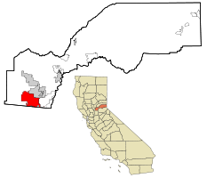 Location in Placer County and the state of California | |
 Roseville, California Location in the United States of America | |
| Coordinates: 38°45′9″N 121°17′22″W | |
| Country | United States |
| State | California |
| County | Placer |
| Incorporated | April 10, 1909[1] |
| Government | |
| • Type | Council-manager[2] |
| • Mayor | Krista Bernasconi[2] |
| • State Senator | Jim Nielsen (R)[3] |
| • Assemblymember | Kevin Kiley (R)[3] |
| • U.S. Rep. | Tom McClintock (R)[4] |
| Area | |
| • Total | 44.08 sq mi (114.16 km2) |
| • Land | 44.08 sq mi (114.16 km2) |
| • Water | 0.00 sq mi (0.00 km2) 0% |
| Elevation | 164 ft (50 m) |
| Population (2010)[7] | |
| • Total | 118,788 |
| • Estimate (2019)[8] | 141,500 |
| • Rank | 1st in Placer County 40th in California 189th in the United States |
| • Density | 3,210.22/sq mi (1,239.46/km2) |
| Time zone | UTC−8 (Pacific) |
| • Summer (DST) | UTC−7 (PDT) |
| ZIP codes | 95678, 95661, 95747 |
| Area code | 916, 279 |
| FIPS code | 06-62938 |
| GNIS feature IDs | 1659544, 2411000 |
| Website | www |
| U.S. Geological Survey Geographic Names Information System: Roseville, California | |
History
The settlement was originally a stage coach station called Griders.[9] According to the Roseville Historical Society,[10] in 1864 the Central Pacific Railroad tracks were constructed northeastward from Sacramento. The point where the tracks met the California Central Railroad line was named "Junction".[9] Junction eventually became known as Roseville. In 1909, three years after the Southern Pacific Railroad moved its facilities from Rocklin to Roseville, the town became an incorporated city. What followed was a period of expansion, with the community building more than 100 structures, including what was the largest ice manufacturing plant in the world (Pacific Fruit Express building, in 1913).
The city was a railroad town for decades, with the railroad employing up to 1,225 people by 1929, out of a population of only 6,425 people.[11] With the onset of World War II, the rail yards became busier than ever and the post-war building boom brought continued prosperity. However, the nature of the city changed dramatically in the 1950s.
During the 1950s the railroad continued to expand and upgrade, converting its steam engine fleet to all diesel engines by the end of the decade. However, the railroads began falling in the shadow of air travel and the development of the national Interstate Highway System. Thus, although the railroad remained (and still remains) a major employer, the expansion of the city began branching out into other employment sectors. Another important change during this period was the Washington Boulevard (then called Seawell) railroad underpass construction in 1950. While this improved the ability of people to travel from one side of the tracks to the other, it meant that people were no longer traveling through the Roseville business district north of the tracks. The completion of Interstate 80 in 1956 shifted the population from downtown to what would become known as East Roseville. The old downtown area slid into a gradual decline.
The Roseville Yard of the Southern Pacific (now Union Pacific) was the site of a major explosion and fire on April 28, 1973.
The city saw steady population growth throughout the ensuing decades, as shopping centers, major retailers, and homes were constructed throughout the city. The growth rate was modest until 1985. Between 1929 when the population was 6,425 people and 1985, the population grew by only 22,563 people. In 1985 the population stood at 28,988 people. Five years later it was 44,685 people, and by 2000 it was 74,234 people. Some of this growth was fueled by the location of major employers, such as Hewlett Packard (in 1979) and NEC (in 1983). The population as of 2014 was 126,956 people.[12]
Revitalization
In 1988, the city embarked on a multi-million dollar plan to redevelop approximately 207 acres (0.8 km2) of land in the downtown core, and revitalize historic areas that had been in decline.[13] Projects included the Vernon Streetscape Project, Atlantic Street Beautification, Civic Plaza Complex, Downtown Vernon Street and Historic Old Town, Historic Old Town Streetscape project, Riverside Avenue Streetscape project, Oak Street Improvement Project, and Washington Boulevard pedestrian underpass.[14] A new parking garage opened in 2007, the Roseville Arts! Blueline Gallery opened in 2008, a new Civic Center opened in 2013, and the Vernon Street Town Square now features a small raised stage, a water spray for children, and a venue for community events.[citation needed]
Geography
According to the Roseville Civic Center, the city has a total area of 42.26 square miles (109.5 km2), of which 42.24 square miles (109.4 km2) is land and 0.002 square miles (0.0052 km2), comprising 0.00%, is water. Several streams flow through Roseville, including Dry Creek, Linda Creek, Secret Ravine and Cirby Creek.[citation needed]
Climate
Roseville has a hot-summer Mediterranean climate that is characterized by cool, wet, usually snowless winters and hot, dry summers (Köppen Csa). The wet season is generally October through April. Because Roseville is east of Sacramento and at a higher elevation, it receives slightly more rainfall. Average daily high temperatures range from 53 °F (12 °C) in January to 94 °F (34 °C) in July. Daily low temperatures range from 39 °F (4 °C) in winter to 61 °F (16 °C) in summer.
On March 26, 2014, an EF0 tornado touched down in Roseville.[15][16]
| Climate data for Roseville, California | |||||||||||||
|---|---|---|---|---|---|---|---|---|---|---|---|---|---|
| Month | Jan | Feb | Mar | Apr | May | Jun | Jul | Aug | Sep | Oct | Nov | Dec | Year |
| Record high °F (°C) | 75 (24) |
78 (26) |
86 (30) |
98 (37) |
107 (42) |
110 (43) |
115 (46) |
110 (43) |
115 (46) |
102 (39) |
87 (31) |
76 (24) |
115 (46) |
| Average high °F (°C) | 53 (12) |
60 (16) |
64 (18) |
71 (22) |
80 (27) |
88 (31) |
94 (34) |
92 (33) |
87 (31) |
77 (25) |
63 (17) |
54 (12) |
74 (23) |
| Daily mean °F (°C) | 46 (8) |
51 (11) |
54 (12) |
60 (16) |
66 (19) |
73 (23) |
78 (26) |
76 (24) |
73 (23) |
65 (18) |
54 (12) |
47 (8) |
62 (17) |
| Average low °F (°C) | 39 (4) |
42 (6) |
44 (7) |
48 (9) |
53 (12) |
58 (14) |
61 (16) |
61 (16) |
58 (14) |
52 (11) |
44 (7) |
39 (4) |
50 (10) |
| Record low °F (°C) | 21 (−6) |
23 (−5) |
27 (−3) |
33 (1) |
36 (2) |
43 (6) |
48 (9) |
46 (8) |
41 (5) |
31 (−1) |
27 (−3) |
16 (−9) |
16 (−9) |
| Average precipitation inches (mm) | 3.98 (101) |
3.46 (88) |
3.07 (78) |
1.58 (40) |
0.58 (15) |
0.12 (3.0) |
0.04 (1.0) |
0.06 (1.5) |
0.35 (8.9) |
1.08 (27) |
2.80 (71) |
3.33 (85) |
20.45 (519.4) |
| Source: http://www.myforecast.com/bin/climate.m?city=12133&metric=false | |||||||||||||
Demographics
| Historical population | |||
|---|---|---|---|
| Census | Pop. | %± | |
| 1870 | 115 | — | |
| 1880 | 258 | 124.3% | |
| 1890 | 345 | 33.7% | |
| 1910 | 2,608 | — | |
| 1920 | 4,477 | 71.7% | |
| 1930 | 6,425 | 43.5% | |
| 1940 | 6,653 | 3.5% | |
| 1950 | 8,723 | 31.1% | |
| 1960 | 13,421 | 53.9% | |
| 1970 | 18,221 | 35.8% | |
| 1980 | 24,347 | 33.6% | |
| 1990 | 44,685 | 83.5% | |
| 2000 | 79,921 | 78.9% | |
| 2010 | 118,788 | 48.6% | |
| 2020 | 147,773 | 24.4% | |
| U.S. Decennial Census[17] | |||
2010
The 2010 United States Census[18] reported that Roseville had a population of 118,788. The population density was 3,279.4 inhabitants per square mile (1,266.2/km2). The racial makeup of Roseville was 94,199 (79.3%) White, 2,329 (2.0%) African American, 885 (0.7%) Native American, 10,026 (8.4%) Asian (3.1% Filipino, 2.0% Indian, 1.0% Chinese, 0.6% Japanese, 0.6% Vietnamese, 0.5% Korean, 0.8% Other), 346 (0.3%) Pacific Islander, 5,087 (4.3%) from other races, and 5,916 (5.0%) from two or more races. Hispanic or Latino of any race were 17,359 persons (14.6%).
The Census reported that 117,941 people (99.3% of the population) lived in households, 478 (0.4%) lived in non-institutionalized group quarters, and 369 (0.3%) were institutionalized.
There were 45,059 households, out of which 16,885 (37.5%) had children under the age of 18 living in them, 24,050 (53.4%) were opposite-sex married couples living together, 4,901 (10.9%) had a female householder with no husband present, 2,088 (4.6%) had a male householder with no wife present. There were 2,518 (5.6%) unmarried opposite-sex partnerships, and 286 (0.6%) same-sex married couples or partnerships. 11,042 households (24.5%) were made up of individuals, and 4,502 (10.0%) had someone living alone who was 65 years of age or older. The average household size was 2.62. There were 31,039 families (68.9% of all households); the average family size was 3.14.
The age distribution of the population shows 31,210 people (26.3%) under the age of 18, 9,397 people (7.9%) aged 18 to 24, 33,362 people (28.1%) aged 25 to 44, 28,952 people (24.4%) aged 45 to 64, and 15,867 people (13.4%) who were 65 years of age or older. The median age was 36.8 years. For every 100 females, there were 91.9 males. For every 100 females age 18 and over, there were 88.4 males.
There were 47,757 housing units at an average density of 1,318.4 per square mile (509.0/km2), of which 29,513 (65.5%) were owner-occupied, and 15,546 (34.5%) were occupied by renters. The homeowner vacancy rate was 2.3%; the rental vacancy rate was 6.8%. 79,887 people (67.3% of the population) lived in owner-occupied housing units and 38,054 people (32.0%) lived in rental housing units.
2005
As of 2005, there were 103,845 people, 42,538 households, and 21,855 families residing in the city. The population density was 2,622.5 inhabitants per square mile (1,012.6/km2). There were 31,925 housing units at an average density of 1,047.6 per square mile (404.5/km2). The racial makeup of the city in 2010 was 71.0% non-Hispanic White, 1.8% non-Hispanic African American, 0.5% Native American, 8.2% Asian, 0.2% Pacific Islander, 0.2% from other races, and 3.4% from two or more races. Hispanic or Latino of any race were 14.6% of the population.
There were 30,783 households, out of which 35.4% had children under the age of 18 living with them, 57.1% were married couples living together, 10.1% had a female householder with no husband present, and 29.0% were non-families. 23.1% of all households were made up of individuals, and 9.2% had someone living alone who was 65 years of age or older. The average household size was 2.57 and the average family size was 3.03.
In the city, the age distribution of the population shows 26.8% under the age of 18, 7.0% from 18 to 24, 30.8% from 25 to 44, 21.0% from 45 to 64, and 14.5% who were 65 years of age or older. The median age was 36 years. For every 100 females, there were 92.1 males. For every 100 females age 18 and over, there were 88.8 males.
According to a 2007 estimate, the median income for a household in the city was $68,273, and the median income for a family was $84,863[19] Males had a median income of $50,426 versus $35,494 for females. The per capita income for the city was $47,021. About 3.4% of families and 4.9% of the population were below the poverty line, including 5.3% of those under age 18 and 4.1% of those age 65 or over.
Economy
The city of Roseville has a variety of businesses. It has encouraged the addition of large retail centers, including one of the largest auto malls in the country,[citation needed] which contributes significantly to sales tax receipts at the city and county level. Revenue from sales tax has been a main reason why the city of Roseville has been able to keep up the city's infrastructure as the population has dramatically increased. This environment has produced a mix of housing, small and large employers, as well as shopping opportunities. A popular water park, Roseville Golfland SunSplash, is also located in Roseville. Companies based in the city include financial technology unicorn GoodLeap.
Shopping
Shopping plays a vital role in the economy of Roseville, which has the thirteenth highest retail sales of all California cities.[20] Roseville is considered a regional shopping destination, with the Westfield Galleria at Roseville being the main shopping center in the city and the second-largest shopping mall in Northern California. Westfield embarked on a 487,806-square-foot (45,319 m2) expansion project costing $270 million, because of the revenue they acquire from this high-end[21] mall.
Across the street from the Galleria, Peter Bollinger Investment Company built a $70 million complex named "Fountains at Roseville".[22] Fountains at Roseville is a 330,000 sq ft (31,000 m2) retail center that includes recreation centers. The first phase opened to the public on June 30, 2008, and includes retailers Whole Foods Market, White House Black Market, and Sunglass Hut, as well as a vast variety of casual and fine dining options.[23] Plans call for future construction of hotel, additional retail, and office buildings as well.
In addition to the Galleria and Fountains at Roseville, the city has many shopping plazas surrounding the Galleria and the Douglas Boulevard financial corridor.
Major employers
The top ten employers of the city as of 2017 are:[24]
| Employer | Number of jobs |
|---|---|
| Kaiser Permanente | 4,988 |
| Hewlett Packard Enterprise | 2,300 |
| Sutter Roseville Medical Center | 2,100 |
| Union Pacific Railroad | 1,150 |
| City of Roseville | 1,149 |
| Roseville Joint Union High School District | 1,090 |
| Roseville City School District | 1,034 |
| PRIDE Industries | 838 |
| Adventist Health | 801 |
| Consolidated Communications | 440 |
Education
Public schools
Roseville is part of the Roseville City School District, Eureka Union School District, Dry Creek Joint Elementary School District, and Roseville Joint Union High School District.
Colleges and universities
Extension campuses of Brandman University and Sierra College (called "Roseville Center") are located in Roseville.[25][26]
Media
Rocklin and Roseville Today is a daily online newspaper. The Roseville Press-Tribune is a local weekly newspaper. Roseville High School's student-run news organization, Eye of the Tiger, publishes the bimonthly Eye of the Tiger newspaper and produces the biweekly Eye of the Tiger News broadcast.[27][28] The Sacramento Bee is also distributed in Roseville. Style Magazine, founded in 2003, is the area's largest circulation general interest, monthly magazine.
Infrastructure
Transportation
Two highways run through the city: Interstate 80 and State Route 65 (the southern terminus of which connects to I-80).
Amtrak, the national passenger rail system, provides service to Roseville at the Roseville Amtrak Station and is part of the Capitol Corridor.
Roseville Transit is a public transit service overseen by the city of Roseville and operated by MV Transportation. The system provides a total of 12 regular local routes, as well as the Roseville Transit Dial-A-Ride (DAR) and Roseville Transit Commuter service. There are several stops where connections may be made with the Sacramento Regional Transit line and Placer County Transit.[29]
Placer County Transit connects Roseville with the Watt/I-80 RT light rail station, as well as the cities of Auburn, Lincoln, Rocklin, and other cities along the Interstate 80 corridor. The Placer Commuter Express service to Sacramento also serves the Taylor Rd. park and ride lot.[30]
Utilities
The City of Roseville provides electric, water, wastewater, and solid waste services to most areas. In February 2020, 75 project customers, including Roseville, received permanent federal water contracts for the Central Valley Project.[31][32]
Pacific Gas and Electric provides natural gas service. Internet, cable, and/or telephone companies that service the Roseville area include AT&T, Comcast, and Consolidated Communications.
Healthcare
Major healthcare providers in the city include Sutter Roseville and Kaiser Permanente. There are multiple smaller clinics located near or around the city. UC Davis Medical Center is also located in nearby Sacramento.
Fire department
The Roseville Fire Department provides fire protection and emergency medical services. The department is responsible for an area of 36 square miles (93 km2) housing a population of 118,788 as of 2010[update].
The department has 8 stations with a single battalion.[33]
Notable people
This section does not cite any sources. (June 2010) |
Residents
- George Barris, auto customizer, created TV's Batmobile
- Isaiah Frey, NFL football player for the Chicago Bears
- Jason Hill, NFL football player
- Bizz Johnson, U.S. Representative and mayor of Roseville
- Dan Quinn, mixed martial arts fighter and stevia advocate
- David Yost, actor
- Neilson Powless, professional cyclist
- Kolton Miller, NFL football player for the Las Vegas Raiders
- Jordan Kunaszyk, NFL football player for the Carolina Panthers
- Steven Anderson, Baptist preacher
Natives
- Evelyn Ashford, runner, Olympic gold medalist and world record holder
- Cameron Beaubier, motorcycle racer, five-time MotoAmerica Superbike champion
- Tedy Bruschi, NFL football player
- Dan Bunz, NFL football player
- Connie Champagne, singer and actress
- Ray Clemons, NFL football player
- John Ensign, U.S. Senator from Nevada
- Leanne Hulsenberg, professional bowler and member of the USBC and PWBA Halls of Fame
- Heather Lynn Johnsen, first female tomb guard for the Tomb of the Unknown Soldier (Arlington)[34][35]
- Thomas King, American-Canadian writer and broadcast presenter
- Andrew Knapp, catcher for the Philadelphia Phillies
- Cassie McFarland, designer of Baseball Hall of Fame Commemorative Coin
- Scott Pruett, 2008 Rolex sports car series championship winner
- Molly Ringwald (1968-), Brat Pack actress
- Summer Sanders, Olympic swimmer, gold medalist, actress, TV personality
- Dominic Sandoval, dancer, member of dance group Quest Crew
- Andrew Susac, MLB baseball player
- Chelsea Wolfe, Heavy metal singer/songwriter
Notable events
On April 28, 1973, 18 boxcars loaded with bombs en route to the Concord Naval Weapons Station began detonating in the Southern Pacific Railroad yard after one of the cars caught fire. More than 6,000 bombs detonated, injuring more than 350 people. The explosions caused damage to 5,500 buildings up to 6,800 feet (2,070 m) away. The cause of the initial car fire has never been determined.[36] In the late 1990s, development in the area by the Union Pacific Railroad uncovered more unexploded ordnance, which was eventually removed.[37]
On October 21, 2010, a young man entered the GameStop store inside Westfield Galleria at Roseville "speaking incoherently" and claiming to have a handgun. The man ordered the employees and customers to vacate the store and proceeded to set fire to the merchandise in the store room. As police and fire crews converged on the scene, the suspect barricaded himself outside the store and began setting other fires. After breaching the barricade, several police officers led the suspect out in handcuffs shortly after 1:00 PM. The mall was evacuated, along with police and fire crews, during the incident due to concerns of a possible incendiary or explosive device in a backpack left behind by the suspect. Due to the wait for the bomb squad, the fire spread and consumed large areas of the ceiling duct work and roof.[38] The suspect, identified as Alexander Piggee, had also set a fire in a local Walmart garden department earlier in the day. He was sentenced to 180 months in prison followed by 72 months surveillance on August 2, 2011, after a guilty plea.[39] The affected wing of Westfield Galleria at Roseville was closed until October 6, 2011, while repairs were made to approximately 40 stores and expansions built.[40]
In CNN Money's "Best Places to Live" study in 2008, Roseville was ranked 90th in the Top 100, "America's best small cities in the country".
See also
- Louis Rose
- Rose Creek
- Placer County, California
- Dry Creek (American River)
- Secret Ravine
References
- "California Cities by Incorporation Date". California Association of Local Agency Formation Commissions. Archived from the original (Word) on February 21, 2013. Retrieved August 25, 2014.
- "City Council/Mayor".
- "Statewide Database". UC Regents. Archived from the original on February 1, 2015. Retrieved November 21, 2014.
- "California's 4th Congressional District - Representatives & District Map". Civic Impulse, LLC. Retrieved March 3, 2013.
- "2019 U.S. Gazetteer Files". United States Census Bureau. Retrieved July 1, 2020.
- "Roseville". Geographic Names Information System. United States Geological Survey, United States Department of the Interior. Retrieved March 15, 2015.
- "Roseville (city) QuickFacts". United States Census Bureau. Retrieved March 15, 2015.
- "Population and Housing Unit Estimates". Retrieved May 21, 2020.
- Durham, David L. (1998). California's Geographic Names: A Gazetteer of Historic and Modern Names of the State. Clovis, Calif.: Word Dancer Press. p. 548. ISBN 1-884995-14-4.
- "Archived copy: History of Roseville". Archived from the original on 2014-05-17. Retrieved 2014-06-11.
In 1864, a track-laying crew from the Central Pacific Railroad came eastward across the plain from Sacramento, building the western half of the nation's first transcontinental railroad. They crossed a small rail line (the California Central Railroad) that linked the young towns of Lincoln and Folsom, and gave the spot the imaginative name of Junction.
- "City of Roseville, California - 1920s". 2013-03-02. Archived from the original on 2013-03-02. Retrieved 2021-08-26.
- "City of Roseville, California - Population". 2010-03-08. Archived from the original on 2010-03-08. Retrieved 2021-08-26.
- Environmental Impact Report for the Roseville Redevelopment Project, Earth Metrics, prepared for City of Roseville and State of California Clearinghouse, May, 1989
- "City of Roseville, California - Improvement & Construction Projects". 2012-08-01. Archived from the original on 2012-08-01. Retrieved 2021-08-26.
- "Roseville Tornado Strike Damages Homes". Roseville Today. 2014-03-27. Retrieved 2022-01-12.
{{cite web}}: CS1 maint: url-status (link) - Medina, Maria (2014-03-26). "Tornado Damages Dozens Of Roseville Homes". CBS Sacramento. Retrieved 2022-01-12.
{{cite web}}: CS1 maint: url-status (link) - "Census of Population and Housing". Census.gov. Retrieved June 4, 2015.
- "2010 Census Interactive Population Search: CA - Roseville city". U.S. Census Bureau. Archived from the original on July 15, 2014. Retrieved July 12, 2014.
- "Roseville 2007 Income Estimates". Archived from the original on 2020-02-12. Retrieved 2009-05-03.
- "City of Roseville – Retail". Retrieved 28 July 2012.
- "City of Roseville Planning Commission Report" (PDF). June 22, 2006.
- Jon, Ortiz (2008-07-04). "Fountains in full flow". The Sacramento Bee. Archived from the original on December 3, 2008. Retrieved 2008-12-03.
- Sorich, Sonya (May 8, 2015). "What's being built at Roseville's Fountains?". American City Business Journals.
- City of Roseville, California - Comprehensive Annual Financial Report (CAFR)
- "College in Roseville, CA | Brandman University". www.brandman.edu. Retrieved 2021-03-07.
- "Sierra College: About Us". 2021.
{{cite web}}: CS1 maint: url-status (link) - "Eye of the Tiger - Roseville High School's independent student press". Eye of the Tiger. Retrieved 2019-05-04.
- "Eye of the Tiger". YouTube. Retrieved 2019-05-04.
- City of Roseville, California - Fixed Route
- "Placer County Transit". Archived from the original on 2008-10-14. Retrieved 2008-10-12.
- Boxall, Bettina (2020-02-29). "Westlands Water District gets permanent U.S. contract for massive irrigation deliveries". Los Angeles Times. Retrieved 2020-03-02.
- "Bureau of Reclamation Completes First Group of Congressionally-Mandated California Central Valley Project Contract Conversions". Sierra Sun Times. March 2, 2010. Retrieved 2020-03-03.
- "Stations". Roseville Fire Department. Retrieved 22 April 2015.
- Virginia Pilot. “FIRST WOMAN GUARDS TOMB OF UNKNOWNS ``THERE IS NO HIGHER HONOR OR GREATER HONOR, SAYS NATIVE CALIFORNIAN, 23.” Saturday, March 23, 1996. https://scholar.lib.vt.edu/VA-news/VA-Pilot/issues/1996/vp960323/03230285.htm
- News & record. “1ST WOMAN GUARDS UNKNOWN SOLDIER.” Knight-Ridder News Service. Mar 22, 1996 Updated Jan 28, 2015. https://greensboro.com/1st-woman-guards-unknown-soldier/article_425e774d-089b-5c3e-9576-0ba767ae41d2.html
- "The Roseville Explosion--". Archived from the original on 2006-07-23. Retrieved 2006-06-28.
- U.S. Army Corps of Engineers: EPA calls on Corps to help with 25-year-old disaster
- "News10: 1 man arrested in Roseville Galleria fire and evacuation".
- "Sacramento, Stockton and Modesto CA News and Weather - KCRA Channel 3". KCRA.
- "Grand Re-Opening Of Roseville Galleria Set For October 6". August 23, 2011.
External links
Places adjacent to Roseville, California | |
|---|---|
Municipalities and communities of Placer County, California, United States | ||
|---|---|---|
County seat: Auburn | ||
| Cities and towns |  | |
| CDPs | ||
| Unincorporated communities |
| |
| Ghost towns | ||
| Footnotes | ‡This CDP also has portions in an adjacent county or counties | |
| ||
| Authority control |
|
|---|
На других языках
[de] Roseville (Kalifornien)
Roseville ist eine Großstadt im Placer County im Norden des US-Bundesstaats Kalifornien mit 127.035 Einwohnern (Stand: 2013). Das Stadtgebiet hat eine Größe von 79,0 km². Aufgrund der starken Zersiedelung ist Roseville mittlerweile mit dem Ballungsraum Sacramento zusammengewachsen, obwohl die Innenstadt von Roseville eigentlich 32 Kilometer von derjenigen Sacramentos entfernt liegt.- [en] Roseville, California
[es] Roseville (California)
Roseville, fundada en 1909 es una ciudad ubicada en el condado de Placer en el estado estadounidense de California. En el año 2009 tenía una población de 112,343 habitantes y una densidad poblacional de 1,438.8 personas por km².[ru] Розвилл (Калифорния)
Ро́звилл[1] (англ. Roseville) — город и крупный транспортный узел в Калифорнии с населением свыше 115 тысяч человек (оценка на 2009 год), входящий в городскую агломерацию Сакраменто.Другой контент может иметь иную лицензию. Перед использованием материалов сайта WikiSort.org внимательно изучите правила лицензирования конкретных элементов наполнения сайта.
WikiSort.org - проект по пересортировке и дополнению контента Википедии