world.wikisort.org - USA
Grass Valley is a city in Nevada County, California, United States. Situated at roughly 2,500 feet (760 m) in elevation in the western foothills of the Sierra Nevada mountain range, this northern Gold Country city is 57 miles (92 km) by car from Sacramento, 64 miles (103 km) from Sacramento International Airport, 88 miles (142 km) west of Reno, and 143 miles (230 km) northeast of San Francisco. As of the 2010 United States Census, its population was 12,860.
City of Grass Valley | |
|---|---|
 The historic Holbrooke Hotel and Restaurant | |
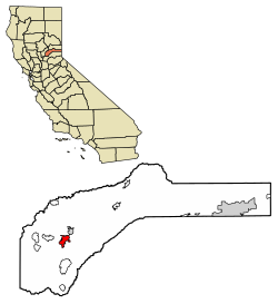 Location of Grass Valley in Nevada County, California | |
 City of Grass Valley Location in the United States | |
| Coordinates: 39°13′9″N 121°3′30″W | |
| Country | United States |
| State | California |
| County | Nevada |
| Incorporated | March 13, 1893[1] |
| Area | |
| • Total | 5.25 sq mi (13.59 km2) |
| • Land | 5.25 sq mi (13.59 km2) |
| • Water | 0.00 sq mi (0.00 km2) 0% |
| Elevation | 2,411 ft (735 m) |
| Population (2010) | |
| • Total | 12,860 |
| • Estimate (2019)[4] | 12,817 |
| • Density | 2,441.80/sq mi (942.82/km2) |
| Time zone | UTC−8 (Pacific (PST)) |
| • Summer (DST) | UTC−7 (PDT) |
| ZIP codes | 95945, 95949 |
| Area code | 530 |
| FIPS code | 06-30798 |
| GNIS feature IDs | 277525, 2410651 |
| Website | www |
History


Grass Valley, which was originally known as Boston Ravine and later named Centerville, dates from the California Gold Rush, as does nearby Nevada City. Gold was discovered at Gold Hill in October 1850 and population grew around the mine. When a post office was established in 1851, it was renamed Grass Valley the next year for unknown reasons. The town incorporated in 1860.[5]
The essential history of Grass Valley mining belongs to the North Star, Empire and Idaho-Maryland mines, for continuous production over a span of years. From 1868 until 1900, the Idaho-Maryland mine was the most productive in the district. From 1900 until 1925, the North Star and the Empire produced the most gold in the county. In 1932, the Empire and North Star were physically connected at the 4600-foot level and 5300-foot level.[6]
Grass Valley has the Empire Mine and North Star Mine, two of California's richest mines. George Starr, manager of the Empire Mine, and William Bowers Bourn II, the owner, donated mine property which became Memorial Park.[7]: 42 Wiliam Bourn Jr. had taken over management of the Empire Mine in 1878 after his father's death, replacing water power with steam. In 1884, Bourn purchased and rejuvenated the North Star mine. The Idaho and Maryland mines were consolidated by Samuel P. Dorsey in 1893. In 1925, Errol MacBoyle acquired the Idaho-Maryland. By 1938, the Idaho-Maryland was the second largest gold producer in the country. However, gold mining operations in the area ended during WWII, due to War Production Board Limitation Order 208. After the war, renewed operations were attempted, but according to Gage McKinney, "...by the mid-1950s mining was no longer profitable in what had been the richest gold mining district in California."[8][9][10][11]
Many of those who came to settle in Grass Valley were tin miners from Cornwall, United Kingdom. Most arrived between 1860 and 1895, composing three quarters of Grass Valley's population.[12]
Grass Valley still holds on to its Cornish heritage, with events such as its annual Cornish Christmas and St Piran's Day celebrations.[13] Cornish pasties are a local favorite dish with a few restaurants in town specializing in recipes handed down from the original immigrant generation. Grass Valley is also twinned with Bodmin in Cornwall (UK).
There was formerly a Roman Catholic Diocese of Grass Valley.[14]
The Grass Valley K-Mart store was one of the nation's few remaining still open and the last one in California. It closed in 2021.[15][16]
Geography
Grass Valley is located at 39°13′9″N 121°3′30″W (39.219215, -121.058414).[17] According to the United States Census Bureau, the city has an area of 4.7 square miles (12 km2), all of it land.
A variety of igneous and metamorphic rock supports Grass Valley. Granitic rock such as quartz diorite underlies the downtown core and extends south along Highway 49. Metavolcanic rock and diabase underlie areas around the granitic zone. Neighborhoods around Nevada County Golf Course and Sierra Nevada Memorial Hospital are underlain by ultramafic rock[18] which supports infertile soils of the Dubakella series. Here the vegetation is sparse considering the high average annual precipitation, with much grassland, and forested areas are often dominated by several species of oaks and the crooked, thin-crowned gray pine.[19] Luxuriant forest dominated by straight, dense ponderosa pine inhabits the more fertile soils, which include Musick series on granitic rock and Sites series on mafic or metamorphic rock.[20][21]
Climate
Grass Valley has a hot-summer Mediterranean climate (Köppen Csa) with warm to hot, dry summers and wet, cool, rainy winters. Summer is very dry, but thunderstorms may occur. Winter rains contribute to a heavy fuel-loading of brush and grass, which dry out during the summer, posing a wildfire hazard. Snow occurs at times. Over the course of a year, 36.4 days of 90 °F (32 °C) or hotter and 0.9 days of 100 °F (38 °C) or hotter occur, with 61.4 days with minimum of 32 °F (0 °C) or colder.[22]
| Climate data for Grass Valley, California 1991-2020, extremes 1966- | |||||||||||||
|---|---|---|---|---|---|---|---|---|---|---|---|---|---|
| Month | Jan | Feb | Mar | Apr | May | Jun | Jul | Aug | Sep | Oct | Nov | Dec | Year |
| Record high °F (°C) | 77 (25) |
81 (27) |
81 (27) |
88 (31) |
99 (37) |
100 (38) |
108 (42) |
108 (42) |
104 (40) |
97 (36) |
87 (31) |
80 (27) |
108 (42) |
| Average high °F (°C) | 53.6 (12.0) |
54.9 (12.7) |
57.9 (14.4) |
62.7 (17.1) |
70.8 (21.6) |
80.2 (26.8) |
88.0 (31.1) |
87.4 (30.8) |
82.3 (27.9) |
72.1 (22.3) |
59.8 (15.4) |
52.6 (11.4) |
68.5 (20.3) |
| Average low °F (°C) | 33.1 (0.6) |
34.2 (1.2) |
37.0 (2.8) |
40.0 (4.4) |
46.8 (8.2) |
52.6 (11.4) |
58.2 (14.6) |
56.8 (13.8) |
52.1 (11.2) |
44.2 (6.8) |
37.1 (2.8) |
32.6 (0.3) |
43.7 (6.5) |
| Record low °F (°C) | 15 (−9) |
9 (−13) |
19 (−7) |
26 (−3) |
27 (−3) |
36 (2) |
40 (4) |
41 (5) |
35 (2) |
27 (−3) |
19 (−7) |
3 (−16) |
3 (−16) |
| Average precipitation inches (mm) | 9.30 (236) |
8.98 (228) |
8.16 (207) |
4.43 (113) |
2.48 (63) |
0.74 (19) |
0.00 (0.00) |
0.11 (2.8) |
0.44 (11) |
2.56 (65) |
5.52 (140) |
10.48 (266) |
53.20 (1,351) |
| Average snowfall inches (cm) | 0.7 (1.8) |
3.0 (7.6) |
3.0 (7.6) |
0.5 (1.3) |
0 (0) |
0 (0) |
0 (0) |
0 (0) |
0 (0) |
0 (0) |
0.2 (0.51) |
1.2 (3.0) |
8.6 (21.81) |
| Average precipitation days (≥ 0.01 in) | 12.8 | 11.7 | 12.2 | 8.5 | 5.9 | 2.7 | 0.2 | 0.8 | 1.6 | 4.4 | 8.4 | 12.3 | 81.5 |
| Average snowy days (≥ 0.1 in) | 0.3 | 1.0 | 1.0 | 0.3 | 0 | 0 | 0 | 0 | 0 | 0 | 0.1 | 0.3 | 3.0 |
| Source 1: NCEI [23] | |||||||||||||
| Source 2: WRCC[24] | |||||||||||||
Demographics
| Historical population | |||
|---|---|---|---|
| Census | Pop. | %± | |
| 1900 | 4,719 | — | |
| 1910 | 4,520 | −4.2% | |
| 1920 | 4,006 | −11.4% | |
| 1930 | 3,817 | −4.7% | |
| 1940 | 5,701 | 49.4% | |
| 1950 | 5,283 | −7.3% | |
| 1960 | 4,876 | −7.7% | |
| 1970 | 5,149 | 5.6% | |
| 1980 | 6,697 | 30.1% | |
| 1990 | 9,048 | 35.1% | |
| 2000 | 10,922 | 20.7% | |
| 2010 | 12,860 | 17.7% | |
| 2019 (est.) | 12,817 | [4] | −0.3% |
| U.S. Decennial Census[25] | |||

2010
The 2010 United States Census[26] reported that Grass Valley had a population of 12,860. The population density was 2,711.3 inhabitants per square mile (1,046.8/km2). The racial makeup of Grass Valley was 11,493 (89.4%) White, 208 (1.6%) Native American, 188 (1.5%) Asian, 46 (0.4%) African American, 9 (0.1%) Pacific Islander, 419 (3.3%) from other races, and 497 (3.9%) from two or more races. Hispanics or Latinos of any race were 1,341 persons (10.4%).
The census reported that 12,401 people (96.4% of the population) lived in households, 118 (0.9%) lived in noninstitutionalized group quarters, and 341 (2.7%) were institutionalized.
Of the 6,077 households, 1,544 (25.4%) had children under the age of 18 living in them, 1,665 (27.4%) were opposite-sex married couples living together, 980 (16.1%) had a female householder with no husband present, and 316 (5.2%) had a male householder with no wife present, 466 (7.7%) were unmarried opposite-sex partnerships, and 33 (0.5%) were same-sex married couples or partnerships. About 2,605 households (42.9%) were made up of individuals, and 1,415 (23.3%) had someone living alone who was 65 years of age or older. The average household size was 2.04. The 2,961 families (48.7% of all households) had an average family size of 2.78.
The population was distributed as 2,625 people (20.4%) under the age of 18, 1,146 people (8.9%) aged 18 to 24, 2,882 people (22.4%) aged 25 to 44, 3,183 people (24.8%) aged 45 to 64, and 3,024 people (23.5%) who were 65 years of age or older. The median age was 43.2 years. For every 100 females, there were 78.9 males. For every 100 females age 18 and over, there were 73.5 males.
The 6,637 housing units averaged 1,399.3 per square mile (540.3/km2), of which 2,391 (39.3%) were owner-occupied, and 3,686 (60.7%) were occupied by renters. The homeowner vacancy rate was 4.0%; the rental vacancy rate was 6.7%; 4,663 people (36.3% of the population) lived in owner-occupied housing units and 7,738 people (60.2%) lived in rental housing units.
2000
As of the census[27] of 2000, 10,922 people, 5,016 households, and 2,678 families resided in the city. The population density was 2,660.2 inhabitants per square mile (1,027.1/km2).
Of the 5,016 households, 26.5% had children under the age of 18 living with them, 32.4% were married couples living together, 16.3% had a female householder with no husband present, and 46.6% were not families. About 39.1% of all households were made up of individuals, and 20.3% had someone living alone who was 65 years of age or older. The average household size was 2.13 and the average family size was 2.80 people.
The median income for a household in the city was $28,182, and for a family was $33,220. Males had a median income of $32,568 versus $21,915 for females. The per capita income for the city was $16,877. About 12.9% of families and 14.9% of the population were below the poverty line, including 20.0% of those under age 18 and 6.3% of those age 65 or over.
Government
Grass Valley has been a charter city since it was incorporated in 1893. It uses a council-manager form of government.[28]
State and federal representation
In the California State Legislature, Grass Valley is in the 1st Senate District, represented by Republican Brian Dahle,[29] and the 1st Assembly District, represented by Republican Megan Dahle.[30]
In the United States House of Representatives, Grass Valley is in California's 1st congressional district, represented by Republican Doug LaMalfa.[31]
Economy

The combined communities of Grass Valley and Nevada City have a fairly diversified economy. The Gold Rush days left a historical legacy and tourism and the related services sector constitute the bulk of the local economy.[32] Many of those who do not commute to the Sacramento Valley work locally in retail, wholesale, trade, engineering, manufacturing, construction, and other businesses, as well in local and state government. A significant number of high-tech electronics companies are in the area.
Another significant sector of the local economy is agriculture, as the soil in Nevada County is quite fertile. Around the time of the Gold Rush, farmers planted orchards, vegetables, and other produce as ranchers brought in cattle, sheep, and other livestock. While the proportion of land dedicated to agriculture has significantly decreased over the last few decades, agriculture continues to be an important aspect of the local economy, including organic agricultural products. Nevada County has also become known for its growing wine industry.[32]
Retail employers in Grass Valley include Raley's, Safeway, CVS Pharmacy, Walgreens, Starbucks, GNC, Jamba Juice, Staples and Hills Flat Lumber Co. Fast-food chain restaurants in Grass Valley include Taco Bell, McDonald's, Carl's Jr., Jimboy's Tacos and KFC. Other major employers include Nevada Union High School, Nevada Irrigation District, Sierra Nevada Memorial Hospital, Golden Empire Nursing and Rehab Center, and Briar Patch Food Co-op.[33]
The Grass Valley Group is a media technology research and development company founded in the city in 1959.[34]
Education
Higher education
- Nevada County Campus of Sierra College
Public primary and secondary schools
- Bear River High School
- Bell Hill Academy
- Bitney College Prep Charter High School
- Cottage Hill Elementary School
- Forest Charter School
- Grass Valley Charter School
- Lyman Gilmore Middle School
- Magnolia Intermediate School
- Nevada Union High School
- Nevada City School District
- Pleasant Ridge Elementary School
- Scotten Elementary School
- Sierra Academy of Expeditionary Learning
- Union Hill Middle School
- William and Marian Ghidotti Early College High School
- Yuba River Charter School
- Clear Creek Elementary School
Public libraries
- Josiah Royce Public Library
Transportation
Grass Valley is at the intersection of State Route 49 and State Route 20. Public transportation is served by the Gold Country Stage and limited to the urban areas.
Designated historical landmarks


- Empire Mine State Historic Park (CHL#298)
- Grass Valley Public Library (NRHP#92000267)
- Holbrooke Hotel (CHL#914)
- Home of Lola Montez (CHL#292)
- Home of Lotta Crabtree (CHL#293)
- Lyman Gilmore Middle School
- Mount Saint Mary's Convent and Academy (CHL#855)
- North Star Mine Powerhouse (CHL#843)
- Overland Emigrant Trail (CHL#799)
- Site of the First Discoveries of Quartz Gold in California (CHL#297)
Popular culture
Wallace Stegner's Angle of Repose features Grass Valley.
Sister cities
Grass Valley has two sister cities:[35]
 Bodmin, Cornwall, United Kingdom
 Limana, Italy
Notable people
- Sam Aanestad, dentist and politician
- Patrick Brice, film director, actor
- Hunter Burgan, musician
- John Cardiel, professional skateboarder
- Lotta Crabtree, 19th-century actress
- Pete Daley, baseball player
- Jonathan Dayton, film director
- Alonzo Delano, first city treasurer
- Mary Florence Denton, educator in Japan
- Matt DiBenedetto, NASCAR driver
- Brodie Farber, professional fighter
- Arthur De Wint Foote, mining engineer
- Mary Hallock Foote, author and illustrator
- Lisa Mispley Fortier, NCAA WBB coach
- John Arthur Gellatly, Lieutenant Governor of Washington
- Lyman Gilmore, historically significant pilot
- Justin Gross, voiceover actor
- Charles Scott Haley, mining engineer, expert in the field of placer gold deposits.[36]
- Fred Hargesheimer, World War II pilot, philanthropist
- John Flint Kidder, builder, historically significant railroad owner
- Sarah Kidder, historically significant railroad owner
- Mark Meckler, political activist
- Lola Montez, 19th-century dancer
- Joanna Newsom, American singer-songwriter
- Hans Ostrom, writer and professor
- Jim Pagliaroni, professional baseball player[37][38]
- Mike Pinder, musician
- Charles H. Prisk, newspaper editor-publisher
- William F. Prisk, State Senator, newspaper editor-publisher
- Chuck Ragan, singer, songwriter, guitarist
- Dennis Richmond, news anchor
- John Rollin Ridge, writer
- Clint Ritchie, actor
- Tim Rossovich, professional football player, actor
- Richard Roundtree, actor
- Josiah Royce, philosopher
- Gabe Ruediger, professional fighter
- Chris Senn, professional skateboarder
- Jeremy Sisto, actor
- Meadow Sisto, actress
- John Aloysius Stanton, painter, born in Grass Valley.[39]
- Wallace Stegner, author and winner of the Pulitzer Prize
- J. Christopher Stevens, assassinated U.S. ambassador to Libya, born in Grass Valley[40]
- Brad Sweet, World of Outlaws Sprint Car Driver and 3X Champion
- Clint Walker, actor
- William Watt, miner, State Senator, University of California Regent
See also
- Little Grass Valley, California
- Cyan Engineering
References
- "California Cities by Incorporation Date". California Association of Local Agency Formation Commissions. Archived from the original (Word) on November 3, 2014. Retrieved August 25, 2014.
- "2019 U.S. Gazetteer Files". United States Census Bureau. Retrieved July 1, 2020.
- "Grass Valley". Geographic Names Information System. United States Geological Survey, United States Department of the Interior. Retrieved October 7, 2014.
- "Population and Housing Unit Estimates". United States Census Bureau. May 24, 2020. Retrieved May 27, 2020.
- Durham, David L. (2000). California's Gold Country: Includes Mariposa, Tuolumne, Calaveras, Amador, El Dorado, Placer, Sierra & Nevada Counties. Clovis, California: Quill Driver Books. p. 133. ISBN 978-1-884995-25-5.
- Johnston, J.D. (1940). "The gold quartz veins of Grass Valley, California, USGS Professional Paper 194". Retrieved March 24, 2022.
- McQuiston, F.W., 1986, Gold: The Saga of the Empire Mine, 1850-1956, Grass Valley:Empire Mine Park Association, ISBN 9780931892073
- McKinney, Gage (2016). MacBoyle's Gold. Santa Rosa: Comstock Bonanza Press. pp. 52–53, 73–75, 119–123, 273–281, 339. ISBN 9780933994614.
- "I-M Project History". Rise Gold Corp. Retrieved March 25, 2022.
- Shanahan, Dennis; Taraya, Jonathan (March 10, 2022). "The new gold rush: Historic Grass Valley mine could yield modern-day discovery". Nexstar media Inc. Retrieved March 25, 2022.
- Clark, Jack (2005). Gold in Quartz: The Legendary Idaho Maryland Mine. Grass Valley: Comstock Bonanza Press. pp. 98–100. ISBN 0933994311.
- "Gold Mining Lore". Nevada City Chamber of Commerce. Retrieved March 24, 2022.
- Moberly, Greg (March 10, 2008). "Flight of the pasty". The Union. Archived from the original on March 14, 2008. Retrieved March 12, 2008.
- Herbermann, Charles George (1913). The Catholic Encyclopedia. Universal Knowledge Foundation. p. 294. Retrieved August 1, 2008.
- "Kmart".
- "Attention, Kmart shoppers: This Northern California city will have the state's last store". KCRA. June 23, 2021. Retrieved October 7, 2021.
{{cite web}}: CS1 maint: url-status (link) - "US Gazetteer files: 2010, 2000, and 1990". United States Census Bureau. February 12, 2011. Retrieved April 23, 2011.
- "NGMDB Product Description Page". ngmdb.usgs.gov. Retrieved August 12, 2017.
- https://www.google.ca/maps/@39.2258162,-121.0474607,3a,75y,291.18h,76.97t/data=!3m4!1e1!3m2!1sH_ppfDYbTkOzB_i11BCCzA!2e0!6m1!1e1 Archived August 12, 2017, at the Wayback Machine Google Street View showing gray pine-studded grassland on Dubakella soil.
- "SoilWeb: An Online Soil Survey Browser". casoilresource.lawr.ucdavis.edu. Retrieved August 12, 2017.
- https://www.google.ca/maps/place/Grass+Valley,+CA,+USA/@39.214774,-121.072447,3a,75y,57.91h,89.67t/data=!3m4!1e1!3m2!1sv44gtXC4_1h3ZL5ciV-FQQ!2e0!4m2!3m1!1s0x809b703f5e27f1a9:0x63ba323ef37bb379 Ponderosa pine in an area dominated by Sites soil as seen in Google Street View
- "NowData - NOAA Online Weather Data". National Oceanic and Atmospheric Administration. Retrieved September 28, 2012.
- https://www.ncei.noaa.gov/access/services/data/v1?dataset=normals-monthly-1991-2020&startDate=0001-01-01&endDate=9996-12-31&stations=USC00043573&format=pdf [bare URL PDF]
- "Seasonal Temperature and Precipitation Information". Western Regional Climate Center. Retrieved May 3, 2013.
- "Census of Population and Housing". Census.gov. Retrieved June 4, 2015.
- "2010 Census Interactive Population Search: CA - Grass Valley city". U.S. Census Bureau. Archived from the original on July 15, 2014. Retrieved July 12, 2014.
- "U.S. Census website". United States Census Bureau. Retrieved January 31, 2008.
- "Town History". City of Grass Valley. Retrieved January 14, 2015.
- "Senators". State of California. Retrieved March 10, 2013.
- "Members Assembly". State of California. Retrieved March 2, 2013.
- "California's 1st Congressional District - Representatives & District Map". Civic Impulse, LLC. Retrieved March 2, 2013.
- "Business & Economic Development in Grass Valley and Nevada County CA". Archived from the original on October 11, 2011. Retrieved August 12, 2017.
- "Major Employers in California". www.labormarketinfo.edd.ca.gov.
- "About Us". www.grassvalley.com. Retrieved August 12, 2017.
- "Sister Cities". City of Grass Valley. Retrieved February 5, 2015.
- Lawler, David (Winter 2008). "Geologists of California Series: Charles Scott Haley". Journal of Sierra Nevada History & Biography. 1 (1). Retrieved July 3, 2019.
- "Lives Lived: Jim Pagliaroni". theunion.com. Retrieved December 29, 2011.
- "Former major league catcher Jim Pagliaroni dies at 72". Los Angeles Times. April 7, 2010. Retrieved December 29, 2011.
- "John Aloysius Stanton". FAMSF Search the Collections. September 21, 2018. Retrieved August 30, 2021.
- "Stevens Remembered as a Man Who Cared Deeply for Libya". Salt Lake City Tribune. September 11, 2012.
External links
- Official website
- The Union - local newspaper
- Grass Valley visitor information
- Grass Valley grocer's ledger, 1894-1895 collection. California State Library, California History Room.
- Grass Valley mining helmets and equipment collection. California State Library, California History Room.
Places adjacent to Grass Valley, California | |
|---|---|

| Mountains |
| |||||||||||
|---|---|---|---|---|---|---|---|---|---|---|---|---|
| Passes |
| |||||||||||
| Rivers | ||||||||||||
| Lakes | ||||||||||||
| Protected areas |
| |||||||||||
| Communities |
| |||||||||||
| Ski areas |
| |||||||||||
| Trails |
| |||||||||||

Authority control | |
|---|---|
| General | |
| National libraries | |
| Other | |
На других языках
[de] Grass Valley (Kalifornien)
Grass Valley ist eine Stadt im Nevada County im US-Bundesstaat Kalifornien, USA, mit rund 12.900 Einwohnern (Stand: 2010). Das Stadtgebiet hat eine Größe von 10,6 km².- [en] Grass Valley, California
[ru] Грасс-Валли (Калифорния)
Грасс-Валли — город в округе Невада, штат Калифорния, США. Это крупнейший город в округе Невада. Он расположен на высоте примерно 760 метров над уровнем моря в западных предгорьях хребта Сьерра-Невада.Другой контент может иметь иную лицензию. Перед использованием материалов сайта WikiSort.org внимательно изучите правила лицензирования конкретных элементов наполнения сайта.
WikiSort.org - проект по пересортировке и дополнению контента Википедии