world.wikisort.org - USA
Santa Paula (Spanish for "St. Paula") is a city in Ventura County, California, United States. Situated amid the orchards of the Santa Clara River Valley, the city advertises itself to tourists as the "Citrus Capital of the World".[11] Santa Paula was one of the early centers of California's petroleum industry. The Union Oil Company Building, the founding headquarters of the Union Oil Company of California in 1890, now houses the California Oil Museum.[11] The population was 30,657 at the 2020 census, up from 29,321 at the 2010 census.
Santa Paula | |
|---|---|
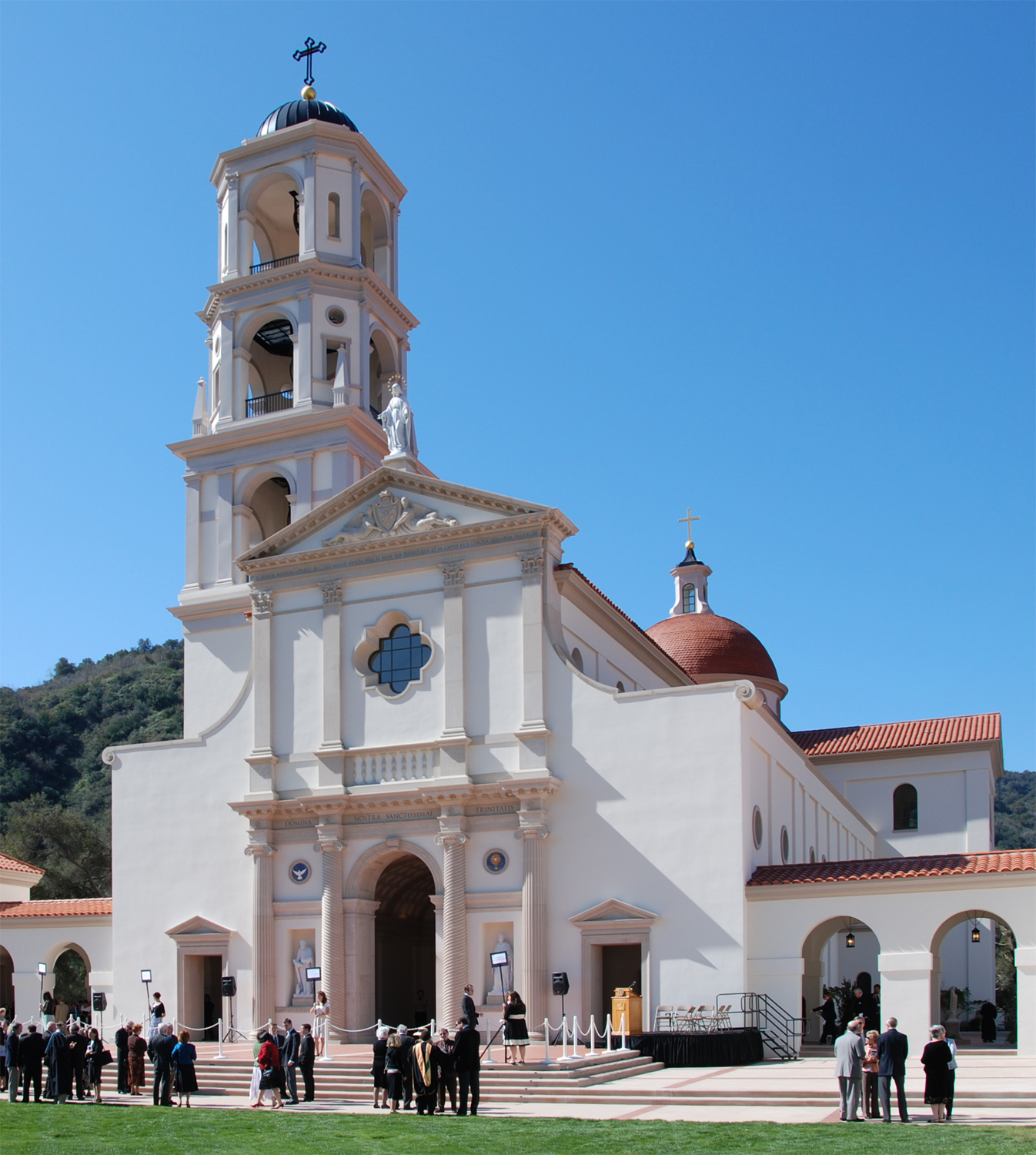 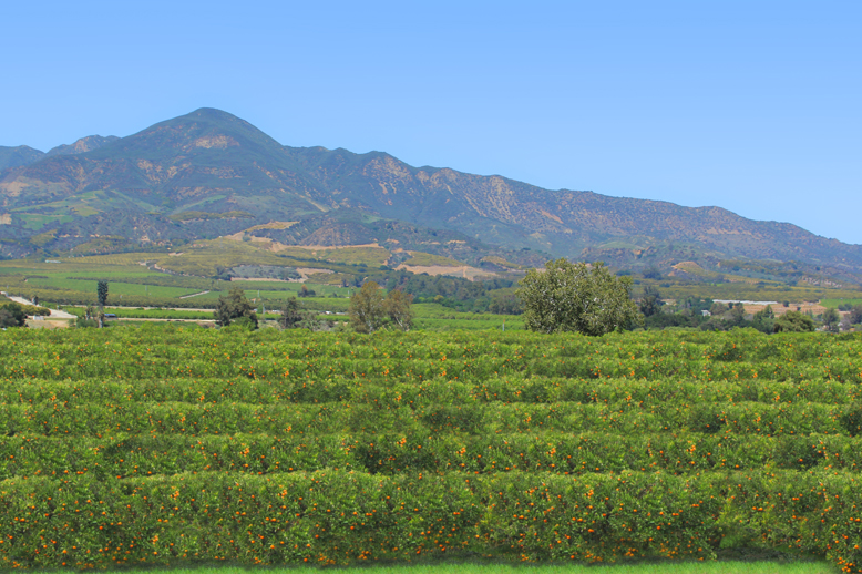  Top: Thomas Aquinas College; Bottom: orange groves (left) and downtown (right) | |
 Seal | |
| Nickname: Citrus Capital of the World[1] | |
 Location in Ventura County and the state of California | |
 Santa Paula Location in the United States | |
| Coordinates: 34°21′21″N 119°4′6″W | |
| Country | United States |
| State | California |
| County | Ventura |
| Founded | 1872[2] |
| Incorporated | April 22, 1902[3] |
| Government | |
| • Mayor | Rick Araiza[4] |
| • State senator | Monique Limón (D)[5] |
| • Assemblymember | Steve Bennett (D)[5] |
| • U.S. rep. | Julia Brownley (D)[6] |
| Area | |
| • City | 5.69 sq mi (14.75 km2) |
| • Land | 5.53 sq mi (14.32 km2) |
| • Water | 0.16 sq mi (0.42 km2) 2.41% |
| Elevation | 279 ft (85 m) |
| Population (2020)[9] | |
| • City | 30,657 |
| • Density | 5,543.76/sq mi (2,081.00/km2) |
| • Metro | 823,318 |
| Time zone | UTC−8 (Pacific) |
| • Summer (DST) | UTC−7 (PDT) |
| ZIP Codes | 93060, 93061 |
| Area code | 805 |
| FIPS code | 06-70042 |
| GNIS feature IDs | 1652793, 2411826 |
| Website | spcity |


History
The area of what today is Santa Paula was inhabited by the Chumash, a Native American people, before the Spanish arrived. In 1769, the Spanish Portola expedition, first Europeans to see inland areas of California, came down the Santa Clara River Valley from the previous night's encampment near Fillmore and camped in the vicinity of Santa Paula on August 12, near one of the creeks coming into the valley from the north (most likely Santa Paula Creek). Fray Juan Crespi, a Franciscan missionary traveling with the expedition, had previously named the valley Cañada de Santa Clara. He noted that the party traveled about 9 to 10 miles (14 to 16 km) that day and camped near a large native village, which he named San Pedro Amoliano.[12] The site of the expedition's arrival has been designated California Historical Landmark No. 727.[13][note 1][note 2][14]
Franciscan missionaries, led by Father Junipero Serra, became active in the area after the founding of the San Buenaventura Mission and established an Asistencia; the town takes its name from the Catholic Saint Paula. Santa Paula is located on the 1843 Rancho Santa Paula y Saticoy Mexican land grant.
In 1872 Nathan Weston Blanchard purchased 2,700 acres (10.9 km2) and laid out the townsite. Considered the founder of the community, he planted seedling orange trees in 1874.[15][16] Several small oil companies owned by Wallace Hardison, Lyman Stewart and Thomas R. Bard were combined and became the Union Oil Company in 1890.[17][18]
Santa Paula was incorporated in April 1902.[19] The first mayor was Lewis Arthur Hardison. [20]

In April 1911, Gaston Méliès moved his Star Film Company from San Antonio, Texas to a site just north of Santa Paula.[21]
The large South Mountain Oil Field southeast of town, just across the Santa Clara River, was discovered by the Oak Ridge Oil Company in 1916, and developed methodically through the 1920s, bringing further economic diversification and growth to the area. While the field peaked in production in the 1950s, Occidental Petroleum continues to extract oil through its Vintage Production subsidiary and remains a significant local employer.
A major expansion began in 2016 when construction started on a 500-acre (200 ha) master-planned community of 1,500 homes.[22]
Disasters
The town has been devastated twice by floods and was affected by a nearby truck explosion that resulted in an industrial disaster.
Floods
The Great Flood of 1862 began on December 24, 1861, when it rained for almost four weeks, reaching a total of 35 inches (890 mm) at Los Angeles. The failure and near complete collapse of the St. Francis Dam took place in the middle of the night on March 12, 1928. The dam was holding a full reservoir of 12.4 billion gallons (47 billion liters) of water that surged down San Francisquito Canyon and emptied into the Santa Clara River. The town was first hit by the waters at approximately 3:00 a.m. Though hundreds of homes and structures were destroyed, the loss of life would have been greater if it were not for two motorcycle police officers that noisily warned as many people as possible.[23] A sculpture called "The Watchers" in downtown Santa Paula depicts this act of heroism.[24]
Santa Clara Waste Water plant industrial disaster
A vacuum truck exploded at the Santa Clara Waste Water plant in the early morning hours of November 18, 2014. Two workers were injured in the initial explosion, three responding fire-fighters were injured by the fumes from the spill of a highly volatile chemical mixture, and 50 others were exposed to fumes and required treatment at local hospitals.[25][26] The driver was transporting waste from a temporary storage drum to a processing center when he stopped to take a meal break.[27] The rear of the truck exploded, spreading a white liquid over a 300-by-400-foot area (91 by 122 m) that spontaneously combusted as it dried and was sensitive to shock, pressure and the application of water or oxygen. The tires of the first fire truck on the scene and the boots of three firefighters sparked small explosions when they drove and walked over the substance as they went to help the injured workers.[28][29] The incident evolved into a disaster when later in the morning additional materials began to burn and explode, which resulted in a three-mile-long plume of toxic smoke (4.8 km) and the closing of Highway 126.[30] Chemical smoke drifted over the area and nearby residents and businesses were required to evacuate.[31]
Cause
What was initially reported as sewage was found to be about 1,000 US gallons (3,800 l; 830 imp gal) of a chemical mixture consisting of some sort of organic peroxide.[32] In the first days of the investigation, officials speculated that two inert chemicals accidentally mixed in the truck and created an organic peroxide substance with sulfuric acid appearing to be part of the mix.[33] Organic peroxide combines unstably bound oxygen together with hydrogen and carbon in the same molecule and ignites easily and then burns rapidly and intensely. While field testing was performed on the reactive material for initial identification, the county hazardous materials manager found that laboratories would not test the chemicals over concerns that lab personnel could be injured or their equipment damaged. Three weeks after the incident, the substance was still highly susceptible to friction and seemed to react to something as slight as wind.[34] Sodium chlorite was identified in an internal investigation by the firm in the months following the disaster. They claimed that the chemical was being using as a water treatment agent for the first time and was stored in the same type of storage container as wastewater.[35][dead link] The worker combined the chemical with wastewater in the vacuum truck where the chemical interacting with organic material caused an explosion that blew off the back of the truck. A former county district attorney, retained by a company attorney, issued a report in March 2015 that provided an explanation of events indicating that the worker may have accidentally combined the chemicals.[35][36] Later, investigators found that an inspection by a Defense Logistics Agency contractor was scheduled for that morning and officials of the firm had directed the transfer of these hazardous materials to another location.[37]
Aftermath
Although the explosion and resulting fumes caused injuries including the lungs of three fire-fighters who remained off-duty indefinitely, the material scattered around the site was found to be non-hazardous for clean-up purposes.[38] The two fire engines that arrived first remained out of service for months and may ultimately have to be scrapped. The Ventura County Sheriff declared a local emergency so the Ventura County Board of Supervisors could ratify the action and allow the county to seek reimbursement for its costs from state disaster relief funds.[36][dead link][39][40] The U.S. Environmental Protection Agency oversaw the decontamination of the site. The material was neutralized and solidified on site.[38] Tons of material were eventually taken to the Chiquita Canyon Landfill in nearby Castaic. Almost three months later on February 10, 2015, the County Supervisors ended the emergency declaration.[41] With the permit to operate suspended, the firm needed to finish removing the waste materials and provide a plan that would show how another such incident would be prevented before being allowed to start accepting liquid waste again. County regulators and county supervisors also wanted the city of Oxnard to agree to accept the waste water again after an analysis of the safety of the pipeline.[42]
On August 7, 2015, a Ventura County grand jury indicted the Santa Clara Waste Water Co., the affiliated Green Compass and nine company executives and managers.[43] Following the indictment, the district attorney had the nine defendants arrested on suspicion of several felonies and misdemeanors, including filing a false or forged instrument, dissuading a witness from reporting a crime, known failure to warn of serious concealed danger, withholding information regarding a substantial danger to public safety, conspiracy to commit a crime, causing impairment of an employee's body, and disposal of hazardous waste.[44] Eight individuals have pleaded guilty or no contest while one is awaiting trial. The two corporate entities reached an agreement in June 2019 after they had already paid about $800,000 in restitution.[45][43][46][47]
Site
The facility at 815 Mission Rock Road, Santa Paula, provided service to over 30,000 waste generators. At the time, it had received and processed over 2,000,000,000 US gallons (7.6×10⁹ l) since it opened in 1959.[48] The company says they treat about 100 different streams of waste.[34] The owner of facility said that they never had a major problem such as this since the plant only takes non-hazardous waste.[49] The capacity of the facility was increased to handle up to 100-US-gallon-per-minute (380 l; 83 imp gal) or 140,000-US-gallon-per-day (530,000 L) by 2014.[50] The facility provides an environmentally safe and legal means of treating, disposing and recycling of contaminated but non-hazardous waste as an alternative to dumping untreated wastes into municipal sewer systems or into the environment. The plant uses centrifuges, electrocoagulation, carbon and micron filtration, ozone injection, dissolved air flotation, and chemical treatments. Treated waste water is sent through a pipeline to the Oxnard municipal treatment plant.
A consortium of six major oil companies (Chevron, Exxon, Mobil, Shell, Texaco and Unocal) established Santa Clara Waste Water to service their internal disposal needs. Eventually the site became a full-service disposal facility for most non-hazardous wastewater and was renamed Southern California Waste Water.[42][48] The site is located in a 91-acre industrial area (37 ha) that is surrounded by agriculture and located about 2-mile southwest (3.2 km) of the Santa Paula city limits. Green Compass that operates the facility also operates a Class II injection well in Kern County that is tailored toward oilfield production and completion fluids. The only other commercial facility for disposal of oil field waste in the county, operated by Anterra Corp. in Oxnard, temporarily expanded operations after the incident.[51]
Wildfires
Thomas Fire
In December 2017, the Thomas Fire broke out nearby. While it was the largest wildfire in modern California history at the time, the Santa Ana winds drove the fire toward Ventura and Santa Barbara. Over a thousand structures were destroyed which included a few out buildings just outside the city. It was finally confirmed to be fully contained in January 2018, and a reported 281,893 acres (440 sq mi; 114,078 ha) had burned. One firefighter and one civilian were the only fatalities directly caused by the fire. The cost of the fire rose to be an estimated $297 million.
Maria Fire
On October 31, 2019, the Maria Fire was reported burning at the top of South Mountain between Santa Paula and Somis and expanded throughout that evening.[52] Heavily influenced by 20–30 mph (32–48 km/h) winds within the canyons, the fire became a full scale conflagration, growing from 50 to 750 acres (20 to 304 ha) inside an hour, to over 4,000 acres (16 km2) after several hours.[52][53] The fire worked its way north towards Santa Paula where the topography of the Santa Clara River Valley which can serve as a funnel for Santa Ana winds.[54] Mandatory evacuations were ordered for a wide swath of over 1,800 homes surrounding the fire area, affecting over 7,500 residences.[52][53]
Geography
The city of Santa Paula, according to the United States Census Bureau, has a total area of 4.7 square miles (12 km2), 4.6 square miles (12 km2) of it land and 0.1 square miles (0.26 km2) of it (2.41%) water. Santa Paula is located in the Santa Clara River Valley on the north bank of the Santa Clara River and is surrounded by fruit orchards. The downtown area is centered around Main Street, which is home to the oldest homes in the city. Homes are often bungalows, cottages, Victorian-style houses and craftsman homes.[55][56]
Climate
Santa Paula has a warm-summer mediterranean climate (Csb) typical of the coastal Southern California with warm summers and cool winters.
| Climate data for Santa Paula, California (normals 1981-2010)(extremes 1894-2020) | |||||||||||||
|---|---|---|---|---|---|---|---|---|---|---|---|---|---|
| Month | Jan | Feb | Mar | Apr | May | Jun | Jul | Aug | Sep | Oct | Nov | Dec | Year |
| Record high °F (°C) | 97 (36) |
92 (33) |
98 (37) |
105 (41) |
106 (41) |
108 (42) |
105 (41) |
105 (41) |
110 (43) |
108 (42) |
99 (37) |
99 (37) |
110 (43) |
| Average high °F (°C) | 69.3 (20.7) |
69.2 (20.7) |
71 (22) |
74 (23) |
75.1 (23.9) |
77.2 (25.1) |
80.7 (27.1) |
82.7 (28.2) |
81.6 (27.6) |
78.5 (25.8) |
73.8 (23.2) |
69.2 (20.7) |
75.2 (24.0) |
| Daily mean °F (°C) | 55.2 (12.9) |
55.9 (13.3) |
57.5 (14.2) |
60 (16) |
62.5 (16.9) |
65.1 (18.4) |
68.8 (20.4) |
69.4 (20.8) |
68.1 (20.1) |
64.4 (18.0) |
59.1 (15.1) |
55.2 (12.9) |
61.8 (16.6) |
| Average low °F (°C) | 41.1 (5.1) |
42.5 (5.8) |
43.9 (6.6) |
45.9 (7.7) |
50 (10) |
53.1 (11.7) |
56.9 (13.8) |
56.1 (13.4) |
54.7 (12.6) |
50.2 (10.1) |
44.4 (6.9) |
41.1 (5.1) |
48.3 (9.1) |
| Record low °F (°C) | 20 (−7) |
23 (−5) |
25 (−4) |
30 (−1) |
35 (2) |
35 (2) |
38 (3) |
36 (2) |
40 (4) |
32 (0) |
28 (−2) |
22 (−6) |
20 (−7) |
| Average precipitation inches (mm) | 3.72 (94) |
4.85 (123) |
2.69 (68) |
0.83 (21) |
0.35 (8.9) |
0.07 (1.8) |
0.01 (0.25) |
0.04 (1.0) |
0.16 (4.1) |
0.69 (18) |
1.44 (37) |
2.53 (64) |
17.38 (441) |
| Source: NOAA[57] | |||||||||||||
Ecology
Bears come down out of the hills and roam in or near the city.[58]
This section needs expansion. You can help by adding to it. (April 2020) |
Demographics
| Historical population | |||
|---|---|---|---|
| Census | Pop. | %± | |
| 1880 | 188 | — | |
| 1890 | 1,047 | 456.9% | |
| 1910 | 2,216 | — | |
| 1920 | 3,967 | 79.0% | |
| 1930 | 7,452 | 87.8% | |
| 1940 | 8,986 | 20.6% | |
| 1950 | 11,049 | 23.0% | |
| 1960 | 13,279 | 20.2% | |
| 1970 | 18,001 | 35.6% | |
| 1980 | 20,658 | 14.8% | |
| 1990 | 25,062 | 21.3% | |
| 2000 | 28,598 | 14.1% | |
| 2010 | 29,321 | 2.5% | |
| 2020 | 30,675 | 4.6% | |
| U.S. Decennial Census[59] | |||
2010
The 2010 United States Census[60] reported that Santa Paula had a population of 29,321. The population density was 6,230.3 inhabitants per square mile (2,405.5/km2). The racial makeup of Santa Paula was 18,458 (63.0%) White, 152 (0.5%) African American, 460 (1.6%) Native American, 216 (0.7%) Asian, 24 (0.1%) Pacific Islander, 8,924 (30.4%) from other races, and 1,087 (3.7%) from two or more races. Hispanic or Latino of any race were 23,299 persons (79.5%).
The Census reported that 29,188 people (99.5% of the population) lived in households, 44 (0.2%) lived in non-institutionalized group quarters, and 89 (0.3%) were institutionalized.
There were 8,347 households, out of which 4,087 (49.0%) had children under the age of 18 living in them, 4,767 (57.1%) were opposite-sex married couples living together, 1,267 (15.2%) had a female householder with no husband present, 650 (7.8%) had a male householder with no wife present. There were 540 (6.5%) unmarried opposite-sex partnerships, and 45 (0.5%) same-sex married couples or partnerships. 1,331 households (15.9%) were made up of individuals, and 678 (8.1%) had someone living alone who was 65 years of age or older. The average household size was 3.50. There were 6,684 families (80.1% of all households); the average family size was 3.85.
The population was spread out, with 8,722 people (29.7%) under the age of 18, 3,295 people (11.2%) aged 18 to 24, 8,012 people (27.3%) aged 25 to 44, 6,193 people (21.1%) aged 45 to 64, and 3,099 people (10.6%) who were 65 years of age or older. The median age was 31.1 years. For every 100 females, there were 101.9 males. For every 100 females age 18 and over, there were 101.5 males.
There were 8,749 housing units at an average density of 1,859.1 per square mile (717.8/km2), of which 4,694 (56.2%) were owner-occupied, and 3,653 (43.8%) were occupied by renters. The homeowner vacancy rate was 2.0%; the rental vacancy rate was 4.1%. 15,528 people (53.0% of the population) lived in owner-occupied housing units and 13,660 people (46.6%) lived in rental housing units.
2000
As of the census of 2000, there were 28,598 people, 8,137 households, and 6,435 families residing in the city. The population density was 6,214.6 inhabitants per square mile (2,400.4/km2). There were 8,341 housing units at an average density of 1,812.6 per square mile (699.8/km2). The racial makeup of the city was 35.2% White, 5.41% African American, 1.02% Native American, 0.70% Asian, 0.19% Pacific Islander, .37% from other races, and 4.68% from two or more races. Hispanic or Latino of any race were 61.2% of the population.[61]
There were 8,136 households, out of which 44.1% had children under the age of 18 living with them, 59.1% were married couples living together, 13.4% had a female householder with no husband present, and 20.9% were non-families. 17.2% of all households were made up of individuals, and 9.4% had someone living alone who was 65 years of age or older. The average household size was 3.49 and the average family size was 3.86.
In the city, the population was spread out, with 31.4% under the age of 18, 10.9% from 18 to 24, 29.7% from 25 to 44, 17.3% from 45 to 64, and 10.7% who were 65 years of age or older. The median age was 30 years. For every 100 females, there were 103.7 males. For every 100 females age 18 and over, there were 102.3 males.
The median income for a household in the city was $41,651, and the median income for a family was $45,419. Males had a median income of $32,165 versus $25,818 for females. The per capita income for the city was $15,736. About 12.2% of families and 14.7% of the population were below the poverty line, including 18.4% of those under age 18 and 9.1% of those age 65 or over.
Economy
While agriculture is the most important industry in Santa Paula today, the city experienced an economic boom after oil was discovered in 1880.[55]
The economy is primarily agriculturally based, originally focusing on the growing of oranges and lemons.[55] Santa Paula's mediterranean climate combined with an estimated 20 feet (6.1 m) of topsoil have made it a prime location for growing citrus. Avocado has also become a major crop and an avocado was added to the city's official seal. Calavo Growers, Inc. is headquartered here.[62]
Santa Paula has very few large retail stores but residents often travel to neighboring cities to purchase hard goods. The Main Street area consists mostly of clothing shops, specialty shops, novelty shops, dollar stores, restaurants, service-oriented businesses and office space. The city also has neighborhood stores and small grocery markets. Many of these small shops and markets have a distinct Latin-American flavor, often selling myriad imported items. In addition some markets also have a meat department which sells a variety of beef, poultry, and seafood.
A 501-acre expansion (203 ha) on the eastern edge of Santa Paula was approved in 2015. This residential and commercial development by Limoneira was known as "East Area One" for the purpose of approval. Officials and residents were hoping this major expansion of the city would create new jobs and increase tax revenue for the cash-strapped city.[63] When the project was first proposed in 1997, concerns were raised that Limoneira was beginning to develop their extensive holdings of prime farmland. Company officials claimed that 83% of the Teague-McKevett parcel was either unsuitable for agriculture or had a low value because of poor soil and drainage.[64]
Tourism
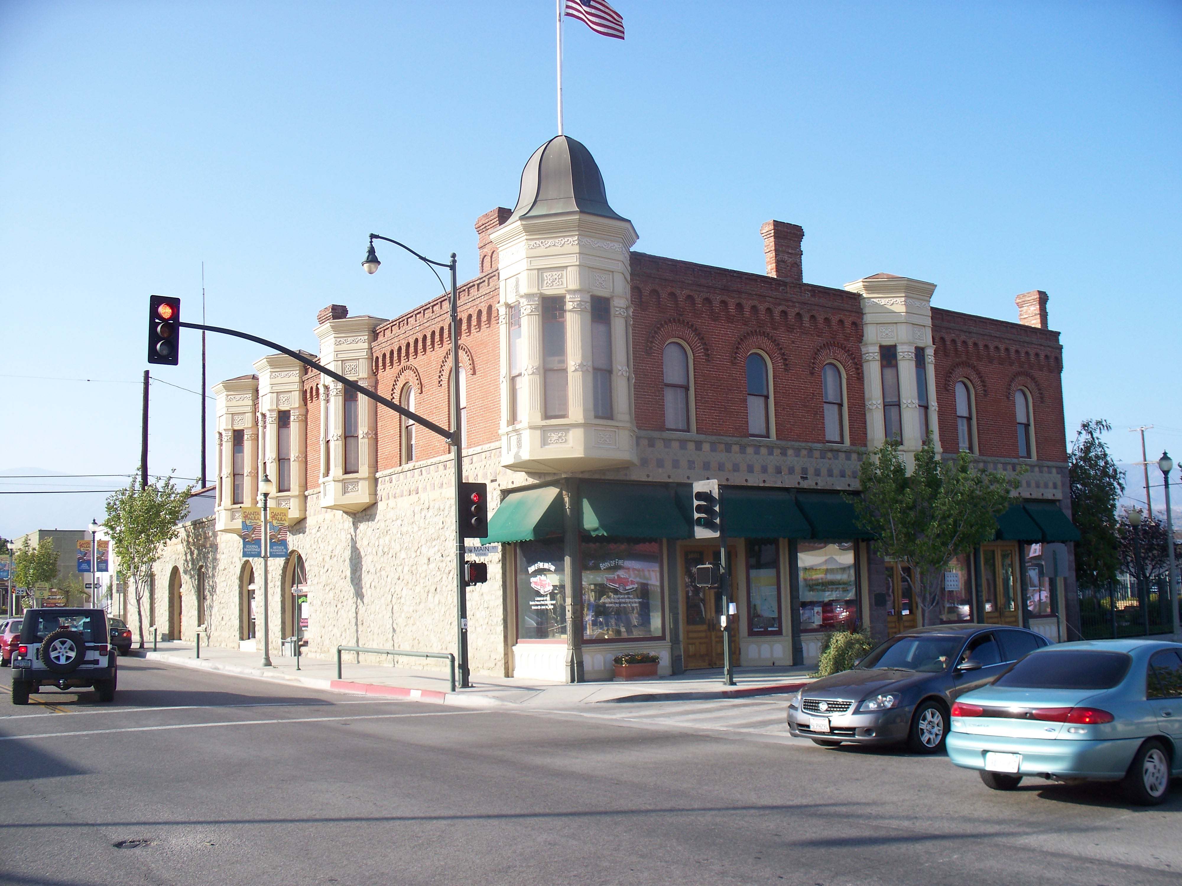
The Santa Clara Valley represents one of the best preserved examples of a mature Southern California landscape of citrus groves.[16][65] Tourists find a town with a main street reminiscent of Middle America in an agricultural setting preserved through Ventura County's greenbelt agreements.[16] The California Oil Museum,[66] within the historic Union Oil building, is located downtown, as are the Santa Paula Art Museum[67] and Museum of Ventura County Agriculture Museum.[68] The Santa Paula Mural Project has completed numerous murals depicting the city's history.[69][70] The monogram "SP" on South Mountain above the city is visible from around town and along Highway 126. Students from Santa Paula High School first etched the letters into the hills in December 1922.[71]
Infrastructure

The Santa Paula Water Recycling Facility was built in 2010 for $63 million to treat the city sewage.[72] Santa Paula Water, a partnership of two corporations, financed, built and operated the facility under the agreement with the city. The city purchased the facility for $70.8 million in 2015 to take control and end a dispute over the failure of the plant to sufficiently remove chlorides. Although the new plant used modern treatment methods, the treated wastewater contained contaminants called chlorides that must be removed under state law before being discharged into the Santa Clara River.[73]
Fire department
The Santa Paula Fire Department provided fire protection and emergency medical services at the basic life support level (BLS) from two fire stations. American Medical Response (AMR) is the paramedic ambulance provider for the city. On July 8, 2018, The Santa Paula Fire Department was disbanded after serving Santa Paula for 115 years. The Ventura County Fire Department now provides fire protection services for the City of Santa Paula. Both fire stations used by Santa Paula Fire were transferred to Ventura County Fire.[74]
Law enforcement
The Santa Paula Police Department provides law enforcement services for the city. The overall crime rate is low.[55]
Notable people
- Gaston Méliès (b.1852): Brother to Georges Méliès; he set up the American branch of their Star Film Company in Santa Paula, filming many movies in the area.
- Jim Colborn (b. 1946): former Major League Baseball pitcher and pitching coach; he was a 20-game winner in 1973.
- Laura Diaz: newscaster, most notably with KABC-TV from 1983 to 2002, KCBS-TV from 2002 to 2011, and KTTV-TV from 2012–Present.
- Dana Elcar: actor, played Pete Thornton in the MacGyver television series from 1985 to 1992 and was featured in many films including The Sting; spent later years at his home on Laurel Road in Santa Paula.
- Nola Fairbanks: born Nola Jo Modine, had a notable singing career on Broadway.
- Eric Fleming: actor, star of Rawhide; born as Edward Heddy, Jr., July 4, 1925.
- Danny Flores: musician, a.k.a. Chuck Rio, wrote and played sax on the 1958 song “Tequila”, winner of best R&B song at the 1st Annual Grammy Awards; he became known as the "Godfather of Latino Rock ‘n’ Roll"
- Grupo Bryndis: internationally known Mexican musical group. Formed by their leader and songwriter Mauro Posadas in 1983, they won a Latin Grammy Award for best album in 2007.
- Joi Lansing: Actress and pin up model is buried there.
- William Lucking: actor, played Piney on Sons of Anarchy; spent much of his early career as a resident, raising two daughters and serving on the school board.
- Steve McQueen (1930-1980): actor, spent the last two years of his life (1979–1980) in Santa Paula, often flying his biplane from the Santa Paula Airport; he and his soon-to-be wife Barbara lived in his hangar at the airport until they moved into a home on South Mountain Road[75] just outside town.[76]
- Richard Pinedo: pleaded guilty to one count of identity fraud in connection to the Russian interference in the 2016 United States elections after allegedly selling stolen bank account information to individuals suspected of interfering in the election through the use of Auction Essistance, an online marketplace.[77][78][79]
- Charles M. Teague (1909-1974): U.S. Representative from California, born in Santa Paula and buried in the local cemetery. He served as director of McKevett Corp. and Teague-McKevett Co.
Education
Historically, education was provided by the Santa Paula Elementary School District and the Santa Paula Union High School District. In 2013, the two bodies were merged to form the Santa Paula Unified School District. Many schools in Santa Paula, largely serving students from low-income families, are scoring low in state-administered tests, below the 30th percentile in statewide comparisons.[55]
Santa Paula Unified School District
Elementary schools
- Barbara Webster Elementary
- Thelma Bedell Elementary
- Blanchard Elementary
- Glenn City Elementary
- McKevett Elementary
- Grace Thille Elementary
Middle school
- Isbell Middle School
High schools
- Renaissance High School
- Santa Paula High School
College
Thomas Aquinas College, outside city limits
Briggs School District
- Olivelands School (elementary)
- Briggs School (middle)
Mupu School District
- Mupu School (elementary)
Private schools
- St. Sebastian School (K-8)
- Westside Baptist Preschool
In popular culture
This section needs additional citations for verification. (April 2014) |
The city has been featured in Hollywood media on numerous occasions. Some examples include:
Commercials
Various commercials, including a Super Bowl Budweiser commercial, (The Human Bridge) have been filmed in downtown Santa Paula.
Movies
Santa Paula was the early film capital of California. Gaston Méliès brought his Star Film Company to the city in 1911, filming movies such as The Ghost of Sulphur Mountain.
Parts of the movie Disorganized Crime (1989), starring Fred Gwynne, was filmed downtown on Main Street.
Main Street and other locations featured prominently in the 1990 Winona Ryder film Welcome Home, Roxy Carmichael.
Chaplin (1992) filmed throughout the surrounding area and held a casting call in town for background actors.
Santa Paula also served as one of the locations for the motion picture Mr. Woodcock (2007), starring Billy Bob Thornton.
A good portion of Joe Dirt (2001) starring David Spade was filmed downtown as well as at the popular restaurant Mary B's.
The Lindsay Lohan movie Georgia Rule (2007) was filmed in Santa Paula.
The majority of the 1997 film Leave It to Beaver was filmed in Santa Paula, with many Santa Paula residents being cast in minor character roles and as extras. The famous scene of Beaver trapped in the giant coffee cup had Main Street blocked off for almost a week while filming continued.
Parts of the Brian De Palma movie Carrie (1976), starring Sissy Spacek, were filmed in Santa Paula.
Other movies that were filmed partially in Santa Paula include The Philadelphia Experiment (1984), the Chinatown sequel The Two Jakes (1990), the Martin Short/Danny Glover buddy comedy Pure Luck (1991), For Love of the Game (1999), Bubble Boy (2001), starring Jake Gyllenhaal, and Bedtime Stories (2008) starring Adam Sandler.
The James M. Sharp House is an historical Italian villa-style house built in 1890. It is located on West Telegraph Road, just outside Santa Paula, and has been the setting for several movies, including Amityville 4 (1989), The Black Gate (1995), and How to Make an American Quilt (1995).
Music videos
The music video for “To Die For” by Sam Smith was shot entirely in the town.[80]
Dennis DeYoung, former lead singer of the popular 1970s and 1980s rock group Styx, filmed the music video for Desert Moon, also the title of his first solo album, at the train depot in 1984.
The music video for the 2001 song “Video” by American R&B artist India Arie was filmed in and around Santa Paula and its surrounding citrus groves. This was India Arie's debut song and video from her Acoustic Soul album.
Television
Parts of the 1976 season 3 episode of The Rockford Files "Coulter City Wildcat", were filmed in Santa Paula.
On the television drama The West Wing, Santa Paula is the hometown of fictional presidential candidate Arnold Vinick (Alan Alda). In early 2005, Santa Paula Mayor Mary Ann Krause began a lobbying campaign to have Santa Paula declared Vinick's hometown. In a publicity move for the town, city officials officially "claim[ed] Senator Arnold Vinick as a resident of Santa Paula," in April 2005, and opened an official campaign headquarters for the fictional Republican Senator in the town's train depot. (Santa Paula for Vinick) On October 14, 2005, NBC released Vinick's official biography and revealed Santa Paula as the town in which he was raised.[81]
Santa Paula served as the backdrop for the fictional Charterville in the 1996–98 TV series Big Bad Beetleborgs.
An episode of the television series Matlock was filmed on Santa Paula St.
After a 1994 fire destroyed their sets in nearby Fillmore, the TV series The Young Indiana Jones Chronicles filmed in various locations, including Santa Paula's Ebell Mansion.
The Santa Paula Train Depot has been a location for various productions, including for the miniseries The Thorn Birds (1983), starring Richard Chamberlain and in the season 3 finale of Glee (2012).
Scenes for the third season of Mayans M.C. were shot on Main Street in October 2020 and February 2021.[82]
See also
- Glen Tavern Inn
- Santa Paula Airport
- Santa Paula Freeway
- Santa Paula Hospital
- Historical Sycamore Tree
- Thomas Fire
Notes
- Registered on February 5, 1960 at Harding Park, Santa Paula Boys and Girls Club Recreation Center, 1400 block of East Harvard Blvd
- 34.35585°N 119.050867°W Coordinates of plaque
References
- Claims to Fame - Agriculture Archived October 7, 2011, at the Wayback Machine, Epodunk, accessed April 16, 2007.
- "City Facts". City of Santa Paula. Archived from the original on January 22, 2021. Retrieved January 6, 2021.
- "California Cities by Incorporation Date". California Association of Local Agency Formation Commissions. Archived from the original (Word) on November 3, 2014. Retrieved August 25, 2014.
- Kelly, Peggy (December 11, 2016). "Mayor and Vice Mayor selected for the City of Santa Paula". Santa Paula Times. Archived from the original on October 7, 2022. Retrieved January 5, 2016.
- "Statewide Database". UC Regents. Archived from the original on February 1, 2015. Retrieved November 24, 2014.
- "California's 26th Congressional District - Representatives & District Map". Civic Impulse, LLC. Retrieved October 5, 2014.
- "2019 U.S. Gazetteer Files". United States Census Bureau. Archived from the original on January 16, 2020. Retrieved July 1, 2020.
- "Santa Paula". Geographic Names Information System. United States Geological Survey, United States Department of the Interior. Retrieved December 3, 2014.
- "Santa Paula (city) QuickFacts". United States Census Bureau. Retrieved January 6, 2021.
- "American Fact Finder - Results". United States Census Bureau. Archived from the original on February 13, 2020. Retrieved May 23, 2015.
- Grimm, Michele; Grimm, Tom (March 30, 1986). "Santa Paula: Citrus Capital of World". Los Angeles Times. Archived from the original on September 16, 2015. Retrieved May 17, 2015.
- Bolton, Herbert E. (1927). Fray Juan Crespi: Missionary Explorer on the Pacific Coast, 1769-1774. HathiTrust Digital Library. p. 157. Archived from the original on July 11, 2019. Retrieved June 2, 2019.
- California State Parks "Portolá Expedition" Archived December 13, 2014, at the Wayback Machine Office of Historic Preservation
- "El Camino Real Bell officially designated - Santa Paula Times". santapaulatimes.com. Archived from the original on February 25, 2019. Retrieved February 25, 2019.
- II, Wes Woods (August 14, 2021). "Pandemic has silver lining for author who sheds light on personal, Santa Paula history". Ventura County Star. Archived from the original on August 17, 2021. Retrieved August 17, 2021.
- "Historic Resources Report: East Area 1 Specific Plan EIR, Santa Paula, California" (PDF). City of Santa Paula. November 7, 2008. Archived (PDF) from the original on September 23, 2015.
- "General Plan Conservation & Open Space Element Appendix: Cultural and Historic Resources" (PDF). City of Santa Paula. April 13, 1998. Archived (PDF) from the original on September 23, 2015.
- Waterfall, Louis (1943). Santa Paula Oil Field, in Geologic Formations and economic development of the Oil and Gas Fields of California. San Francisco: State of California Dept. of Natural Resources Division of Mines, Bulletin 118. p. 394.
- "Archived copy". Archived from the original on August 31, 2021. Retrieved August 31, 2021.
{{cite web}}: CS1 maint: archived copy as title (link) - "Press-Courier Oxnard, California". November 28, 1921. Archived from the original on September 27, 2022.
- Hulse, Jane (January 2, 1997). "Ventura Ready for Its Close-Up". Los Angeles Times. Archived from the original on October 7, 2022. Retrieved May 5, 2018.
- Boyd-Barrett, Claudia (September 9, 2015). "Limoneira teams with residential developer on East Area One". Ventura County Star. Archived from the original on September 11, 2015. Retrieved September 10, 2015.
- (March 12, 2008) "St. Francis Dam disaster: A tale of failure, tragedy and heroism" Archived May 22, 2014, at the Wayback Machine Ventura County Star
- "The Warning: Famed Santa Paula statue warns passersby about COVID-19!". Santa Paula Times. March 31, 2020. Archived from the original on January 24, 2021. Retrieved April 1, 2020.
- The Associated Press (November 19, 2014) "Crews try to ID substance in Calif. plant fire" Archived November 29, 2014, at the Wayback Machine Miami Herald
- Wenner, Gretchen (November 26, 2014) "Oxnard shuts out Santa Clara Waste Water from sewer system" Archived December 3, 2014, at the Wayback Machine Ventura County Star
- Wilson, Kathleen and Von Quednow, Cindy (November 21, 2014) "Truck explosion near Santa Paula draws scrutiny" Archived December 19, 2014, at the Wayback Machine Ventura County Star
- Von Quednow, Cindy (November 18, 2014) "Santa Paula chemical explosion causes injuries, evacuations, road closures" Archived November 21, 2014, at the Wayback Machine Ventura County Star
- Rocha, Veronica (November 18, 2014) "2 dozen treated after truck explodes; chemical hits air, ignites" Archived November 19, 2014, at the Wayback Machine Los Angeles Times
- Kelly, Peggy (November 27, 2014) "‘3-mile plume of toxic smoke’: VC Sheriff declares emergency in wake of SCWW blasts, fires" Archived November 29, 2014, at the Wayback Machine Santa Paula Times
- Aguilar, Mercedes (November 22, 2014). "Evacuation order lifted near Santa Paula explosion site". Ventura County Star. Archived from the original on December 8, 2014.
- Von Quednow, Cindy (November 19, 2014). "Officials work to identify, clean up chemical in Santa Paula explosion". Ventura County Star. Archived from the original on December 23, 2014.
- Von Quednow, Cindy (November 20, 2014) "Businesses take stock after Santa Paula chemical explosion" Archived June 18, 2018, at the Wayback Machine Ventura County Star
- Wilson, Kathleen (December 5, 2014) "Cleanup of spill slow as county shuts plant indefinitely" Archived March 24, 2015, at the Wayback Machine Ventura County Star
- Wilson, Kathleen (March 3, 2015). "Accidental mixture led to blast, former DA says". Ventura County Star. Archived from the original on March 6, 2015.
- Wilson, Kathleen (February 9, 2015) "Chemical that triggered Santa Paula blast identified" Archived February 11, 2015, at the Wayback Machine Ventura County Star
- Cole, Matt (September 8, 2015). "Crime report: Eleven indicted after explosion of vacuum cargo tank trailer". Commercial Carrier Journal (CCJ) Online. Tuscaloosa, AL: Randall-Reilly. Archived from the original on September 29, 2015. Retrieved September 9, 2015.
- Wilson, Kathleen (December 16, 2014) "Crops cleared but farm losses from blast estimated at $1 million" Archived December 20, 2014, at the Wayback Machine Ventura County Star
- Staff (November 27, 2014) "Local emergency declared for Santa Paula explosion, fire" Archived December 3, 2014, at the Wayback Machine Ventura County Star
- Wilson, Kathleen (January 6, 2015) "Waste company sues insurer over chemical blast cleanup" Archived January 9, 2015, at the Wayback Machine Ventura County Star
- Wilson, Kathleen (February 10, 2015) "County calls off emergency declaration triggered by plant explosion" Archived February 11, 2015, at the Wayback Machine Ventura County Star
- Wilson, Kathleen (March 14, 2015). "Santa Paula company moves to reopen plant amid questions". Ventura County Star. Archived from the original on March 16, 2015.
- Wilson, Kathleen (May 17, 2019). "Reopening of explosion site near Santa Paula passes critical hurdle". Ventura County Star. Archived from the original on May 28, 2019. Retrieved June 2, 2019.
- Wilson, Kathleen (August 19, 2015). "DA reports finding falsified records in Santa Clara Waste Water case". Ventura County Star. Archived from the original on August 20, 2015.
- Diskin, Megan (June 6, 2019). "Corporations agree to pay $2.8M to victims in explosion at Santa Clara Waste Water site". Ventura County Star. Archived from the original on August 24, 2019. Retrieved August 26, 2019.
- Childs, Jeremy (August 23, 2019). "$2.65 million in restitution ordered in 2014 explosion near Santa Paula, chemical case". Ventura County Star. Archived from the original on August 24, 2019. Retrieved August 25, 2019.
- Diskin, Megan (October 15, 2019). "Lawyers push for progress on suits over 2014 explosion near Santa Paula". Ventura County Star. Archived from the original on October 17, 2019. Retrieved October 16, 2019.
- "About Us" Archived November 29, 2014, at the Wayback Machine Green Compass Environmental Solutions website Accessed 19 November 2014
- Moreno, John A.; Pascucci, Christina; Pamer, Melissa; and Chambers, Rick (November 18, 2014) "Dozens Injured When Vacuum Truck Explodes in Santa Paula Area" Archived November 29, 2014, at the Wayback Machine KTLA
- "Santa Clara Waste Water using Electrocoagulation" Archived July 24, 2015, at the Wayback Machine Santa Barbara, California Natural Systems Accessed 21 November 2014
- Wilson, Kathleen (November 20, 2014) "Oil field waste diverted to Anterra in wake of Santa Paula explosion" Archived November 24, 2014, at the Wayback Machine Ventura County Star
- Carlson, Cheri; Diskin, Megan; Jazi, Mo Najafian. "Maria Fire atop South Mountain explodes between Santa Paula and Somis". Ventura County Star. Archived from the original on November 5, 2019. Retrieved October 31, 2019.
- Wigglesworth, Alex. "Brush fire in Ventura County explodes to 4,000 acres, prompting evacuations". Los Angeles Times. Archived from the original on November 5, 2019. Retrieved October 31, 2019.
- Fry, Hanna; Puente, Mark; Lin II, Rong-Gong; Wigglesworth, Alex (November 1, 2019). "Maria fire charges toward Santa Paula neighborhoods, forcing additional evacuations". Los Angeles Times. Archived from the original on November 6, 2019. Retrieved November 1, 2019.
- McCormack, Don (1999). McCormack's Guides Santa Barbara and Ventura 2000. Mccormacks Guides. Page 116. ISBN 9781929365098.
- Childs, Jeremy (October 2, 2019). "Santa Paula prowler proves to be a mountain lion". Ventura County Star. Archived from the original on October 4, 2019. Retrieved October 3, 2019.
- "Santa Maria - NWS Los Angeles/Oxnard NOAA Online Weather Data". NOAA. Archived from the original on July 11, 2015. Retrieved February 8, 2021.
- Carlson, Cheri (August 18, 2020). "Bear bites man working in orchard near Santa Paula; one of five attacks statewide in 2020". Ventura County Star. Archived from the original on August 18, 2020. Retrieved August 19, 2020.
- "Census of Population and Housing". Census.gov. Archived from the original on July 17, 2022. Retrieved January 6, 2021.
- "2010 Census Interactive Population Search: CA - Santa Paula city". U.S. Census Bureau. Archived from the original on January 29, 2016. Retrieved July 12, 2014.
- Santa Paula city, California - Fact Sheet - American FactFinder Archived February 12, 2020, at archive.today.
- "Calavo Growers". www.calavo.com. Archived from the original on October 11, 2016. Retrieved October 10, 2016.
- Boyd-Barrett, Claudia (February 18, 2015). "Limoneira gets final go-ahead for massive project in Santa Paula". Ventura County Star. Archived from the original on February 21, 2015. Retrieved March 1, 2015. (subscription may be required for this article)
- Green, Nick (July 20, 1997). "Cultivating Change in Santa Paula". Los Angeles Times. Archived from the original on October 24, 2015. Retrieved May 24, 2015.
- Foxhall, Emily (February 4, 2015). "How Orange County's namesake was squeezed out—and is being squeezed in". Los Angeles Times. Archived from the original on May 26, 2015. Retrieved May 23, 2015.
- California Oil Museum Archived April 10, 2009, at the Wayback Machine.
- "Home". Santa Paula Art Museum. Archived from the original on March 23, 2017. Retrieved April 10, 2017.
- Fleming, Charles (February 6, 2020). "Looking for a weekend road trip from L.A.? This historic gem is closer than you think". Los Angeles Times. Archived from the original on February 7, 2020. Retrieved February 7, 2020.
- Nash, Bill (January 17, 2008) "Giant murals on Santa Paula walls are visions of city's vibrant past" Archived May 22, 2014, at the Wayback Machine Ventura County Star
- Mejia, Brittny (February 24, 2017). "Gripped by fear of ICE raids and deportations, one town tries to separate fact from rumor". Los Angeles Times. Archived from the original on February 25, 2017. Retrieved February 25, 2017.
- Salgado, Cytlalli (July 17, 2022). "Santa Paula's hillside 'SP' monogram is fading. Here's what we know". Ventura County Star. Archived from the original on October 7, 2022. Retrieved July 18, 2022.
- Kelly, Peggy (December 15, 2010) "Santa Paula’s new water recycling facility officially completed" Archived April 5, 2015, at the Wayback Machine Santa Paula Times
- Boyd-Barrett, Claudia (February 3, 2015) "Santa Paula will buy wastewater treatment plant" Archived February 11, 2015, at the Wayback Machine Ventura County Star (subscription may be required for this article)
- "Santa Paula Fire joins VCFD". vcfd.org. Archived from the original on July 28, 2018. Retrieved July 27, 2018.
- U.S. Geological Survey Geographic Names Information System: South Mountain
- Johnson, Brett (January 13, 2008) "Steve McQueen turned to quiet life in Santa Paula before 1980 death" Archived May 15, 2009, at the Wayback Machine Ventura County Star
- HAMILTON, MATT; QUEALLY, JAMES; LIVINGSTON, MICHAEL (February 16, 2018). "Who is the California man who just pleaded guilty to unwittingly aiding Russian interference in the 2016 election". Los Angeles Times. Archived from the original on February 17, 2018. Retrieved February 17, 2018.
- Nicholas Fandos (February 16, 2018). "Russians Bought Bank Accounts From California Man, Mueller Says". The New York Times. Archived from the original on February 16, 2018. Retrieved February 17, 2018.
- Diskin, Megan (February 16, 2018). "Santa Paula man pleads guilty to role in helping Russians to meddle in 2016 election". Ventura County Star. Archived from the original on February 18, 2018. Retrieved February 18, 2018.
- Sam Smith - To Die For, archived from the original on February 13, 2020, retrieved September 25, 2022
- "Arnold Vinick". The West Wing. NBC. Archived from the original on September 6, 2006.
- Wenner, Gretchen (February 5, 2021) "Santa Paula dresses up again for 'Mayans M.C.' shoot" Archived February 13, 2021, at the Wayback Machine Ventura County Star
Further reading
- Santa Paula (Images of America), by Mary Alice Orcutt Henderson. 2006, Arcadia. ISBN 0738531243
External links
Destinations from Santa Paula | |
|---|---|
Municipalities and communities of Ventura County, California, United States | ||
|---|---|---|
County seat: Ventura | ||
| Cities |  | |
| CDPs | ||
| Unincorporated communities |
| |
| Footnotes | ‡This populated place also has portions in an adjacent county or counties | |
| ||

Authority control | |
|---|---|
| General | |
| National libraries | |
| Other |
|
На других языках
[de] Santa Paula
Santa Paula ist eine Stadt im Ventura County im US-Bundesstaat Kalifornien, Vereinigte Staaten, mit 29.000 Einwohnern (Stand: 2004). Die geographischen Koordinaten sind: 34,35° Nord, 119,07° West. Das Stadtgebiet hat eine Größe von 11,9 km².- [en] Santa Paula, California
[es] Santa Paula (California)
Santa Paula, fundada en 1948, es una ciudad ubicada en el condado de Ventura en el estado estadounidense de California. En el año 2000 tenía una población de 28,598 habitantes y una densidad poblacional de 2,403.2 personas por km².Другой контент может иметь иную лицензию. Перед использованием материалов сайта WikiSort.org внимательно изучите правила лицензирования конкретных элементов наполнения сайта.
WikiSort.org - проект по пересортировке и дополнению контента Википедии