world.wikisort.org - USA
Natchez (/ˈnætʃɪz/ NATCH-iz) is the county seat of and only city[2] in Adams County, Mississippi, United States. Natchez has a total population of 15,792 (as of the 2010 census).[3] Located on the Mississippi River across from Vidalia in Concordia Parish, Louisiana, Natchez was a prominent city in the antebellum years, a center of cotton planters and Mississippi River trade.
Natchez, Mississippi | |
|---|---|
Incorporated city | |
 The Convention Center in Downtown Natchez | |
 Flag | |
| Nickname(s): The Bluff City, The Trace City, The River City, Antebellum Capital of the World, Historic Natchez on the Mississippi | |
| Motto: "On the Mighty Mississippi" | |
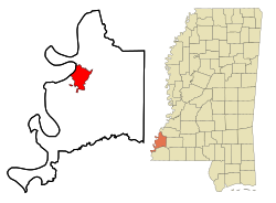 Location of Natchez in Adams County | |
 Natchez, Mississippi Location in Mississippi  Natchez, Mississippi Natchez, Mississippi (the United States) | |
| Coordinates: 31°33′16″N 91°23′15″W | |
| Country | United States |
| State | Mississippi |
| County | Adams |
| Founded | 1716 as Fort Rosalie, renamed by 1730 Louisiana (New France) |
| Established | c. 1790 as the capital of the Natchez District Spanish West Florida |
| Incorporated | 1800s |
| Government | |
| • Mayor | Dan Gibson |
| Area | |
| • Total | 16.41 sq mi (42.49 km2) |
| • Land | 15.81 sq mi (40.96 km2) |
| • Water | 0.59 sq mi (1.53 km2) |
| Elevation | 217 ft (66 m) |
| Population (2020) | |
| • Total | 14,520 |
| • Density | 918.12/sq mi (354.48/km2) |
| Time zone | UTC−6 (CST) |
| • Summer (DST) | UTC−5 (CDT) |
| ZIP codes | 39120-39122 |
| Area code | 601 |
| FIPS code | 28-50440 |
| GNIS feature ID | 0691586 |
| Website | www |
Natchez is some 90 miles (140 km) southwest of Jackson, the capital of Mississippi, which is located near the center of the state. It is approximately 85 miles (137 km) north of Baton Rouge, Louisiana, located on the lower Mississippi River. Natchez is the 25th-largest city in the state.[4] The city was named for the Natchez tribe of Native Americans, who with their ancestors, inhabited much of the area from the 8th century AD through the French colonial period.
History
This section needs additional citations for verification. (May 2020) |
Established by French colonists in 1716, Natchez is one of the oldest and most important European settlements in the lower Mississippi River Valley. After the French lost the French and Indian War (Seven Years' War), they ceded Natchez and near territory to Great Britain in the Treaty of Paris of 1763. (It later traded other territory east of the Mississippi River with Great Britain, which expanded what it called West Florida). The British Crown bestowed land grants in this territory to officers who had served with distinction in the war. These officers came mostly from the colonies of New York, New Jersey, and Pennsylvania. They established plantations and brought their upper-class style of living to the area.
Beginning 1779, the area was under Spanish colonial rule. After defeat in the American Revolutionary War, Great Britain ceded the territory to the United States under the terms of the Treaty of Paris (1783). Spain was not a party to the treaty, and it was their forces who had taken Natchez from British troops. Although Spain had been allied with the American colonists, they were more interested in advancing their power at the expense of Britain. Once the war was over, they were not inclined to give up that which they had acquired by force.
In 1797 Major Andrew Ellicott of the United States marched to the highest ridge in the young town of Natchez, set up camp, and raised the first American Flag claiming Natchez and all former Spanish lands east of the Mississippi above the 31st parallel for the United States.
After the United States acquired this area from the Spanish, the city served as the capital of the Mississippi Territory and then of the state of Mississippi. It predates Jackson by more than a century; the latter replaced Natchez as the capital in 1822, as it was more centrally located in the developing state. The strategic location of Natchez, on a bluff overlooking the Mississippi River, ensured that it would be a pivotal center of trade, commerce, and the interchange of ethnic Native American, European, and African cultures in the region; it held this position for two centuries after its founding.
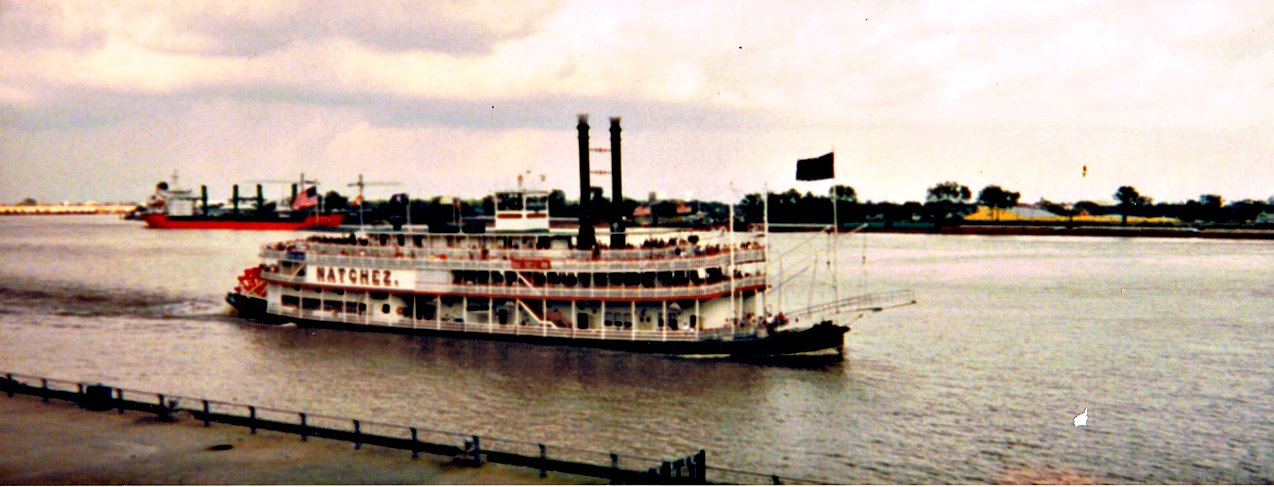
In U.S. history, Natchez is recognized particularly for its role in the development of the Old Southwest during the first half of the 19th century. It was the southern terminus of the historic Natchez Trace, with the northern terminus being Nashville, Tennessee. After unloading their cargoes in Natchez or New Orleans, many pilots and crew of flatboats and keelboats traveled by the Trace overland to their homes in the Ohio River Valley. (Given the strong current of the Mississippi River, it was not until steam-powered vessels were developed in the 1820s that travel northward on the river could be accomplished by large boats.) The Natchez Trace also played an important role during the War of 1812. Today the modern Natchez Trace Parkway, which commemorates this route, still has its southern terminus in Natchez.
In the decades preceding the Civil War, Natchez was by far the most prevalent slave trading city in Mississippi, and second in the United States only to New Orleans.[5] The leading markets were located at the Forks of the Road, at the intersection of Liberty Road and Washington Road (now D’Evereux Drive and St. Catherine Street). In 1833, the most active slavers in the United States, John Armfield and Isaac Franklin began a program of arbitrating low slave prices in the Middle Atlantic area by sending thousands of slaves to Deep South markets in Natchez and New Orleans. Their company, Franklin and Armfield sent an annual caravan of slaves, called a coffle, from Virginia to the Forks of the Road in Natchez, as well as sending others by ship through New Orleans. Unlike other slave sellers of the day, Franklin and Armfield sold slaves individually, with the buyers allowed to survey the people much like items in a modern retail store.[6]
In 1840, the city was struck by a devastating tornado that killed 317 people and injured 109. It ranks today as the second-deadliest tornado in U.S history, although the death toll may be higher due to slave deaths not traditionally being counted in the South at that time.
In the middle of the nineteenth century, the city attracted wealthy Southern planters as residents, who built mansions to fit their ambitions. Their plantations were vast tracts of land in the surrounding lowlands along the river fronts of Mississippi and Louisiana, where they grew large commodity crops of cotton and sugarcane using slave labor. Natchez became the principal port from which these crops were exported, both upriver to Northern cities and downriver to New Orleans, where much of the cargo was exported to Europe. Many of the mansions built by planters before 1860 survive and form a major part of the city's architecture and identity. Agriculture remained the primary economic base for the region until well into the twentieth century.
During the American Civil War Natchez was surrendered by Confederate forces without a fight in September 1862. Following the Union victory at the Battle of Vicksburg in July 1863, many refugees, including former slaves, freed by the Emancipation Proclamation, began moving into Natchez and the surrounding countryside. The Union Army officers claimed to be short on resources and unable to provide for the refugees. The Army planned to address the situation with a mixture of paid labor for freed slaves on government leased plantations, the enlistment of able bodied males who were willing to fight in the Union Army and the establishment of refugee camps where former slaves could be provided with education. However, as the war continued, the plan was never effectively implemented and the leased plantations were crowded, poorly managed and frequently raided by Confederate troops who controlled the surrounding territory. Hundreds of people living in Natchez, including many former slaves and refugees, died of hunger, disease, overwork or were killed in the fighting during this period.[7] In order to manage the tens of thousands of freed Black slaves, the Union Army created a concentration camp in Natchez in a natural pit known as the Devil's Punchbowl, where thousands died of starvation, smallpox, and other diseases.[8][9] After the American Civil War, the city's economy rapidly revived, mostly due to Natchez having been spared the destruction visited upon many other parts of the South. The vitality of the city and region was captured most significantly in the 80 years or so following the war by the photographers Henry C. Norman and his son Earl. The output of the Norman Studio between roughly 1870 and 1950 documents this period in Natchez's development vividly; the photographs are now preserved as the Thomas and Joan Gandy Collection in special collections of the library of Louisiana State University in Baton Rouge. During the twentieth century, the city's economy experienced a downturn, first due to the replacement of steamboat traffic on the Mississippi River by railroads in the early 1900s, some of which bypassed the river cities and drew away their commerce. Later in the 20th century, many local industries closed in a restructuring that sharply reduced the number of jobs in the area. Despite its status as a popular destination for heritage tourism because of well-preserved antebellum architecture, Natchez has had a general decline in population since 1960. It remains the principal city of the Natchez micropolitan area.
Geography
According to the United States Census Bureau, the city has a total area of 13.9 square miles (36 km2), of which 13.2 square miles (34 km2) are land and 0.6 square miles (1.6 km2) (4.62%) is water.
Climate
Natchez has a humid subtropical climate (Cfa) under the Köppen climate classification system.
| Climate data for Natchez, Mississippi (1991–2020 normals, extremes 1892–present) | |||||||||||||
|---|---|---|---|---|---|---|---|---|---|---|---|---|---|
| Month | Jan | Feb | Mar | Apr | May | Jun | Jul | Aug | Sep | Oct | Nov | Dec | Year |
| Record high °F (°C) | 83 (28) |
86 (30) |
92 (33) |
92 (33) |
99 (37) |
103 (39) |
105 (41) |
105 (41) |
105 (41) |
98 (37) |
89 (32) |
89 (32) |
105 (41) |
| Average high °F (°C) | 56.9 (13.8) |
60.9 (16.1) |
68.0 (20.0) |
75.1 (23.9) |
81.7 (27.6) |
87.3 (30.7) |
89.5 (31.9) |
89.3 (31.8) |
85.5 (29.7) |
76.9 (24.9) |
66.6 (19.2) |
58.9 (14.9) |
74.7 (23.7) |
| Daily mean °F (°C) | 46.4 (8.0) |
50.0 (10.0) |
57.3 (14.1) |
63.9 (17.7) |
71.7 (22.1) |
77.9 (25.5) |
80.4 (26.9) |
79.9 (26.6) |
75.1 (23.9) |
65.1 (18.4) |
54.8 (12.7) |
48.4 (9.1) |
64.2 (17.9) |
| Average low °F (°C) | 35.9 (2.2) |
39.0 (3.9) |
46.5 (8.1) |
52.7 (11.5) |
61.6 (16.4) |
68.5 (20.3) |
71.3 (21.8) |
70.5 (21.4) |
64.7 (18.2) |
53.2 (11.8) |
43.0 (6.1) |
37.9 (3.3) |
53.7 (12.1) |
| Record low °F (°C) | 4 (−16) |
4 (−16) |
18 (−8) |
28 (−2) |
30 (−1) |
49 (9) |
55 (13) |
50 (10) |
40 (4) |
27 (−3) |
18 (−8) |
5 (−15) |
4 (−16) |
| Average precipitation inches (mm) | 6.23 (158) |
5.54 (141) |
6.03 (153) |
4.90 (124) |
4.69 (119) |
4.48 (114) |
4.47 (114) |
4.87 (124) |
4.14 (105) |
4.04 (103) |
5.08 (129) |
5.66 (144) |
60.13 (1,527) |
| Average snowfall inches (cm) | 0.1 (0.25) |
0.0 (0.0) |
0.0 (0.0) |
0.0 (0.0) |
0.0 (0.0) |
0.0 (0.0) |
0.0 (0.0) |
0.0 (0.0) |
0.0 (0.0) |
0.0 (0.0) |
0.0 (0.0) |
0.2 (0.51) |
0.3 (0.76) |
| Average precipitation days (≥ 0.01 in) | 11.2 | 10.4 | 9.9 | 8.3 | 9.2 | 9.9 | 10.6 | 10.2 | 7.2 | 6.7 | 7.8 | 10.3 | 111.7 |
| Average snowy days (≥ 0.1 in) | 0.1 | 0.0 | 0.0 | 0.0 | 0.0 | 0.0 | 0.0 | 0.0 | 0.0 | 0.0 | 0.0 | 0.0 | 0.1 |
| Source: NOAA[10][11] | |||||||||||||
Demographics
| Historical population | |||
|---|---|---|---|
| Census | Pop. | %± | |
| 1810 | 1,511 | — | |
| 1820 | 2,184 | 44.5% | |
| 1830 | 2,789 | 27.7% | |
| 1840 | 3,612 | 29.5% | |
| 1850 | 4,434 | 22.8% | |
| 1860 | 6,612 | 49.1% | |
| 1870 | 9,057 | 37.0% | |
| 1880 | 7,058 | −22.1% | |
| 1890 | 10,101 | 43.1% | |
| 1900 | 12,210 | 20.9% | |
| 1910 | 11,791 | −3.4% | |
| 1920 | 12,608 | 6.9% | |
| 1930 | 13,422 | 6.5% | |
| 1940 | 15,296 | 14.0% | |
| 1950 | 22,740 | 48.7% | |
| 1960 | 23,791 | 4.6% | |
| 1970 | 19,704 | −17.2% | |
| 1980 | 22,015 | 11.7% | |
| 1990 | 19,535 | −11.3% | |
| 2000 | 18,464 | −5.5% | |
| 2010 | 15,792 | −14.5% | |
| 2020 | 14,520 | −8.1% | |
| U.S. Decennial Census[12] | |||

2020 census
| Race | Num. | Perc. |
|---|---|---|
| White | 5,156 | 35.51% |
| Black or African American | 8,729 | 60.12% |
| Native American | 16 | 0.11% |
| Asian | 73 | 0.5% |
| Pacific Islander | 2 | 0.01% |
| Other/Mixed | 343 | 2.36% |
| Hispanic or Latino | 201 | 1.38% |
As of the 2020 United States Census, there were 14,520 people, 6,026 households, and 3,149 families residing in the city.
2000 census
As of the census[14][15] of 2000, there were 18,464 people, 7,591 households, and 4,858 families residing in the city. The population density was 1,398.3 people per square mile (540.1/km2). There were 8,479 housing units at an average density of 642.1 per square mile (248.0/km2). The racial makeup of the city was 54.49% African American, 44.18% White, 0.38% Asian, 0.11% Native American, 0.02% Pacific Islander, 0.18% from other races, and 0.63% from two or more races. 0.70% of the population were Hispanic or Latino of any race.
There were 7,591 households, out of which 29.7% had children under the age of 18 living with them, 36.6% were married couples living together, 23.5% had a female householder with no husband present, and 36.0% were non-families. 32.4% of all households were made up of individuals, and 14.6% had someone living alone who was 65 years of age or older. The average household size was 2.37 and the average family size was 3.00.
In the city, the population was spread out, with 26.5% under the age of 18, 8.8% from 18 to 24, 24.3% from 25 to 44, 22.4% from 45 to 64, and 18.0% who were 65 years of age or older. The median age was 38 years. For every 100 females, there were 81.5 males. For every 100 females age 18 and over, there were 76.7 males.
The median income for a household in the city was $25,117, and the median income for a family was $29,723. Males had a median income of $31,323 versus $20,829 for females. The per capita income for the city was $16,868. 28.6% of the population and 25.1% of families were below the poverty line. 41.6% of those under the age of 18 and 23.3% of those 65 and older were living below the poverty line.
Economy
Adams County Correctional Center, a private prison operated by the Corrections Corporation of America on behalf of the Federal Bureau of Prisons, is in an unincorporated area in Adams County, near Natchez.[16]
Education
Natchez is home to Alcorn State University's Natchez Campus, which offers the School of Nursing, the School of Business, and graduate business programs. The School of Business offers Master of Business Administration (MBA) degree and other business classes from its Natchez campus. The MBA program attracts students from a wide range of academic disciplines and preparation from the Southwest Mississippi area and beyond offering concentrations in general business, gaming management and hospitality management.[17] Both schools in the Natchez campus provide skills which has enabled community students to have an important impact on the economic opportunities of people in Southwest Mississippi.[18]
Copiah-Lincoln Community College also operates a campus in Natchez.
The city of Natchez and Adams County operate one public school system, the Natchez-Adams School District. The district comprises ten schools. They are Susie B. West, Morgantown, Gilmer McLaurin, Joseph F. Frazier, Robert Lewis Magnet School, Natchez Freshman Academy, Natchez Early College@Co-Lin, Central Alternative School, Natchez High School, and Fallin Career and Technology Center.
In Natchez, there are a number of private and parochial schools. Adams County Christian School (ACCS) is also a PK-12 school in the city. Adams County Christian School was founded as a segregation academy and is a member of the Mississippi Association of Independent Schools (MAIS). Cathedral School is also a PK-12 school in the city. It is affiliated with the Roman Catholic St. Mary Basilica. Holy Family Catholic School, founded in 1890, is a PK-3 school affiliated with Holy Family Catholic Church.
Media
A list of media in the Natchez metropolitan area (collectively known as the "Miss-Lou"):
AM
| Channel | Callsign | Format |
|---|---|---|
| 1240 | WMIS | Blues |
| 1450 | WNAT | Rhythmic AC |
FM
| Channel | Callsign | Format |
|---|---|---|
| 88.9 | WMAU | Public radio |
| 91.1 | WASM | Religious |
| 91.9 | WYFQ | Religious |
| 95.1 | WQNZ | Country |
| 97.3 | WKSO | Top 40 Adult |
| 97.7 | WTYJ | Blues |
| 101.1 | WWUU | Classic Hits |
| 104.7 | KWTG | Classic Country |
| 105.1 | KZKR | Classic Rock |
| 107.1 | KFNV | Classic Hits |
Infrastructure
Transportation
Highways
U.S. 61 runs north–south, parallel to the Mississippi River, linking Natchez with Port Gibson, Woodville, Mississippi and Baton Rouge, Louisiana.
U.S. 84 runs east–west and bridges the Mississippi, connecting it with Vidalia, Louisiana and Brookhaven, Mississippi.
U.S. 425 runs north from Natchez after crossing the Mississippi, connecting Ferriday with Clayton, at which point U.S. 65 follows the west bank of the Mississippi, connecting to Waterproof north to St. Joseph, Newellton, and Tallulah, Louisiana.
U.S. 98 runs east from Natchez towards Bude and McComb, Mississippi.
Mississippi 555 runs north from the center of Natchez to where it joins Mississippi Highway 554.
Mississippi 554 runs from the north side of the city to where it joins Highway 61, northeast of town.
Rail
Natchez is served by the Natchez Railway, which interchanges with Canadian National.
Air
Natchez is served by the Natchez-Adams County Airport, a general aviation facility. The nearest airports with commercial service are Baton Rouge Metropolitan Airport, 85 miles (137 km) to the south via US 61 and Alexandria International Airport, 82 miles (132 km) to the west via US 84 to LA-28W.
Notable people
- Robert H. Adams, former United States senator from Mississippi[20]
- William Wirt Adams, Confederate States Army officer, grew up in Natchez[20]
- Philip Alston, prominent plantation owner and early American outlaw
- Glen Ballard, five-time Grammy Award-winning songwriter/producer
- Pierre A. Barker, former Mayor of Buffalo, New York
- Campbell Brown, Emmy Award-winning journalist, political anchor for CNN; grew up in Natchez and attended both Trinity Episcopal and Cathedral High School
- John J. Chanche, first Roman Catholic bishop of Natchez, buried on the grounds of St. Mary Basilica, Natchez
- George Henry Clinton, member of both houses of the Louisiana State Legislature in the first quarter of the 20th century, born in Natchez in the late 1860s[21]
- Charles C. Cordill, Louisiana state senator from Concordia and Tensas parishes, interred at Natchez City Cemetery[22]
- Charles G. Dahlgren, Confederate brigadier general during American Civil War
- Olu Dara, musician and father of rapper Nas
- Varina Howell Davis, first lady of the Confederate States of America; born, reared, and married in Natchez
- Bob Dearing, longtime member of the Mississippi State Senate
- Ellen Douglas, novelist, author of Black Cloud, White Cloud and Apostles of Light, nominated for the National Book Award
- A. W. Dumas (1876-1945), physician
- Stephen Duncan (1787-1867), planter and banker
- Robert C. Farrell (born 1936), journalist and member of the Los Angeles City Council, 1974–91
- Je'Kel Foster, basketball player
- Terry W. Gee, member of the Louisiana House of Representatives from 1980 to 1992 from suburban New Orleans; born in Natchez in 1940, died in Baton Rouge in 2014[23]
- Jimmie Giles, NFL Tight End & four-time Pro Bowl selection in the 1980s while with the Tampa Bay Buccaneers
- Mickey Gilley, country music singer, born in Natchez
- Hugh Green, All-American defensive end at the University of Pittsburgh, two-time Pro Bowler, Heisman runner-up
- Elizabeth Taylor Greenfield, noted black concert singer and Mississippi Musicians Hall of Fame inductee, was born in Natchez in 1824.
- Cedric Griffin, Minnesota Vikings cornerback born in Natchez but raised in San Antonio, Texas
- Bishop Gunn, rock and roll band whose members were born in Natchez and hold 'The Bishop Gunn Crawfish Boil' in the city every May.
- Malcolm Harvey, former sheriff of Stone Mountain, Georgia and murderer, was born in Natchez
- Abijah Hunt, merchant during the Territorial Period who owned a chain of stores and public cotton gins along the Natchez Trace[24]
- Von Hutchins, former NFL football player for the Indianapolis Colts 2004-2005 Houston Texans 2006-2007Atlanta Falcons 2008
- Greg Iles, raised in Natchez and a best-selling author of many novels set in the city
- Wharlest Jackson, Sr. (1929–1967), civil rights activist
- Rosa Vertner Jeffrey (1828-1894), poet and novelist
- William Johnson, "The Barber of Natchez", freed slave and prominent businessman[25]
- Nook Logan, former Major League Baseball player for the Washington Nationals
- John R. Lynch, the first African-American Speaker of the House in Mississippi and one of the earliest African-American members of Congress
- Samuel Abraham Marx, architect, was born in Natchez
- George Mathews, former governor of Georgia, lived in Natchez in the late 1790s.[26]
- Lynda Lee Mead, Miss Mississippi in 1959 and Miss America in 1960. A Natchez city street, Lynda Lee Drive, is named in her honor.
- Marion Montgomery, jazz singer born in Natchez
- Anne Moody, civil rights activist and author of Coming of Age in Mississippi, attended Natchez Junior College
- Alexander O'Neal, R&B singer
- Col. John Joseph "Jack" Pitchford, USAF Ret. Among the first USAF "Wild Weasel" combat pilots, imprisoned 7 years in Vietnam returning home in 1973.
- General John Anthony Quitman, Mexican War hero, plantation owner, governor of Mississippi, owner of Monmouth Plantation
- Clyde V. Ratcliff, member of the Louisiana State Senate from 1944 to 1948, lived in Natchez
- Rico Richardson, NFL player
- Stevan Ridley, NFL running back for the Denver Broncos
- Pierre Adolphe Rost, a member of the Mississippi State Senate and commissioner to Europe for the Confederate States, immigrated to Natchez from France
- Billy Shaw, Pro Football Hall of Fame member, born in Natchez
- Chris Shivers, two-time PBR world champion bull rider, born in Natchez
- Carter Smith, film director and fashion photographer
- Abdul Rahman Ibrahima Sori, African nobleman sold into slavery and sent to work a plantation in Natchez, Mississippi for thirty-eight years before being freed at the request of Abd al-Rahman, the Sultan of Morocco
- Hound Dog Taylor, blues singer and slide guitar player
- Fred Toliver, former pitcher for the Philadelphia Phillies and the Minnesota Twins
- Don José Vidal, Spanish governor of the Natchez District, buried in the Natchez City Cemetery[27]
- Joanna Fox Waddill, Civil War nurse known as the "Florence Nightingale of the Confederacy"
- Samuel Washington Weis (1870–1956), painter
- Marie Selika Williams, first black artist to perform at the White House
- Richard Wright, novelist, author of Black Boy and Native Son, born on Rucker plantation in Roxie, twenty-two miles east of Natchez; lived in Natchez as a child
In popular culture
Various movies have been shot here, including The Autobiography of Miss Jane Pittman (1974), Crossroads (1986), Raintree County (1957), Horse Soldiers (1959),[28] Rascals and Robbers: The Secret Adventures of Tom Sawyer and Huckleberry Finn (1981),[29] The Ladykillers (2004),[30] Get On Up (2014)[31] and Ma (film) (2019).
Historic sites
Post-classical thru Early modern periods
- Anna site
- Grand Village of the Natchez
Antebellum period
- Commercial Bank and Banker's House
- First Presbyterian Church of Natchez
- Great Natchez Tornado
- Natchez Museum of African American History and Culture
- Natchez National Cemetery
- Natchez On-Top-of-the-Hill Historic District
- Selma Plantation
- St. Mary Basilica, Natchez
- United States Courthouse (Natchez, Mississippi)
Pre-Civil War homes
- Airlie (Natchez)
- Arlington (Natchez, Mississippi)
- Auburn (Natchez, Mississippi)
- Brandon Hall (Washington, Mississippi)
- The Briars (Natchez, Mississippi)
- The Burn (Natchez, Mississippi)
- Concord (Natchez, Mississippi)
- Cottage Gardens
- D'Evereux
- Dunleith
- Elgin (Natchez, Mississippi)
- The Elms (Natchez, Mississippi)
- Elms Court
- Glenfield Plantation
- Gloucester (Natchez, Mississippi)
- Hawthorne Place
- Homewood Plantation (Natchez, Mississippi)
- Lansdowne (Natchez, Mississippi)
- Linden (Natchez, Mississippi)
- Longwood (Natchez, Mississippi)
- Magnolia Hill (Natchez, Mississippi)
- Melrose (Natchez, Mississippi)
- Monmouth (Natchez, Mississippi)
- Montaigne (Natchez, Mississippi)
- Ravenna (Natchez, Mississippi)
- Richmond (Natchez, Mississippi)
- Routhland
Town houses
- Choctaw
- Green Leaves
- House on Ellicott's Hill
- King's Tavern
- The Presbyterian Manse
- Magnolia Hall (Natchez, Mississippi)
- Rosalie Mansion
- Smith-Bontura-Evans House
- Stanton Hall
- William Johnson House (Natchez, Mississippi)
- Winchester House (Natchez, Mississippi)
Footnotes
- "2020 U.S. Gazetteer Files". United States Census Bureau. Retrieved July 24, 2022.
- "Find a County". National Association of Counties. Archived from the original on 2011-05-31. Retrieved 2011-06-07.
- "Geographic Identifiers: 2010 Demographic Profile Data (G001): Natchez city, Mississippi". U.S. Census Bureau, American Factfinder. Archived from the original on February 12, 2020. Retrieved June 17, 2013.
- "Geographic Identifiers: 2010 Demographic Profile Data (G001): All places within Mississippi". U.S. Census Bureau, American Factfinder. Archived from the original on February 12, 2020. Retrieved June 17, 2013.
- Hawkins, Scott (February 27, 2020). "Celebrating Black History: Forks of Road tells story of second largest slave market in the South". Natchez Democrat. Retrieved 5 January 2022.
- Barnett, Jim (February 2003). "The Forks of the Road Slave Market at Natchez". Retrieved 5 January 2022.
- Ronald L. F Davis (1999). The Black experience in Natchez, 1720–1880: A special history study, Natchez National Historical Park, Mississippi. Eastern National. pp. 145–160. ISBN 978-1888213379. Archived from the original on 2015-02-17. Retrieved 2019-03-14.
- "The Devil's Punchbowl (Mississippi), a story".
- "Devil's Punch Bowl in Natchez: Confederate Disaster and Propaganda Campaign | flyingpenguin".
- "NowData - NOAA Online Weather Data". National Oceanic and Atmospheric Administration. Retrieved June 9, 2021.
- "Station: Natchez, MS". U.S. Climate Normals 2020: U.S. Monthly Climate Normals (1991-2020). National Oceanic and Atmospheric Administration. Retrieved June 9, 2021.
- "Census of Population and Housing". Census.gov. Retrieved June 4, 2015.
- "Explore Census Data". data.census.gov. Retrieved 2021-12-09.
- "U.S. Census website". United States Census Bureau. Retrieved 2008-01-31.
- "Censtats" (PDF). Censtats.census.gov. Archived from the original (PDF) on 2012-05-25. Retrieved 2017-05-02.
- "Adams County Correctional Center Archived 2016-08-01 at the Wayback Machine." Corrections Corporation of America. Retrieved on June 28, 2016. "20 Hobo Fork Road, Natchez, MS 39120"
- "Alcorn State University - School of Business". Archived from the original on 2012-06-07. Retrieved 2012-06-09.
- Archived 2012-04-18 at the Wayback Machine
- Who Was Who in America, Historical Volume, 1607–1896. Chicago: Marquis Who's Who. 1963. ISBN 1-299-64851-7.
- James Matthew Reonas, Once Proud Princes: Planters and plantation Culture in Louisiana's Northeast Delta, From the First World War Through the Great Depression (PDF). Baton Rouge: Louisiana State University Ph.D. dissertation, December 2006, pp. 263-264. Archived from the original (PDF) on September 21, 2013. Retrieved July 19, 2013.
- "113. Charles C. Cordill". homepages.rootsweb.ancestry.com. Archived from the original on February 18, 2011. Retrieved July 19, 2013.
- "Terry Wayne Gee, Sr. Obituary". New Orleans Times-Picayune. Archived from the original on May 25, 2014. Retrieved May 25, 2014.
- A Guide to the Abijah Hunt Papers, 1800-1821, 1880 Archived 2016-03-04 at the Wayback Machine, The University of Texas at Austin: Briscoe Center for American History
- "The Barber of Natchez - Natchez National Historical Park (U.S. National Park Service)". Nps.gov. 2016-03-16. Archived from the original on 2014-03-10. Retrieved 2017-05-02.
- Herndon, G. Melvin (1969). "George Mathews, Frontier Patriot". The Virginia Magazine of History and Biography. 77 (3): 325–326. JSTOR 4247487.
- Maude K. Barton (1915-03-14). "Historic Cemeteries of Natchez". Natchez Democrat. Archived from the original on 2007-10-12. Retrieved 2009-11-03.
- Barth, Jack (1991). Roadside Hollywood: The Movie Lover's State-By-State Guide to Film Locations, Celebrity Hangouts, Celluloid Tourist Attractions, and More. Contemporary Books. Page 170. ISBN 9780809243266
- "Behind the Scenes - Rascals and Robbers - the Secret Adventures of Tom Sawyer and Huck Finn". Archived from the original on 2018-03-09. Retrieved 2018-03-09.
- "Filming for 'The Ladykillers' includes outside scenes on Natchez streets". September 4, 2003.
- Shelton, Lindsey (November 16, 2013). "'Get On Up' filming turns back clock on Natchez streets". The Natchez Democrat. Retrieved September 15, 2019.
Further reading
- Anderson, Aaron D. Builders of a New South: Merchants, Capital, and the Remaking of Natchez, 1865-1914. Jackson, MS: University Press of Mississippi, 2013.
- Boler, Jaime Elizabeth. City under Siege: Resistance and Power in Natchez, Mississippi, 1719–1857, PhD. U. of Southern Mississippi, Dissertation Abstracts International 2006 67(3): 1061-A. DA3209667, 393p.
- Brazy, Martha Jane. An American Planter: Stephen Duncan of Antebellum Natchez and New York, Louisiana State U. Press, 2006. 232 pp.
- Broussard, Joyce L. "Occupied Natchez, Elite Women, and the Feminization of the Civil War," Journal of Mississippi History, 2008 70(2): 179–207.
- Broussard, Joyce L. Stepping Lively in Place: The Not-Married, Free Women of Civil War-Era Natchez, Mississippi. Athens, GA: University of Georgia Press, 2016.
- Cox, James L. The Mississippi Almanac. New York: Computer Search & Research, 2001. ISBN 0-9643545-2-7.
- Davis, Jack E. Race Against Time: Culture and Separation in Natchez Since 1930, Baton Rouge: Louisiana State University Press, 2001.
- Davis, Ronald L. F. Good and Faithful Labor: from Slavery to Sharecropping in the Natchez District 1860-1890, Westport, CT: Greenwood Press, 1982.
- Dittmer, John. Local People: The Civil Rights Movement in Mississippi. Urbana: University of Illinois Press, 1994.
- Dolensky, Suzanne T. "Natchez in 1920: On the Threshold of Modernity." Journal of Mississippi History 72#2 (2011): 95-137 online
- Gandy, Thomas H. and Evelyn. The Mississippi Steamboat Era in Historic Photographs: Natchez to New Orleans, 1870–1920. New York: Dover Publications, 1987.
- Gower, Herschel. Charles Dahlgren of Natchez: The Civil War and Dynastic Decline Brassey's, 2002. 293 pp.
- Inglis, G. Douglas. "Searching for Free People of Color in Colonial Natchez," Southern Quarterly 2006 43(2): 97–112
- James, Dorris Clayton. Ante-Bellum Natchez (1968), the standard scholarly study
- Libby, David J. Slavery and Frontier Mississippi, 1720–1835, U. Press of Mississippi, 2004. 163 pp. focus on Natchez
- Nguyen, Julia Huston. "Useful and Ornamental: Female Education in Antebellum Natchez," Journal of Mississippi History 2005 67(4): 291–309
- Nolan, Charles E. St. Mary's of Natchez: The History of a Southern Catholic Congregation, 1716–1988 (2 vol 1992)
- Umoja, Akinyele Omowale. "'We Will Shoot Back': The Natchez Model and Paramilitary Organization in the Mississippi Freedom Movement"], Journal of Black Studies, Vol. 32, No. 3 (Jan., 2002), pp. 271–294. In JSTOR
- Way, Frederick. Way's Packet Dictionary, 1848–1994: Passenger Steamboats of the Mississippi River System Since the Advent of Photography in Mid-Continent America. 2nd ed. Athens, OH: Ohio University Press, 1994.
- Wayne, Michael. The Reshaping of Plantation Society: The Natchez District, 1860–1880 (1983).
External links
Places adjacent to Natchez, Mississippi | |
|---|---|
City of Natchez, Mississippi | |
|---|---|
| Topics |
|
| Education |
|
| Landmarks |
|
| Transportation | |
Municipalities and communities of Adams County, Mississippi, United States | ||
|---|---|---|
County seat: Natchez | ||
| Cities |  | |
| CDPs | ||
| Other unincorporated communities | ||
| Ghost towns | ||
| ||
Authority control | |
|---|---|
| General | |
| National libraries | |
| Other |
|
На других языках
[de] Natchez (Mississippi)
Natchez ist eine Stadt im Südwesten des US-Bundesstaates Mississippi und hat eine Fläche von 35,9 km². Sie ist County Seat des Adams Countys und liegt unmittelbar am Mississippi River. Die Stadt liegt 277 km nördlich von New Orleans. Im Jahr 2020 hatte Natchez 14.520 Einwohner.[1]- [en] Natchez, Mississippi
[ru] Натчез (Миссисипи)
Натчез (англ. Natchez) — небольшой город районного значения в округе Адамс на юго-западе штата Миссисипи.Другой контент может иметь иную лицензию. Перед использованием материалов сайта WikiSort.org внимательно изучите правила лицензирования конкретных элементов наполнения сайта.
WikiSort.org - проект по пересортировке и дополнению контента Википедии