world.wikisort.org - USA
Gulfport is the second-largest city in Mississippi after the state capital, Jackson. Along with Biloxi, Gulfport is the co-county seat of Harrison County and the larger of the two principal cities of the Gulfport-Biloxi, Mississippi Metropolitan Statistical Area.[3] As of the 2020 census, the city of Gulfport had a total population of 72,926,[4] with 416,259 in the metro area as of 2018.[3] It is also home to the US Navy Atlantic Fleet Seabees.[5]
Gulfport, Mississippi | |
|---|---|
City | |
Clockwise from top: Downtown Gulfport, Mississippi Aquarium, Dan M. Russel Jr. Courthouse | |
 Flag Logo | |
| Motto: Where Your Ship Comes In | |
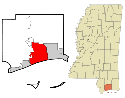 Location within Harrison County | |
 Gulfport Location within Mississippi  Gulfport Location within the United States | |
| Coordinates: 30°24′6″N 89°4′34″W | |
| Country | United States |
| State | Mississippi |
| County | Harrison |
| Incorporated | July 28, 1898 |
| Government | |
| • Type | Strong mayor–council[1] |
| • Body | Gulfport City Council |
| • Mayor | Billy Hewes (R) |
| Area | |
| • City | 64.01 sq mi (165.79 km2) |
| • Land | 55.62 sq mi (144.06 km2) |
| • Water | 8.39 sq mi (21.73 km2) |
| Elevation | 20 ft (6 m) |
| Population (2020) | |
| • City | 72,926 |
| • Density | 1,311.08/sq mi (506.21/km2) |
| • Metro | 416,259 (US: 133rd)[3] |
| Time zone | UTC−6 (CST) |
| • Summer (DST) | UTC−5 (CDT) |
| ZIP Codes | 39501-39503, 39505-39507 |
| Area code | 228 |
| FIPS code | 28-29700 |
| GNIS feature ID | 0670771 |
| Website | City of Gulfport |
History
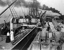

This area was occupied by indigenous cultures for thousands of years, culminating in the historic encounter between the Choctaw and the first European explorers of the area. Along the Gulf Coast, French colonists founded nearby Biloxi, and Mobile in the 18th century, well before the area was acquired from France by the United States in 1803 in the Louisiana Purchase. By the Indian Removal Act of 1830, the United States completed treaties to extinguish Choctaw and other tribal land claims and removed them to Indian Territory, now Oklahoma. In that period, the other four of the Five Civilized Tribes in the Southeast were also removed, to make way for white settlers to take over the lands and develop them for agriculture, especially cotton.

An early settlement near this location, known as Mississippi City, appeared on a map of Mississippi from 1855.[6] Mississippi City was the county seat of Harrison County from 1841 to 1902, but is now a suburb in east Gulfport.[7][8]
Gulfport was incorporated on July 28, 1898. The city was founded by William H. Hardy,[9] who was president of the Gulf and Ship Island Railroad (G&SIRR) that connected inland lumber mills to the coast. He was joined by Joseph T. Jones, who later took over the G&SIRR, dredged the harbor in Gulfport, and opened the shipping channel to the sea. In 1902, the harbor was completed and the Port of Gulfport became a working seaport. On April 28, 1904 the Treasury Department changed the port of entry for the district of the Pearl River from Shieldsboro to Gulfport.[10] It now accounts for millions of dollars in annual sales and tax revenue for the state of Mississippi.
In 1910, the U.S. Post Office and Customhouse was built here. This Gulfport Post office was listed on the National Register of Historic Places in 1984.[11]
In March 1916, Mayor George M. Foote announced that the Andrew Carnegie foundation was going to aid in construction of a Carnegie Library in Gulfport.[12] The city had agreed to providing matching funds for the construction as well as committing to provide operating funds. In the 20th century, the city developed as an important port; as it was served by railroads from the interior, it stimulated town growth by providing a way to get products to markets.
The city's location on the coast made it vulnerable to hurricanes and it weathered several. But on August 17, 1969, Gulfport and the Mississippi Gulf Coast were hit by Hurricane Camille. Measured by central pressure, Camille was the second-strongest hurricane to make U.S. landfall in recorded history. The area of total destruction in Harrison County was 68 square miles (180 km2).[11] The total estimated cost of damage was $1.42 billion (1969 USD, $9 billion 2012 USD).[12] Camille was the second-most expensive hurricane in the United States, up to that point (behind Hurricane Betsy).[13] The storm directly killed 143 people in Alabama, Mississippi, and Louisiana.
In December 1993, the City annexed 33 square miles (85 km2) north of Gulfport, making it the second-largest city in Mississippi.
Hurricane Katrina
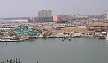
On August 29, 2005, Gulfport was hit by the strong eastern side of Hurricane Katrina. Much of the city was flooded or destroyed that day by the strong, hurricane-force winds, which lasted more than 16 hours, and a storm surge exceeding 28 feet (9 m) in some sections.[13]
Hurricane Katrina damaged more than 40 Mississippi libraries, gutting the Gulfport Public Library, first floor, and breaking windows on the second floor, beyond repair. It required total reconstruction.[14]
Although Katrina's damage was far more widespread, it was not the fiercest hurricane to hit Gulfport. Katrina, a Category 3 storm at landfall, was dwarfed by Hurricane Camille, a Category 5 storm, which had hit Gulfport and neighboring communities on August 17, 1969 with 175 mph sustained winds compared to Katrina's 120 mph sustained winds.[15]
The Sun Herald newspaper in Biloxi-Gulfport, under the executive editor Stanley R. Tiner, won the 2006 Pulitzer Prize in journalism for its Katrina coverage. The local ABC television affiliate, WLOX, won the Peabody Award for its Hurricane Katrina coverage.[16]
Geography
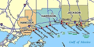
According to the United States Census Bureau, the city had a total area of 64.2 sq mi (166.4 km2), of which 56.9 sq mi (147.4 km2) is land and 7.3 sq mi (19.0 km2) (11.40%) is water.
Gulfport Formation, here named in Harrison Co., southeastern MS, described as barrier ridge composed of white, medium- to fine-grained sand, yellow-orange near surface. Thickness ranges form 5.0 to 9.5 m. Overlies Biloxi Formation. Age is late Pleistocene.[17]
Gulfport Formation is limited to a 1- to 3-km-wide discontinuous barrier ridge belt that borders the Gulf mainland shore. Commonly overlies Prairie Formation (alluvium) landward and Biloxi Formation (shelf deposits) near shore. Grades upward from poorly to moderately sorted shoreface sands to foreshore sand and dunes. Fig. 1 shows unit extending from Gulfport, MS, eastward to the mouth of the Ochlockonee River, Franklin Co., FL. Deposited during the Sangamonian.[17]
Climate
Gulfport has a humid subtropical climate, which is strongly moderated by the Gulf of Mexico. Winters are short and generally mild; cold spells do occur, but seldom last long. Snow flurries are rare in the city, with no notable accumulation occurring most years. Summers are generally long, hot and humid, though the city's proximity to the Gulf prevents extreme summer highs, as seen farther inland. Gulfport is subject to extreme weather, most notably tropical storm activity through the Gulf of Mexico.
| Climate data for Gulfport, Mississippi (Gulfport-Biloxi Int'l) 1991–2020 normals, extremes 1893–present | |||||||||||||
|---|---|---|---|---|---|---|---|---|---|---|---|---|---|
| Month | Jan | Feb | Mar | Apr | May | Jun | Jul | Aug | Sep | Oct | Nov | Dec | Year |
| Record high °F (°C) | 82 (28) |
87 (31) |
89 (32) |
94 (34) |
98 (37) |
103 (39) |
103 (39) |
104 (40) |
101 (38) |
98 (37) |
88 (31) |
83 (28) |
104 (40) |
| Average high °F (°C) | 61.3 (16.3) |
64.8 (18.2) |
70.4 (21.3) |
76.5 (24.7) |
83.6 (28.7) |
88.7 (31.5) |
90.4 (32.4) |
90.7 (32.6) |
87.8 (31.0) |
79.9 (26.6) |
70.0 (21.1) |
63.5 (17.5) |
77.3 (25.2) |
| Daily mean °F (°C) | 51.8 (11.0) |
55.5 (13.1) |
61.1 (16.2) |
67.5 (19.7) |
75.0 (23.9) |
80.9 (27.2) |
82.7 (28.2) |
82.6 (28.1) |
79.2 (26.2) |
70.0 (21.1) |
59.6 (15.3) |
54.0 (12.2) |
68.3 (20.2) |
| Average low °F (°C) | 42.4 (5.8) |
46.2 (7.9) |
51.8 (11.0) |
58.4 (14.7) |
66.4 (19.1) |
73.2 (22.9) |
74.9 (23.8) |
74.6 (23.7) |
70.6 (21.4) |
60.1 (15.6) |
49.2 (9.6) |
44.6 (7.0) |
59.4 (15.2) |
| Record low °F (°C) | 4 (−16) |
1 (−17) |
22 (−6) |
34 (1) |
43 (6) |
52 (11) |
58 (14) |
59 (15) |
42 (6) |
33 (1) |
24 (−4) |
9 (−13) |
1 (−17) |
| Average precipitation inches (mm) | 4.87 (124) |
4.44 (113) |
5.22 (133) |
5.51 (140) |
4.74 (120) |
6.89 (175) |
7.21 (183) |
6.53 (166) |
5.18 (132) |
3.71 (94) |
4.03 (102) |
4.49 (114) |
62.82 (1,596) |
| Average precipitation days (≥ 0.01 In) | 8.9 | 9.3 | 8.9 | 7.5 | 7.3 | 12.0 | 12.8 | 13.9 | 9.2 | 7.9 | 8.3 | 10.5 | 116.5 |
| Source: NOAA[18][19] | |||||||||||||
Demographics
| Historical population | |||
|---|---|---|---|
| Census | Pop. | %± | |
| 1900 | 1,060 | — | |
| 1910 | 6,386 | 502.5% | |
| 1920 | 8,157 | 27.7% | |
| 1930 | 12,547 | 53.8% | |
| 1940 | 15,105 | 20.4% | |
| 1950 | 22,659 | 50.0% | |
| 1960 | 30,204 | 33.3% | |
| 1970 | 40,791 | 35.1% | |
| 1980 | 39,676 | −2.7% | |
| 1990 | 40,775 | 2.8% | |
| 2000 | 71,127 | 74.4% | |
| 2010 | 67,793 | −4.7% | |
| 2020 | 72,926 | 7.6% | |
| U.S. Decennial Census[20] 2018 Estimate[21] 2020 census[4] | |||
2020 census
| Race | Num. | Perc. |
|---|---|---|
| White (non-Hispanic) | 34,382 | 47.15% |
| Black or African American (non-Hispanic) | 28,287 | 38.79% |
| Native American | 293 | 0.4% |
| Asian | 1,147 | 1.57% |
| Pacific Islander | 114 | 0.16% |
| Other/Mixed | 3,688 | 5.06% |
| Hispanic or Latino | 5,015 | 6.88% |
As of the 2020 United States census, there were 72,926 people,[4] 25,559 households, and 15,584 families residing in the city.
2010 census
According to the census of 2010, there were 67,793 people living in the city. The population density was 1,191.4 people per square mile (459.9/km2). The city had 50,825 or 74.97% of its population at the age of 18 and above. The racial makeup of the city was 56.86% White, 36.07% African American, 0.39% Native American, 1.69% Asian, 0.14% Pacific Islander, 2.13% from other races, and 2.73% from two or more races. Results show that 5.19% of the population was Hispanic/Latino of any race.
There were 31,602 housing units at an average density of 555.4 per square mile (214.4/km2) with 83.24% of housing units occupied and an average of 2.57 persons living in each occupied housing unit.
Comparing the 2000 and 2010 Census, the population of the city went down while the total number of housing units rose. This can be attributed to Hurricane Katrina, which destroyed housing and displaced people. New housing development has continued with a mixture of redevelopment from hurricane damage, though not all of the displaced population returned.
As of the census of 2000, there were 26,943 households, out of which 32.1% had children under the age of 18 living with them, 42.6% were married couples living together, 18.2% had a female householder with no husband present, and 34.5% were non-families. 27.7% of all households were made up of individuals, and 8.5% had someone living alone who was 65 years of age or older. The average household size was 2.51 and the average family size was 3.07.
In Gulfport, the population dispersal was 26.0% under the age of 18, 11.1% from 18 to 24, 30.4% from 25 to 44, 21.1% from 45 to 64, and 11.4% who were 65 years of age or older. The median age was 34 years. For every 100 females, there were 98.2 males. For every 100 females age 18 and over, there were 96.1 males. The median income for a household in the city was $32,779, and the median income for a family was $39,213. Males had a median income of $29,220 versus $21,736 for females. The per capita income for the city was $17,554. 17.7% of the population and 14.1% of families were below the poverty line. Out of the total population, 25.8% of those under the age of 18 and 13.7% of those 65 and older were living below the poverty line.
Gulfport is the location of Gulfport-Biloxi International Airport. The airport suffered extensive damage due to Hurricane Katrina. A major renovation project is for the most part completed and it has resumed commercial air service.
Economy
According to Gulfport's 2017 Comprehensive Annual Financial Report,[23] the top employers in the city were:
| # | Employer | # of Employees |
|---|---|---|
| 1 | Naval Construction Battalion Center | 5,500 |
| 2 | Memorial Hospital | 3,331 |
| 3 | Harrison County School District | 1,802 |
| 4 | Island View Casino | 1,206 |
| 5 | Hancock Bank | 864 |
| 6 | Gulfport School District | 848 |
| 7 | Mississippi Power | 728 |
| 8 | City of Gulfport | 640 |
| 9 | Gulfport Combat Readiness Training Center | 636 |
| 10 | Wal-Mart | 585 |
Tourism
This section does not cite any sources. (January 2015) |
From its beginnings as a lumber port, Gulfport evolved into a diversified city. With about 6.7 miles (10.7 kilometres) of white sand beaches along the Gulf of Mexico, Gulfport has become a tourism destination, due in large part to Mississippi's coast casinos. Gulfport has served as host to popular cultural events such as the "World's Largest Fishing Rodeo," "Cruisin' the Coast" (a week of classic cars), “Black Spring Break” and "Smokin' the Sound" (speedboat races). Gulfport is a thriving residential community with a strong mercantile center. There are historic neighborhoods and home sites, as well as diverse shopping opportunities and several motels scattered throughout to accommodate golfing, gambling, and water-sport tourism. Gulfport is also home to the Island View Casino, one of twelve casinos on the Mississippi Gulf Coast.
Infrastructure
Law enforcement
Gulfport Police
The Gulfport Police Department has 160 sworn personnel and 80 civilian staff.
U.S. Coast Guard
The U.S. Coast Guard operates 9 boats out of the port of Gulfport 4 of which are Patrol Boats. The Gulfport station has 110 members which include Active, Reserve and Coast Guard Auxiliary who respond to an average of 300 search and rescue cases annually.
Fire protection and EMS
Gulfport Fire Department
The Gulfport Fire Department was founded in 1908 and currently provides fire suppression, HAZMAT response, and technical rescue services within the city limits of Gulfport, Mississippi . The GFD operates out of 11 active stations and is staffed by professional firefighters.[24] The GFD works in conjunction with American Medical Response for EMS related emergencies.
Transportation
Air
Gulfport/Biloxi and the Gulf Coast area is served by the Gulfport-Biloxi International Airport.
Roads
Major roads and highways serve Gulfport. Interstate 10 runs east-west through the middle section of Gulfport. U.S. 90, following the coast in this region, runs east-west through the downtown area. U.S. 49 from the north terminates in Gulfport.
Trains
Until Hurricane Katrina in 2005, Amtrak's Sunset Limited from Los Angeles to Orlando made stops in Gulfport station.[25][26] Well into the 1960s, the Louisville and Nashville ran several trains daily, making stops in Gulfport--Crescent, Gulf Wind, Humming Bird, Pan-American and Piedmont Limited—varied destinations including New Orleans, Cincinnati, Atlanta, New York City and Jacksonville.[27]
Education
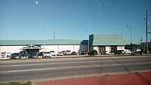

The City of Gulfport is served by the Gulfport School District and the Harrison County School District. The Harrison County Campus of Mississippi Gulf Coast Community College is also located in Gulfport.[28]
Before Hurricane Katrina, William Carey University had a satellite campus in Gulfport. In 2009, the university moved to its new Tradition Campus, constructed off Mississippi Highway 67 in north Harrison County.[29]
The Gulf Park Campus of the University of Southern Mississippi is located in Long Beach, just west of Gulfport. In 2012, repairs and renovations to campus buildings were still in progress following extensive damage in 2005 by Hurricane Katrina.[30]
Media
Gulfport's local newspaper is The Sun Herald. It is also served by two television stations, the ABC affiliate WLOX and CBS on WLOX-DT2, the Fox affiliate WXXV, WXXV Digital signal on Channel 25.2 as NBC 25 NBC affiliate, and WXXV Digital signal on Channel 25.3 as The Gulf Coast CW CW+ affiliate. There are also seven radio stations in the Gulfport area.[31]
Notable people
- Mahmoud Abdul-Rauf, former NBA point guard for the Denver Nuggets, Sacramento Kings and Vancouver Grizzlies[32]
- Stacey Abrams, American politician, lawyer, and author[33]
- Thomas H. Anderson, Jr., Ambassador of the United States to Barbados, Dominica, St. Lucia, Antigua, St. Vincent, and St. Christopher-Nevis-Anguilla from 1984 to 1986, was born in Gulfport[34]
- Tommy Armstrong, Jr., quarterback for the Nebraska Cornhuskers[35]
- Jerome Barkum, former wide receiver and tight end for the New York Jets from 1972 to 1983 in the National Football League[36]
- Milton Barney, 1990 AFL Ironman of the Year
- William Joel Blass, attorney and educator[37]
- Timmy Bowers, professional basketball player[38]
- Rod Davis, professional football player, played for the Minnesota Vikings[39]
- Brett Favre, quarterback in the National Football League for the Green Bay Packers, New York Jets and Minnesota Vikings, born in Gulfport[40]
- William H. Hardy, co-founder of the city of Gulfport[41]
- Josh Hayes, professional motorcycle roadracer, AMA Superbike Championship title winner[42]
- William Gardner Hewes, politician and Mayor of Gulfport[43]
- Jonathan Holder, Major League Baseball pitcher
- Boyce Holleman, attorney, politician and actor[44]
- Jaimoe, original member and drummer of the Allman Brothers Band, grew up in Gulfport
- Joseph T. Jones, co-founder of the city of Gulfport[45]
- Matt Lawton, former Major League Baseball player best known for his stint with the Minnesota Twins[46]
- Matt Luke, former head coach of the Ole Miss Rebels football team of the University of Mississippi.
- Stanford Morse (1926-2002), member of the Mississippi State Senate, 1956–1964; Republican candidate for lieutenant governor in 1963.[47]
- Brittney Reese, long jumper, Olympic gold medalist[48]
- John C. Robinson (1903-1954), “The Brown Condor”, aviator and civil rights activist
- Stuart Roosa, Colonel, US Air Force, Apollo 14 astronaut, Command Module Pilot. Brought seeds to moon that germinated in space[49]
- Tiffany Travis, former WNBA Basketball player, played for Charlotte Sting[50]
- Natasha Trethewey, Pulitzer Prize winning poet, former Poet Laureate of the United States, and Professor at Emory University, born in Gulfport[51]
- Tim Young, professional baseball player, played for the Montreal Expos and the Boston Red Sox[52]
Filmed in Gulfport
- Precious Cargo, 2016 film starring Bruce Willis, Mark-Paul Gosselaar, and Claire Forlani.[53]
- The Astronaut Wives Club, TV series.[54]
- Christmas in Mississippi, 2017 TV movie starring Jana Kramer.[55]
See also
- Grass Lawn (Gulfport, Mississippi)
- Great Southern Golf Club
- Gulf and Ship Island Railroad
- Gulf Coast Military Academy
- Gulfport Army Air Field Hangar
- Gulfport Veterans Administration Medical Center Historic District
- Historic Grand Hotels on the Mississippi Gulf Coast
- List of Mayors of Gulfport, Mississippi
- Mississippi Aquarium
- Mississippi City, Mississippi
- National Register of Historic Places listings in Harrison County, Mississippi
- Old Gulfport High School
- Turkey Creek Community Historic District
- United States Post Office and Customhouse (Gulfport, Mississippi)
- United States container ports
References
- Davis, Summer; Miller, Patrick, eds. (2017). Municipal Government in Mississippi (6th ed.). Starkville: Center for Government & Community Development Mississippi State University Extension Service. p. 36.
- "2020 U.S. Gazetteer Files". United States Census Bureau. Retrieved July 24, 2022.
- "2020 Population and Housing State Data". United States Census Bureau. August 12, 2021. Retrieved January 16, 2021.
{{cite web}}: CS1 maint: url-status (link) - "U.S. Census Bureau QuickFacts: United States". United States Census Bureau. Retrieved January 15, 2021.
{{cite web}}: CS1 maint: url-status (link) - "Home". Seabee.navy.mil. Archived from the original on 2015-07-17. Retrieved 2017-05-02.
- "Sketch II Showing the Progress of the Survey in Section No. 8, 1846 - 1855". United States Coast Survey. 1855.
- "Mississippi's Harrison County Coast at the Turn of the Twentieth Century". Loblolly Writer's House Site. 2006.
- "Mississippi City". Geographic Names Information System. United States Geological Survey, United States Department of the Interior.
- "M380 Hardy (William H. and Sallie J.) Papers". Lib.usm.edu. Retrieved 2017-05-02.
- United States. Department of the Treasury. (1904). Treasury Decisions Under the Customs, Internal Revenue, and Other Laws: Including the Decisions of the Board of General Appraisers and the Court of Customs Appeals, Volume 7. Washington, DC: U.S. Government Printing Office. Google Books website p.2ff. Retrieved 3 March 2020.
- "Download". Nrhp.focus.nps.gov. 2014-04-28. Archived from the original on 2010-12-04. Retrieved 2017-05-02.
- Archived 2011-03-20 at the Wayback Machine
- Gary Tuchman, Transcript of "Anderson Cooper 360 Degrees" (2006-08-29) 19:00 ET, CNN, CNN.com web: CNN-ACooper082906: GARY TUCHMAN, CNN Correspondent: Responds to Anderson Cooper "that it felt like it would never end, saying winds were at least 100 miles per hour in Gulfport for seven hours, between about 7:00 a.m. and 2:00 p.m. For another five or six hours, on each side of that, they [Gulfport] had hurricane-force winds over 75 miles per hour; much of the city of 71,000 was then under water."
- "Hurricane Katrina Related Damages to Public Libraries in Mississippi" (September 2005), Mississippi Library Commission, web:ALA-Katrina Archived 2007-10-31 at the Wayback Machine.
- Masters, Jeffrey. "PhD". cane/surge_details.asp. Weather Underground. Retrieved 15 December 2017.
- "WLOX-TV Wins Prestigious Peabody Award For Hurricane Katrina Coverage". WLOX.com. Retrieved 2017-05-02.
- "Geologic Unit: Gulfport". National Geologic Map Database. U.S. Department of the Interior U.S. Geological Survey.
 This article incorporates text from this source, which is in the public domain.
 - "NowData – NOAA Online Weather Data". National Oceanic and Atmospheric Administration. Retrieved May 16, 2021.
- "Station: Gulfport–Biloxi AP, MS". U.S. Climate Normals 2020: U.S. Monthly Climate Normals (1991-2020). National Oceanic and Atmospheric Administration. Retrieved May 16, 2021.
- United States Census Bureau. "Census of Population and Housing". Retrieved September 2, 2013.
- "Population Estimates". United States Census Bureau. Retrieved June 8, 2018.
- "Explore Census Data". data.census.gov. Retrieved 2021-12-16.
- "Comprehensive Annual Financial Report 2017" (PDF). City of Gulfport, Mississippi. Archived from the original (PDF) on 2022-03-19. Retrieved 2022-10-31.
- gulfport-ms.gov. "Gulfport-MS.gov | The Official Web Site for the City of Gulfport Mississippi". Gulfport-MS.gov | The Official Web Site for the City of Gulfport Mississippi. Retrieved 2016-02-16.
- "Alabama, Mississippi refuse to pledge money to resume Amtrak, create New Orleans route". The Advocate. Associated Press. June 22, 2018. Retrieved 2019-01-27.
- "Trains". The Tallahassee Democrat. August 29, 2005. p. 2. Retrieved November 21, 2020 – via Newspapers.com.

- "Louisville and Nashville Railroad, Table 1". Official Guide of the Railways. National Railway Publication Company. 98 (2). July 1965.
- "MGCCC - Facilities - Jefferson Davis Campus". Archived from the original on 2012-07-17. Retrieved 2012-07-06.
- "Tradition Campus | William Carey University". Wmcarey.edu. 2009-08-19. Archived from the original on 2012-09-26. Retrieved 2017-05-02.
- "Gulf Park Campus | the University of Southern Mississippi Gulf Coast". Archived from the original on 2012-06-26. Retrieved 2012-07-06.
- "Radio Stations in Gulfport MS". ontheradio.net. Retrieved 2008-03-12.
- Giardina, A.J. "The city of Gulfport honors Mahmoud Abdul-Rauf". WLOX13. Retrieved November 27, 2013.
- Powell, Kevin (May 14, 2020). "The Power of Stacey Abrams". The Washington Post Magazine. Retrieved 2020-05-27.
- "Ronald Reagan: Nomination of Thomas H. Anderson, Jr., To Be United States Ambassador to Barbados". Presidency.ucsb.edu. Retrieved 2017-05-02.
- Waldron, Travis (August 29, 2015). "From 'Katrina Kid' To Nebraska Quarterback: Tommy Armstrong Beats The Odds". The Huffington Post. Retrieved 2017-05-02.
- "Jerome Phillip Barkum". databaseFootball.com. Archived from the original on 2016-01-14. Retrieved 2015-08-25.
- "The Clinton Courier, William Joel Blass". Archived from the original on 2014-04-21. Retrieved 2014-05-16.
- "Timmy Bowers". NBA Development League. Archived from the original on December 11, 2013. Retrieved November 27, 2013.
- "Rod Davis". Pro-Football-Reference.com. Retrieved November 27, 2013.
- "Brett Favre". databaseFootball.com. Retrieved November 27, 2013.
- "Hardy (William H. and Sallie J.) Papers". The University of Southern Mississippi -- McCain Library and Archives. Retrieved November 27, 2013.
- "Josh Hayes". AMA Pro Racing. Retrieved November 27, 2013.
- "Billy Hewes running unopposed for mayor of Gulfport". gulflive.com. Associated Press. March 18, 2013. Retrieved May 16, 2019.
{{cite web}}: CS1 maint: url-status (link) - "University of Mississippi News: Attorney Boyce Holleman Remembered By Sons with $100,000 Gift to Law School". University of Mississippi News. May 14, 2010. Retrieved 2014-05-16.
- Port of Gulfport (USA) / Mississippi State Port Authority (ID: 36200). Port of Gulfport (USA). p. 2. Archived from the original on 2013-12-03. Retrieved 2013-11-28.
- "Matt Lawton Stats". AMA Pro Racing. Retrieved November 27, 2013.
- Billy Hathorn, "Challenging the Status Quo: Rubel Lex Phillips and the Mississippi Republican Party (1963-1967)", The Journal of Mississippi History XLVII, November 1985, No. 4, p. 240-264
- "Brittney Reese". USA Track & Field. Retrieved November 27, 2013.
- "STUART ALLEN ROOSA (COLONEL, USAF, RET.)". NASA. Retrieved November 27, 2013.
- "#12 Tiffany Travis". University Athletic Assoc., Inc. Archived from the original on December 3, 2013. Retrieved November 27, 2013.
- "Natasha Trethewey". Poetry Foundation. Retrieved November 27, 2013.
- "Tim Young". The Baseball Cube. Retrieved November 27, 2013.
- "WATCH: Gulfport locations featured prominently in 'Precious Cargo' trailer". Retrieved 8 October 2020.
- "Gulfport businesses excited about premiere of Astronaut Wives Club". Retrieved 8 October 2020.
- "Gulf Coast is backdrop for Lifetime movie 'Christmas In Mississippi'". Retrieved 8 October 2020.
External links
На других языках
[de] Gulfport (Mississippi)
Gulfport ist eine Stadt im Harrison County, Mississippi, mit 72.926[2] Einwohnern (laut Volkszählung 2020 des US Census Bureaus). Gulfport hat eine Größe von 166 km², wobei 147 km² aus Land und 19 km² aus Wasser bestehen. Die 29.559 Gebäude der Stadt wurden durch den Hurrikan Katrina am 29. August 2005 weitgehend zerstört, zahlreiche Einwohner starben, rund 15.000 Arbeitsplätze gingen verloren. Der Wiederaufbau der Stadt und eines Casinos hat 2006 begonnen. Die Einwohnerzahl wurde 2006 auf 64.316 geschätzt; das entspricht einem Rückgang von 9,6 % gegenüber dem Jahr 2000. Diese Einschätzung bzgl. des Bevölkerungsrückgangs stellte sich in der Volkszählung 2010 als korrekt heraus. Gulfport ist ebenfalls Sitz der Countyverwaltung (County Seat) des Harrison Countys.- [en] Gulfport, Mississippi
[ru] Галфпорт (Миссисипи)
Галфпорт (англ. Gulfport в буквальном переводе «порт у залива») — город районного значения в округе Гаррисон, штат Миссисипи, США. Расположен на берегу Мексиканского залива и образует единую прибрежную агломерацию с городами Билокси и Паскагула. Город является крупным портом, центром корабелестроения и важным туристическо-рекреационным и рыболовецким местом в штате. В городе размещаются казино. Первым европейцем, ступившим на территорию будущего города, был Эрнандо де Сото, затем территория перешла под управление Новой Франции, а столица региона располагалась в соседнем Билокси, основанном в 1699. В начале XIX века город переходит под юрисдикцию США. Бурный рост населения начался только в конце 70-х — начале 80-х годов XX века, а до начала 40-х годов это был лишь небольшой рыбацкий посёлок. Город сильно пострадал от урагана Камилла 17 августа 1969 года, а затем был разрушен ураганом Катрина 29 августа 2005 года.Другой контент может иметь иную лицензию. Перед использованием материалов сайта WikiSort.org внимательно изучите правила лицензирования конкретных элементов наполнения сайта.
WikiSort.org - проект по пересортировке и дополнению контента Википедии


