world.wikisort.org - USA
Bay St. Louis is a city in and the county seat of Hancock County, Mississippi, in the United States.[2] Located on the Gulf Coast on the west side of the Bay of St. Louis, it is part of the Gulfport–Biloxi Metropolitan Statistical Area. As of 2010, Bay St. Louis’ population was 9,260.
This article needs additional citations for verification. (May 2010) |
Bay St. Louis, Mississippi | |
|---|---|
City | |
 The Bay of St. Louis, the new bay bridge, and the city of Bay St. Louis on the western shore (upper part of photo) | |
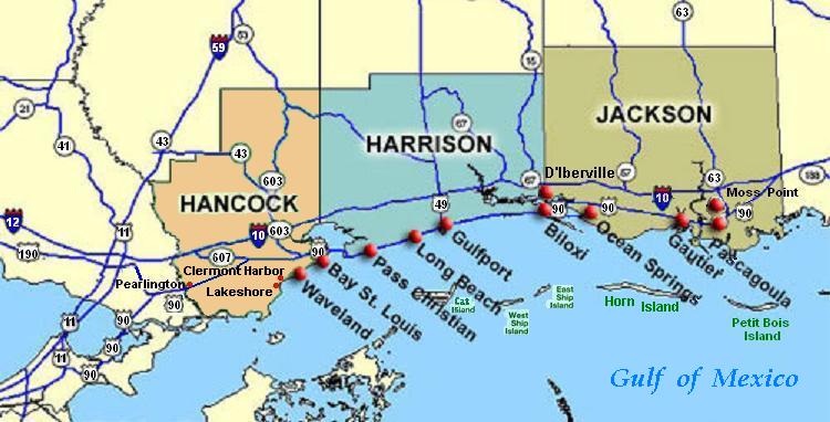
 Location of Bay St. Louis, MS | |
 Bay St. Louis, Mississippi Location in the United States | |
| Coordinates: 30°18′53″N 89°20′39″W | |
| Country | United States |
| State | Mississippi |
| County | Hancock |
| Government | |
| • Mayor | Mike Favre |
| Area | |
| • Total | 26.62 sq mi (68.95 km2) |
| • Land | 14.69 sq mi (38.05 km2) |
| • Water | 11.93 sq mi (30.90 km2) |
| Elevation | 23 ft (7 m) |
| Population (2020) | |
| • Total | 9,284 |
| • Density | 631.91/sq mi (243.99/km2) |
| Time zone | UTC−6 (Central (CST)) |
| • Summer (DST) | UTC−5 (CDT) |
| ZIP Code | 39520, 39521, 39522 |
| Area code | 228 |
| FIPS code | 28-03980 |
| GNIS feature ID | 0666588 |
| Website | www |
History
The first European settlers in this area were French colonists, whose culture still influences the small city and who imported slaves from Africa. A Louisiana Creole population developed, featuring people of color as well as white colonists of largely French descent.
The county was organized by European Americans, who named it after John Hancock, who was a Founding Father of the United States. While more Protestant Americans migrated into this area after Indian Removal in the 1830s, there are still many Catholic families, some dating to both African and French ancestors of the colonial era. Roman Catholic schools still draw area students.
The 1966 movie This Property is Condemned starring Natalie Wood and Robert Redford was filmed in Bay St. Louis, which was called "Dodson" in the movie, with some additional shooting in Biloxi, Mississippi, and New Orleans, Louisiana.[3][better source needed]
Geography
Bay St. Louis is located in southeastern Hancock County at 30°18'53" North, 89°20'39" West (30.314696, −89.344096).[4] It is situated on the west side of the Bay of St. Louis which empties into the Mississippi Sound, adjacent to Pass Christian to the east. The city is bordered to the north by the Jourdan River, the primary inlet of the bay and Diamondhead. The eastern border of the city is the Harrison County line in the middle of the bay.
According to the United States Census Bureau, the city has a total area of 26.6 square miles (69.0 km2), of which 14.7 square miles (38.1 km2) are land and 11.9 square miles (30.9 km2), or 44,82%, are water.[5]
Major highways
 Interstate 10 passes through the northern extension of the city, 10 miles (16 km) northwest of downtown, with access from Exit 13 (Highway 603). I-10 leads east 37 miles (60 km) to Biloxi and southwest 54 miles (87 km) to New Orleans.
 U.S. Highway 90 passes just north of downtown Bay St. Louis, leading east across the St. Louis Bay Bridge to Pass Christian. Via US 90 it is 15 miles (24 km) east to Gulfport and 60 miles (97 km) southwest to New Orleans.
 Mississippi Highway 603 runs along the western edge of the Bay St. Louis city limits, connecting US 90 and Interstate 10.
Adjacent cities and towns
- Diamondhead (north)
- Pass Christian (east)
- Waveland (west)
Demographics
| Historical population | |||
|---|---|---|---|
| Census | Pop. | %± | |
| 1880 | 1,978 | — | |
| 1890 | 1,974 | −0.2% | |
| 1900 | 2,872 | 45.5% | |
| 1910 | 3,388 | 18.0% | |
| 1920 | 3,033 | −10.5% | |
| 1930 | 3,724 | 22.8% | |
| 1940 | 4,138 | 11.1% | |
| 1950 | 4,621 | 11.7% | |
| 1960 | 5,073 | 9.8% | |
| 1970 | 6,752 | 33.1% | |
| 1980 | 7,850 | 16.3% | |
| 1990 | 8,063 | 2.7% | |
| 2000 | 8,209 | 1.8% | |
| 2010 | 9,260 | 12.8% | |
| 2020 | 9,284 | 0.3% | |
| U.S. Decennial Census[6] | |||

2020 census
| Race | Num. | Perc. |
|---|---|---|
| White (non-Hispanic) | 6,996 | 75.36% |
| Black or African American (non-Hispanic) | 1,357 | 14.62% |
| Native American | 37 | 0.4% |
| Asian | 93 | 1.0% |
| Pacific Islander | 1 | 0.01% |
| Other/Mixed | 404 | 4.35% |
| Hispanic or Latino | 396 | 4.27% |
As of the 2020 United States census, there were 9,284 people, 5,995 households, and 3,562 families residing in the city.
2000 census
As of the census[8] of 2000, there were 8,209 people, 3,271 households, and 2,064 families residing in the city. The population density was 1,342.1 people per square mile (517.9/km2). There were 3,817 housing units at an average density of 624.1 per square mile (240.8/km2). The racial makeup of the city was 80.23% White, 16.59% African American, 0.40% Native American, 1.11% Asian, 0.05% Pacific Islander, 0.19% from other races, and 1.43% from two or more races. 1.68% of the population was Hispanic or Latino of any race.
There were 3,271 households, out of which 29.6% had children under the age of 18 living with them, 44.0% were married couples living together, 14.7% had a female householder with no husband present, and 36.9% were non-families. 31.5% of all households were made up of individuals, and 12.6% had someone living alone who was 65 years of age or older. The average household size was 2.41 and the average family size was 3.05.
In the city, the population was 24.5% under the age of 18, 7.6% from 18 to 24, 26.8% from 25 to 44, 24.5% from 45 to 64, and 16.6% who were 65 years of age or older. The median age was 39 years. For every 100 females, there were 92.0 males. For every 100 females age 18 and over, there were 88.0 males. The median income for a household in the city was $34,106, and the median income for a family was $41,957. Males had a median income of $32,261 versus $21,308 for females. The per capita income for the city was $18,483. 13.2% of the population and 10.0% of families were below the poverty line. Out of the total population, 17.2% of those under the age of 18 and 11.5% of those 65 and older were living below the poverty line.
Education
Almost all of the city of Bay St. Louis is served by the Bay St. Louis-Waveland School District. Small portions of land are within the Hancock County School District.[9]
It is the home of Bay High School. In addition to Bay High, there are private Catholic schools: Saint Stanislaus College, a residency and day school for boys grades 7–12; and Our Lady Academy, a day school for girls grades 7–12. The latter two share some classrooms as well as a Roman Catholic curriculum.
All of Hancock County is in the service area of Pearl River Community College.[10]
Hurricanes

On August 17, 1969, Hurricane Camille made landfall at the tip of Louisiana before continuing to Bay St. Louis.
On August 29, 2005, at 10:00 a.m. CDT, Hurricane Katrina made its final landfall just west of Bay St. Louis, at the mouth of the Pearl River, causing a 28-foot (8.5 m) storm surge. Hurricane Katrina came ashore during the high tide of 9:15AM, +2.3 feet more,[11] causing a storm tide more than 30 feet (9.1 m) high.
USGS topographic maps show a common 25-foot (7.6 m) elevation contour line running throughout a ridge along the former routing of Highway 90 (Old Spanish Trail) on the western edge of the city. As higher ground, this area was spared inundation from the storm surge of Hurricane Katrina.[citation needed]
Katrina damaged more than 40 Mississippi libraries, including severe roof and water damage to the Bay St. Louis Public Library. The library reopened to the public on October 12, 2005.[12]
The Bay St. Louis Bridge on US Highway 90 was severely damaged, with many bridge sections down-dropped at the west edges. The destroyed bridge was replaced by a new Bay St. Louis Bridge, which received America's Transportation Award. It includes a pedestrian bridge with an art walk featuring the works of local artists.
The underground utility infrastructure in Bay St. Louis received a federally funded total overhaul and replacement.[citation needed]
Climate
The climate in this area is characterized by hot, humid summers and generally mild to cool winters. According to the Köppen Climate Classification system, Bay St. Louis has a humid subtropical climate, abbreviated "Cfa" on climate maps.[13]
Notable people
- Stephen E. Ambrose, historian and author[14]
- Richmond Barthé, sculptor associated with the Harlem Renaissance[15]
- J. P. Compretta, former member of the Mississippi House of Representatives[16]
- Leo Fabian Fahey, coadjutor bishop of the Diocese of Baker City, Oregon from 1948 until 1950[17]
- Shannon Garrett, former professional Canadian football player[18]
- Walter J. Gex III, United States District Judge of the United States District Court for the Southern District of Mississippi[19]
- Jacob Lindgren, MLB player
- Philip Moran, member of the Mississippi State Senate[20]
- Alice Moseley, folk artist
- Leo Norris, former infielder for the Philadelphia Phillies[21]
- Carlile Pollock Patterson, fourth superintendent of the United States Coast Survey[22]
- Albert J. Raboteau, is an African-American scholar of African and African-American religions
- Lawrence E. Roberts, pilot with the Tuskegee Airmen and colonel in the United States Air Force[23]
- John Scafide, former offensive lineman for the Boston Redskins and mayor of Bay St. Louis from 1953 to 1969[24]
- Caroline Snedeker, children's author[25]
- Gene Taylor, member of the United States House of Representatives from 1989 to 2011[26]
- Tank Williams, former NFL player[27]
See also
- List of cities in Mississippi
References
- "2020 U.S. Gazetteer Files". United States Census Bureau. Retrieved July 24, 2022.
- "Find a County". National Association of Counties. Archived from the original on 2012-07-12. Retrieved 2011-06-07.
- This Property Is Condemned (1966) - IMDb, retrieved 2021-02-20
- "US Gazetteer files: 2010, 2000, and 1990". United States Census Bureau. 2011-02-12. Retrieved 2011-04-23.
- "Geographic Identifiers: 2010 Census Summary File 1 (G001): Bay St. Louis city, Mississippi". American Factfinder. U.S. Census Bureau. Archived from the original on February 13, 2020. Retrieved August 14, 2017.
- "Census of Population and Housing". Census.gov. Retrieved June 4, 2015.
- "Explore Census Data". data.census.gov. Retrieved 2021-12-16.
- "U.S. Census website". United States Census Bureau. Retrieved 2008-01-31.
- "2020 CENSUS - SCHOOL DISTRICT REFERENCE MAP: Hancock County, MS" (PDF). U.S. Census Bureau. Retrieved 2022-04-14.
- "2014-2016 Catalog" (PDF). Pearl River Community College. Retrieved 2022-04-13.
- "2005 NOAA Tide Predictions: St. Louis Bay entrance" (2005), tide on 29-Aug-2005, NOAA, web: NOAA-tide-tables.
- "Hurricane Katrina Related Damages to Public Libraries in Mississippi" (September 2005), Mississippi Library Commission, (ALA-Katrina) Archived 2007-10-31 at the Wayback Machine.
- "Bay St. Louis, Mississippi Köppen Climate Classification (Weatherbase)". Weatherbase. Retrieved 2 May 2017.
- "Senate Concurrent Resolution 506". Mississippi Legislature. Retrieved 20 February 2021.
- Henry Louis Gates Jr.; Evelyn Brooks Higginbotham (29 April 2004). African American Lives. Oxford University Press. p. 51. ISBN 978-0-19-988286-1.
- "Joseph Compretta's Biography". Project Vote Smart. Retrieved 20 February 2021.
- Charles N. Bransom (1990). Ordinations of U.S. Catholic Bishops, 1790-1989: A Chronological List. National Conference of Catholic Bishops, U.S. Catholic Conference. p. 113. ISBN 978-1-55586-323-4.
- National Football League; Workman Publishing (July 2000). The Official NFL 2000 Record and Fact Book. Workman Publishing Company, Incorporated. p. 129. ISBN 978-0-7611-1982-1.
- The American Bar, the Canadian Bar, the International Bar. R.B. Forster & Associates. 1988. p. 1959. ISBN 978-0-931398-17-9.
- "Philip Moran-Biography". Project Vote Smart. Retrieved 20 February 2021.
- Rex D. Hamann (21 October 2014). The Millers and the Saints: Baseball Championships of the Twin Cities Rivals, 1903-1955. McFarland. p. 144. ISBN 978-1-4766-1599-8.
- Proceedings of the American Philosophical Society. American Philosophical Society. 1882. p. 522.
- "Lawrence Edward Roberts Sr". CAF Rise Above. Retrieved 20 February 2021.
- United States. Congress. House. Committee on Interior and Insular Affairs. Subcommittee on National Parks and Insular Affairs (1980). To Establish a Barrier Islands Protection System: Hearings Before the Subcommittee on National Parks and Insular Affairs of the Committee on Interior and Insular Affairs, House of Representatives, Ninety-sixth Congress, Second Session, on H. R. 5981 ... Hearings Held in Washington, D. C., March 24 and 27, 1980. U.S. Government Printing Office. p. 341.
- The Horn Book Magazine. Horn Book, Incorporated. 1956. p. 85.
- Nancy Capace (1 January 2001). Encyclopedia of Mississippi. Somerset Publishers, Inc. p. 416. ISBN 978-0-403-09603-9.
- Stanford University (2002). Annual Commencement: Order of Exercises. p. 74.
External links
Municipalities and communities of Hancock County, Mississippi, United States | ||
|---|---|---|
County seat: Bay St. Louis | ||
| Cities |  | |
| CDPs | ||
| Other unincorporated communities |
| |
| Ghost towns | ||
| ||
Authority control | |
|---|---|
| General |
|
| National libraries | |
| Other |
|
На других языках
[de] Bay St. Louis
Bay St. Louis ist eine Stadt innerhalb des Hancock County, Mississippi in den Vereinigten Staaten. Sie ist Teil der Metropolregion Gulfport–Biloxi–Pascagoula. Bei der Volkszählung im Jahr 2010 hatte Bay St. Louis 14.792 Einwohner.- [en] Bay St. Louis, Mississippi
Другой контент может иметь иную лицензию. Перед использованием материалов сайта WikiSort.org внимательно изучите правила лицензирования конкретных элементов наполнения сайта.
WikiSort.org - проект по пересортировке и дополнению контента Википедии