world.wikisort.org - USA
Forest is a city and the county seat of Scott County, Mississippi. The population was 5,684 at the 2010 census and the population is a minority-majority.[2]
Forest, Mississippi | |
|---|---|
City | |
 Scott County Courthouse in Forest | |
 Location of Forest, Mississippi | |
 Forest, Mississippi Location in the United States | |
| Coordinates: 32°21′49″N 89°28′31″W | |
| Country | United States |
| State | Mississippi |
| County | Scott |
| Government | |
| • Mayor | Nancy Chambers |
| Area | |
| • Total | 13.10 sq mi (33.93 km2) |
| • Land | 13.08 sq mi (33.87 km2) |
| • Water | 0.02 sq mi (0.06 km2) |
| Elevation | 476 ft (145 m) |
| Population (2020) | |
| • Total | 5,430 |
| • Density | 415.17/sq mi (160.30/km2) |
| Time zone | UTC-6 (Central (CST)) |
| • Summer (DST) | UTC-5 (CDT) |
| ZIP code | 39074 |
| Area code | 601 |
| FIPS code | 28-25340 |
| GNIS feature ID | 0693243 |
| Website | www |
Geography
Forest is located at 32°21′49″N 89°28′31″W (32.363627, -89.475348).[3]
According to the United States Census Bureau, the city has a total area of 13.0 square miles (34 km2), of which 13.0 square miles (34 km2) is land and 0.04 square miles (0.10 km2) (0.15%) is water.
Demographics
| Historical population | |||
|---|---|---|---|
| Census | Pop. | %± | |
| 1890 | 547 | — | |
| 1900 | 761 | 39.1% | |
| 1910 | 1,136 | 49.3% | |
| 1920 | 1,188 | 4.6% | |
| 1930 | 2,176 | 83.2% | |
| 1940 | 2,735 | 25.7% | |
| 1950 | 2,874 | 5.1% | |
| 1960 | 3,917 | 36.3% | |
| 1970 | 4,085 | 4.3% | |
| 1980 | 5,229 | 28.0% | |
| 1990 | 5,060 | −3.2% | |
| 2000 | 5,987 | 18.3% | |
| 2010 | 5,684 | −5.1% | |
| 2020 | 5,430 | −4.5% | |
| U.S. Decennial Census[4] | |||

2020 census
| Race | Num. | Perc. |
|---|---|---|
| White | 1,123 | 20.68% |
| Black or African American | 2,319 | 42.71% |
| Native American | 20 | 0.37% |
| Asian | 30 | 0.72% |
| Other/Mixed | 88 | 1.62% |
| Hispanic or Latino | 1,841 | 33.9% |
As of the 2020 United States Census, there were 5,430 people, 1,987 households, and 1,165 families residing in the city.
2000 census
As of the census[6] of 2000, there were 5,987 people, 2,085 households, and 1,478 families residing in the city. The population density was 460.0 people per square mile (177.7/km2). There were 2,257 housing units at an average density of 173.4 per square mile (67.0/km2). The racial makeup of the city was 40.35% White, 50.88% African American, 0.40% Native American, 0.53% Asian, 0.07% Pacific Islander, 5.85% from other races, and 1.92% from two or more races. Hispanic or Latino of any race were 12.71% of the population.
There were 2,085 households, out of which 36.5% had children under the age of 18 living with them, 41.6% were married couples living together, 24.1% had a female householder with no husband present, and 29.1% were non-families. 23.7% of all households were made up of individuals, and 10.6% had someone living alone who was 65 years of age or older. The average household size was 2.80 and the average family size was 3.25.
In the city, the population was spread out, with 29.3% under the age of 18, 10.6% from 18 to 24, 27.5% from 25 to 44, 19.7% from 45 to 64, and 13.0% who were 65 years of age or older. The median age was 32 years. For every 100 females, there were 94.8 males. For every 100 females age 18 and over, there were 91.5 males.
The median income for a household in the city was $25,638, and the median income for a family was $29,767. Males had a median income of $23,825 versus $17,277 for females. The per capita income for the city was $16,484. About 21.6% of families and 23.5% of the population were below the poverty line, including 29.5% of those under age 18 and 13.8% of those age 65 or over.
Transportation
Forest is served by Interstate 20, U.S. Route 80, and Mississippi Highways 21, 35, and 501. Air transportation is available through G. V. Montgomery Airport or the nearby Jackson-Evers International Airport (JAN).
Education
Almost all of the City of Forest is served by the Forest Municipal School District.[7] Schools include Forest Elementary School, Hawkins Middle School and Forest High School.
A small portion is in the Scott County School District.[7]
Business
This section does not cite any sources. (July 2020) |
Forest is home to several poultry processing plants, including Koch Foods, Tyson Foods, and the Forest Packing Company.
Raytheon has a consolidated manufacturing center in Forest; it builds electronic equipment for radars and other sensor systems.
Notable people
- Rashard Anderson, football player
- "Big Boy" Crudup (1905-1974), blues musician - wrote "That's All Right (Mama)", honored with a Mississippi Blues Trail marker.[8]
- James Eastland (1904–1986), United States Senator from Mississippi
- Sheila Guyse (1925-2013), actress and recording artist
- Andrew R. Johnson (1856–1933), Louisiana state senator from 1916–1924.
- Lewis Nordan, writer
- Todd Pinkston, former NFL wide receiver, Philadelphia Eagles
- The Scott Sisters, convicted in a controversial case that has drawn national attention
- Kevin Sessums, writer
- Donald Triplett, first person to be diagnosed with autism
- Victoria Vivians, athlete, played at Mississippi State University for the women's basketball program. Drafted by Indiana Fever of the WNBA.
- Cardis Cardell Willis, comedian
References
- "2020 U.S. Gazetteer Files". United States Census Bureau. Retrieved July 24, 2022.
- "Find a County". National Association of Counties. Archived from the original on 2011-05-31. Retrieved 2011-06-07.
- "US Gazetteer files: 2010, 2000, and 1990". United States Census Bureau. 2011-02-12. Retrieved 2011-04-23.
- "Census of Population and Housing". Census.gov. Retrieved June 4, 2015.
- "Explore Census Data". data.census.gov. Retrieved 2021-12-08.
- "U.S. Census website". United States Census Bureau. Retrieved 2008-01-31.
- "2020 CENSUS - SCHOOL DISTRICT REFERENCE MAP: Scott County, MS" (PDF). U.S. Census Bureau. Retrieved 2022-08-06. - Text list
- Mississippi Blues Commission. "Arthur "Big Boy" Crudup". msbluestrail.org. Retrieved 1 February 2010.
External links
Municipalities and communities of Scott County, Mississippi, United States | ||
|---|---|---|
County seat: Forest | ||
| Cities | 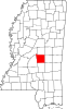 | |
| Towns |
| |
| CDPs |
| |
| Other communities | ||
| Indian reservation |
| |
| Footnotes | ‡This populated place also has portions in an adjacent county or counties | |
| ||
Authority control | |
|---|---|
| General |
|
| National libraries | |
| Other |
|
Другой контент может иметь иную лицензию. Перед использованием материалов сайта WikiSort.org внимательно изучите правила лицензирования конкретных элементов наполнения сайта.
WikiSort.org - проект по пересортировке и дополнению контента Википедии