world.wikisort.org - USA
Yazoo County is a county located in the U.S. state of Mississippi. As of the 2010 census, the population was 28,065.[1] The county seat is Yazoo City.[2] It is named for the Yazoo River, which forms its western border. Its name is said to come from a Choctaw language word meaning "River of Death."[3][4]
Yazoo County | |
|---|---|
County | |
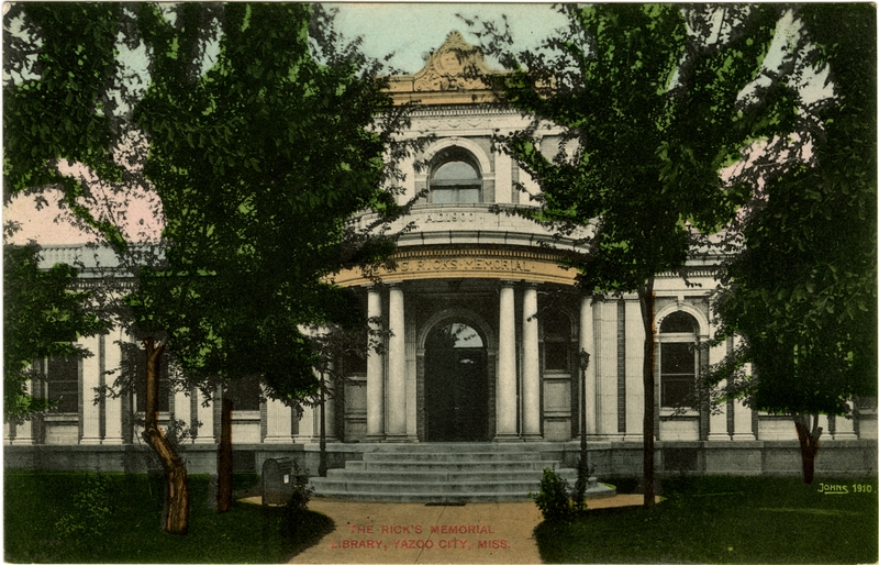 Postcard. Ricks Memorial Library in Yazoo City. | |
 Location within the U.S. state of Mississippi | |
 Mississippi's location within the U.S. | |
| Coordinates: 32°47′N 90°24′W | |
| Country | |
| State | |
| Founded | January 21, 1823 |
| Named for | Yazoo River |
| Seat | Yazoo City |
| Largest city | Yazoo City |
| Area | |
| • Total | 934 sq mi (2,420 km2) |
| • Land | 923 sq mi (2,390 km2) |
| • Water | 11 sq mi (30 km2) 1.2% |
| Population (2010) | |
| • Total | 28,065 |
| • Estimate (2018) | 28,248 |
| • Density | 30/sq mi (12/km2) |
| Time zone | UTC−6 (Central) |
| • Summer (DST) | UTC−5 (CDT) |
| ZIP Codes | 39039, 39040, 39088, 39095, 39146, 39162, 39179, 39194 |
| Area code | 662 |
| Congressional district | 2nd |
| Website | yazoocounty |
History
The area which is now Yazoo County was acquired by the State of Mississippi from the Choctaw Indians in 1820. Yazoo County was established on January 21, 1823. It was the 19th county established in the State of Mississippi, and remains the largest in area. It was developed for cotton plantations, and the first had access to the major river. The first county seat was at Beatties Bluff. In 1829, the county seat was moved to Benton. In 1849 the county seat was moved again, to Yazoo City, where it remains.
Yazoo County was a battlefield in 1863 and 1864 during the American Civil War. After the war, there was violence of whites against freedmen. Such violence continued after Reconstruction. In the period from 1877 to 1950, Yazoo County had 18 documented lynchings of African Americans.[5] Most occurred around the turn of the 20th century, as part of white imposition of Jim Crow conditions and suppression of black voting.
In 1900 there was a railroad disaster that killed engineer Casey Jones; it took place in Yazoo County just north of Vaughan. The Great Mississippi Flood of 1927 did much damage in Yazoo County.
Geography
According to the U.S. Census Bureau, the county has a total area of 934 square miles (2,420 km2), of which 923 square miles (2,390 km2) is land and 11 square miles (28 km2) (1.2%) is water.[6] It is the largest county in Mississippi by land area and third-largest by total area.
Adjacent counties
- Humphreys County (north)
- Holmes County (northeast)
- Madison County (east)
- Hinds County (south)
- Warren County (southwest)
- Issaquena County (west)
- Sharkey County (northwest)
National protected area
- Hillside National Wildlife Refuge (part)
- Panther Swamp National Wildlife Refuge
Demographics
| Historical population | |||
|---|---|---|---|
| Census | Pop. | %± | |
| 1830 | 6,550 | — | |
| 1840 | 10,480 | 60.0% | |
| 1850 | 14,418 | 37.6% | |
| 1860 | 22,373 | 55.2% | |
| 1870 | 17,279 | −22.8% | |
| 1880 | 33,845 | 95.9% | |
| 1890 | 36,394 | 7.5% | |
| 1900 | 43,948 | 20.8% | |
| 1910 | 46,672 | 6.2% | |
| 1920 | 37,149 | −20.4% | |
| 1930 | 37,262 | 0.3% | |
| 1940 | 40,091 | 7.6% | |
| 1950 | 35,712 | −10.9% | |
| 1960 | 31,653 | −11.4% | |
| 1970 | 27,304 | −13.7% | |
| 1980 | 27,349 | 0.2% | |
| 1990 | 25,506 | −6.7% | |
| 2000 | 28,149 | 10.4% | |
| 2010 | 28,065 | −0.3% | |
| 2018 (est.) | 28,248 | [7] | 0.7% |
| U.S. Decennial Census[8] 1790–1960[9] 1900–1990[10] 1990–2000[11] 2010-2013[1] | |||
![Age pyramid Yazoo County[12]](http://upload.wikimedia.org/wikipedia/commons/thumb/2/2e/USA_Yazoo_County%2C_Mississippi_age_pyramid.svg/175px-USA_Yazoo_County%2C_Mississippi_age_pyramid.svg.png)
2020 census
| Race | Num. | Perc. |
|---|---|---|
| White | 9,184 | 34.34% |
| Black or African American | 15,812 | 59.13% |
| Native American | 50 | 0.19% |
| Asian | 115 | 0.43% |
| Pacific Islander | 6 | 0.02% |
| Other/Mixed | 500 | 1.87% |
| Hispanic or Latino | 1,076 | 4.02% |
As of the 2020 United States Census, there were 26,743 people, 8,542 households, and 5,203 families residing in the county.
2010 census
As of the 2010 United States Census, there were 28,065 people living in the county. 57.1% were Black or African American, 40.0% White, 0.4% Asian, 0.3% Native American, 0.7% of some other race and 1.5% of two or more races. 4.6% were Hispanic or Latino (of any race).
2000 census
As of the census[14] of 2000, there were 28,149 people, 9,178 households, and 6,644 families living in the county. The population density was 31 people per square mile (12/km2). There were 10,015 housing units at an average density of 11 per square mile (4/km2). The racial makeup of the county was 53.96% Black or African American, 44.74% White, 0.20% Native American, 0.36% Asian, 0.22% from other races, and 0.52% from two or more races. 4.38% of the population were Hispanic or Latino of any race.
35.60% of the 9,178 households had children under the age of 18 living with them, 43.20% were married couples living together, 23.70% had a female householder with no husband present, and 27.60% were non-families. 24.50% of all households were made up of individuals, and 11.70% had someone living alone who was 65 years of age or older. The average household size was 2.81 and the average family size was 3.35.
In the county, the population was spread out, with 28.50% under the age of 18, 9.80% from 18 to 24, 29.20% from 25 to 44, 20.10% from 45 to 64, and 12.40% who were 65 years of age or older. The median age was 34 years. For every 100 females there were 103.60 males (boys). For every 100 females age 18 and over, there were 103.60 males.
The median income for a household in the county was $24,795, and the median income for a family was $29,395. Males had a median income of $28,553 versus $19,797 for females. The per capita income for the county was $12,062. About 25.40% of families and 31.90% of the population were below the poverty line, including 42.90% of those under age 18 and 22.50% of those age 65 or over.
Transportation
Major highways
 Interstate 55
 U.S. Highway 49
 U.S. Highway 49W
 U.S. Highway 49E
 Mississippi Highway 3
 Mississippi Highway 16
 Mississippi Highway 149
 Mississippi Highway 433
Airport
Yazoo County Airport is located in an unincorporated area in Yazoo County,[15] 2 miles (3.2 km) west of central Yazoo City.[16]
Education
- Public School Districts
- Private Schools
- Benton Academy (Benton)
- Manchester Academy (Yazoo City)
- Covenant Christian School (Yazoo City)
- Thomas Christian Academy (Yazoo City)
Politics
| Year | Republican | Democratic | Third parties |
|---|---|---|---|
| 2020 | 46.3% 4,832 | 52.7% 5,496 | 1.0% 108 |
| 2016 | 45.7% 4,598 | 53.3% 5,369 | 1.0% 103 |
| 2012 | 42.5% 4,941 | 56.8% 6,603 | 0.7% 76 |
| 2008 | 46.1% 5,290 | 53.3% 6,116 | 0.6% 71 |
| 2004 | 51.6% 5,672 | 45.6% 5,013 | 2.8% 302 |
| 2000 | 50.0% 5,254 | 47.5% 4,997 | 2.5% 265 |
| 1996 | 44.5% 4,152 | 50.9% 4,754 | 4.6% 427 |
| 1992 | 47.6% 5,113 | 45.4% 4,880 | 7.0% 752 |
| 1988 | 48.0% 5,538 | 43.3% 4,989 | 8.7% 1,003 |
| 1984 | 55.0% 6,275 | 44.1% 5,037 | 0.9% 100 |
| 1980 | 45.9% 4,819 | 52.1% 5,468 | 2.0% 211 |
| 1976 | 50.2% 4,255 | 47.9% 4,053 | 1.9% 163 |
| 1972 | 72.6% 5,555 | 26.2% 2,008 | 1.2% 91 |
| 1968 | 11.9% 958 | 26.8% 2,163 | 61.3% 4,939 |
| 1964 | 95.9% 4,801 | 4.1% 204 | |
| 1960 | 23.3% 778 | 21.4% 715 | 55.3% 1,847 |
| 1956 | 12.0% 370 | 29.5% 911 | 58.5% 1,807 |
| 1952 | 49.7% 1,683 | 50.3% 1,702 | |
| 1948 | 1.1% 26 | 2.9% 70 | 96.0% 2,297 |
| 1944 | 3.3% 78 | 96.7% 2,301 | |
| 1940 | 1.9% 45 | 98.2% 2,390 | |
| 1936 | 0.8% 17 | 99.1% 2,141 | 0.1% 3 |
| 1932 | 1.2% 24 | 98.6% 1,995 | 0.3% 5 |
| 1928 | 5.2% 112 | 94.8% 2,029 | |
| 1924 | 4.1% 57 | 95.9% 1,348 | |
| 1920 | 4.6% 46 | 94.1% 948 | 1.3% 13 |
| 1916 | 2.1% 25 | 97.3% 1,146 | 0.6% 7 |
| 1912 | 0.8% 7 | 95.0% 887 | 4.3% 40 |
Communities
Cities
- Yazoo City (county seat)
Towns
Villages
Census-designated place
Unincorporated communities
- Anding
- Carter
- Holly Bluff
- Hopewell Landing
- Little Yazoo
- Midway
- Oil City
- Scotland
- Tinsley
- Vaughan
Ghost towns
Popular culture
Yazoo County, Mississippi has been featured in an Independent Lens series documenting bullying.[19]
Notable people
- Haley Barbour, Governor of Mississippi
- Willie Brown, football player
- Jerry Clower, comedian
- Henry Espy, Mayor of Clarksdale, Mississippi
- Mike Espy, former U.S. Secretary of Agriculture
- Lawrence Gordon, motion picture producer
- Lynn Hamilton, actress
- Jesse E. Holmes, minister, community leader
- Duck Holmes, blues musician
- T. J. Huddleston, entrepreneur
- Skip James, blues musician
- Tommy McClennan, blues musician
- Willie Morris, writer
- Stella Stevens, actress
- Zig Ziglar, writer and motivational speaker
See also
- List of counties in Mississippi
- National Register of Historic Places listings in Yazoo County, Mississippi
References
- "State & County QuickFacts". United States Census Bureau. Retrieved September 7, 2013.
- "Find a County". National Association of Counties. Retrieved June 7, 2011.
- Seale, Lea Leslie (1939). Indian Place-Names in Mississippi (Thesis). Louisiana State University. p. 211. Retrieved November 28, 2018.
- Johnson's (revised) Universal Cyclopaedia. 1886.
- Lynching in America, 3rd edition Archived 2017-10-23 at the Wayback Machine, Supplement by County, p. 6
- "2010 Census Gazetteer Files". United States Census Bureau. August 22, 2012. Archived from the original on September 28, 2013. Retrieved November 8, 2014.
- "Population and Housing Unit Estimates". Retrieved November 8, 2019.
- "U.S. Decennial Census". United States Census Bureau. Retrieved November 8, 2014.
- "Historical Census Browser". University of Virginia Library. Retrieved November 8, 2014.
- "Population of Counties by Decennial Census: 1900 to 1990". United States Census Bureau. Retrieved November 8, 2014.
- "Census 2000 PHC-T-4. Ranking Tables for Counties: 1990 and 2000" (PDF). United States Census Bureau. Archived (PDF) from the original on March 27, 2010. Retrieved November 8, 2014.
- Based on 2000 census data
- "Explore Census Data". data.census.gov. Retrieved December 8, 2021.
- "U.S. Census website". United States Census Bureau. Retrieved January 31, 2008.
- FAA Airport Form 5010 for 87I PDF - Retrieved on September 23, 2010.
- Jeter, Lynne W. "Airports an advantage when it comes to site selection." Mississippi Business Journal. March 26, 2001. Retrieved on September 21, 2010.
- "2020 CENSUS - SCHOOL DISTRICT REFERENCE MAP: Yazoo County, MS" (PDF). U.S. Census Bureau. Archived (PDF) from the original on August 1, 2022. Retrieved July 31, 2022. - Text list - 2010 Map, 2010 text list
- Leip, David. "Dave Leip's Atlas of U.S. Presidential Elections". Uselectionatlas.org. Retrieved August 12, 2017.
- "INDEPENDENT LENS: Bully". Public Broadcasting System. Retrieved September 12, 2015.
Further reading
- James L. Cox, The Mississippi Almanac. 2001.
- Harriet DeCell and JoAnne Prichard, Yazoo: Its Legends and Legacies. n.c.: Yazoo Delta Press, 1976.
- A.T. Morgan, Yazoo; or, On the Picket Line of Freedom in the South: A Personal Narrative. New York: Russell and Russell, 1968.
- Willie Morris, A Pictorial History of Yazoo County. n.c.: Heritage House Publishing, 1996.
- Nicholas Russell Murray, Yazoo County, Mississippi, 1845-1900. Hammond, LA: Hunting for Bears, c. 1982.
- New Orleans Exposition Committee, Official Information Respecting Yazoo County, Mississippi. Yazoo City, MS: n.p., 1884.
- Roster and Sketches of the Several Military Companies Which Were in Regular Service of the Confederate States During the Civil War from Yazoo County, Mississippi. Leland, Mississippi: Mrs. C. Q. Hollowell. March 1, 1960 [1st pub. Yazoo Camp, 176, of Confederate Veterans – via Waller Printing Co.:1905].
- Yazoo Historical Association, Yazoo County Story: A Pictorial History of Yazoo County, Mississippi, Covering Both the Old and the New. Fort Worth, TX: University Supply and Equipment Co., 1958.
External links
- Official website
- Yazoo County Mississippi on RootsWeb.com
- Yazoo County Convention and Visitors Bureau
Places adjacent to Yazoo County, Mississippi | ||||||||||||||||
|---|---|---|---|---|---|---|---|---|---|---|---|---|---|---|---|---|
| ||||||||||||||||
Municipalities and communities of Yazoo County, Mississippi, United States | ||
|---|---|---|
County seat: Yazoo City | ||
| City |
|  |
| Town | ||
| Villages | ||
| CDP | ||
| Other communities |
| |
| Ghost towns | ||
| ||
Authority control | |
|---|---|
| General | |
| National libraries | |
| Other |
|
На других языках
[de] Yazoo County
Das Yazoo County[1] ist ein County im US-Bundesstaat Mississippi. Der Verwaltungssitz (County Seat) ist Yazoo City.- [en] Yazoo County, Mississippi
[fr] Comté de Yazoo
Le comté de Yazoo est situé dans l’État du Mississippi, aux États-Unis. Il comptait 28 149 habitants en 2000. Son siège est Yazoo City.[it] Contea di Yazoo
La contea di Yazoo ( in inglese Yazoo County ) è una contea dello Stato del Mississippi, negli Stati Uniti. La popolazione al censimento del 2000 era di 28149 abitanti. Il capoluogo di contea è Yazoo City.[ru] Язу (округ)
Округ Язу (англ. Yazoo County) — округ штата Миссисипи, США. Население округа на 2000 год составляло 28149 человек. Административный центр округа — город Язу Сити.Другой контент может иметь иную лицензию. Перед использованием материалов сайта WikiSort.org внимательно изучите правила лицензирования конкретных элементов наполнения сайта.
WikiSort.org - проект по пересортировке и дополнению контента Википедии