world.wikisort.org - USA
Dawson County is a county located in the north-central portion of the U.S. state of Georgia. As of the 2020 census, the population was 26,798 up from 22,330 in 2010.[2][3] The county seat is Dawsonville.[4]
Dawson County | |
|---|---|
U.S. county | |
 Dawson County Courthouse in Dawsonville | |
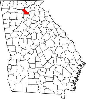 Location within the U.S. state of Georgia | |
 Georgia's location within the U.S. | |
| Coordinates: 34°26′N 84°10′W | |
| Country | |
| State | |
| Founded | 1857 |
| Named for | William Crosby Dawson |
| Seat | Dawsonville |
| Largest city | Dawsonville |
| Area | |
| • Total | 214 sq mi (550 km2) |
| • Land | 211 sq mi (550 km2) |
| • Water | 3.6 sq mi (9 km2) 1.7%% |
| Population (2020) | |
| • Total | 26,798 [1] |
| Time zone | UTC−5 (Eastern) |
| • Summer (DST) | UTC−4 (EDT) |
| Congressional district | 9th |
| Website | www |
Dawson County is included in the Atlanta-Sandy Springs-Roswell, Georgia Metropolitan Statistical Area. Its natural resources include Amicalola Falls, the highest falls in Georgia and one of the Seven Natural Wonders of the state.
History
Dawson County was created on December 3, 1857, from Gilmer and Lumpkin Counties.[5] It is named for William Crosby Dawson, a U.S. Senator from Georgia.[6]
Civil War
The 1860s brought war and hardships to the people of Dawson County. Many men of Dawson County answered the call and went to fight in the Civil War. Several Confederate units were raised in Dawson County, including:
- 21st Regiment, Georgia Infantry, Company E Concord Rangers
- 22nd Regiment, Georgia Infantry, Company I, Dawson County Independents
- 38th Regiment, Georgia Infantry, Company I (Wright's Legion), Dawson Farmers
- 38th Regiment, Georgia Infantry, Company L (Wright's Legion)
- 52nd Regiment, Georgia Volunteer Infantry, Company I
The 1st Georgia Infantry Battalion (Union), Companies B and C also was raised there.
After Civil War to present
The county is known in its long involvement in auto racing, which was established in the 20th century; many of the original NASCAR racers came from this area. Local racing skills are said to have been developed by men who ran moonshine down Georgia State Route 9, also known as Thunder Road, to Atlanta. Celebrations of Dawson County's history and of its "likker" involvement occur every October with the Moonshine Festival.
Locals have referred to Dawson County as the Moonshine Capital of the World. This title is claimed by many other areas, but is fiercely defended by residents of this area. They took advantage of its relative isolation and the ability to move so much moonshine to the larger cities, especially Atlanta, during the Prohibition era.
Education
Dawson County currently serves grades K-12. It has a total of seven schools - one for pre-K, four for grades K-5, one for grades 6–7, one for grades 8–9, and Dawson County High School (grades 10–12).
Geography

According to the U.S. Census Bureau, the county has a total area of 214 square miles (550 km2), of which 211 square miles (550 km2) are land and 3.6 square miles (9.3 km2) (1.7%) are covered by water.[7]
The county is located in the foothills of the Blue Ridge Mountains. Portions of the mountain chain extend into the far northern and western portions of the county, with elevations around 3,500 ft. in this area.
Part of Lake Lanier is in the southeastern part of the county and the boundary lines with neighboring counties pass through the lake. The 729-ft (222-m) Amicalola Falls, are located in the county. The Amicalola Falls are the highest in Georgia, the tallest cascading waterfall east of the Mississippi River, and one of the Seven Natural Wonders of Georgia. The highest point in the county is Black Mountain, with an elevation of 3,600 feet (1,100 m). The Chestatee and Etowah Rivers flow through Dawson County.
The vast majority of Dawson County is located in the Etowah River subbasin of the ACT River Basin (Coosa-Tallapoosa River Basin). The southeastern tip of the county is located in the Upper Chattahoochee River subbasin of the Apalachicola-Chattahoochee-Flint River Basin, and a very small northern section of Dawson County is located in the Coosawattee River subbasin of the larger ACT River Basin.[8]
Adjacent counties
- Fannin County - north
- Lumpkin County - northeast
- Hall County - east
- Forsyth County - south
- Cherokee County - southwest
- Pickens County - west
- Gilmer County - northwest
National protected area
- Chattahoochee National Forest (part)
Transportation
Major highways
 U.S. Route 19
 State Route 9
 State Route 52
 State Route 53
 State Route 136
 State Route 183
 State Route 400
Pedestrians and cycling
- Springer Mountain Trail
Demographics
| Historical population | |||
|---|---|---|---|
| Census | Pop. | %± | |
| 1860 | 3,856 | — | |
| 1870 | 4,369 | 13.3% | |
| 1880 | 5,837 | 33.6% | |
| 1890 | 5,612 | −3.9% | |
| 1900 | 5,442 | −3.0% | |
| 1910 | 4,686 | −13.9% | |
| 1920 | 4,204 | −10.3% | |
| 1930 | 3,502 | −16.7% | |
| 1940 | 4,479 | 27.9% | |
| 1950 | 3,712 | −17.1% | |
| 1960 | 3,590 | −3.3% | |
| 1970 | 3,639 | 1.4% | |
| 1980 | 4,774 | 31.2% | |
| 1990 | 9,429 | 97.5% | |
| 2000 | 15,999 | 69.7% | |
| 2010 | 22,330 | 39.6% | |
| 2020 | 26,798 | 20.0% | |
| U.S. Decennial Census[9] 1790-1960[10] 1900-1990[11] 1990-2000[12] 2010-2019[2] 2020[13] | |||
2000 census
As of the census[14] of 2010, 22,330 people, and 10,425 households, and 6,390 families were living in the county. The racial makeup of the county was 95.62% White, 0.5% African American, 0.4% Native American, 0.6% Asian, 1.6% from other races, and 1.4% from two or more races. Hispanics or Latinos of any race were 4.1% of the population.
Of the 8,433 households, 21.9% had children under the age of 18 living with them, 61.7% were married couples living together, 9.5% had a female householder with no husband present, 4.6% had a male householder with no wife present, and 24.2% were not families. About 19.7% of all households were made up of individuals living alone, and 6.5% of whom were 65 years of age or older. The average household size was 2.61, and the average family size was 2.97.
In the county, the population was distributed as 5.7% under the age of 5, 6.5% at 5–9 years, 6.8% at 10–14 years, 6.0% at 15–19 years, 6.1% at 20–24 years, 5.7% at 25–29 years, 5.8% at 30–34 years, 6.6% at 35–39 years, 6.9% at 40–44 years, 8.1% at 45–49 years, 7.2% at 50–54 years, 7.0% at 55–59 years, 7.6% at 60–64 years, 6.0% at 65–69 years, 3.6% at 70–74 years, 2.4% at 75–79 years, 1.3% at 80–84 years, and 0.8% over age 85. The median age was 40.6 years - 11,164 were male and 11,166 were female.
The median income for a household in the county was estimated at $51,989, and for a family was estimated at $60,455. About 8.9% of families and 13.5% of the population were below the poverty line, including 16.0% of those under age 18 and 6.3% of those age 65 or over.[15]
2010 census
As of the 2010 United States Census, there were 22,330 people, 8,433 households, and 6,390 families living in the county.[16] The population density was 105.9 inhabitants per square mile (40.9/km2). There were 10,425 housing units at an average density of 49.4 per square mile (19.1/km2).[17] The racial makeup of the county was 95.6% white, 0.6% Asian, 0.5% black or African American, 0.4% American Indian, 1.6% from other races, and 1.4% from two or more races. Those of Hispanic or Latino origin made up 4.1% of the population.[16] In terms of ancestry, 18.9% were American, 18.8% were Irish, 14.7% were English, and 13.6% were German.[18]
Of the 8,433 households, 33.0% had children under the age of 18 living with them, 61.7% were married couples living together, 9.5% had a female householder with no husband present, 24.2% were non-families, and 19.7% of all households were made up of individuals. The average household size was 2.61 and the average family size was 2.97. The median age was 40.6 years.[16]
The median income for a household in the county was $51,128 and the median income for a family was $60,236. Males had a median income of $41,726 versus $31,978 for females. The per capita income for the county was $25,557. About 7.8% of families and 12.0% of the population were below the poverty line, including 16.0% of those under age 18 and 5.3% of those age 65 or over.[19]
2020 census
| Race | Num. | Perc. |
|---|---|---|
| White (non-Hispanic) | 23,544 | 87.86% |
| Black or African American (non-Hispanic) | 200 | 0.75% |
| Native American | 63 | 0.24% |
| Asian | 235 | 0.88% |
| Pacific Islander | 14 | 0.05% |
| Other/Mixed | 1,137 | 4.24% |
| Hispanic or Latino | 1,605 | 5.99% |
As of the 2020 United States census, there were 26,798 people, 9,041 households, and 6,491 families residing in the county.
Communities
Cities
Unincorporated communities
Private communities
Several large, gated, private communities function similar to a municipality, providing many municipal-type services that operate independently of county government.
- Big Canoe
Politics
Dawson County is the only county in the country that supported Thomas Dewey in 1948 that then supported Adlai Stevenson II in 1952.[21]
| Year | Republican | Democratic | Third party | |||
|---|---|---|---|---|---|---|
| No. | % | No. | % | No. | % | |
| 2020 | 13,398 | 83.30% | 2,486 | 15.46% | 200 | 1.24% |
| 2016 | 9,900 | 83.76% | 1,448 | 12.25% | 472 | 3.99% |
| 2012 | 8,847 | 86.19% | 1,241 | 12.09% | 176 | 1.71% |
| 2008 | 8,242 | 82.54% | 1,632 | 16.34% | 112 | 1.12% |
| 2004 | 6,649 | 81.87% | 1,407 | 17.33% | 65 | 0.80% |
| 2000 | 4,210 | 71.38% | 1,458 | 24.72% | 230 | 3.90% |
| 1996 | 2,343 | 54.41% | 1,434 | 33.30% | 529 | 12.29% |
| 1992 | 1,696 | 43.58% | 1,399 | 35.95% | 797 | 20.48% |
| 1988 | 1,908 | 71.03% | 761 | 28.33% | 17 | 0.63% |
| 1984 | 1,322 | 67.28% | 643 | 32.72% | 0 | 0.00% |
| 1980 | 729 | 39.68% | 1,072 | 58.36% | 36 | 1.96% |
| 1976 | 370 | 21.09% | 1,384 | 78.91% | 0 | 0.00% |
| 1972 | 828 | 78.26% | 230 | 21.74% | 0 | 0.00% |
| 1968 | 509 | 31.81% | 246 | 15.38% | 845 | 52.81% |
| 1964 | 639 | 40.67% | 932 | 59.33% | 0 | 0.00% |
| 1960 | 401 | 30.45% | 916 | 69.55% | 0 | 0.00% |
| 1956 | 613 | 45.95% | 721 | 54.05% | 0 | 0.00% |
| 1952 | 470 | 37.90% | 770 | 62.10% | 0 | 0.00% |
| 1948 | 786 | 52.82% | 660 | 44.35% | 42 | 2.82% |
| 1944 | 342 | 42.17% | 469 | 57.83% | 0 | 0.00% |
| 1940 | 276 | 36.17% | 484 | 63.43% | 3 | 0.39% |
| 1936 | 322 | 46.07% | 377 | 53.93% | 0 | 0.00% |
| 1932 | 105 | 15.53% | 567 | 83.88% | 4 | 0.59% |
| 1928 | 290 | 46.62% | 332 | 53.38% | 0 | 0.00% |
| 1924 | 264 | 48.35% | 279 | 51.10% | 3 | 0.55% |
| 1920 | 354 | 58.22% | 254 | 41.78% | 0 | 0.00% |
| 1916 | 29 | 3.91% | 440 | 59.30% | 273 | 36.79% |
| 1912 | 23 | 6.42% | 170 | 47.49% | 165 | 46.09% |
Notable people
- Bill Elliott - NASCAR racer, 1988 Cup Series champion, and Hall of Fame member
- Chase Elliott - NASCAR racer and 2014 NASCAR Xfinity Series champion, and 2020 NASCAR Cup Series champion
- Gober Sosebee - stock-car racer (three-time Daytona champion)
- Jerry Glanville - National Football League head coach, NASCAR driver
- Bill Goldberg - professional wrestler and actor (once resided in Dawson County)
See also
- National Register of Historic Places listings in Dawson County, Georgia
References
- US 2020 Census Bureau report, Dawson County, Georgia
- "State & County QuickFacts". United States Census Bureau. Archived from the original on June 7, 2011. Retrieved February 15, 2014.
- US 2020 Census Bureau report, Dawson County, Georgia
- "Find a County". National Association of Counties. Archived from the original on May 31, 2011. Retrieved June 7, 2011.
- Krakow, Kenneth K. (1975). Georgia Place-Names: Their History and Origins (PDF). Macon, GA: Winship Press. p. 59. ISBN 0-915430-00-2.
- Gannett, Henry (1905). The Origin of Certain Place Names in the United States. Govt. Print. Off. pp. 101.
- "US Gazetteer files: 2010, 2000, and 1990". United States Census Bureau. February 12, 2011. Retrieved April 23, 2011.
- "Georgia Soil and Water Conservation Commission Interactive Mapping Experience". Georgia Soil and Water Conservation Commission. Retrieved November 19, 2015.
- "U.S. Decennial Census". United States Census Bureau. Retrieved June 21, 2014.
- "Historical Census Browser". University of Virginia Library. Retrieved June 21, 2014.
- "Population of Counties by Decennial Census: 1900 to 1990". United States Census Bureau. Retrieved June 21, 2014.
- "Census 2000 PHC-T-4. Ranking Tables for Counties: 1990 and 2000" (PDF). United States Census Bureau. Retrieved June 21, 2014.
- US 2020 Census Bureau report, Dawson County, Georgia
- Bureau, U.S. Census. "American FactFinder - Results". factfinder2.census.gov.
- "Archived copy". Archived from the original on April 5, 2019. Retrieved November 21, 2013.
{{cite web}}: CS1 maint: archived copy as title (link) - "DP-1 Profile of General Population and Housing Characteristics: 2010 Demographic Profile Data". United States Census Bureau. Archived from the original on February 13, 2020. Retrieved December 29, 2015.
- "Population, Housing Units, Area, and Density: 2010 - County". United States Census Bureau. Archived from the original on February 13, 2020. Retrieved December 29, 2015.
- "DP02 SELECTED SOCIAL CHARACTERISTICS IN THE UNITED STATES – 2006-2010 American Community Survey 5-Year Estimates". United States Census Bureau. Archived from the original on February 13, 2020. Retrieved December 29, 2015.
- "DP03 SELECTED ECONOMIC CHARACTERISTICS – 2006-2010 American Community Survey 5-Year Estimates". United States Census Bureau. Archived from the original on February 13, 2020. Retrieved December 29, 2015.
- "Explore Census Data". data.census.gov. Retrieved December 14, 2021.
- "Re: Dole 1996/Gore 2000 counties". Talk Elections. Retrieved December 11, 2021.
- Leip, David. "Dave Leip's Atlas of U.S. Presidential Elections". uselectionatlas.org. Retrieved March 19, 2018.
External links
- Archives of Dawson County, Roadside Georgia Archived July 19, 2018, at the Wayback Machine
- Dawson County historical marker
Places adjacent to Dawson County, Georgia | ||||||||||||||||
|---|---|---|---|---|---|---|---|---|---|---|---|---|---|---|---|---|
| ||||||||||||||||
Municipalities and communities of Dawson County, Georgia, United States | ||
|---|---|---|
County seat: Dawsonville | ||
| City |  | |
| Unincorporated communities |
| |
| Ghost town |
| |
| Footnotes | ‡This populated place also has portions in an adjacent county or counties | |
| ||
Metro Atlanta | ||||||
|---|---|---|---|---|---|---|
|  | |||||
|
| ||||||
Authority control | |
|---|---|
| General | |
| National libraries | |
| Other | |
На других языках
[de] Dawson County (Georgia)
Das Dawson County[3] ist ein County im Bundesstaat Georgia der Vereinigten Staaten. Der Verwaltungssitz (County Seat) ist Dawsonville.- [en] Dawson County, Georgia
[ru] Досон (округ, Джорджия)
До́сон[1] (англ. Dawson County) — округ штата Джорджия, США. Население округа на 2000 год составляло 15999 человек. Административный центр округа — город Досонвилл.Другой контент может иметь иную лицензию. Перед использованием материалов сайта WikiSort.org внимательно изучите правила лицензирования конкретных элементов наполнения сайта.
WikiSort.org - проект по пересортировке и дополнению контента Википедии