world.wikisort.org - USA
Twiggs County is a county located in the central portion of the U.S. state of Georgia. As of the 2010 census, the population was 9,023.[1] The county seat is Jeffersonville.[2] The county was created on December 14, 1809, and named for American Revolutionary War general John Twiggs.[3]
Twiggs County | |
|---|---|
U.S. county | |
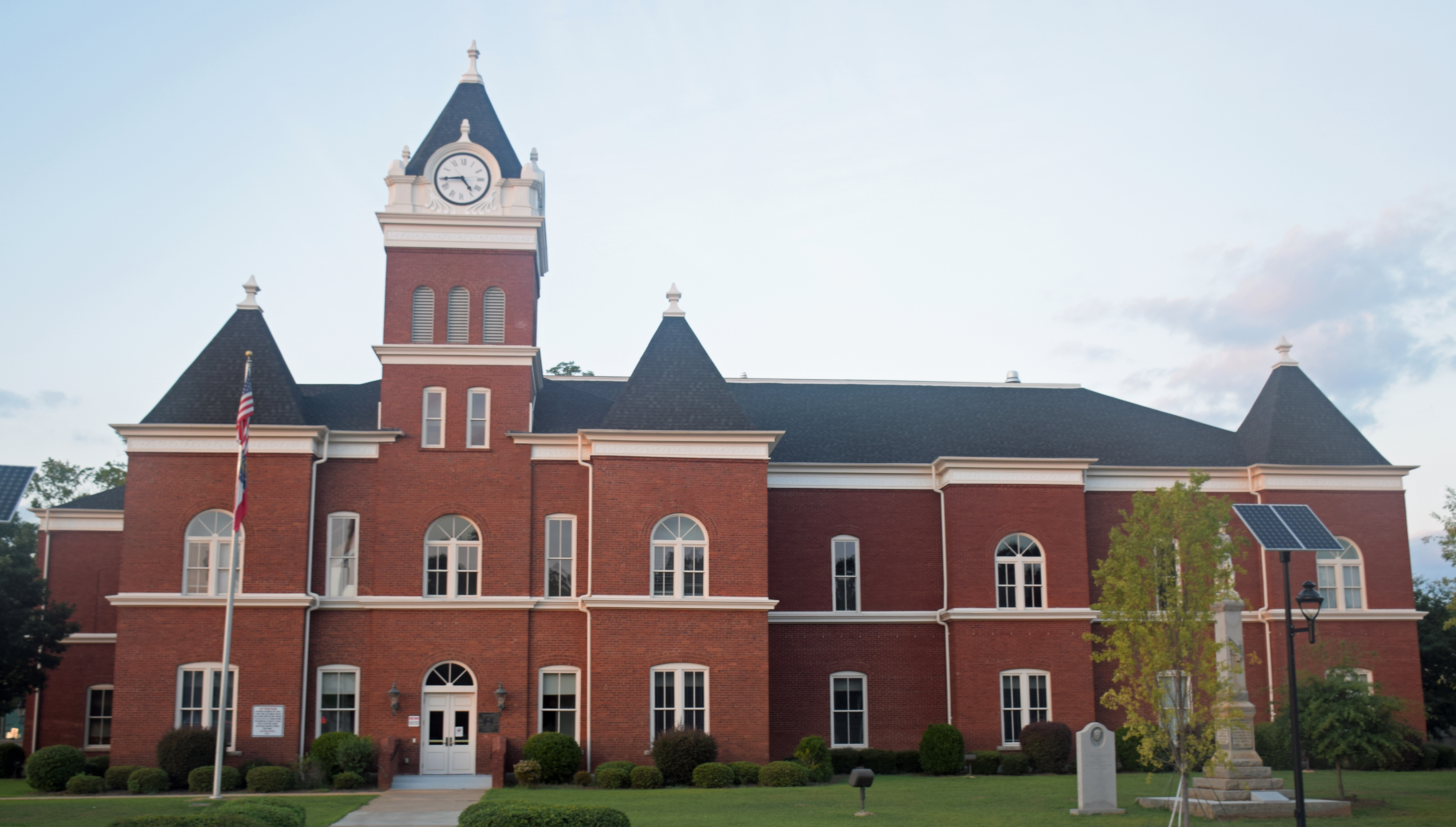
 Twiggs County Courthouse, Jeffersonville | |
 Location within the U.S. state of Georgia | |
 Georgia's location within the U.S. | |
| Coordinates: 32°40′N 83°26′W | |
| Country | |
| State | |
| Founded | December 14, 1809 |
| Named for | John Twiggs |
| Seat | Jeffersonville |
| Largest city | Jeffersonville |
| Area | |
| • Total | 363 sq mi (940 km2) |
| • Land | 358 sq mi (930 km2) |
| • Water | 4.2 sq mi (11 km2) 1.2%% |
| Population | |
| • Estimate (2018) | 8,188 |
| • Density | 25/sq mi (10/km2) |
| Time zone | UTC−5 (Eastern) |
| • Summer (DST) | UTC−4 (EDT) |
| Congressional district | 8th |
| Website | www |
Twiggs County is included in the Macon, GA Metropolitan Statistical Area.
The Twiggs County Courthouse is located in Jeffersonville.
Geography
According to the U.S. Census Bureau, the county has a total area of 363 square miles (940 km2), of which 358 square miles (930 km2) is land and 4.2 square miles (11 km2) (1.2%) is water.[4]
Due to its location on the fall line, the county boasts a diverse geography. Northern parts of the county tend to be hillier, being part of the Piedmont region, and southern parts of the county tend to be flatter, being part of the upper Atlantic coastal plain.
The geographical center of Georgia lies in Twiggs County — off Bullard Road near Old Marion.[5]
The southwestern and central portion of Twiggs County, south of Dry Branch and west of Jeffersonville, is located in the Lower Ocmulgee River sub-basin of the Altamaha River basin. A narrow northwestern portion of the county, from just north to southwest of Dry Branch, is located in the Upper Ocmulgee River sub-basin of the Altamaha River basin. The entire eastern edge of the county is located in the Lower Oconee River sub-basin of the same Altamaha River basin, with a small triangular portion of Twiggs County, south of Interstate 16 and west of Danville, located in the Little Ocmulgee River sub-basin of the same larger Altamaha River basin.[6]
Major highways
 Interstate 16
 U.S. Route 23
 U.S. Route 80
 U.S. Route 129 Alternate
 State Route 18
 State Route 19
 State Route 57
 State Route 87
 State Route 96
 State Route 112
 State Route 358
 State Route 404 (unsigned designation for I-16)
 State Route 540 (Fall Line Freeway)
Adjacent counties
- Wilkinson County - northeast
- Laurens County - southeast
- Bleckley County - south
- Houston County - southwest
- Bibb County - west
- Jones County - northwest
National protected area
- Bond Swamp National Wildlife Refuge (part)
Demographics
| Historical population | |||
|---|---|---|---|
| Census | Pop. | %± | |
| 1810 | 3,405 | — | |
| 1820 | 10,640 | 212.5% | |
| 1830 | 8,031 | −24.5% | |
| 1840 | 8,422 | 4.9% | |
| 1850 | 8,179 | −2.9% | |
| 1860 | 8,320 | 1.7% | |
| 1870 | 8,545 | 2.7% | |
| 1880 | 8,918 | 4.4% | |
| 1890 | 8,195 | −8.1% | |
| 1900 | 8,716 | 6.4% | |
| 1910 | 10,736 | 23.2% | |
| 1920 | 10,407 | −3.1% | |
| 1930 | 8,372 | −19.6% | |
| 1940 | 9,117 | 8.9% | |
| 1950 | 8,308 | −8.9% | |
| 1960 | 7,935 | −4.5% | |
| 1970 | 8,222 | 3.6% | |
| 1980 | 9,354 | 13.8% | |
| 1990 | 9,806 | 4.8% | |
| 2000 | 10,590 | 8.0% | |
| 2010 | 9,023 | −14.8% | |
| 2018 (est.) | 8,188 | [7] | −9.3% |
| U.S. Decennial Census[8] 1790-1960[9] 1900-1990[10] 1990-2000[11] 2010-2013[1] | |||
2000 census
As of the census[12] of 2000, there were 10,590 people, 3,832 households, and 2,862 families living in the county. The population density was 29 inhabitants per square mile (11/km2). There were 4,291 housing units at an average density of 12 per square mile (5/km2). The racial makeup of the county was 54.88% White, 43.65% Black or African American, 0.21% Native American, 0.11% Asian, 0.03% Pacific Islander, 0.25% from other races, and 0.87% from two or more races. 1.06% of the population were Hispanic or Latino of any race.
There were 3,832 households, out of which 33.40% had children under the age of 18 living with them, 52.00% were married couples living together, 17.50% had a female householder with no husband present, and 25.30% were non-families. 22.30% of all households were made up of individuals, and 8.70% had someone living alone who was 65 years of age or older. The average household size was 2.73 and the average family size was 3.20.
In the county, the population was spread out, with 27.00% under the age of 18, 9.40% from 18 to 24, 29.00% from 25 to 44, 23.30% from 45 to 64, and 11.30% who were 65 years of age or older. The median age was 35 years. For every 100 females, there were 91.80 males. For every 100 females age 18 and over, there were 90.60 males.
The median income for a household in the county was $31,608, and the median income for a family was $38,715. Males had a median income of $31,141 versus $22,057 for females. The per capita income for the county was $14,259. About 15.50% of families and 19.70% of the population were below the poverty line, including 25.20% of those under age 18 and 25.80% of those age 65 or over.
2010 census
As of the 2010 United States Census, there were 9,023 people, 3,634 households, and 2,492 families living in the county.[13] The population density was 25.2 inhabitants per square mile (9.7/km2). There were 4,235 housing units at an average density of 11.8 per square mile (4.6/km2).[14] The racial makeup of the county was 56.8% white, 41.3% black or African American, 0.3% American Indian, 0.2% Asian, 0.3% from other races, and 1.1% from two or more races. Those of Hispanic or Latino origin made up 1.4% of the population.[13] In terms of ancestry, 11.1% were American, and 8.4% were English.[15]
Of the 3,634 households, 28.8% had children under the age of 18 living with them, 46.4% were married couples living together, 16.5% had a female householder with no husband present, 31.4% were non-families, and 27.6% of all households were made up of individuals. The average household size was 2.46 and the average family size was 2.99. The median age was 45.0 years.[13]
The median income for a household in the county was $26,521 and the median income for a family was $31,324. Males had a median income of $38,886 versus $25,446 for females. The per capita income for the county was $15,904. About 17.3% of families and 21.2% of the population were below the poverty line, including 27.6% of those under age 18 and 20.9% of those age 65 or over.[16]
2020 census
| Race | Num. | Perc. |
|---|---|---|
| White (non-Hispanic) | 4,487 | 55.93% |
| Black or African American (non-Hispanic) | 3,099 | 38.63% |
| Native American | 16 | 0.2% |
| Asian | 37 | 0.46% |
| Other/Mixed | 259 | 3.23% |
| Hispanic or Latino | 124 | 1.55% |
As of the 2020 United States census, there were 8,022 people, 3,044 households, and 1,838 families residing in the county.
Education
- Twiggs Academy
- Twiggs County Comprehensive Middle/High School
- Jefersonville Elementary
Communities
- Allentown
- Danville
- Dry Branch
- Jeffersonville (county seat)
Notable people
- Philip Cook, Confederate general in the Civil War and postbellum U.S. Congressman.
- Darqueze Dennard, cornerback for the Cincinnati Bengals of the National Football League and former cornerback for the Michigan State Spartans football team. He was the winner of the 2013 Jim Thorpe Award.
- Dudley Mays Hughes, member of the U.S. House of Representatives, American politician, farmer and railroad executive.
- Chuck Leavell, an American musician and current tree farmer in Twiggs County, who was a member of The Allman Brothers Band during the height of their 1970s popularity, a founding member of the jazz-rock combo Sea Level, a frequently-employed session musician, and long-time touring member of The Rolling Stones.
Politics
| Year | Republican | Democratic | Third party | |||
|---|---|---|---|---|---|---|
| No. | % | No. | % | No. | % | |
| 2020 | 2,370 | 53.33% | 2,044 | 45.99% | 30 | 0.68% |
| 2016 | 2,035 | 50.14% | 1,971 | 48.56% | 53 | 1.31% |
| 2012 | 1,907 | 45.35% | 2,270 | 53.98% | 28 | 0.67% |
| 2008 | 2,087 | 46.15% | 2,402 | 53.12% | 33 | 0.73% |
| 2004 | 2,112 | 48.34% | 2,220 | 50.81% | 37 | 0.85% |
| 2000 | 1,570 | 43.43% | 1,977 | 54.69% | 68 | 1.88% |
| 1996 | 958 | 30.80% | 1,927 | 61.96% | 225 | 7.23% |
| 1992 | 853 | 25.15% | 2,097 | 61.82% | 442 | 13.03% |
| 1988 | 1,261 | 41.96% | 1,730 | 57.57% | 14 | 0.47% |
| 1984 | 1,143 | 39.44% | 1,755 | 60.56% | 0 | 0.00% |
| 1980 | 747 | 25.07% | 2,213 | 74.26% | 20 | 0.67% |
| 1976 | 513 | 16.94% | 2,515 | 83.06% | 0 | 0.00% |
| 1972 | 1,363 | 55.05% | 1,113 | 44.95% | 0 | 0.00% |
| 1968 | 336 | 14.51% | 812 | 35.08% | 1,167 | 50.41% |
| 1964 | 1,178 | 59.98% | 786 | 40.02% | 0 | 0.00% |
| 1960 | 263 | 23.74% | 845 | 76.26% | 0 | 0.00% |
| 1956 | 168 | 14.36% | 1,002 | 85.64% | 0 | 0.00% |
| 1952 | 191 | 15.03% | 1,080 | 84.97% | 0 | 0.00% |
| 1948 | 55 | 6.75% | 359 | 44.05% | 401 | 49.20% |
| 1944 | 170 | 27.11% | 457 | 72.89% | 0 | 0.00% |
| 1940 | 91 | 11.18% | 723 | 88.82% | 0 | 0.00% |
| 1936 | 57 | 10.38% | 491 | 89.44% | 1 | 0.18% |
| 1932 | 15 | 2.26% | 646 | 97.29% | 3 | 0.45% |
| 1928 | 74 | 11.47% | 571 | 88.53% | 0 | 0.00% |
| 1924 | 39 | 8.02% | 417 | 85.80% | 30 | 6.17% |
| 1920 | 44 | 13.88% | 273 | 86.12% | 0 | 0.00% |
| 1916 | 15 | 3.75% | 365 | 91.25% | 20 | 5.00% |
| 1912 | 3 | 0.92% | 310 | 95.09% | 13 | 3.99% |
See also
- National Register of Historic Places listings in Twiggs County, Georgia
References
- "State & County QuickFacts". United States Census Bureau. Archived from the original on January 8, 2016. Retrieved June 26, 2014.
- "Find a County". National Association of Counties. Retrieved June 7, 2011.
- Krakow, Kenneth K. (1975). Georgia Place-Names: Their History and Origins (PDF). Macon, GA: Winship Press. p. 234. ISBN 0-915430-00-2.
- "US Gazetteer files: 2010, 2000, and 1990". United States Census Bureau. February 12, 2011. Retrieved April 23, 2011.
- "Historical Markers by County - GeorgiaInfo". University Association of Georgia. Retrieved March 16, 2015.
- "Georgia Soil and Water Conservation Commission Interactive Mapping Experience". Georgia Soil and Water Conservation Commission. Retrieved November 22, 2015.
- "Population and Housing Unit Estimates". Retrieved July 31, 2019.
- "U.S. Decennial Census". United States Census Bureau. Retrieved June 26, 2014.
- "Historical Census Browser". University of Virginia Library. Retrieved June 26, 2014.
- "Population of Counties by Decennial Census: 1900 to 1990". United States Census Bureau. Retrieved June 26, 2014.
- "Census 2000 PHC-T-4. Ranking Tables for Counties: 1990 and 2000" (PDF). United States Census Bureau. Retrieved June 26, 2014.
- "U.S. Census website". United States Census Bureau. Retrieved January 31, 2008.
- "DP-1 Profile of General Population and Housing Characteristics: 2010 Demographic Profile Data". United States Census Bureau. Archived from the original on February 13, 2020. Retrieved December 30, 2015.
- "Population, Housing Units, Area, and Density: 2010 - County". United States Census Bureau. Archived from the original on February 13, 2020. Retrieved December 30, 2015.
- "DP02 SELECTED SOCIAL CHARACTERISTICS IN THE UNITED STATES – 2006-2010 American Community Survey 5-Year Estimates". United States Census Bureau. Archived from the original on February 13, 2020. Retrieved December 30, 2015.
- "DP03 SELECTED ECONOMIC CHARACTERISTICS – 2006-2010 American Community Survey 5-Year Estimates". United States Census Bureau. Archived from the original on February 13, 2020. Retrieved December 30, 2015.
- "Explore Census Data". data.census.gov. Retrieved December 18, 2021.
- Leip, David. "Dave Leip's Atlas of U.S. Presidential Elections". uselectionatlas.org. Retrieved March 22, 2018.
Places adjacent to Twiggs County, Georgia | ||||||||||||||||
|---|---|---|---|---|---|---|---|---|---|---|---|---|---|---|---|---|
| ||||||||||||||||
Municipalities and communities of Twiggs County, Georgia, United States | ||
|---|---|---|
County seat: Jeffersonville | ||
| Cities |  | |
| Town | ||
| Unincorporated communities |
| |
| Ghost town |
| |
| Footnotes | ‡This populated place also has portions in an adjacent county or counties | |
| ||
Macon-Warner Robins-Fort Valley Combined Statistical Area | ||
|---|---|---|
| Principal cities |
|  |
| Municipalities | ||
| Other communities | ||
| Counties | ||
| CSA components |
| |
Authority control | |
|---|---|
| General | |
| National libraries | |
| Other | |
На других языках
[de] Twiggs County
Das Twiggs County[3] ist ein County im Bundesstaat Georgia der Vereinigten Staaten. Der Verwaltungssitz (County Seat) ist Jeffersonville.- [en] Twiggs County, Georgia
[es] Condado de Twiggs
El condado de Twiggs (en inglés: Twiggs County), fundado en 1809, es uno de 159 condados del estado estadounidense de Georgia. En el año 2000, el condado tenía una población de 10 590 habitantes y una densidad poblacional de 11 personas por km². La sede del condado es Jeffersonville.[1][ru] Туигс (округ)
Туи́гс[1] (англ. Twiggs County) — округ штата Джорджия, США. Население округа на 2000 год составляло 10590 человек. Административный центр округа — город Джефферсонвилл.Другой контент может иметь иную лицензию. Перед использованием материалов сайта WikiSort.org внимательно изучите правила лицензирования конкретных элементов наполнения сайта.
WikiSort.org - проект по пересортировке и дополнению контента Википедии