world.wikisort.org - USA
Liberty County is a county in the U.S. state of Georgia. As of the 2020 census, the population is 65,256.[1] The county seat is Hinesville.[2]
Liberty County | |
|---|---|
U.S. county | |
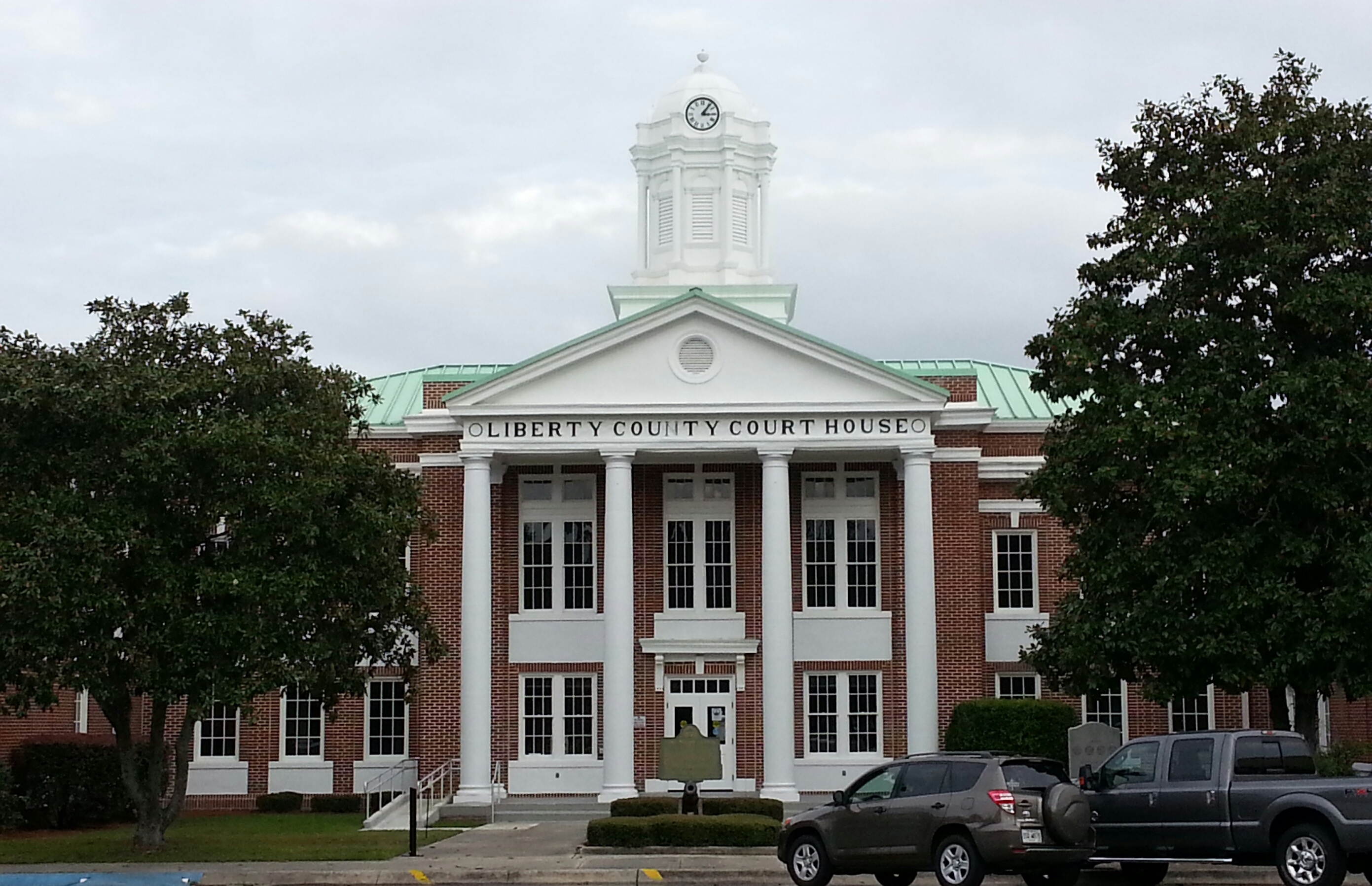 Liberty County Courthouse in Hinesville | |
 Location within the U.S. state of Georgia | |
 Georgia's location within the U.S. | |
| Coordinates: 31°48′N 81°28′W | |
| Country | |
| State | |
| Founded | February 5, 1777 |
| Seat | Hinesville |
| Largest city | Hinesville |
| Area | |
| • Total | 603 sq mi (1,560 km2) |
| • Land | 490 sq mi (1,300 km2) |
| • Water | 113 sq mi (290 km2) 18.7%% |
| Population | |
| • Estimate (2019) | 61,435 |
| • Density | 130/sq mi (50/km2) |
| Time zone | UTC−5 (Eastern) |
| • Summer (DST) | UTC−4 (EDT) |
| Congressional district | 1st |
| Website | www |
Liberty County is part of the Hinesville, Georgia Metropolitan Statistical Area, which is also included in the Savannah-Hinesville-Statesboro, Georgia Combined Statistical Area.
History
Liberty County was established in 1777. It is named for the American ideal of liberty.[3] Sunbury was first designated the county seat in 1784. In 1797, the seat was transferred to Riceboro, and in 1837 it was transferred again to Hinesville.[4]
1922 lynching
On July 1, 1922, James Harvey and Joe Jordan, two African American men, were lynched by a mob of about 50 people in Liberty County during an escort by police from Jesup, Georgia to a jail in Savannah, Georgia. The event drew condemnation from both the local black community and from several prominent white citizens, with the preacher at Midway Methodist Church denouncing the acts and publishing a widely circulated letter condemning the Wayne County officials of being complicit in the murders. The incident prompted an investigation by the NAACP, and in total, 22 men were indicted, with four being convicted.[5]
Geography
According to the U.S. Census Bureau, the county has a total area of 603 square miles (1,560 km2), of which 490 square miles (1,300 km2) is land and 113 square miles (290 km2) (18.7%) is water.[6]
The eastern and southern portion of Liberty County is located in the Ogeechee Coastal sub-basin of the Ogeechee River basin. The northern and western portion of the county is located in the Canoochee River sub-basin of the Ogeechee River basin.[7]
Major highways
 Interstate 95
 U.S. Route 17
 U.S. Route 84
 State Route 25
 State Route 38
 State Route 38 Connector
 State Route 119
 State Route 144
 State Route 196
 State Route 405 (unsigned designation for I-95)
Adjacent counties
- Chatham County - northeast
- Bryan County - north
- McIntosh County - south
- Long County - west
- Evans County - northwest
- Tattnall County - northwest
Demographics
| Historical population | |||
|---|---|---|---|
| Census | Pop. | %± | |
| 1790 | 5,355 | — | |
| 1800 | 5,313 | −0.8% | |
| 1810 | 6,228 | 17.2% | |
| 1820 | 6,695 | 7.5% | |
| 1830 | 7,233 | 8.0% | |
| 1840 | 7,241 | 0.1% | |
| 1850 | 7,926 | 9.5% | |
| 1860 | 8,367 | 5.6% | |
| 1870 | 7,688 | −8.1% | |
| 1880 | 10,649 | 38.5% | |
| 1890 | 12,887 | 21.0% | |
| 1900 | 13,093 | 1.6% | |
| 1910 | 12,924 | −1.3% | |
| 1920 | 12,707 | −1.7% | |
| 1930 | 8,153 | −35.8% | |
| 1940 | 8,595 | 5.4% | |
| 1950 | 8,444 | −1.8% | |
| 1960 | 14,487 | 71.6% | |
| 1970 | 17,569 | 21.3% | |
| 1980 | 37,583 | 113.9% | |
| 1990 | 52,745 | 40.3% | |
| 2000 | 61,610 | 16.8% | |
| 2010 | 63,453 | 3.0% | |
| 2020 | 65,256 | 2.8% | |
| U.S. Decennial Census[8] 1790-1960[9] 1900-1990[10] 1990-2000[11] 2010-2013[1] | |||
2000 census
At the 2000 census there were 61,610 people, 19,383 households, and 15,138 families living in the county. The population density was 119 inhabitants per square mile (46/km2). There were 21,977 housing units at an average density of 42 per square mile (16/km2). The racial makeup of the county was 46.64% White, 42.84% Black or African American, 0.52% Native American, 1.76% Asian, 0.43% Pacific Islander, 4.43% from other races, and 3.37% from two or more races. 8.15% of the population were Hispanic or Latino of any race.[12] According to 2005 Census Estimates Liberty County had a population that was 44.5% African-American, 44.4% Non-Hispanic white, 7.2% Latino, 3.1% non-Hispanics who reported multiple races, 1.9% Asian and 0.5% of both Native Americans and Pacific Islanders.
Of the 19,383 households 50.50% had children under the age of 18 living with them, 59.60% were married couples living together, 14.80% had a female householder with no husband present, and 21.90% were non-families. 16.60% of households were one person and 3.20% were one person aged 65 or older. The average household size was 2.93 and the average family size was 3.29.
The age distribution was 32.00% under the age of 18, 17.90% from 18 to 24, 33.90% from 25 to 44, 12.20% from 45 to 64, and 3.90% 65 or older. The median age was 25 years. For every 100 females, there were 111.30 males. For every 100 females age 18 and over, there were 115.10 males.
The median household income was $33,477 and the median family income was $35,031. Males had a median income of $25,305 versus $20,765 for females. The per capita income for the county was $13,855. About 13.50% of families and 15.00% of the population were below the poverty line, including 19.20% of those under age 18 and 19.90% of those age 65 or over.
2010 census
At the 2010 census, there were 63,453 people, 22,155 households, and 16,566 families living in the county.[13] The population density was 129.5 inhabitants per square mile (50.0/km2). There were 26,731 housing units at an average density of 54.6 per square mile (21.1/km2).[14] The racial makeup of the county was 47.1% white, 42.2% black or African American, 2.0% Asian, 0.6% Pacific islander, 0.6% American Indian, 2.9% from other races, and 4.7% from two or more races. Those of Hispanic or Latino origin made up 9.7% of the population.[13] In terms of ancestry, 8.8% were German, 6.9% were Irish, and 6.0% were American.[15]
Of the 22,155 households, 45.9% had children under the age of 18 living with them, 49.0% were married couples living together, 21.5% had a female householder with no husband present, 25.2% were non-families, and 20.7% of households were made up of individuals. The average household size was 2.75 and the average family size was 3.18. The median age was 27.9 years.[13]
The median household income was $42,674 and the median family income was $46,818. Males had a median income of $35,881 versus $31,159 for females. The per capita income for the county was $18,662. About 15.0% of families and 17.8% of the population were below the poverty line, including 26.2% of those under age 18 and 13.4% of those age 65 or over.[16]
2020 census
| Race | Num. | Perc. |
|---|---|---|
| White (non-Hispanic) | 24,004 | 36.78% |
| Black or African American (non-Hispanic) | 27,309 | 41.85% |
| Native American | 225 | 0.34% |
| Asian | 1,325 | 2.03% |
| Pacific Islander | 437 | 0.67% |
| Other/Mixed | 4,170 | 6.39% |
| Hispanic or Latino | 7,786 | 11.93% |
As of the 2020 United States census, there were 65,256 people, 23,485 households, and 16,657 families residing in the county.
Communities
Cities
- Allenhurst
- Flemington
- Gumbranch
- Hinesville (county seat)
- Midway
- Riceboro
- Walthourville
Census-designated place
- Fort Stewart
Unincorporated communities
- Sunbury
- Fleming
- Limerick
- McIntosh
- Seabrook
Education

Liberty County School District is the designated school district for grades K-12 for the county, except parts in Fort Stewart. Fort Stewart has the Department of Defense Education Activity (DoDEA) as its local school district,[18] for the elementary level.[19] Students at the secondary level on Fort Stewart attend public schools operated by county school districts.[20]
The Liberty district operates public schools, including the comprehensive high school Liberty County High School and the Bradwell Institute, as well as its educative middle schools Midway Middle School, Lewis Frasier Middle School, and Snelson-Golden Middle School.
They also provide a career academy, Liberty College & Career Academy (LCCA), for extra academics where students study for a profession they could seek out in the future.
In the media
The 2014 independent film, A Promise, was filmed in Liberty County.[21][22]
Politics
| Year | Republican | Democratic | Third party | |||
|---|---|---|---|---|---|---|
| No. | % | No. | % | No. | % | |
| 2020 | 7,959 | 37.20% | 13,104 | 61.25% | 331 | 1.55% |
| 2016 | 6,134 | 38.00% | 9,556 | 59.20% | 453 | 2.81% |
| 2012 | 5,565 | 34.36% | 10,457 | 64.57% | 173 | 1.07% |
| 2008 | 5,828 | 35.54% | 10,474 | 63.87% | 98 | 0.60% |
| 2004 | 6,131 | 47.86% | 6,619 | 51.67% | 59 | 0.46% |
| 2000 | 4,455 | 44.68% | 5,347 | 53.62% | 170 | 1.70% |
| 1996 | 3,042 | 37.42% | 4,462 | 54.89% | 625 | 7.69% |
| 1992 | 2,832 | 35.87% | 3,853 | 48.80% | 1210 | 15.33% |
| 1988 | 3,100 | 51.24% | 2,906 | 48.03% | 44 | 0.73% |
| 1984 | 3,229 | 53.53% | 2,803 | 46.47% | 0 | 0.00% |
| 1980 | 1,507 | 32.18% | 3,099 | 66.18% | 77 | 1.64% |
| 1976 | 979 | 22.73% | 3,328 | 77.27% | 0 | 0.00% |
| 1972 | 2,337 | 65.76% | 1,217 | 34.24% | 0 | 0.00% |
| 1968 | 592 | 16.78% | 1572 | 44.55% | 1,365 | 38.68% |
| 1964 | 1,458 | 39.73% | 2,212 | 60.27% | 0 | 0.00% |
| 1960 | 929 | 36.88% | 1,590 | 63.12% | 0 | 0.00% |
| 1956 | 967 | 52.02% | 892 | 47.98% | 0 | 0.00% |
| 1952 | 517 | 26.31% | 1,448 | 73.69% | 0 | 0.00% |
| 1948 | 121 | 9.98% | 820 | 67.66% | 271 | 22.36% |
| 1944 | 122 | 20.23% | 481 | 79.77% | 0 | 0.00% |
| 1940 | 102 | 20.00% | 407 | 79.80% | 1 | 0.20% |
| 1936 | 49 | 11.64% | 369 | 87.65% | 3 | 0.71% |
| 1932 | 18 | 5.84% | 289 | 93.83% | 1 | 0.32% |
| 1928 | 203 | 50.25% | 201 | 49.75% | 0 | 0.00% |
| 1924 | 39 | 9.38% | 334 | 80.29% | 43 | 10.34% |
| 1920 | 175 | 36.61% | 303 | 63.39% | 0 | 0.00% |
| 1916 | 103 | 27.54% | 245 | 65.51% | 26 | 6.95% |
| 1912 | 77 | 21.57% | 251 | 70.31% | 29 | 8.12% |
Gallery
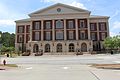 Liberty County Justice Center
 Liberty County Courthouse Annex
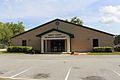 Liberty County Recreation Department


See also
- National Register of Historic Places listings in Liberty County, Georgia
References
- General
- "State & County QuickFacts". United States Census Bureau. Archived from the original on June 7, 2011. Retrieved June 23, 2014.
- "Find a County". National Association of Counties. Archived from the original on May 31, 2011. Retrieved June 7, 2011.
- Gannett, Henry (1905). The Origin of Certain Place Names in the United States. U.S. Government Printing Office. p. 186.
- Hellmann, Paul T. (May 13, 2013). Historical Gazetteer of the United States. Routledge. p. 233. ISBN 978-1135948597. Retrieved November 30, 2013.
- Harris, J. William (2001). Deep Souths: Delta, Piedmont, and Sea Island Society in the Age of Segregation. Johns Hopkins University Press. p. 288. ISBN 978-0-8018-6563-3 – via Google Books.
- "US Gazetteer files: 2010, 2000, and 1990". United States Census Bureau. February 12, 2011. Retrieved April 23, 2011.
- "Georgia Soil and Water Conservation Commission Interactive Mapping Experience". Georgia Soil and Water Conservation Commission. Retrieved November 22, 2015.
- "U.S. Decennial Census". United States Census Bureau. Retrieved June 23, 2014.
- "Historical Census Browser". University of Virginia Library. Retrieved June 23, 2014.
- "Population of Counties by Decennial Census: 1900 to 1990". United States Census Bureau. Retrieved June 23, 2014.
- "Census 2000 PHC-T-4. Ranking Tables for Counties: 1990 and 2000" (PDF). United States Census Bureau. Retrieved June 23, 2014.
- "U.S. Census website". United States Census Bureau. Retrieved May 14, 2011.
- "DP-1 Profile of General Population and Housing Characteristics: 2010 Demographic Profile Data". United States Census Bureau. Archived from the original on February 13, 2020. Retrieved December 30, 2015.
- "Population, Housing Units, Area, and Density: 2010 - County". United States Census Bureau. Archived from the original on February 13, 2020. Retrieved December 30, 2015.
- "DP02 SELECTED SOCIAL CHARACTERISTICS IN THE UNITED STATES – 2006-2010 American Community Survey 5-Year Estimates". United States Census Bureau. Archived from the original on February 13, 2020. Retrieved December 30, 2015.
- "DP03 SELECTED ECONOMIC CHARACTERISTICS – 2006-2010 American Community Survey 5-Year Estimates". United States Census Bureau. Archived from the original on February 13, 2020. Retrieved December 30, 2015.
- "Explore Census Data". data.census.gov. Retrieved December 14, 2021.
- "2020 CENSUS - SCHOOL DISTRICT REFERENCE MAP: Liberty County, GA" (PDF). U.S. Census Bureau. Retrieved July 5, 2022. - text list - "Fort Stewart School District" refers to the DoDEA schools.
- "Fort Stewart Schools". Department of Defense Education Activity. Retrieved July 5, 2022.
- "Fort Stewart Education". Military One Source. Retrieved July 5, 2022. - This is from a .mil website.
- "Film company sets premieres". www.bryancountynews.com. Archived from the original on April 6, 2016. Retrieved March 26, 2016.
- "Georgia hears about local film industry". coastalcourier.com. Archived from the original on April 9, 2016. Retrieved March 26, 2016.
- Leip, David. "Dave Leip's Atlas of U.S. Presidential Elections". uselectionatlas.org. Retrieved March 21, 2018.
- Specific
Places adjacent to Liberty County, Georgia | ||||||||||||||||
|---|---|---|---|---|---|---|---|---|---|---|---|---|---|---|---|---|
| ||||||||||||||||
Municipalities and communities of Liberty County, Georgia, United States | ||
|---|---|---|
County seat: Hinesville | ||
| Cities |  | |
| CDP |
| |
| Unincorporated communities |
| |
| Ghost towns |
| |
| ||
Authority control | |
|---|---|
| General | |
| National libraries | |
| Other |
|
На других языках
[de] Liberty County (Georgia)
Das Liberty County[1] ist ein County im US-Bundesstaat Georgia der Vereinigten Staaten. Der Verwaltungssitz (County Seat) ist Hinesville, benannt nach Senator Charlton Hines.- [en] Liberty County, Georgia
[ru] Либерти (округ, Джорджия)
Ли́берти[1] (англ. Liberty County) — округ штата Джорджия, США. Население округа на 2000 год составляло 61610 человек. Административный центр округа — город Хайнсвилл.Другой контент может иметь иную лицензию. Перед использованием материалов сайта WikiSort.org внимательно изучите правила лицензирования конкретных элементов наполнения сайта.
WikiSort.org - проект по пересортировке и дополнению контента Википедии