world.wikisort.org - USA
Houston County (/ˈhaʊstən/ HOW-stən) is a county located in the central portion of the U.S. state of Georgia. The estimated 2019 population is 157,863.[1] Its county seat is Perry; the city of Warner Robins is substantially larger in both area and population.[2]
Houston County | |
|---|---|
U.S. county | |
 Houston County courthouse in Perry | |
 Location within the U.S. state of Georgia | |
 Georgia's location within the U.S. | |
| Coordinates: 32°28′N 83°40′W | |
| Country | |
| State | |
| Founded | May 15, 1821 |
| Named for | John Houstoun |
| Seat | Perry |
| Largest city | Warner Robins |
| Area | |
| • Total | 380 sq mi (1,000 km2) |
| • Land | 376 sq mi (970 km2) |
| • Water | 4.4 sq mi (11 km2) 1.2%% |
| Population | |
| • Estimate (2020) | 163,633 |
| • Density | 373/sq mi (144/km2) |
| Time zone | UTC−5 (Eastern) |
| • Summer (DST) | UTC−4 (EDT) |
| Congressional district | 8th |
| Website | www |
The county was created on May 15, 1821, along with 4 other counties in the state, and later reduced in size with the formation of Bibb, Crawford, Pike, Macon, and Peach counties.[3] It was named after Georgia governor John Houstoun, with the spelling being a common 19th-century variation that later evolved to "Houston".[4] The pronunciation, however, remains to this day "howston."[5] The geographic center of the county was given the name Wattsville, which was later changed to Perry.[5]
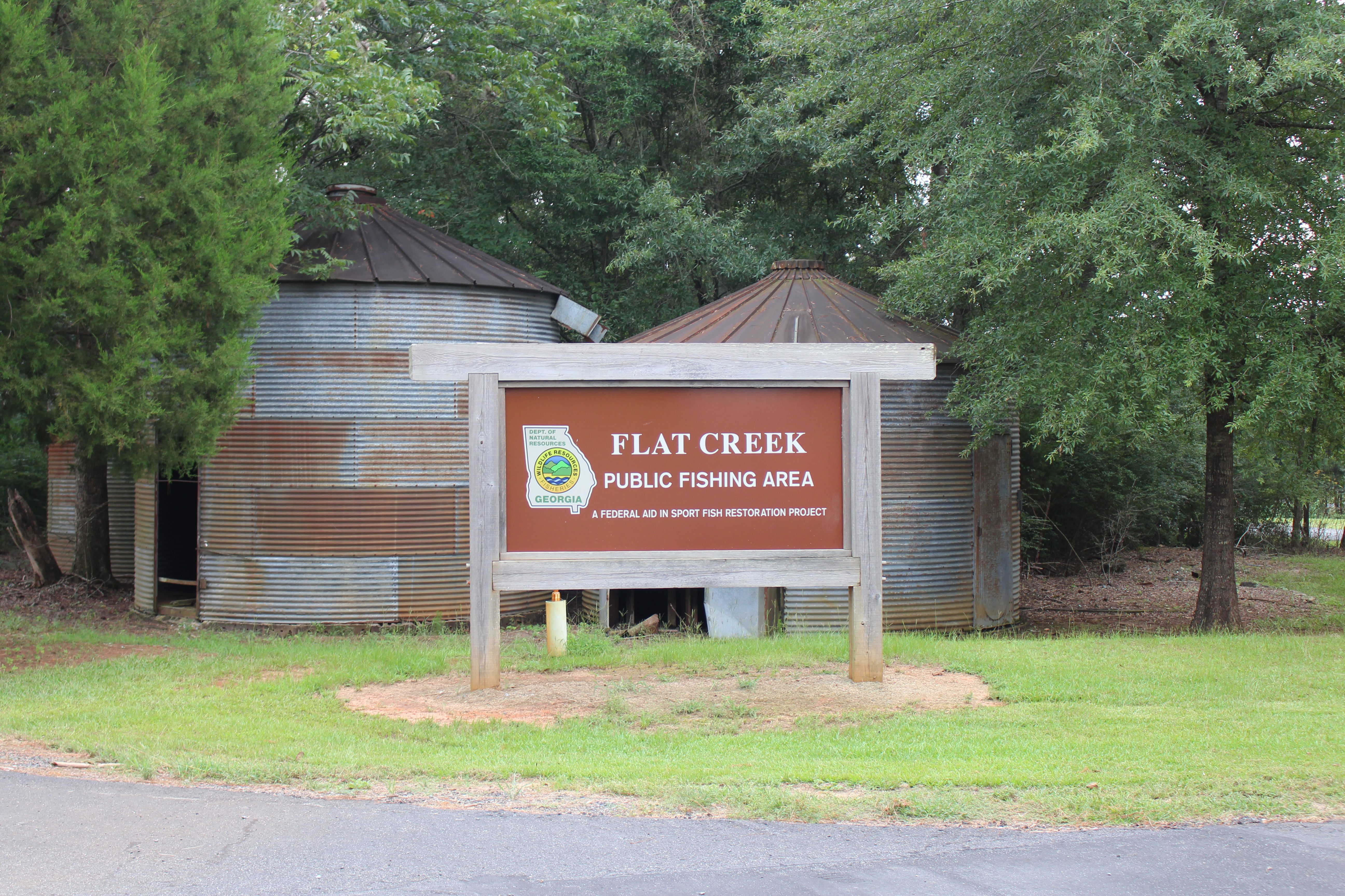
Houston County is included in the Warner Robins, GA Metropolitan Statistical Area, which in turn is included in the Macon-Warner Robins-Fort Valley Combined Statistical Area. Flat Creek Public Fishing Area is in Houston County, south west of Perry.
Geography
According to the U.S. Census Bureau, the county has a total area of 380 square miles (980 km2), of which 376 square miles (970 km2) is land and 4.4 square miles (11 km2) (1.2%) is water.[6] The county is located in the upper Atlantic coastal plain region of the state.
The vast majority of Houston County is located in the Lower Ocmulgee River sub-basin of the Altamaha River basin. The very northern edge of the county, north of Centerville and Warner Robins, is located in the Upper Ocmulgee River sub-basin of the same Altamaha River basin. The very southwestern corner of Houston County, well west of Interstate 75, is located in the Middle Flint River sub-basin of the ACF River Basin (Apalachicola-Chattahoochee-Flint River Basin).[7]
Adjacent counties
- Bibb County - north
- Peach County - west
- Twiggs County - east
- Bleckley County - southeast
- Pulaski County - south-southeast
- Dooly County - south
- Macon County - southwest
Transportation
Major highways
 Interstate 75
 U.S. Route 41
 U.S. Route 129
 U.S. Route 341
 State Route 7
 State Route 7 Spur
 State Route 11
 State Route 11 Business
 State Route 11 Connector
 State Route 26
 State Route 49
 State Route 96
 State Route 127
 State Route 224
 State Route 247
 State Route 247 Connector
 State Route 247 Spur
 State Route 329
 State Route 401 (unsigned designation for I-75)
Pedestrians and cycling
- Big Indian Creek Trail (Proposed)[8]
- Walker's Pond Trail
- Wellston Trail
- The Walk at Sandy Run Creek
Demographics
| Historical population | |||
|---|---|---|---|
| Census | Pop. | %± | |
| 1830 | 7,369 | — | |
| 1840 | 9,711 | 31.8% | |
| 1850 | 16,450 | 69.4% | |
| 1860 | 15,611 | −5.1% | |
| 1870 | 20,406 | 30.7% | |
| 1880 | 22,414 | 9.8% | |
| 1890 | 21,613 | −3.6% | |
| 1900 | 22,641 | 4.8% | |
| 1910 | 23,609 | 4.3% | |
| 1920 | 21,964 | −7.0% | |
| 1930 | 11,280 | −48.6% | |
| 1940 | 11,303 | 0.2% | |
| 1950 | 20,964 | 85.5% | |
| 1960 | 39,154 | 86.8% | |
| 1970 | 62,924 | 60.7% | |
| 1980 | 77,605 | 23.3% | |
| 1990 | 89,208 | 15.0% | |
| 2000 | 110,765 | 24.2% | |
| 2010 | 139,900 | 26.3% | |
| 2020 | 163,633 | 17.0% | |
| U.S. Decennial Census[9] 1790-1960[10] 1900-1990[11] 1990-2000[12] 2010-2019[1] | |||
2020 census
| Race | Num. | Perc. |
|---|---|---|
| White (non-Hispanic) | 86,211 | 52.69% |
| Black or African American (non-Hispanic) | 51,992 | 31.77% |
| Native American | 339 | 0.21% |
| Asian | 4,905 | 3.0% |
| Pacific Islander | 124 | 0.08% |
| Other/Mixed | 8,255 | 5.04% |
| Hispanic or Latino | 11,807 | 7.22% |
As of the 2020 United States census, there were 163,633 people, 58,417 households, and 39,810 families residing in the county.
2010 census
As of the 2010 United States Census, there were 139,900 people, 53,051 households, and 37,874 families residing in the county.[14] The population density was 372.5 inhabitants per square mile (143.8/km2). There were 58,325 housing units at an average density of 155.3 per square mile (60.0/km2).[15] The racial makeup of the county was 63.3% white, 28.6% black or African American, 2.4% Asian, 0.3% American Indian, 0.1% Pacific islander, 2.4% from other races, and 2.8% from two or more races. Those of Hispanic or Latino origin made up 6.1% of the population.[14] In terms of ancestry, 12.9% were American, 10.3% were German, 10.0% were English, and 9.1% were Irish.[16]
Of the 53,051 households, 38.7% had children under the age of 18 living with them, 50.3% were married couples living together, 16.2% had a female householder with no husband present, 28.6% were non-families, and 24.0% of all households were made up of individuals. The average household size was 2.61 and the average family size was 3.09. The median age was 34.5 years.[14]
The median income for a household in the county was $55,098 and the median income for a family was $67,227. Males had a median income of $47,557 versus $34,239 for females. The per capita income for the county was $25,206. About 10.3% of families and 12.8% of the population were below the poverty line, including 18.7% of those under age 18 and 9.5% of those age 65 or over.[17]
Education

Houston County Schools operates public schools.[18]
Communities
Cities
- Byron (part)
- Centerville
- Perry
- Warner Robins
Census-designated place
- Robins Air Force Base
Unincorporated communities
Politics
Houston County voted for conservative Democrats for most of the twentieth century, and gradually switched to voting for conservative Republicans closer to the century's end and into the twenty-first. In the 2018 gubernatorial election, while she did not carry Houston County, Stacey Abrams improved on Democratic margins in the county, improving five percent compared to Hillary Clinton's 2016 presidential run and by four percent compared to Barack Obama's 2008 run. Houston was one of five counties not carried by Abrams which improved their Democratic margins.[19] In 2020, Joe Biden improved Democratic margins to their best since Jimmy Carter carried it in 1980. He also became the first non-Georgian Democrat to win 40 percent of the county’s vote since 1960.
| Year | Republican | Democratic | Third party | |||
|---|---|---|---|---|---|---|
| No. | % | No. | % | No. | % | |
| 2020 | 41,540 | 55.51% | 32,239 | 43.08% | 1,059 | 1.42% |
| 2016 | 35,430 | 58.97% | 22,553 | 37.54% | 2096 | 3.49% |
| 2012 | 34,662 | 59.58% | 22,702 | 39.02% | 811 | 1.39% |
| 2008 | 33,392 | 59.59% | 22,094 | 39.43% | 548 | 0.98% |
| 2004 | 29,862 | 66.03% | 15,054 | 33.29% | 310 | 0.69% |
| 2000 | 23,174 | 62.65% | 13,301 | 35.96% | 513 | 1.39% |
| 1996 | 17,050 | 52.18% | 12,760 | 39.05% | 2868 | 8.78% |
| 1992 | 14,119 | 43.11% | 12,270 | 37.47% | 6359 | 19.42% |
| 1988 | 15,748 | 64.02% | 8,664 | 35.22% | 185 | 0.75% |
| 1984 | 14,255 | 60.71% | 9,226 | 39.29% | 0 | 0.00% |
| 1980 | 9,005 | 43.51% | 10,915 | 52.74% | 775 | 3.74% |
| 1976 | 5,404 | 29.10% | 13,164 | 70.90% | 0 | 0.00% |
| 1972 | 13,576 | 84.16% | 2,556 | 15.84% | 0 | 0.00% |
| 1968 | 4,285 | 29.64% | 2833 | 19.60% | 7,339 | 50.76% |
| 1964 | 6,532 | 60.53% | 4,258 | 39.46% | 1 | 0.01% |
| 1960 | 1,757 | 30.35% | 4,033 | 69.65% | 0 | 0.00% |
| 1956 | 1,060 | 19.12% | 4,483 | 80.88% | 0 | 0.00% |
| 1952 | 511 | 15.48% | 2,789 | 84.52% | 0 | 0.00% |
| 1948 | 204 | 9.85% | 1,437 | 69.35% | 431 | 20.80% |
| 1944 | 190 | 26.21% | 535 | 73.79% | 0 | 0.00% |
| 1940 | 149 | 19.30% | 622 | 80.57% | 1 | 0.13% |
| 1936 | 37 | 4.44% | 796 | 95.56% | 0 | 0.00% |
| 1932 | 27 | 5.54% | 460 | 94.46% | 0 | 0.00% |
| 1928 | 92 | 22.17% | 323 | 77.83% | 0 | 0.00% |
| 1924 | 75 | 4.39% | 1,611 | 94.27% | 23 | 1.35% |
| 1920 | 39 | 5.12% | 723 | 94.88% | 0 | 0.00% |
| 1916 | 12 | 1.38% | 806 | 92.64% | 52 | 5.98% |
| 1912 | 16 | 2.00% | 760 | 95.00% | 24 | 3.00% |
| 1908 | 27 | 2.58% | 855 | 81.58% | 166 | 15.84% |
| 1904 | 78 | 8.99% | 768 | 88.48% | 22 | 2.53% |
| 1900 | 81 | 9.11% | 798 | 89.76% | 10 | 1.12% |
| 1896 | 192 | 17.63% | 875 | 80.35% | 22 | 2.02% |
| 1892 | 507 | 20.48% | 1,953 | 78.88% | 16 | 0.65% |
| 1888 | 466 | 32.86% | 949 | 66.93% | 3 | 0.21% |
| 1884 | 433 | 24.99% | 1,300 | 75.01% | 0 | 0.00% |
| 1880 | 909 | 39.68% | 1,382 | 60.32% | 0 | 0.00% |
See also
- National Register of Historic Places listings in Houston County, Georgia
- Houston County Schools
References
- "2016 Population Estimates". United States Census Bureau. Retrieved June 23, 2014.
- "Find a County". National Association of Counties. Archived from the original on May 31, 2011. Retrieved June 7, 2011.
- "Houston County". The New Georgia Encyclopedia. Georgia Humanities Council, in partnership with the University of Georgia Press, the University System of Georgia/GALILEO, and the Office of the Governor. Retrieved September 24, 2008.
- "Houston County, Georgia - Centerville, Perry, Warner Robins - Georgia's Most Progressive County!".
- "Houston County". The New Georgia Encyclopedia. Georgia Humanities Council, in partnership with the University of Georgia Press, the University System of Georgia/GALILEO, and the Office of the Governor. Retrieved September 1, 2016.
- "US Gazetteer files: 2010, 2000, and 1990". United States Census Bureau. February 12, 2011. Retrieved April 23, 2011.
- "Georgia Soil and Water Conservation Commission Interactive Mapping Experience". Georgia Soil and Water Conservation Commission. Retrieved November 24, 2015.
- "Perry, Houston County considering 7.5 mile recreation trail".
- "U.S. Decennial Census". United States Census Bureau. Retrieved June 23, 2014.
- "Historical Census Browser". University of Virginia Library. Retrieved June 23, 2014.
- "Population of Counties by Decennial Census: 1900 to 1990". United States Census Bureau. Retrieved June 23, 2014.
- "Census 2000 PHC-T-4. Ranking Tables for Counties: 1990 and 2000" (PDF). United States Census Bureau. Retrieved June 23, 2014.
- "Explore Census Data". data.census.gov. Retrieved December 18, 2021.
- "DP-1 Profile of General Population and Housing Characteristics: 2010 Demographic Profile Data". United States Census Bureau. Archived from the original on February 13, 2020. Retrieved December 30, 2015.
- "Population, Housing Units, Area, and Density: 2010 - County". United States Census Bureau. Archived from the original on February 13, 2020. Retrieved December 30, 2015.
- "DP02 SELECTED SOCIAL CHARACTERISTICS IN THE UNITED STATES – 2006-2010 American Community Survey 5-Year Estimates". United States Census Bureau. Archived from the original on February 13, 2020. Retrieved December 30, 2015.
- "DP03 SELECTED ECONOMIC CHARACTERISTICS – 2006-2010 American Community Survey 5-Year Estimates". United States Census Bureau. Archived from the original on February 13, 2020. Retrieved December 30, 2015.
- "2020 CENSUS - SCHOOL DISTRICT REFERENCE MAP: Houston County, GA" (PDF). U.S. Census Bureau. Retrieved August 1, 2022. - Text list
- https://www.macon.com/news/politics-government/election/article221405270.html [bare URL]
- Leip, David. "Dave Leip's Atlas of U.S. Presidential Elections". uselectionatlas.org. Retrieved March 20, 2018.
External links
- Ripley, George; Dana, Charles A., eds. (1879). . The American Cyclopædia.
- Flint Electric Membership Corporation historical marker
- Houston County historical marker
Places adjacent to Houston County, Georgia | ||||||||||||||||
|---|---|---|---|---|---|---|---|---|---|---|---|---|---|---|---|---|
| ||||||||||||||||
Municipalities and communities of Houston County, Georgia, United States | ||
|---|---|---|
County seat: Perry | ||
| Cities |  | |
| CDP |
| |
| Unincorporated communities | ||
| Footnotes | ‡This populated place also has portions in an adjacent county or counties | |
| ||
Macon-Warner Robins-Fort Valley Combined Statistical Area | ||
|---|---|---|
| Principal cities |
|  |
| Municipalities | ||
| Other communities | ||
| Counties | ||
| CSA components |
| |
Atlanta (capital) | |
| Topics |
|
| Society |
|
| Regions |
|
| Largest cities |
|
| Counties |
|
| |
Authority control | |
|---|---|
| General | |
| National libraries | |
| Other | |
На других языках
[de] Houston County (Georgia)
Das Houston County[1][2] ist ein County im Bundesstaat Georgia der Vereinigten Staaten. Der Verwaltungssitz (County Seat) ist Perry, das nach Oliver Hazard Perry benannt wurde.- [en] Houston County, Georgia
[ru] Хьюстон (округ, Джорджия)
Хьюстон, также Ха́устон[1] (англ. Houston County) — округ штата Джорджия, США. Население округа на 2000 год составляло 110765 человек. Административный центр округа — город Перри.Другой контент может иметь иную лицензию. Перед использованием материалов сайта WikiSort.org внимательно изучите правила лицензирования конкретных элементов наполнения сайта.
WikiSort.org - проект по пересортировке и дополнению контента Википедии