world.wikisort.org - USA
Broomfield is a consolidated city and county located in the U.S. state of Colorado.[1] Broomfield has a consolidated government which operates under Article XX, Sections 10-13 of the Constitution of the State of Colorado. The Broomfield population was 74,112 at the 2020 United States Census,[5] making it the 15th most populous municipality and the 12th most populous county in Colorado. Broomfield is a part of the Denver–Aurora–Lakewood, CO Metropolitan Statistical Area and the Front Range Urban Corridor.
Broomfield, Colorado | |
|---|---|
Consolidated city and county[1] | |
 | |
 Flag  Seal | |
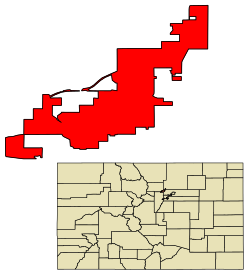 Location of the City and County of Broomfield in Colorado | |
 Broomfield Location of the City and County of Broomfield in the United States. | |
| Coordinates: 39°57′12″N 105°03′07″W[2] | |
| Country | |
| State | |
| City and County | Broomfield[3] |
| Incorporated | June 6, 1961[4] |
| Consolidated | November 15, 2001 |
| Named for | The broomcorn once grown in the area. |
| Government | |
| • Type | consolidated city and county[1] |
| • Mayor | Guyleen Castriotta |
| Area | |
| • Total | 33.548 sq mi (86.890 km2) |
| • Land | 32.968 sq mi (85.387 km2) |
| • Water | 0.580 sq mi (1.503 km2) |
| Elevation | 5,420 ft (1,629 m) |
| Population (2020)[5] | |
| • Total | 74,112 |
| • Density | 2,248/sq mi (868/km2) |
| • Metro | 2,963,821 (19th) |
| • CSA | 3,623,560 (17th) |
| • Front Range | 5,055,344 |
| Time zone | UTC−07:00 (MST) |
| • Summer (DST) | UTC−06:00 (MDT) |
| ZIP codes[7] | 80020, 80021, 80023, 80038 (PO Box) |
| Area code | 303 and 720 |
| FIPS code | 08-09280 |
| GNIS ID[8] | 1945881, 204704 |
| Interstate highway | |
| Toll road | NW Parkway |
| U.S. highways | |
| State highways | |
| Website | www |
Fifteenth most populous Colorado city Twelfth most populous Colorado county | |
History
Several railroads figure in the development of this area. The Colorado Central Railroad built a narrow gauge line from Golden in 1873, the Denver, Utah and Pacific Railroad arrived in 1881, and the Denver, Marshall and Boulder Railway built a line through what would become Broomfield in 1886. The Denver, Utah and Pacific was widened to standard gauge in 1889. One of the early names for the area was Zang's Spur, after the railroad spur serving Adolph Zang's grain fields.[9]
The municipality of Broomfield was incorporated in 1961 in the southeastern corner of Boulder County. While it is unsure how it received its name, most researchers guess it is from the broomcorn grown in the area, a tall sorghum that farmers sold for use as brooms and whisk brooms. Over the next three decades, the city grew through annexations. Eventually, Broomfield spilled into portions of four counties: Adams, Boulder, Jefferson and Weld.
In the 1990s, city leaders felt increasing chagrin with the need to deal with four separate court districts, four different county seats, and four separate county sales tax bases. They began pushing to make Broomfield a consolidated city-county similar to Denver, reasoning that they could provide services more responsively if it had its own county government. They sought an amendment to the Colorado State Constitution to create a new county. The amendment was passed in 1998, after which a three-year transition period followed. On November 15, 2001, Broomfield County became the 64th and smallest county of Colorado. It is the most recently created county in Colorado, and also in the United States as a whole if county equivalents are not included.[10]
On February 20, 2021, United Airlines Flight 328 experienced an engine failure after takeoff from Denver International Airport and debris from the engine landed in parts of Broomfield.[11]
Geography
Broomfield is located midway between downtown Denver and Boulder along U.S. Route 36. Its coordinates are 39°55′55″N 105°3′57″W (39.931817, -105.065919).[12]
The elevation in Broomfield ranges from 5,096 to 5,856 feet.[13] At the 2020 United States Census, Broomfield had a total area of 21,471 acres (86.890 km2) including 371 acres (1.503 km2) of water.[5] It is the smallest county by area in Colorado and the 5th smallest in the United States. Broomfield is the second most densely populated county in Colorado behind Denver.[14]
Airport
Rocky Mountain Metropolitan Airport formerly known as Jefferson County (Jeffco) Airport is located in Broomfirld.
Major highways
 Interstate 25
 U.S. Highway 36 (Denver-Boulder Turnpike)
 U.S. Highway 85
 U.S. Highway 287
 State Highway 7
 State Highway 121
 State Highway 128
- E-470 (tollway)
- Northwest Parkway (tollway)
Adjacent counties
- Weld County – northeast
- Adams County – southeast
- Jefferson County – southwest
- Boulder County – northwest
Climate
According to the Köppen climate classification system, Broomfield has a Cold Semi-arid climate (BSk). According to the United States Department of Agriculture, the Plant Hardiness zone is 6a with an average annual extreme minimum temperature of -9.4 °F (-23.0 °C).[15]
| Climate data for Broomfield, Broomfield County, CO. Elevation 5407 ft | |||||||||||||
|---|---|---|---|---|---|---|---|---|---|---|---|---|---|
| Month | Jan | Feb | Mar | Apr | May | Jun | Jul | Aug | Sep | Oct | Nov | Dec | Year |
| Average high °F (°C) | 45.4 (7.4) |
47.5 (8.6) |
54.6 (12.6) |
62.3 (16.8) |
71.6 (22.0) |
81.9 (27.7) |
88.7 (31.5) |
86.2 (30.1) |
78.1 (25.6) |
65.8 (18.8) |
53.0 (11.7) |
44.7 (7.1) |
65.1 (18.4) |
| Average low °F (°C) | 18.3 (−7.6) |
20.2 (−6.6) |
27.0 (−2.8) |
33.8 (1.0) |
43.0 (6.1) |
51.7 (10.9) |
57.6 (14.2) |
56.2 (13.4) |
47.3 (8.5) |
35.9 (2.2) |
25.7 (−3.5) |
18.0 (−7.8) |
36.3 (2.4) |
| Average precipitation inches (mm) | 0.44 (11) |
0.43 (11) |
1.64 (42) |
2.07 (53) |
2.26 (57) |
1.73 (44) |
1.76 (45) |
1.86 (47) |
1.26 (32) |
1.12 (28) |
0.87 (22) |
0.68 (17) |
16.12 (409) |
| Average relative humidity (%) | 50.5 | 51.1 | 48.0 | 45.8 | 49.6 | 46.8 | 44.2 | 48.5 | 46.1 | 47.2 | 49.8 | 51.8 | 48.3 |
| Average dew point °F (°C) | 15.6 (−9.1) |
17.7 (−7.9) |
22.6 (−5.2) |
28.2 (−2.1) |
38.6 (3.7) |
45.8 (7.7) |
50.0 (10.0) |
50.8 (10.4) |
41.7 (5.4) |
31.4 (−0.3) |
22.2 (−5.4) |
15.6 (−9.1) |
31.8 (−0.1) |
| Source: PRISM Climate Group[16] | |||||||||||||
Ecology
According to the A. W. Kuchler U.S. Potential natural vegetation Types, Broomfield would have a Grama, aka Bouteloua / Buffalo grass (65) vegetation type and a Shortgrass prairie (17) vegetation form.[17]
Demographics
| Historical population | |||
|---|---|---|---|
| Census | Pop. | %± | |
| 1960 | 4,535 | — | |
| 1970 | 7,261 | 60.1% | |
| 1980 | 20,730 | 185.5% | |
| 1990 | 24,638 | 18.9% | |
| 2000 | 38,272 | 55.3% | |
| 2010 | 55,889 | 46.0% | |
| 2020 | 74,112 | 32.6% | |
| U.S. Decennial Census | |||
Broomfield is a part of the Denver-Aurora-Lakewood, CO Metropolitan Statistical Area.
The 2017 census estimates there were 68,341 people living in the city.[18] The population density was 2,193 per square mile as of the 2010 census. The racial makeup of the city was 86.1 percent White, 11.1 percent Hispanic or Latino, 6.1 percent Asian, 2.1 percent from two or more races, 1.1 percent African American, 0.6 percent Native American, and 0.1 percent Pacific Islander.
There were 22,016 households, of which 41.2 percent had children under the age of 18 living with them, 61.8 percent were married couples living together, 8.2 percent had a female householder with no husband present, and 25.8 percent were non-families. 19.3 percent of all households were made up of individuals, and 4.2 percent had someone living alone who was 65 years of age or older. The average household size was 2.76 people, and the average family size was 3.19 people.
Age distribution figures show 26.2 percent of residents under the age of 18 and 9.9 percent age 65 years or older. The median age was 36.4 years. Females made up 50.2% of the population.
The median household income was $79,034 and the median family income was $96,206 in 2013. The per capita income for the city was $38,792. 48.1 percent of the population over age 25 held a bachelor's degree or higher.[19]
Politics
When the county was formed in 2001, it was a swing county, and the city itself had voted for the winning candidate in each presidential election from 2000 to 2020. In the 2012 election, incumbent president and Democrat Barack Obama defeated Republican Mitt Romney by roughly five percentage points. In recent years, the county has trended towards the Democratic Party. In 2016, it voted decisively for Hillary Clinton. Joe Biden won the county by an even larger margin in 2020.
Since its inception, Broomfield County has voted for the winner of Colorado's electoral votes.
As of March 1, 2021, 15,671 voters were Democrats, 11,658 voters were Republicans, and 23,354 voters were not affiliated with any party.[20]
| Year | Republican | Democratic | Third party | |||
|---|---|---|---|---|---|---|
| No. | % | No. | % | No. | % | |
| 2020 | 16,295 | 34.94% | 29,077 | 62.35% | 1,260 | 2.70% |
| 2016 | 14,367 | 38.12% | 19,731 | 52.35% | 3,591 | 9.53% |
| 2012 | 15,008 | 45.67% | 16,966 | 51.62% | 891 | 2.71% |
| 2008 | 12,757 | 43.31% | 16,168 | 54.89% | 528 | 1.79% |
| 2004 | 12,007 | 51.68% | 10,935 | 47.06% | 293 | 1.26% |
Economy
In the 1990s, Broomfield and other area suburbs experienced tremendous economic growth, much of it focused in technology.
The Flatiron Crossing Mall is a large shopping and entertainment center, anchored by Dick's Sporting Goods, Macy's, and Forever 21.
The Broomfield Enterprise is the local newspaper. KBDI-TV, the secondary PBS member station for the Denver area, is licensed to Broomfield.
Ball, Vail Resorts, MWH Global, Flatiron Construction, Webroot, Noodles & Company, WhiteWave Foods and Mrs. Fields are headquartered in Broomfield.
Top employers
According to Broomfield's 2020 Comprehensive Annual Financial Report,[21] the top employers in the city are:
| # | Employer | # of Employees |
|---|---|---|
| 1 | Lumen Technologies | 1,850 |
| 2 | Oracle | 1,620 |
| 3 | SCL Health | 1,530 |
| 4 | Hunter Douglas | 980 |
| 5 | City and County of Broomfield | 795 |
| 6 | Vail Resorts | 740 |
| 7 | TSYS | 580 |
| 8 | DanoneWave Foods | 570 |
| 9 | Broadcom Inc. | 500 |
| 10 | VMWare | 465 |
Recreation
This section does not cite any sources. (April 2019) |
Broomfield's recreation opportunities include the Paul Derda Recreation Center and pool, athletic fields, courts and rinks and open space and trails.[22][23]
Broomfield has an extensive trail system that connects the various lakes and parks. A scenic trail connects the Stearns Lake and the Josh's Pond on the west side of town. Broomfield also has a 9/11 memorial containing a piece of a steel beam from one of the towers.
Broomfield also has a skate park with many different features such as bowls, a large half pipe and several "street" obstacles.
Government
- Mayor – Guyleen Castriotta [24]
- Mayor Pro-Tem – Stan Jezierski
- City and County Manager – Jennifer Hoffman
- City and County Attorney – Nancy Rodgers

Council members
- Ward 1
- Stan Jezierski
- James Marsh-Holschen
- Ward 2
- William Lindstedt
- Austin Ward
- Ward 3
- Jean Lim
- Deven Shaff
- Ward 4
- Bruce Leslie
- Laurie Anderson
- Ward 5
- Heidi Henkel
- Todd Cohen
Sheriff and county commissioners
Broomfield operates as a consolidated city-county. The city council acts simultaneously as the board of county commissioners, and the police chief is simultaneously the county sheriff. The Broomfield Police Department performs all of the duties that would normally be performed by a county sheriff's office, including operating the county jail (detention center), providing security and bailiff services for the Broomfield Municipal, County, and District Courts and the Combined Courts Building, and providing civil process in the county. The police chief can be hired or fired at will by the city council, which makes Broomfield's sheriff, along with Denver's, the only non-elected sheriffs in the state.
Education
This section does not cite any sources. (March 2010) |
Since Broomfield used to be divided among four counties, students living in the city were served by the separate school districts for their county.[citation needed] While the city is now united within one county, the city is still separated among multiple school districts.
School districts that have sections of Broomfield:[25]
- Adams County District Twelve Five Star Schools
- Boulder Valley School District RE-2
- School District 27J
- Weld County School District RE-8
- Jefferson County School District R-1
- St. Vrain Valley School District RE 1J
There are five school districts that overlap Broomfield, but the two largest school districts in Broomfield are Adams Twelve Five Star Schools and[Boulder Valley School District.[citation needed]
Broomfield features two large public high schools (Broomfield High School, which underwent significant renovations from 2009 to 2010, and Legacy High), two public middle schools and eight public elementary schools. There are three private schools: Broomfield Academy, with an academic preschool, an elementary school and a middle school; Holy Family, a Catholic high school; and Nativity of Our Lord Parish, a Catholic elementary school. Broomfield also contains two K-12 charter schools, Prospect Ridge Academy, and Front Range Academy, which has two Broomfield campuses.
Notable people
Notable individuals who were born in or have lived in Broomfield or both include:
- Mark Boslough, physicist[26]
- Drew Brown, musician, guitarist for OneRepublic and Debate Team[27]
- Dianne Primavera, 50th Lieutenant Governor of Colorado and former member of the Colorado House of Representatives[28]
- Anna Prins, basketball center[29]
- Vince Russo, pro wrestler[30]
- Steve Schmuhl, swimmer[31]
- Mike Wilpolt, football wide receiver, defensive back, coach[32]
- Cat Zingano, bantamweight MMA fighter[33]
See also
- Colorado
- Bibliography of Colorado
- Index of Colorado-related articles
- Outline of Colorado
- List of counties in Colorado
- List of municipalities in Colorado
- List of places in Colorado
- List of statistical areas in Colorado
- Front Range Urban Corridor
- North Central Colorado Urban Area
- Denver-Aurora, CO Combined Statistical Area
- Denver-Aurora-Lakewood, CO Metropolitan Statistical Area
- Jefferson Parkway
- Northwest Parkway
- Rocky Flats National Wildlife Refuge
- 2013 Colorado floods
References
- "Active Colorado Municipalities". Colorado Department of Local Affairs. Retrieved October 15, 2021.
- "2014 U.S. Gazetteer Files: Places". United States Census Bureau. July 1, 2014. Retrieved January 5, 2015.
- "Colorado Counties". State of Colorado, Colorado Department of Local Affairs, Division of Local Government. Retrieved January 25, 2021.
- "Colorado Municipal Incorporations". State of Colorado, Department of Personnel & Administration, Colorado State Archives. December 1, 2004. Retrieved September 2, 2007.
- "Decennial Census P.L. 94-171 Redistricting Data". United States Census Bureau, United States Department of Commerce. August 12, 2021. Retrieved September 7, 2021.
- "City & County of Broomfield: Community". City & County of Broomfield. Archived from the original on September 27, 2007. Retrieved August 2, 2007.
- "ZIP Code Lookup". United States Postal Service. Archived from the original (JavaScript/HTML) on September 3, 2007. Retrieved September 4, 2007.
- "Feature Detail Report for: Broomfield County". Geographic Names Information System. United States Geological Survey, United States Department of the Interior. Retrieved September 23, 2010.
- History of Broomfield, Broomfield, Colorado, 2020.
- "Substantial Changes to Counties and County Equivalent Entities: 1970-Present". United States Census Bureau.
- "Plane Debris Falls From Sky & Onto Broomfield Neighborhoods". CBS Denver. February 20, 2021. Retrieved March 15, 2021.
{{cite news}}: CS1 maint: url-status (link) - "US Gazetteer files: 2010, 2000, and 1990". United States Census Bureau. February 12, 2011. Retrieved April 23, 2011.
- "City and County of Broomfield - Official Website - Demographics". broomfield.org. Retrieved September 2, 2015.
- "Colorado Population Density County Rank". Usa.com. Retrieved August 27, 2017.
- "USDA Interactive Plant Hardiness Map". United States Department of Agriculture. Retrieved July 11, 2019.
- "PRISM Climate Group, Oregon State University". www.prism.oregonstate.edu. Retrieved July 10, 2019.
- "U.S. Potential Natural Vegetation, Original Kuchler Types, v2.0 (Spatially Adjusted to Correct Geometric Distortions)". Data Basin. Retrieved July 11, 2019.
- "Broomfield (city) QuickFacts from the US Census Bureau". census.gov. Archived from the original on September 5, 2015. Retrieved September 2, 2015.
- "Broomfield, Colorado". city-data.com. Retrieved September 2, 2015.
- "Total Registered Voters by Party & Status as of 03:26 on 03/01/2021" (PDF). Colorado Secretary of State. March 1, 2021. Archived (PDF) from the original on March 26, 2021. Retrieved March 29, 2021.
- City and County of Broomfield 2020 CAFR
- "Recreation and Senior Services | City and County of Broomfield - Official Website". www.broomfield.org. Retrieved April 26, 2019.
- "Open Space and Trails | City and County of Broomfield - Official Website". www.broomfield.org. Retrieved April 26, 2019.
- "City and County of Broomfield - Official Website – Council-Members". Ci.broomfield.co.us. Retrieved July 26, 2022.
- "2020 CENSUS - SCHOOL DISTRICT REFERENCE MAP: Broomfield County, CO" (PDF). U.S. Census Bureau. Retrieved July 19, 2022. - Text list
- Boslough, Mark (November 30, 2014). "F-Bomb the N-Word Out of Existence". Huffington Post. Retrieved May 2, 2016.
- "Brown comes home to Broomfield for Broomstock". Retrieved March 10, 2018.
- "Dianne Primavera's Biography". Vote Smart. Retrieved May 2, 2016.
- "Anna Prins". Iowa State Cyclones. Retrieved May 2, 2016.
- Russo, Vince (2010). Rope Opera: How WCW Killed Vince Russo. ISBN 978-1550228687.
- "Steve Schmuhl". Indiana University Athletics. Retrieved May 2, 2016.
- "Mike Wilpolt". ArenaFan. Retrieved May 2, 2016.
- "Kitty Zingano". UFC. Retrieved May 2, 2016.
External links
 Media from Commons
 Travel information from Wikivoyage
- City and County of Broomfield website
- CDOT map of the City and County of Broomfield
- History Colorado website
Surrounding communities | ||||||||||||||||
|---|---|---|---|---|---|---|---|---|---|---|---|---|---|---|---|---|
| ||||||||||||||||
Authority control | |
|---|---|
| General | |
| National libraries | |
| Other |
|
На других языках
[de] Broomfield (Colorado)
Broomfield ist eine Stadt und zugleich ein County im Bundesstaat Colorado der Vereinigten Staaten, mit 74.112[1] Einwohnern (Stand: Volkszählung 2020) und Sitz der County-Verwaltung. Es ist Teil der Metropolregion Denver.- [en] Broomfield, Colorado
[ru] Брумфилд (Колорадо)
Бру́мфилд (англ. Broomfield, рус. Сорговое поле) — город-округ[en] в штате Колорадо, США.Другой контент может иметь иную лицензию. Перед использованием материалов сайта WikiSort.org внимательно изучите правила лицензирования конкретных элементов наполнения сайта.
WikiSort.org - проект по пересортировке и дополнению контента Википедии