world.wikisort.org - USA
Clear Creek County is a county located in the U.S. state of Colorado. As of the 2020 census, the population was 9,397.[1] The county seat is Georgetown.[2]
Clear Creek County | |
|---|---|
U.S. county | |
 Alpine Hose, historic firehouse in Georgetown. | |
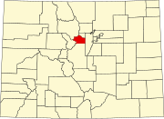
Location within the U.S. state of Colorado | |
 Colorado's location within the U.S. | |
| Coordinates: 39°41′N 105°38′W | |
| Country | |
| State | |
| Founded | November 1, 1861 |
| Named for | Clear Creek |
| Seat | Georgetown |
| Largest city | Idaho Springs |
| Area | |
| • Total | 396 sq mi (1,030 km2) |
| • Land | 395 sq mi (1,020 km2) |
| • Water | 1.3 sq mi (3 km2) 0.3%% |
| Population | |
| • Estimate (2020) | 9,397[1] |
| • Density | 24/sq mi (9/km2) |
| Time zone | UTC−7 (Mountain) |
| • Summer (DST) | UTC−6 (MDT) |
| Congressional district | 2nd |
| Website | www |
Clear Creek County is part of the Denver metropolitan area.
History

![Crystalline gold specimen from the Dixie mine, Lamartine District, SW of Idaho Springs, Colorado. Size: 1.8 x 0.9 x 0.2 cm.[3]](http://upload.wikimedia.org/wikipedia/commons/9/9f/Gold-231683.jpg)
Clear Creek County was one of the original 17 counties created by the Colorado legislature on 1 November 1861, and is one of only two counties (along with Gilpin) to have persisted with its original boundaries unchanged. It was named after Clear Creek, which runs down from the continental divide through the county. Idaho Springs was originally designated the county seat, but the county government was moved to Georgetown in 1867.
Geography
According to the U.S. Census Bureau, the county has a total area of 396 square miles (1,030 km2), of which 395 square miles (1,020 km2) is land and 1.3 square miles (3.4 km2) (0.3%) is water.[4]
Adjacent counties
- Jefferson County - east
- Gilpin County - northeast
- Park County - south
- Summit County - west
- Grand County - northwest
Major highways
 Interstate 70
 U.S. Highway 6
 U.S. Highway 40
 State Highway 5
 State Highway 103
- Central City Parkway
National protected areas
- Pike National Forest
- Roosevelt National Forest
- James Peak Wilderness
- Mount Evans Wilderness
Scenic trails and byways
- American Discovery Trail
- Continental Divide National Scenic Trail
- Grays Peak National Recreation Trail
- Mount Evans National Recreation Trail
- Guanella Pass Scenic Byway
- Mount Evans Scenic Byway
Politics
Throughout its history, Clear Creek County tended to be somewhat divided between Republicans and Democrats, but has reliably voted Democratic in recent elections, with George W. Bush having been the most recent Republican to win the county, in 2000, while his father, George H. W. Bush, was the last Republican to win the narrow majority of the county's votes, in 1988. During the 2016 Presidential Election, Hillary Clinton became the first Democrat since her husband in 1996 to not win the majority of the county's vote, while still winning the county by a plurality.
| Year | Republican | Democratic | Third party | |||
|---|---|---|---|---|---|---|
| No. | % | No. | % | No. | % | |
| 2020 | 2,754 | 42.06% | 3,604 | 55.04% | 190 | 2.90% |
| 2016 | 2,575 | 43.90% | 2,729 | 46.52% | 562 | 9.58% |
| 2012 | 2,430 | 42.31% | 3,119 | 54.31% | 194 | 3.38% |
| 2008 | 2,300 | 39.88% | 3,332 | 57.78% | 135 | 2.34% |
| 2004 | 2,522 | 44.93% | 2,989 | 53.25% | 102 | 1.82% |
| 2000 | 2,247 | 45.63% | 2,188 | 44.44% | 489 | 9.93% |
| 1996 | 1,746 | 41.97% | 1,863 | 44.78% | 551 | 13.25% |
| 1992 | 1,356 | 30.40% | 1,744 | 39.10% | 1,360 | 30.49% |
| 1988 | 1,820 | 50.11% | 1,698 | 46.75% | 114 | 3.14% |
| 1984 | 2,151 | 65.34% | 1,089 | 33.08% | 52 | 1.58% |
| 1980 | 1,784 | 56.22% | 837 | 26.38% | 552 | 17.40% |
| 1976 | 1,477 | 55.36% | 1,069 | 40.07% | 122 | 4.57% |
| 1972 | 1,557 | 62.23% | 815 | 32.57% | 130 | 5.20% |
| 1968 | 1,011 | 52.71% | 719 | 37.49% | 188 | 9.80% |
| 1964 | 676 | 38.26% | 1,086 | 61.46% | 5 | 0.28% |
| 1960 | 964 | 58.35% | 688 | 41.65% | 0 | 0.00% |
| 1956 | 973 | 64.87% | 520 | 34.67% | 7 | 0.47% |
| 1952 | 1,145 | 67.71% | 540 | 31.93% | 6 | 0.35% |
| 1948 | 810 | 48.68% | 836 | 50.24% | 18 | 1.08% |
| 1944 | 795 | 55.29% | 636 | 44.23% | 7 | 0.49% |
| 1940 | 1,018 | 44.15% | 1,281 | 55.55% | 7 | 0.30% |
| 1936 | 720 | 34.68% | 1,340 | 64.55% | 16 | 0.77% |
| 1932 | 597 | 38.17% | 939 | 60.04% | 28 | 1.79% |
| 1928 | 790 | 61.05% | 481 | 37.17% | 23 | 1.78% |
| 1924 | 722 | 61.87% | 284 | 24.34% | 161 | 13.80% |
| 1920 | 765 | 58.31% | 518 | 39.48% | 29 | 2.21% |
| 1916 | 474 | 26.35% | 1,289 | 71.65% | 36 | 2.00% |
| 1912 | 469 | 23.83% | 1,166 | 59.25% | 333 | 16.92% |
Demographics
| Historical population | |||
|---|---|---|---|
| Census | Pop. | %± | |
| 1870 | 1,596 | — | |
| 1880 | 7,823 | 390.2% | |
| 1890 | 7,184 | −8.2% | |
| 1900 | 7,082 | −1.4% | |
| 1910 | 5,001 | −29.4% | |
| 1920 | 2,891 | −42.2% | |
| 1930 | 2,155 | −25.5% | |
| 1940 | 3,784 | 75.6% | |
| 1950 | 3,289 | −13.1% | |
| 1960 | 2,793 | −15.1% | |
| 1970 | 4,819 | 72.5% | |
| 1980 | 7,308 | 51.6% | |
| 1990 | 7,619 | 4.3% | |
| 2000 | 9,322 | 22.4% | |
| 2010 | 9,088 | −2.5% | |
| 2020 | 9,397 | 3.4% | |
| U.S. Decennial Census[6] 1790-1960[7] 1900-1990[8] 1990-2000[9] 2010-2020[1] | |||
At the 2000 census there were 9,322 people, 4,019 households, and 2,608 families living in the county. The population density was 24 people per square mile (9/km2). There were 5,128 housing units at an average density of 13 per square mile (5/km2). The racial makeup of the county was 96.37% White, 0.28% Black or African American, 0.73% Native American, 0.36% Asian, 0.03% Pacific Islander, 1.02% from other races, and 1.20% from two or more races. 3.87% of the population were Hispanic or Latino of any race.[10] Of the 4,019 households 28.20% had children under the age of 18 living with them, 54.60% were married couples living together, 6.90% had a female householder with no husband present, and 35.10% were non-families. 27.20% of households were one person and 4.30% were one person aged 65 or older. The average household size was 2.31 and the average family size was 2.81.
The age distribution was 22.60% under the age of 18, 5.60% from 18 to 24, 32.60% from 25 to 44, 32.20% from 45 to 64, and 7.10% 65 or older. The median age was 40 years. For every 100 females there were 108.80 males. For every 100 females age 18 and over, there were 110.20 males.
The median household income was $50,997 and the median family income was $61,400. Males had a median income of $41,667 versus $30,757 for females. The per capita income for the county was $28,160. About 3.00% of families and 5.40% of the population were below the poverty line, including 6.80% of those under age 18 and 5.60% of those age 65 or over.
Communities
City
- Idaho Springs
Towns
Census-designated places
Ghost towns
Historic areas
- Georgetown Loop Historic Mining & Railroad Park
- Georgetown-Silver Plume National Historic District
Ski areas
- Echo Mountain
- Loveland
- Otter Mountain
See also
- Outline of Colorado
- Index of Colorado-related articles
- Arapahoe County, Kansas Territory
- Montana County, Jefferson Territory
- Colorado census statistical areas
- Denver-Aurora-Boulder Combined Statistical Area
- Front Range Urban Corridor
- National Register of Historic Places listings in Clear Creek County, Colorado
References
- "U.S. Census Bureau QuickFacts". U.S. Census Bureau. Retrieved September 4, 2021.
- "Find a County". National Association of Counties. Archived from the original on May 31, 2011. Retrieved June 7, 2011.
- Lamartine Mining District at Mindat.org
- "US Gazetteer files: 2010, 2000, and 1990". United States Census Bureau. February 12, 2011. Retrieved April 23, 2011.
- Leip, David. "Dave Leip's Atlas of U.S. Presidential Elections". uselectionatlas.org. Retrieved December 15, 2020.
- "U.S. Decennial Census". United States Census Bureau. Retrieved June 7, 2014.
- "Historical Census Browser". University of Virginia Library. Retrieved June 7, 2014.
- "Population of Counties by Decennial Census: 1900 to 1990". United States Census Bureau. Retrieved June 7, 2014.
- "Census 2000 PHC-T-4. Ranking Tables for Counties: 1990 and 2000" (PDF). United States Census Bureau. Retrieved June 7, 2014.
- "U.S. Census website". United States Census Bureau. Retrieved May 14, 2011.
External links
Places adjacent to Clear Creek County, Colorado | ||||||||||||||||
|---|---|---|---|---|---|---|---|---|---|---|---|---|---|---|---|---|
| ||||||||||||||||
Municipalities and communities of Clear Creek County, Colorado, United States | ||
|---|---|---|
County seat: Georgetown | ||
| Cities |
|  |
| Towns | ||
| CDPs |
| |
| Unincorporated communities |
| |
| Ghost towns |
| |
| Footnotes | ‡This populated place also has portions in an adjacent county or counties | |
| ||
Denver (capital) | ||
| Topics |
|  |
| Society |
| |
| Cities |
| |
| Counties |
| |
| Regions |
| |
Authority control | |
|---|---|
| General | |
| National libraries | |
| Other | |
На других языках
- [en] Clear Creek County, Colorado
[ru] Клир-Крик (округ)
Клир-Крик[1] (англ. Clear Creek County) — округ в штате Колорадо (США).Другой контент может иметь иную лицензию. Перед использованием материалов сайта WikiSort.org внимательно изучите правила лицензирования конкретных элементов наполнения сайта.
WikiSort.org - проект по пересортировке и дополнению контента Википедии