world.wikisort.org - United_Kingdom
The City of Canterbury (/ˈkæntərbəri/)[1] is a local government district with city status in Kent, England. As well as Canterbury itself, the district extends north to the coastal towns of Whistable and Herne Bay.
City of Canterbury | |
|---|---|
Non-metropolitan district, borough, city | |
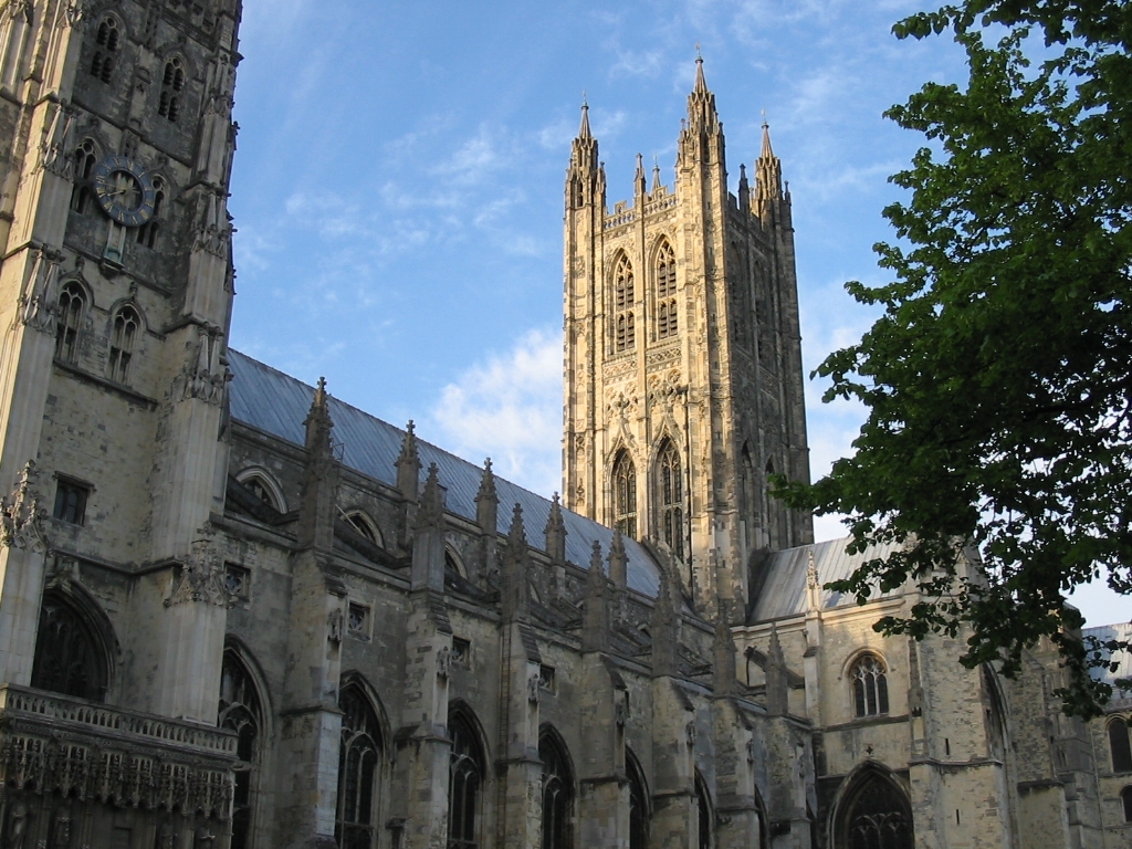 Canterbury Cathedral | |
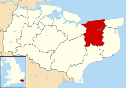 Canterbury shown within Kent | |
| Sovereign state | United Kingdom |
| Country | England |
| Region | South East England |
| Non-metropolitan county | Kent |
| Status | Non-metropolitan district, Borough, City |
| Admin HQ | Canterbury |
| Incorporated | 1 April 1974 |
| Government | |
| • Type | Non-metropolitan district council |
| • Body | Canterbury City Council |
| • Leadership | Committee system, Ben Fitter-Harding (Conservative) |
| • MPs | Rosie Duffield Roger Gale |
| Area | |
| • Total | 119.24 sq mi (308.84 km2) |
| • Rank | 131st (of 309) |
| Population (mid-2019 est.) | |
| • Total | 165,394 |
| • Rank | 118th (of 309) |
| • Density | 1,400/sq mi (540/km2) |
| • Ethnicity | 93.4% White 2.2% S.Asian 1.6% Chinese and other 1.4% Mixed Race |
| Time zone | UTC0 (GMT) |
| • Summer (DST) | UTC+1 (BST) |
| ONS code | 29UC (ONS) E07000106 (GSS) |
| OS grid reference | TR145575 |
| Website | www |
 | |
| Click the map for an interactive fullscreen view | |
History
The district was formed on 1 April 1974 by the merger of the existing city of Canterbury with the Whitstable and Herne Bay Urban Districts, and Bridge-Blean Rural District. The latter district entirely surrounded the city; the urban districts occupied the coastal area to the north.
Politics
Canterbury City Council | |
|---|---|
 | |
| History | |
| Founded | 1 April 1974 |
| Leadership | |
Lord Mayor | Anne Dekker, Conservative since 18 May 2022 |
Leader | |
| Structure | |
| Seats | 39 |
 | |
Political groups |
|
| Elections | |
Last election | 2 May 2019 |
Next election | 2023 |
| Meeting place | |
 | |
| Canterbury Guildhall (formerly the Church of the Holy Cross) | |
| Website | |
| www | |
Elections for to all seats on the city council are held every four years. After being under no overall control for a number of years, the Conservative party gained a majority in 2005 following a by election and defection from the Liberal Democrats.
Following the 2019 United Kingdom local elections the political composition of Canterbury council is as follows (2017 results follows by-elections):[3]
| Year | Conservative | Labour Party | Liberal Democrat | UKIP |
|---|---|---|---|---|
| 2019 | 23 | 10 | 6 | 0 |
| 2017 | 30 | 4 | 3 | 2 |
Meeting place
After the Church of the Holy Cross, which was commissioned by Archbishop Simon Sudbury and completed before his death in 1381,[4][5] was declared redundant and de-consecrated in 1972, it was acquired by the city council and converted for municipal use: it was officially re-opened by the Prince of Wales as the new Canterbury Guildhall and meeting place of the city council on 9 November 1978.[6]
Geography
Within the district are the towns of Herne Bay and Whitstable, which, with the rural parishes and the cathedral city itself, make up the district of the City of Canterbury. There are 26 parishes within the district, as follows:[7]
- Adisham
- Barham
- Bekesbourne-with-Patrixbourne
- Bishopsbourne
- Blean
- Bridge
- Chartham
- Chestfield
- Chislet
- Fordwich, which has town status
- Hackington
- Harbledown and Rough Common
- Herne and Broomfield
- Hoath
- Ickham
- Kingston
- Littlebourne
- Lower Hardres and Nackington
- Petham
- Sturry
- Thanington Without
- Upper Hardres
- Waltham
- Westbere
- Wickhambreaux
- Womenswold
Swalecliffe is an unparished area within the district.
The district is largely rural, with a coastal strip taken up by the almost unbroken spread of seaside towns and beaches from Seasalter, west of Whitstable, to Herne Bay. Between them and the city the hills rise into the wooded area of Blean, south of which the Great Stour flows from its source beyond Ashford.
Demography
| Ethnic Group | 1991[8] | 2001[9] | 2011[10] | |||
|---|---|---|---|---|---|---|
| Number | % | Number | % | Number | % | |
| White: Total | 121,942 | 98.4% | 130,700 | 96.6% | 140,620 | 93% |
| White: British | – | – | 125,289 | 92.6% | 132,269 | 87.5% |
| White: Irish | – | – | 1,338 | 1,260 | ||
| White: Gypsy or Irish Traveller | – | – | – | – | 374 | |
| White: Other | – | – | 4,073 | 3% | 6,717 | 4.4% |
| Asian or Asian British: Total | 1,086 | 0.9% | 1,964 | 1.5% | 5,135 | 3.4% |
| Asian or Asian British: Indian | 349 | 600 | 1,448 | |||
| Asian or Asian British: Pakistani | 34 | 77 | 306 | |||
| Asian or Asian British: Bangladeshi | 110 | 117 | 251 | |||
| Asian or Asian British: Chinese | 279 | 650 | 1,436 | |||
| Asian or Asian British: Other Asian | 314 | 520 | 1,694 | |||
| Black or Black British: Total | 409 | 0.3% | 610 | 0.5% | 1,937 | 1.3% |
| Black or Black British: Caribbean | 121 | 186 | 437 | |||
| Black or Black British: African | 149 | 384 | 1,338 | |||
| Black or Black British: Other Black | 139 | 40 | 162 | |||
| Mixed or British Mixed: Total | – | – | 1,362 | 1% | 2,551 | 1.7% |
| Mixed: White and Black Caribbean | – | – | 331 | 680 | ||
| Mixed: White and Black African | – | – | 134 | 305 | ||
| Mixed: White and Asian | – | – | 494 | 897 | ||
| Mixed: Other Mixed | – | – | 403 | 669 | ||
| Other: Total | 510 | 0.4% | 642 | 0.5% | 902 | 0.6% |
| Other: Arab | – | – | – | – | 405 | |
| Other: Any other ethnic group | 510 | 0.4% | 642 | 0.5% | 497 | |
| Total | 123,947 | 100% | 135,278 | 100% | 151,145 | 100% |

Twin towns
The district participates in the Sister Cities programme, with links[11] to Bloomington-Normal, Illinois, and Vladimir, Russia.
The Three Towns Association was founded in 1985 on the initiative of three local clergymen to promote person-to-person contact between ordinary people in the UK, the U.S. and Russia. The name was subsequently changed to the Three Cities Association. The Association chose Vladimir as the twin city in Russia because it is the seat of Christianity in that country as Canterbury is the seat of Christianity in England. Vladimir was already twinned with Bloomington-Normal. Among other activities, the Association arranged home-stay exchanges between the two Simon Langton Schools in Canterbury and School No. 23 in Vladimir, where the teaching was conducted in English.
Several towns and villages within the City of Canterbury have their own twinning arrangements:[11] see the articles on Canterbury, Whitstable and Herne Bay.
References
- "Canterbury". Collins Dictionary. n.d. Archived from the original on 23 September 2015. Retrieved 24 September 2014.
- "Ben Fitter-Harding". Canterbury City Council. Retrieved 27 June 2021.
- "Declaration of result of poll - Canterbury - Election of a City Councillor for Reculver on 5 May 2016" (PDF). Archived from the original (PDF) on 20 August 2016.
- Bax, Stephen (2000). "Canterbury buildings". Westgate Tower. Retrieved 28 January 2010.
- Historic England. "Church of the Holy Cross, Canterbury (1241661)". National Heritage List for England. Retrieved 8 November 2020.
- "Remember Prince is Freeman of City". Kentish Gazette. 14 February 2013.
- "Parish Councils". Canterbury City Council. 2008. Archived from the original on 15 August 2010. Retrieved 5 September 2010.
- Data is taken from United Kingdom Casweb Data services of the United Kingdom 1991 Census on Ethnic Data for England, Scotland and Wales (Table 6)
- "Office of National Statistics; 2001 Census Key Statistics". webarchive.nationalarchives.gov.uk. Retrieved 7 September 2021.
- "2011 Census: Ethnic Group, local authorities in England and Wales". webarchive.nationalarchives.gov.uk. Retrieved 15 December 2021.
- "Twinning contacts". Archived from the original on 21 July 2012. Retrieved 21 July 2012.
External links
- Canterbury City Council
- Population breakdown
- City of Canterbury councillors listed by ward, as of 2010
Towns and villages in the Canterbury district of Kent, England | ||
|---|---|---|
 |
| |
| ||
Districts of South East England | ||
|---|---|---|
| Berkshire |  | |
| Buckinghamshire |
| |
| East Sussex | ||
| Hampshire |
| |
| Isle of Wight | ||
| Kent | ||
| Oxfordshire | ||
| Surrey | ||
| West Sussex | ||
| |
| |
| Northern Ireland | |
| Authority control |
|
|---|
На других языках
[de] City of Canterbury
City of Canterbury ist ein Verwaltungsbezirk mit dem Status einer City in der Grafschaft Kent in England. Neben dem Verwaltungssitz Canterbury umfasst er auch die Städte Whitstable und Herne Bay sowie die Kleinstadt Fordwich.- [en] City of Canterbury
[ru] Сити-оф-Кентербери
Сити-оф-Кентербери (англ. City of Canterbury) — неметрополитенский район (англ. non-metropolitan district) со статусом «сити» в графстве Кент (Англия). Административный центр — город Кентербери.Другой контент может иметь иную лицензию. Перед использованием материалов сайта WikiSort.org внимательно изучите правила лицензирования конкретных элементов наполнения сайта.
WikiSort.org - проект по пересортировке и дополнению контента Википедии