world.wikisort.org - United_Kingdom
Woolage Village is a former mining village situated midway between Canterbury and Dover in the English county of Kent. It is 1 mile (1.6 km) to the east of the A2 road. Together with Womenswold and Woolage Green, it forms Womenswold parish.
| Woolage Village | |
|---|---|
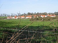
 View of Woolage Village | |
 Woolage Village Location within Kent | |
| OS grid reference | TR2350 |
| District |
|
| Shire county |
|
| Region |
|
| Country | England |
| Sovereign state | United Kingdom |
| Post town | Canterbury |
| Postcode district | CT4 |
| Police | Kent |
| Fire | Kent |
| Ambulance | South East Coast |
It consists of approximately 52 semi-detached houses built in 1912, to house miners and their families working at the nearby Snowdown Colliery. The village shop and post office was shut in the 1990s and converted to a dwelling.
External links
Wikimedia Commons has media related to Woolage Village.
Текст в блоке "Читать" взят с сайта "Википедия" и доступен по лицензии Creative Commons Attribution-ShareAlike; в отдельных случаях могут действовать дополнительные условия.
Другой контент может иметь иную лицензию. Перед использованием материалов сайта WikiSort.org внимательно изучите правила лицензирования конкретных элементов наполнения сайта.
Другой контент может иметь иную лицензию. Перед использованием материалов сайта WikiSort.org внимательно изучите правила лицензирования конкретных элементов наполнения сайта.
2019-2025
WikiSort.org - проект по пересортировке и дополнению контента Википедии
WikiSort.org - проект по пересортировке и дополнению контента Википедии
