world.wikisort.org - United_Kingdom
Gravesham (/ˈɡreɪvʃəm/ GRAYV-shəm) is a local government district with borough status in north-west Kent, England. Its administrative centre[1] and largest town is Gravesend, which was known as Gravesham in ancient times.
Gravesham
Borough of Gravesham | |
|---|---|
Borough & Non-metropolitan district | |
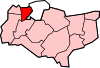
 Gravesham located within Kent | |
| Sovereign state | United Kingdom |
| Constituent country | England |
| Non-metropolitan county | Kent |
| Status | Borough |
| Admin HQ | Gravesend |
| Incorporated | 1 April 1974 |
| Government | |
| • Type | Non-metropolitan District Council |
| • Body | Gravesham Borough Council |
| • Leadership | Member of Parliament (Conservative) |
| • MP | Adam Holloway |
| Area | |
| • Total | 38.23 sq mi (99.02 km2) |
| • Rank | 216th (of 309) |
| Population (mid-2019 est.) | |
| • Total | 106,939 |
| • Rank | 223rd (of 309) |
| • Density | 2,800/sq mi (1,100/km2) |
| • Ethnicity | 87.8% White 8.5% S.Asian 1.4% Black 1.3% Mixed Race 1.0% Chinese or Other |
| Time zone | UTC0 (GMT) |
| • Summer (DST) | UTC+1 (BST) |
| ONS code | 29UG (ONS) E07000109 (GSS) |
| OS grid reference | TQ647740 |
| Website | www.gravesham.gov.uk |

Gravesham was formed on 1 April 1974 by the merger of the Municipal Borough of Gravesend with Northfleet Urban District and part of Strood Rural District, under the Local Government Act 1972. It borders the Borough of Dartford and Sevenoaks District to the west, the Borough of Tonbridge and Malling to the south, the Medway unitary authority to the east and the Thurrock unitary authority of Essex to the north, via the River Thames.
Gravesham is twinned with Cambrai in Hauts-de-France, France. The present borders of Gravesham parliamentary constituency are almost the same as those of the borough.
History
Robert Heath Hiscock LL.B., F.S.A., Chairman of the Gravesend Historical Society, in the foreword to his book, 'A History of Gravesend' (Phillimore, 1976) wrote:
- "The name Gravesham appears only in the Domesday Book, 1086, and was probably the error of a Norman scribe. It was 'Gravesend' in the Domesday Monarchorum c.1100, and 'Gravesende' in the Textus Roffensis c. 1100. It is strange that this "clerical error" should now have been adopted as the name of the new Council".
Housing and architecture
Housing varies from mid rise to low rise, particularly in the villages. The district has 12 buildings listed in the highest category of the national grading system, Grade I, three of which are private residences:
- Gadshill Place in Higham
- Luddesdown Court in Luddesdown
- Nurstead Court in Meopham
Cobham Hall, also in the highest architectural category,[2] is a stately home which was formerly the seat of the Earls of Darnley: since 1965 it has been an independent girls' school. Cobham Park is Grade II*-listed which is listed separately in the gardens and parklands category of classification approved by the Department of Culture, Media and Sport;[3] and includes the remains of a Roman villa.[2][4]
The other Grade I-listed buildings in the borough comprise its ancient parish churches.
Governance
Gravesham Borough Council | |
|---|---|
 | |
| Leadership | |
Leader | John Burden, Labour since 16 May 2019 |
| Seats | 44 councillors |
| Elections | |
Voting system | First past the post |
| Meeting place | |
| Civic Centre, Windmill Street, Gravesend, DA12 1AU | |
| Website | |
| www | |
Wards
There are eighteen wards represented on the borough council:
- Those serving Gravesend town:
- Central
- Pelham
- Riverside
- Singlewell
- Whitehill
- Woodlands
- Other urban areas:
- Northfleet (2 wards - North & South)
- Coldharbour
- Istead Rise
- Painters Ash
- Riverview
- Westcourt
- Outlying villages:
Elections
Gravesham Borough Council is elected every four years, with currently 44 Councillors being elected at each election. From the first election in 1973 the council has alternated between Labour and Conservative control. Since 1995 Labour has controlled the council apart from 4 years between the 2007 and 2011 elections. As of the 2019 election the council is composed as follows:[5]
| Party | Councillors | |
| Conservative Party | 18 | |
| Labour Party | 24 | |
| Independents | 2 | |
See also
- List of civil parishes in Kent
References
- Reserved, Gravesham Borough Council - All Rights (1 January 2016). "Home". www.gravesham.gov.uk.
- Historic England. "Cobham Hall (1000182)". National Heritage List for England. Retrieved 1 June 2014.
- "Gravesham Listed Building Guidance Notes". Archived from the original on 21 December 2014. Retrieved 21 December 2014.
- Historic England. "Romano-British villa and 19th century reservoir in Cobham Park (1012964)". National Heritage List for England. Retrieved 1 June 2014.
- "England council elections". BBC News Online. 10 May 2011. Retrieved 27 September 2011.
External links
Towns and villages in the Borough of Gravesham | ||
|---|---|---|
 |
| |
List of places in Kent | ||
Districts of South East England | ||
|---|---|---|
| Berkshire |  | |
| Buckinghamshire |
| |
| East Sussex | ||
| Hampshire |
| |
| Isle of Wight | ||
| Kent | ||
| Oxfordshire |
| |
| Surrey | ||
| West Sussex | ||
На других языках
[de] Gravesham
Gravesham ist ein Borough (Verwaltungsbezirk) im nordwestlichen Teil von Kent, England östlich von Greater London. Es liegt am südlichen Ufer der Themse gegenüber Tilbury (Essex). Im Bezirk leben etwa 95.000 Einwohner, davon zwischen 8 und 9 % asiatischer Abstammung. Die Fläche beträgt 99,02 km². Die Verwaltung hat ihren Sitz in Gravesend, in seiner jetzigen Form besteht der Bezirk seit einer Gebietsreform im Jahre 1974.- [en] Gravesham
[ru] Грейвшем
Грейвшем (англ. Gravesham) — неметрополитенский район (англ. non-metropolitan district) со статусом боро в графстве Кент (Англия). Административный центр — город Грейвзенд.Другой контент может иметь иную лицензию. Перед использованием материалов сайта WikiSort.org внимательно изучите правила лицензирования конкретных элементов наполнения сайта.
WikiSort.org - проект по пересортировке и дополнению контента Википедии