world.wikisort.org - United_Kingdom
Sevenoaks is a local government district[1] in west Kent, England. Its council is based in the town of Sevenoaks.
Sevenoaks | |
|---|---|
Non-metropolitan district | |
 Sevenoaks shown within Kent | |
| Sovereign state | United Kingdom |
| Constituent country | England |
| Region | South East England |
| Non-metropolitan county | Kent |
| Status | Non-metropolitan district |
| Admin HQ | Sevenoaks |
| Incorporated | 1 April 1974 |
| Government | |
| • Type | Non-metropolitan district council |
| • Body | Sevenoaks District Council |
| • Leadership | Leader & Cabinet (Conservative) |
| • MPs | Laura Trott Gareth Johnson Tom Tugendhat |
| Area | |
| • Total | 142.99 sq mi (370.34 km2) |
| • Rank | 107th (of 309) |
| Population (mid-2019 est.) | |
| • Total | 120,750 |
| • Rank | 193rd (of 309) |
| • Density | 840/sq mi (330/km2) |
| • Ethnicity | 95.2% White 1.5% S.Asians 1.2% Black 1.2% Mixed Race |
| Time zone | UTC0 (GMT) |
| • Summer (DST) | UTC+1 (BST) |
| ONS code | 29UK (ONS) E07000111 (GSS) |
| OS grid reference | TQ525555 |
| Website | www |
The district was formed on 1 April 1974 by the merger of Sevenoaks Urban District, Sevenoaks Rural District and part of Dartford Rural District.
Geography
The area is approximately evenly divided between buildings and infrastructure on the one hand and woodland or agricultural fields on the other. It contains the upper valley of the River Darenth and some headwaters of the River Eden.
The vast majority of the district is covered by the Metropolitan Green Belt.
In terms of districts, it borders Dartford to the north, Gravesham to the northeast, Tonbridge and Malling to the east, briefly Tunbridge Wells to the southeast. It also borders two which, equal to it, do not have borough status, the Wealden district of East Sussex to the south and the Tandridge district of Surrey to the southwest. It borders the London Boroughs of Bromley and Bexley to the northwest.
In the 2011 Census, the district had a population of 114,893.[2]
Council
Sevenoaks District Council | |
|---|---|
 | |
| Type | |
| Type | Non-metropolitan district council |
| Leadership | |
Leader | Peter Fleming, Conservative since 10 May 2005 |
| Structure | |
| Seats | 54 |
Political groups | Administration (45)
Opposition (10)
|
| Elections | |
Last election | 2 May 2019 |
| Meeting place | |
| Council Offices, Argyle Road, Sevenoaks, TN13 1HG | |
| Website | |
| https://www.sevenoaks.gov.uk/ | |
The third tier of government within the district consists of the following town and parish councils:
Elections and political control
The council consists of 54 elected councillors.[3]
As of the 2019 election and subsequent by-elections,[4] the political makeup of the council is:
- Administration
- Conservative (45)
- Other parties
- Liberal Democrat (4)
- Hextable Independents (2)
- Independent (2)
- Labour (1)
Audit
In 2009 the Audit Commission named Sevenoaks District Council as one of the four best-run and most efficient councils in the country.[5]
Premises
The council is based at the Council Offices on Argyle Road. The offices were built for the council on the site of a large house which had served as the offices of one of the council's predecessors, the Sevenoaks Urban District Council. The new building was formally opened on 3 March 1986.[6]
Housing and architecture
The layout of the district is dual-centred:
- A well-buffered suburban town itself, which spreads into suburban villages (St Johns, Riverhead, Dunton Green, Sevenoaks Weald).
- Swanley and smaller, equally buffered Hextable and Crockenhill within the M25 motorway.
In all areas low-rise dominates: the incidence of flats exceeding two storeys is rare.
The number of listed buildings in the district exceeds 150. This includes 16 churches listed in the highest grading in the national listing system (Grade I). Castles and English country houses of the wealthiest in society from the 16th to 18th centuries form part of this district.
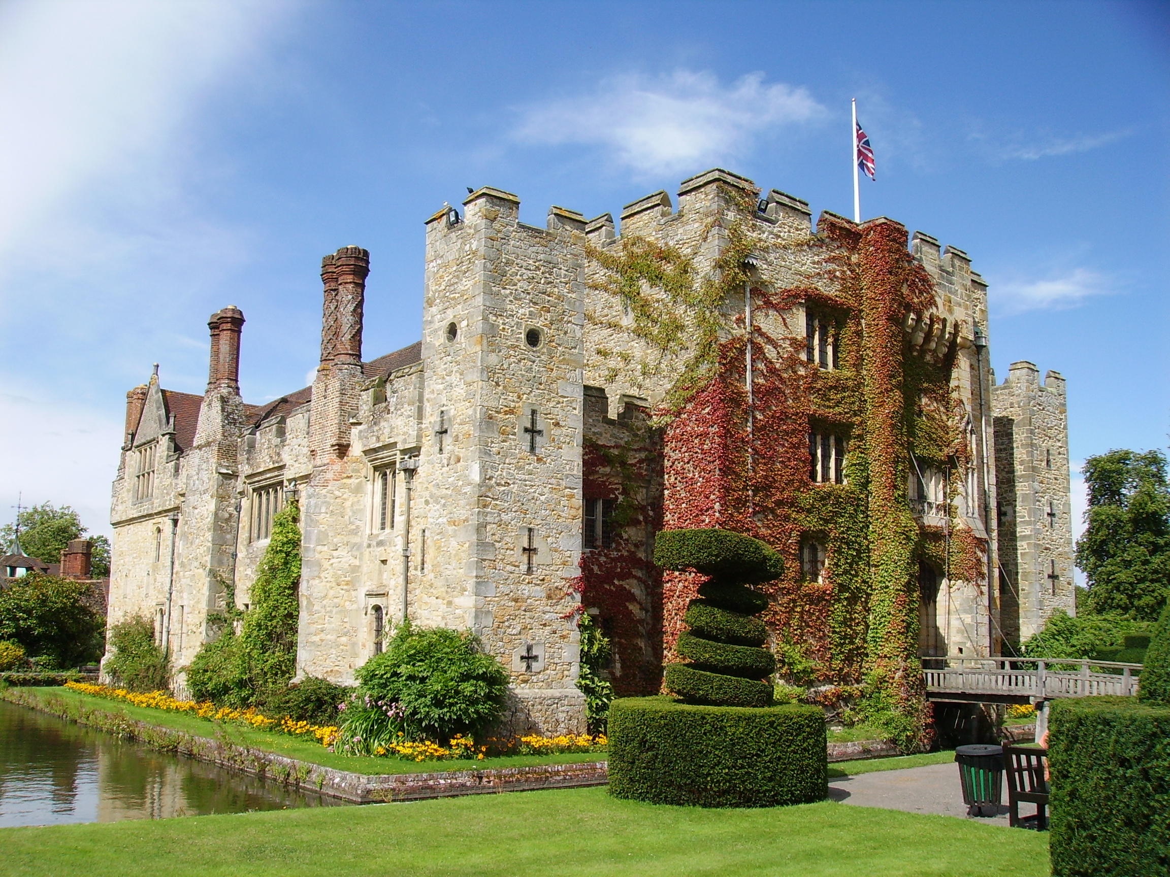
Examples at Grade I include Knole House, Chartwell, Penshurst Place and Chevening House, most of which have their own produce-selling farms. Older with original stone walls are Hever Castle with its 16 acres (6.5 ha)-wooded island in a listed parkland. A folly exists at Lullingstone Castle which is a reconstruction of its gatehouse and separate modern house.[7]
See also
- List of places of worship in Sevenoaks District
References
- District Council website
- "2011 Census profile: Age and gender profile (unrounded)" (PDF). Kent County Council. Retrieved 28 March 2014.
- List of Council members Archived 2009-02-12 at the Wayback Machine
- "Councils Map | LocalCouncils.co.uk".
- Sevenoaks District Council : 9 December 2009 : Sevenoaks Tops National Performance League Table Retrieved 22 August 2010
- "New offices... Plenty of room in council's new home". Sevenoaks Chronicle. 7 March 1986. p. 11. Retrieved 25 July 2022.
- Hever CastleHistoric England. "Details from listed building database (1273465)". National Heritage List for England. Retrieved 30 May 2014.
Towns and villages in the Sevenoaks District, Kent, England | ||
|---|---|---|
 |
| |
List of places in Kent | ||
Districts of South East England | ||
|---|---|---|
| Berkshire |  | |
| Buckinghamshire |
| |
| East Sussex | ||
| Hampshire |
| |
| Isle of Wight | ||
| Kent | ||
| Oxfordshire |
| |
| Surrey | ||
| West Sussex | ||
На других языках
[de] Sevenoaks District
Sevenoaks ist ein District in der Grafschaft Kent in England. Verwaltungssitz ist Sevenoaks; weitere bedeutende Orte sind Ash-cum-Ridley, Brasted, Edenbridge, Farningham, Knockholt, Otford, Seal, Swanley und Westerham.- [en] Sevenoaks District
[ru] Севенокс (район)
Севенокс (англ. Sevenoaks) — неметрополитенский район (англ. non-metropolitan district) в графстве Кент (Англия). Административный центр — город Севенокс.Другой контент может иметь иную лицензию. Перед использованием материалов сайта WikiSort.org внимательно изучите правила лицензирования конкретных элементов наполнения сайта.
WikiSort.org - проект по пересортировке и дополнению контента Википедии