world.wikisort.org - United_Kingdom
The Borough of Warrington is a unitary authority area with borough status in the ceremonial county of Cheshire, North West England. The borough is centered around the town of Warrington, and extends out into outlying areas such as Lymm, Great Sankey, and Birchwood. The borough is geographically located to the north and northeast of the Cheshire West and Chester and Halton districts in Cheshire, the metropolitan borough of St Helens in Merseyside to the northwest and north and the metropolitan boroughs of Wigan and Trafford in Greater Manchester to the northeast, east, and southeast. Additionally, to the south-east, the borough borders Cheshire East. The borough is also located between the cities of Liverpool, Salford, Manchester, Chester and Preston. The district straddles the historic counties of Cheshire (the South part of the district includes Lymm and Stockton Heath) and Lancashire (the North part including Warrington itself and Latchford).
Borough of Warrington | |
|---|---|
Borough and unitary authority area | |
 Aerial view of Warrington | |
| Motto(s): Latin: Deus Dat Incrementum (God giveth the increase) | |
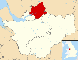 Shown within Cheshire | |
 Borough of Warrington Shown within the United Kingdom  Borough of Warrington Shown within England Borough of Warrington Shown within Europe | |
| Coordinates: 53°23′30″N 2°35′50″W | |
| Sovereign state | |
| Constituent country | |
| Region | North West England |
| Ceremonial county | Cheshire |
| Historic county | Lancashire (North of the Mersey), Cheshire (South of the Mersey) |
| Founded | 1 April 1974 |
| Unitary authority | 1 April 1998 |
| Administrative HQ | Warrington (Town Hall) |
| Government | |
| • Type | Unitary authority |
| • Body | Warrington Borough Council |
| • Leadership | Leader and cabinet |
| • Executive | Labour |
| • Mayor | Jean Flaherty |
| • MPs | Charlotte Nichols (L) Andy Carter (C) |
| Area | |
| • Borough | 69.7 sq mi (180.6 km2) |
| • Rank | 167th |
| Population (mid-2019 est.) | |
| • Borough | 210,014 |
| • Rank | 88th |
| • Density | 3,000/sq mi (1,160/km2) |
| • Ethnicity | 92.9% White British 2.5% Asian |
| Demonym | Warringtonian[1] |
| Time zone | UTC+0 (Greenwich Mean Time) |
| • Summer (DST) | UTC+1 (British Summer Time) |
| Postcode area | |
| Dialling code | 01925 |
| ISO 3166 code | GB-WRT |
| GSS code | E06000007 |
| NUTS 3 code | UKD21 |
| ONS code | 00EU |
| OS grid reference | SJ605885 |
| Website | warrington |
Civil parishes
The borough contains the unparished area of Warrington and 18 civil parishes:[2]
- Appleton
- Birchwood (Town Council)[3]
- Burtonwood and Westbrook
- Croft
- Cuerdley
- Culcheth and Glazebury
- Grappenhall and Thelwall
- Great Sankey
- Hatton
- Lymm
- Penketh
- Poulton-with-Fearnhead
- Rixton-with-Glazebrook
- Stockton Heath
- Stretton
- Walton
- Winwick
- Woolston
History
The borough was historically split between the historic counties of Cheshire and Lancashire,[4][5][6] the whole borough (north of the River Mersey) is within the historic boundaries of the county of Lancashire which includes the town of Warrington, and the areas of Latchford, Great Sankey, Culcheth, Glazebury, Burtonwood and Birchwood.
At the same time, the whole part of the borough (south of the River Mersey) is within the historic boundaries of the county of Cheshire which includes the villages of Lymm, Stockton Heath, Appleton Thorn and Stretton. These remain in the same county now unchanged by the reforms. In 1974, following the local government reforms which saw many old counties and districts abolished and new counties or districts were created. Warrington along with the neighboring town of Widnes was moved into the county of Cheshire which saw the entire area from the border with Speke/Widnes to Glazebury/Cadishead moved into the county of Cheshire. The current borough was formed from the County Borough of Warrington, the wards of Culcheth and Newchurch in Golborne Urban District, Warrington Rural District and part of the parish of Bold in Whiston Rural District, in Lancashire and Lymm Urban District and the parishes of Appleton, Grappenhall, Hatton, Stockton Heath, Stretton and Walton from Runcorn Rural District in Lancashire.[7] The M62 motorway forms a border with both Greater Manchester and Merseyside.[8]
The borough became a unitary authority in 1998 alongside Halton[9] making it separate from the-then Cheshire County Council before the 2009 restructuring of local government which saw the county council abolished and replaced by two new unitary authorities, Cheshire East and Cheshire West (and Chester). All four unitary authorities still form Cheshire for ceremonial purposes and share local services.[10][11]
References
- Gary Jenkins (Senior Communications Officer, Warrington Borough Council). "Tribute to famous Warringtonian Joseph Priestley". Warrington Borough Council Smartnews. NB: In addition to verifying the notability of J Priestley, this reference demonstrates the use of the term Warringtonian. Archived from the original on 19 August 2007. Retrieved 7 November 2006.
- "Warrington". Ordnance Survey. Retrieved 2 June 2022.
- "Birchwood Town Council | Warrington | Cheshire". www.birchwoodtowncouncil.org.uk. Retrieved 30 May 2022.
- "Council rules out new signs to show town 'located' in Lancashire". Warrington Guardian. Retrieved 30 May 2022.
- "Old Maps of Warrington history". www.alangodfreymaps.co.uk. Retrieved 30 May 2022.
- "History of Warrington in Lancashire". A Vision of Britain Through Time. A Vision of Britain Through Time. Retrieved 30 May 2022.
- "The English Non-metropolitan Districts (Definition) Order 1972". legislation.gov.uk. Retrieved 2 June 2022.
- "Genuki: Warrington Parish Boundaries, Lancashire". www.genuki.org.uk. Retrieved 31 May 2022.
- "The Cheshire (Boroughs of Halton and Warrington) (Structural Change) Order 1996". legislation.gov.uk. Retrieved 2 June 2022.
- Fire, Cheshire. "Unitary Performance Area Profiles". Cheshire Fire and Rescue Service. Retrieved 31 May 2022.
- Norbury, David (13 October 2018). "Have Cheshire's Unitary Authorities worked?". CheshireLive. Retrieved 31 May 2022.
External links
- . Encyclopædia Britannica. Vol. 28 (11th ed.). 1911. p. 332.
- Warrington Borough Council
| Unitary authorities | |
|---|---|
| Major settlements |
|
| Rivers | |
| Topics |
|
Districts of North West England | ||
|---|---|---|
| Cheshire |  | |
| Cumbria |
| |
| Greater Manchester | ||
| Lancashire | ||
| Merseyside | ||
| Districts |
|  |
|---|---|---|
| Councils |
| |
| Local elections |
| |
На других языках
[de] Borough of Warrington
Das Borough of Warrington ist eine selbständige Verwaltungseinheit (Unitary Authority) im Nordwesten Englands, das zur Region North West England gehört. Der Verwaltungssitz befindet sich in der Stadt Warrington. Neben dem Gebiet des ehemaligen County Boroughs Warrington, welches keine eigenständige Gemeindeverwaltung besitzt, gibt es in der Unitary Authority 18 Gemeinden (civil parishes): Appleton, Birchwood, Burtonwood and Westbrook, Croft, Cuerdley, Culcheth and Glazebury, Grappenhall and Thelwall, Great Sankey, Hatton, Lymm, Penketh, Poulton-with-Fearnhead, Rixton-with-Glazebrook, Stockton Heath, Stretton, Walton, Winwick, Woolston.- [en] Borough of Warrington
Другой контент может иметь иную лицензию. Перед использованием материалов сайта WikiSort.org внимательно изучите правила лицензирования конкретных элементов наполнения сайта.
WikiSort.org - проект по пересортировке и дополнению контента Википедии