world.wikisort.org - United_Kingdom
Ribble Valley is a local government district with borough status within the non-metropolitan county of Lancashire, England. The total population of the non-metropolitan district at the 2011 Census was 57,132.[2] Its council is based in Clitheroe. Other places include Whalley, Longridge and Ribchester. The area is so called due to the River Ribble which flows in its final stages towards its estuary near Preston. The area is popular with tourists who enjoy the area's natural unspoilt beauty, much of which lies within the Forest of Bowland.
This article needs additional citations for verification. (May 2020) |
Borough of Ribble Valley | |
|---|---|
Borough | |
Beacon Hill overlooking Ribble Valley | |
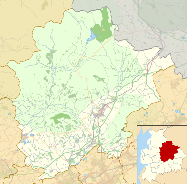
 Ribble Valley shown within Lancashire and England | |
| Sovereign state | United Kingdom |
| Constituent country | England |
| Region | North West England |
| Ceremonial county | Lancashire |
| Historic county | Lancashire and West Riding |
| Admin. HQ | Clitheroe |
| Government | |
| • Type | Ribble Valley Borough Council |
| • Leadership: | Alternative – Sec.31 |
| • Executive: | Conservative |
| • MPs: | Nigel Evans |
| Area | |
| • Total | 225.2 sq mi (583.2 km2) |
| • Rank | 74th |
| Population (mid-2019 est.) | |
| • Total | 60,888 |
| • Rank | Ranked 304th |
| • Density | 270/sq mi (100/km2) |
| Time zone | UTC+0 (Greenwich Mean Time) |
| • Summer (DST) | UTC+1 (British Summer Time) |
| ONS code | 30UL (ONS) E07000124 (GSS) |
| Ethnicity | 95.8% White 2.5% S. Asian[1] |
| Website | ribblevalley.gov.uk |
The district was formed on 1 April 1974 under the Local Government Act 1972, as a merger of the municipal borough of Clitheroe, Longridge urban district, Clitheroe Rural District, part of Blackburn Rural District, part of Burnley Rural District, and part of Preston Rural District, as well as the Bowland Rural District from the West Riding of Yorkshire, hence the addition of the Red Rose of Lancaster and White Rose of York on the council's coat of arms.
Governance
Elections to the borough council are held every four years, with all of the 40 seats on the council being filled at each election. After being under no overall control for a number of years, the Conservative party gained a majority at the 2003 election, when boundary changes saw the number of councillors increase by one.
Following the 2011 United Kingdom local elections and subsequent by-elections,[3][4] the political composition of Ribble Valley Borough Council is as follows:
| Year | Conservative | Liberal Democrat | Independent |
|---|---|---|---|
| 2013 | 33 | 6 | 1 |
Education
State-funded schools
Primary
See List of schools in Lancashire § Ribble Valley
Secondary
- Bowland High School, Grindleton
- Clitheroe Royal Grammar School
- Longridge High School
- Ribblesdale High School, Clitheroe
- St Augustine's RC High School, Billington
- St Cecilia's RC High School, Longridge
Specialist
- Hillside Specialist School, Longridge
Independent schools
- Stonyhurst Saint Mary's Hall, Hurst Green (preparatory)
- Moorland School, Clitheroe
- Oakhill School, Whalley
- Stonyhurst College, Hurst Green
Adult education
- Alston Hall, Longridge
Sport
- Clitheroe FC
Local radio
Community radio
Ribble Valley Radio was a community radio station based in Clitheroe, part of the new, third sector of local radio licensed by OFCOM.[5] The project was launched in September 2004. The radio station helped six local residents into paid work within the radio sector in just three years and trained more than 100 volunteers to present and produce their own radio shows. The project was not supported by the Borough Council, which caused controversy in the area, and local newspaper the Clitheroe Advertiser and Times' held a poll which returned the result that 94% agreed that the Ribble Valley Borough Council were wrong not to fund the project and assist its long-term success. Many letters appeared in support of the project and damning the "short sighted" decision of the council. The whole episode brought excellent publicity and boosted the radio station's listening figures by 400%.
MP Nigel Evans was a staunch supporter and tabled an Early Day Motion at Parliament EDM 979[6] calling for "better resources and funding" for Ribble Valley Radio and the new and emerging sector. None of this was sufficient to save the station and on 14 October 2007 Ribble Valley Radio closed, because it was unable to gain sufficient funding to apply for a licence.[7]
A new group, known as Ribble FM,[8] was formed in 2011 with the aim of applying for a community radio licence in the third round of licensing by Ofcom. Ribble FM was set up by The Bee founder Roy Martin and includes local directors and trustees.
Neighbouring districts
Places adjacent to Ribble Valley | ||||||||||||||||
|---|---|---|---|---|---|---|---|---|---|---|---|---|---|---|---|---|
| ||||||||||||||||
Settlements
Civil parishes

- Aighton, Bailey and Chaigley
- Balderstone
- Bashall Eaves
- Billington and Langho
- Bolton-by-Bowland
- Bowland Forest High
- Bowland Forest Low
- Bowland-with-Leagram
- Chatburn
- Chipping
- Clayton-le-Dale
- Clitheroe
- Dinckley
- Downham
- Dutton
- Easington
- Gisburn
- Gisburn Forest
- Great Mitton
- Grindleton
- Horton
- Hothersall
- Little Mitton
- Longridge
- Mearley
- Mellor
- Middop
- Newsholme
- Newton
- Osbaldeston
- Paythorne
- Pendleton
- Ramsgreave
- Read
- Ribchester
- Rimington
- Sabden
- Salesbury
- Sawley
- Simonstone
- Slaidburn
- Thornley-with-Wheatley
- Twiston
- Waddington
- West Bradford
- Whalley
- Wilpshire
- Wiswell
- Worston
Economy
Although Ribble Valley is the largest area of Lancashire, it also has the smallest population. The economy of Ribble Valley is mainly rural in nature, with a high proportion of jobs being in the private sector, due to BAE there is a bigger sway towards manufacturing jobs and less of a service economy when compared to the rest of Lancashire presumably due to the size of the authority and the dispersed nature of settlements. The authority also has the highest proportion of remote workers in Lancashire.[9]
Notable businesses
- BAE Systems and Spirit Aerosytems at Samlesbury Aerodrome
Freedom of the Borough
The following people and military units have received the Freedom of the Borough of Ribble Valley.
This list is incomplete; you can help by adding missing items. (May 2022) |
Military Units
- The 14th/20th King's Hussars: 24 August 1992.[10]
- The King's Royal Hussars: 2 December 1992.[11][12]
- The Duke of Lancaster's Regiment: 10 March 2011.[13]
References
- Neighbourhood Statistics: Ribble Valley
- "Non-Metropolitan district population 2011". Retrieved 20 January 2016.
- Ribble Valley Borough Council (17 November 2011). "Result of Poll Salthill Ward of Ribble Valley Borough Council | Ribble Valley Borough Council". Ribblevalley.gov.uk. Retrieved 16 May 2020.
- Ribble Valley Borough Council (4 July 2013). "Building Control Video Guides | Home Owner Video Guides | Ribble Valley Borough Council". Ribblevalley.gov.uk. Retrieved 16 May 2020.
- http://www.ofcom.org.uk/radio/ Archived 2009-07-10 at the Wayback Machine ofcom.org.uk
- http://edmi.parliament.uk/EDMi/EDMDetails.aspx?EDMID=32699&SESSION=885 edmi.parliament.uk
- Radio station closes due to funding problems Archived 2008-02-23 at Wikiwix
- "Home". Ribble FM. 16 May 2020. Retrieved 16 May 2020.
- "District Profile – Ribble Valley". Lancashire County Council. Archived from the original on 6 October 2014. Retrieved 3 October 2014.
- "Cavalry regiment parades through Leyland". The Lancashire Telegraph. Retrieved 16 May 2022.
- "King's Royal Hussars homecoming parade in Leyland". BBC News Lancashire. Retrieved 16 May 2022.
- "Flag waving public line the route for Freedom parade". The Lancashire Evening Post. Retrieved 16 May 2022.
- "Duke of Lancaster's Regiment's freedom of Ribble Valley". BBC News Lancashire. Retrieved 16 May 2022.
Districts of North West England | ||
|---|---|---|
| Cheshire |  | |
| Cumbria |
| |
| Greater Manchester | ||
| Lancashire |
| |
| Merseyside | ||
На других языках
- [en] Ribble Valley
[ru] Риббл-Вэлли
Риббл-Вэлли (англ. Ribble Valley) — район (англ. non-metropolitan district) в церемониальном неметрополитенском графстве Ланкашир, административный центр — город Клайтеро.Другой контент может иметь иную лицензию. Перед использованием материалов сайта WikiSort.org внимательно изучите правила лицензирования конкретных элементов наполнения сайта.
WikiSort.org - проект по пересортировке и дополнению контента Википедии