world.wikisort.org - United_Kingdom
Barrow-in-Furness is a local government district with borough status in Cumbria, England. It is named after its main town, Barrow-in-Furness. Other settlements include Dalton-in-Furness and Askam-in-Furness. It is the smallest district in the county, but is the most densely populated, with 924 people per square kilometre. The population was 71,980 in 2001,[1] reducing to 69,087 at the 2011 Census.[2]
Borough of Barrow-in-Furness | |
|---|---|
Borough and Non-metropolitan district | |
 Skyline of Barrow-in-Furness | |
 Coat of arms Logo | |
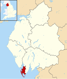 Shown within Cumbria | |
| Coordinates (Barrow-In-Furness Town Centre): 54.11155°N 3.22614°W | |
| Sovereign state | United Kingdom |
| Constituent country | England |
| Region | North West England |
| Ceremonial county | Cumbria |
| Historic county | Lancashire |
| Admin. HQ | Barrow Town Hall, Barrow-in-Furness |
| Government | |
| • Type | Barrow-in-Furness Borough Council |
| • Leadership: | Alternative – Sec.31 |
| • MPs: | Simon Fell |
| Area | |
| • Total | 30.11 sq mi (77.98 km2) |
| • Rank | 242nd |
| Population (mid-2019 est.) | |
| • Total | 67,049 |
| • Rank | Ranked 300th |
| • Density | 2,200/sq mi (860/km2) |
| Time zone | UTC+0 (Greenwich Mean Time) |
| • Summer (DST) | UTC+1 (British Summer Time) |
| Area code | 01229 |
| ONS code | 16UC (ONS) E07000027 (GSS) |
| Ethnicity (2011) | 97.1%% White British 0.9% White Other 0.9% Asian 0.5% Mixed Race 0.1% Black 0.1% Other |
| Website | www |
In July 2021 the Ministry of Housing, Communities and Local Government announced that in April 2023, Cumbria will be reorganised into two unitary authorities.[3] Barrow-in-Furness Borough Council is to be abolished and its functions transferred to a new authority, to be known as Westmorland and Furness, which will cover the current districts of Barrow-in-Furness, Eden and South Lakeland.[4]
In April 2022 Gareth Davies became the first person to run every single street in the Borough of Barrow-In-Furness. Covering all 1,026 streets over an end to end distance of 201 miles.
Background
The area covered by the district is at the edge of the Furness peninsula. It jolts into the Irish Sea, being north of Morecambe Bay and south of the Duddon Estuary. The current borough was formed on 1 April 1974 by the merger of the former county borough of Barrow-in-Furness and the Dalton-in-Furness urban district from the administrative county of Lancashire. Despite being one of England's smallest local authorities it has a coastline of 63 km and has equally diverse built and natural environments. This includes 274 Listed buildings and four SSSIs, ranking as the seventh highest concentration of 325 districts on the English Heritage Index.[5]
Barrow Borough Council
Barrow-in-Furness Borough Council sits at the Town Hall in Barrow. It is led by a mayor, who is elected by council members. In 2006, the Council was fined £125,000 for violation of health and safety laws that led to the deaths of seven people in the United Kingdom's worst outbreak of Legionnaires' disease.[clarification needed] The council also became the UK's first public body to be charged with corporate manslaughter, but was found not guilty.[6]
Following boundary changes in 2008,[7] the council is composed of 36 seats, elected across 13 wards. From 2011 the council has switched from the previous system of elections occurring over a four-year cycle, with a third of seats elected each year and one 'fallow' year, to one where full council elections occur every four years.[8]
Since its inception in 1973, the council has often been under Labour control, most recently from the 2011 election, but with three years of Conservative control (1976–1979) and ten years of no overall control (most recently from 2006 to 2011).[9]
Current Composition
As of 2021[10]
| Affiliation | Members | |
| Labour Party | 24 | |
| Conservative Party | 12 | |
Council wards
The Borough of Barrow-in-Furness comprises thirteen electoral wards, all of which can be seen on the map below.


![]()
South
Freedom of the Borough
The following people and military units have received the Freedom of the Borough of Barrow-in-Furness.
This list is incomplete; you can help by adding missing items. (October 2022) |
Individuals
- Margaret Burrow MBE: 25 September 2022.[11]
Military Units
References
- UK Census (2001). "Local Area Report – Barrow-in-Furness Local Authority (E07000027)". Nomis. Office for National Statistics. Retrieved 27 March 2021.
- UK Census (2011). "Local Area Report – Barrow-in-Furness Local Authority (E07000027)". Nomis. Office for National Statistics. Retrieved 27 March 2021.
- "Next steps for new unitary councils in Cumbria, North Yorkshire and Somerset". GOV.UK. Retrieved 1 January 2022.
- "Local Government Reorganisation. Delivering Two New Councils for Cumbria". Retrieved 1 January 2022.
- "Explore the Heritage Index for England". The Royal Society for the Encouragement of Arts, Manufactures and Commerce. Retrieved 24 September 2015.
- "How Legionnaires' struck Barrow". 31 July 2006. Retrieved 22 July 2022.
- "The Borough of Barrow-in-Furness (Electoral Changes) Order 2008". Government of the United Kingdom. Retrieved 22 July 2022.
- "Whole Council Elections". Barrow Borough Council. Archived from the original on 27 September 2011. Retrieved 25 June 2011.
- "England council elections". BBC News. Retrieved 25 June 2011.
- "Your Councillors". 23 December 2021.
- Young, Ambrose (25 September 2022). "Margaret Burrow MBE awarded the Freedom of Barrow". The North-West Evening Mail. Retrieved 2 October 2022.
- "Submariners to exercise Freedom of Barrow". United Kingdom Ministry of Defence. 8 June 2016. Retrieved 2 October 2022.
- "Submariners exercise the Freedom of the Borough of Barrow". United Kingdom Ministry of Defence. 13 June 2016. Retrieved 2 October 2022.
|  | |
| ||
Districts of North West England | ||
|---|---|---|
| Cheshire |  | |
| Cumbria |
| |
| Greater Manchester | ||
| Lancashire | ||
| Merseyside | ||
На других языках
[de] Borough of Barrow-in-Furness
Barrow-in-Furness ist ein District mit dem Status eines Borough in der Grafschaft Cumbria in England, der die Halbinsel Furness umfasst. Verwaltungssitz ist die gleichnamige Stadt Barrow-in-Furness, in der mehr als drei Viertel der Bevölkerung lebt. Ebenfalls zum Bezirk gehören Askam-in-Furness und Ireleth, Dalton-in-Furness und Roose.- [en] Borough of Barrow-in-Furness
[ru] Барроу-ин-Фернесс (район)
Барроу-ин-Фернесс (англ. Barrow-in-Furness) — район (англ. non-metropolitan district) в неметрополитенском графстве Камбрия, административный центр и главный город — Барроу-ин-Фернесс.Другой контент может иметь иную лицензию. Перед использованием материалов сайта WikiSort.org внимательно изучите правила лицензирования конкретных элементов наполнения сайта.
WikiSort.org - проект по пересортировке и дополнению контента Википедии