world.wikisort.org - United_Kingdom
Argyll (/ɑːrˈɡaɪl/; archaically Argyle, Earra-Ghàidheal in modern Gaelic, pronounced [ˈaːrˠəɣɛː.əl̪ˠ]), sometimes called Argyllshire, is a historic county and registration county of western Scotland.
Argyll
Earra-Ghàidheal | |
|---|---|
Historic county | |
 | |
| Coordinates: 56°15′N 5°15′W | |
| Sovereign state | |
| Country | |
| County town | Inveraray |
| Area | |
| • Total | 3,110 sq mi (8,055 km2) |
| Ranked 2nd of 34 | |
| Chapman code | ARL |

Argyll is of ancient origin, and corresponds to most of the part of the ancient kingdom of Dál Riata on Great Britain. Argyll was also a medieval bishopric with its cathedral at Lismore, as well as an early modern earldom and dukedom, the Dukedom of Argyll.
It borders Inverness-shire to the north, Perthshire and Dunbartonshire to the east, and—separated by the Firth of Clyde—neighbours Renfrewshire and Ayrshire to the south-east, and Buteshire to the south.
Between 1890 and 1975, Argyll was an administrative county with a county council. Its area corresponds with most of the modern council area of Argyll and Bute, excluding the Isle of Bute and the Helensburgh area, but including the Morvern and Ardnamurchan areas of the Highland council area.
There was an Argyllshire constituency of the Parliament of Great Britain then Parliament of the United Kingdom, from 1708 until 1983.
Name
The name derives from Old Gaelic airer Goídel (border region of the Gaels). The early 13th-century author of De Situ Albanie wrote that "the name Arregathel means margin (i.e., border region) of the Scots or Irish, because all Scots and Irish are generally called Gattheli (i.e. Gaels), from their ancient warleader known as Gaithelglas." The De Situ Albanie is however of dubious authenticity.
However, the word airer naturally carries the meaning of the word 'coast' when applied to maritime regions, so the placename can also be translated as "Coast of [the] Gaels". Woolf has suggested that the name Airer Goídel replaced the name Dál Riata when the 9th-century Norse conquest split Irish Dál Riata and the islands of Alban Dál Riata off from mainland Alban Dál Riata. The mainland area, renamed Airer Goídel, would have contrasted with the offshore islands of Innse Gall, literally 'islands of the foreigners'. They were referred to this way because during the 9th to 12th centuries, they were ruled by Old Norse-speaking Norse–Gaels.[1]
North Argyll
The term North Argyll historically referred to what is now called Wester Ross. It acquired the name North Argyll as it was settled by missionaries and refugees from Dál Riata, based at the abbey of Applecross. The position of abbot was hereditary, and when Ferchar mac in tSagart, son of the abbot, became the Earl of Ross, the region of North Argyll started to acquire the name Wester Ross. Both names continued in use until the 15th century, when Wester Ross became the exclusive term.
Geography
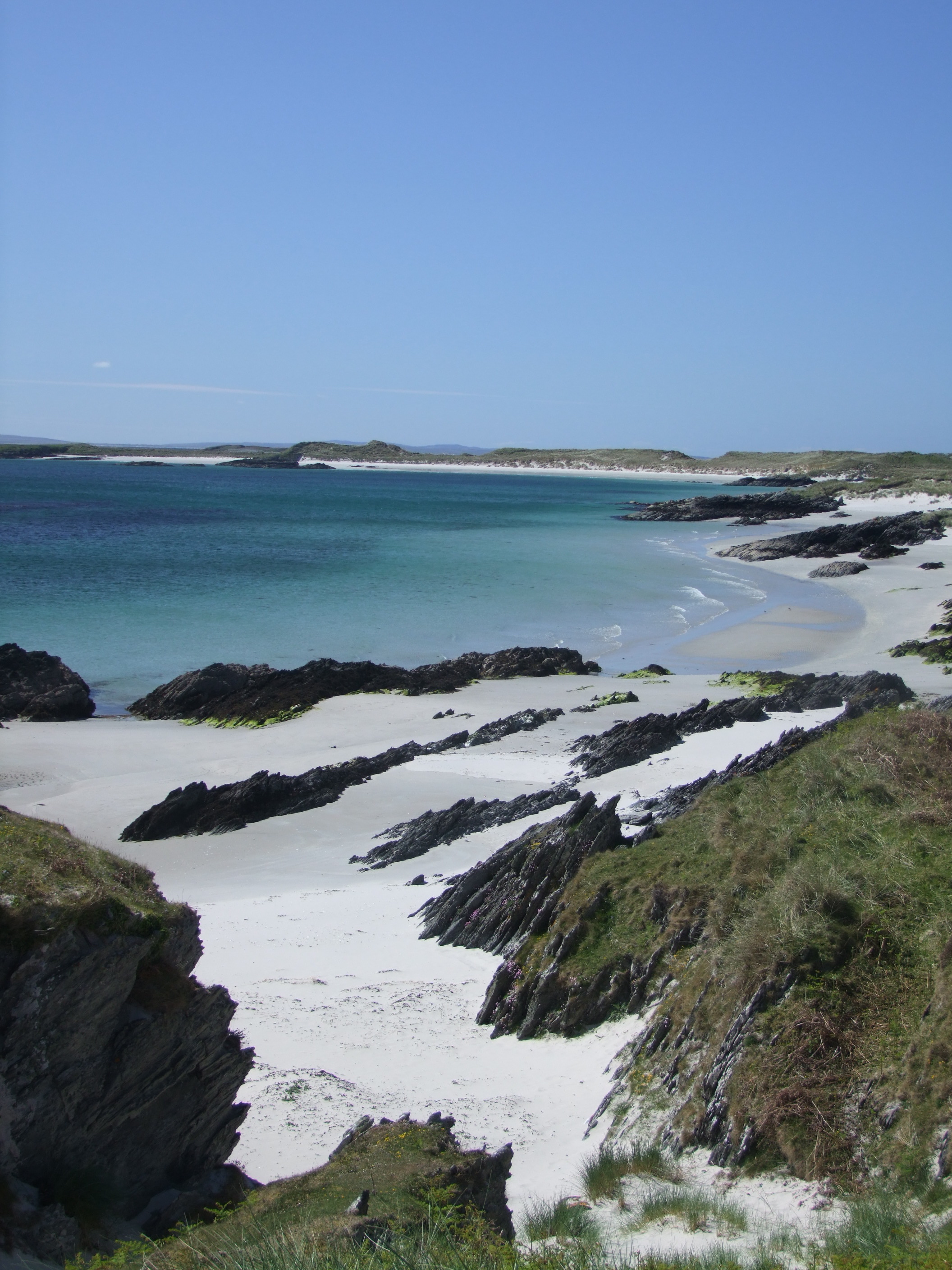
Argyllshire is split into two non-contiguous mainland sections divided by Loch Linnhe, plus a large number of islands that fall within the Inner Hebrides. Mainland Argyllshire is characterised by mountainous Highland scenery interspersed with hundreds of lochs, with a heavily indented coastline containing numerous small offshore islands. The islands present a contrasting range of scenery – from the relatively flat islands of Coll and Tiree to the mountainous terrain of Jura and Mull. For ease of reference the following is split into three sections: Mainland (north), Mainland (south) and the Inner Hebrides.
Mainland (north)
The northern mainland section consists of two large peninsulas – Ardnamurchan and Morvern – divided by Loch Sunart, with a large inland section – known traditionally as Ardgour – bounded on the east by Loch Linnhe. This loch gradually narrows, before turning sharply west in the vicinity of Fort William (where it is known as Loch Eil), almost cutting the northern mainland section of Argyll in two. This area, in the vicinity of Fort William and along the railway line, contains the largest towns of northern mainland Argyll.
Ardnamurchan is a remote, mountainous region with only one access road; it terminates in Ardnamurchan Point and Corrachadh Mòr, the westernmost points of the British mainland. In the north-east of the peninsula two unnamed sub-peninsulas almost encircle Kentra Bay, and are bound by the South Channel of Loch Moidart to the north; to the east of this lies the River Shiel and then Loch Shiel, a long loch which forms most of this section of the border with Inverness-shire. Morvern is a large peninsula and like its northern neighbour is remote, mountainous and sparsely populated. In its north-west Loch Teacuis cuts deeply into the peninsula, as does Loch Aline in the south. At the estuary of Loch Teacuis lie the large islands of Oronsay, Risga and Càrna. There are numerous lochs in northern Argyll, the largest being Loch Doilet, Loch Arienas, Loch Teàrnait, Loch Doire nam Mart and Loch Mudle.
List of islands
- Am Brican
- Ardtoe Island
- Big Stirk
- Càrna
- Dearg Sgeir
- Dubh Sgeir
- Eilean a' Chuilinn
- Eilean a' Mhuirich
- Eilean an Fhèidh
- Eilean an t-Sionnaich
- Eilean Ghleann Fhionainn
- Eilean Mhic Dhomhnuill Dhuibh
- Eilean mo Shlinneag
- Eilean Mòr, Loch Sunart
- Eilean Mòr, Loch Sunart (inner)
- Eilean na h-Acarseid
- Eilean na Beitheiche
- Eilean nam Gillean
- Eilean nan Eildean
- Eilean nan Gabhar
- Eilean nan Gall
- Eilean Rubha an Ridire
- Eilean Uillne
- Eileanan Glasa
- Eileanan Loisgte
- Eileanan nan Gad
- Garbh Eilean
- Glas Eilean (inner Loch Sunart)
- Glas Eilean (outer Loch Sunart)
- Glas Eileanan
- Little Stirk
- Oronsay
- Red Rocks
- Risga
- Seilag
- Sgeir an Eididh
- Sgeir an t-Seangain
- Sgeir Buidhe
- Sgeir Charrach
- Sgeir Ghobhlach
- Sgeir Horsgeat
- Sgeir Mhali
- Sgeir Mhòr
- Sgeir nan Gillean
- Sgeirean nan Torran
- Sgeirean Shallachain
- Sligneach Bag
- Sligneach Mòr
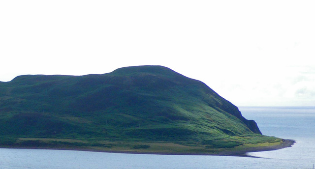
 Corrachadh Mòr as seen from the Ardnamurchan Point lighthouse
 Loch Sunart
 Creach Bheinn on the Morvern peninsula
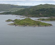 The isle of Risga
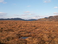 Kentra Moss flatlands


Mainland (south)
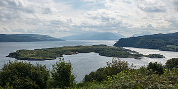
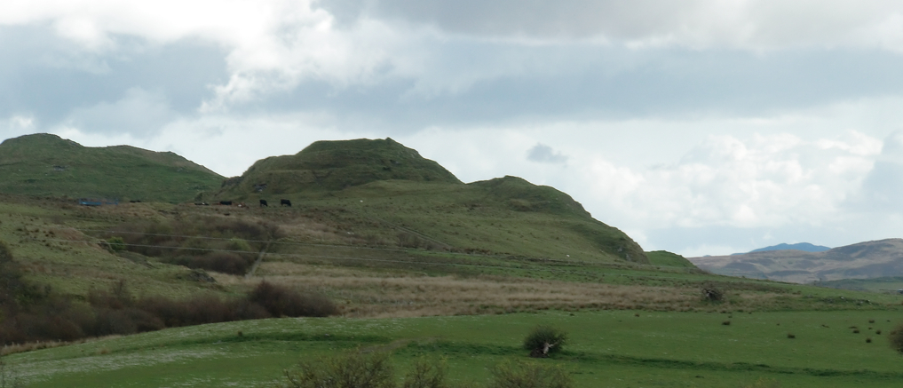
The southern mainland section is much larger than the northern, and is dominated by the long Kintyre peninsula, the terminus of which lies only 13 miles (21 kilometres) from Northern Ireland on the other side of the North Channel. The coast is complex, with the west coast in particular being heavily indented and containing numerous sea inlets, peninsulas and sub-peninsulas; of the latter, the major ones (north to south) are Appin, Ardchattan, Craignish, Tayvallich, Taynish, Knapdale and Kintyre, and the major loch inlets (north to south) are Loch Leven, Loch Creran, Loch Etive, Loch Feochan, Loch Melfort, Loch Craignish, Loch Crinan, Loch Sween, Loch Caolisport and West Loch Tarbert, the latter dividing Kintyre from Knapdale. To the east Loch Fyne separates Kintyre from the Cowal peninsula, which is itself split into three sub-peninsulas by Lochs Striven and Riddon and split on its east coast by Holy Loch and Loch Goil; south across the Kyles of Bute lies the island of Bute, which is part of Buteshire, and to east across Loch Long lies the Rosneath peninsula in Dunbartonshire. The topography of south Argyll is in general heavily mountainous and sparsely populated, with numerous lochs; Kintyre is slightly flatter though still hilly. Near Glen Coe can be found Bidean nam Bian, the tallest peak in the county at 1,150 m (3,770 ft). Of the lochs and bodies of water the largest are (roughly north to south) the Blackwater Reservoir, Loch Achtriochtan, Loch Laidon, Loch Bà, loch Buidhe, Lochan na Stainge, Loch Dochard, Loch Tulla, Lochan Shira, the Cruachan Reservoir, Loch Restil, Loch Awe, Loch Avich, Blackmill Loch, Loch Nant, Loch Nell, Loch Scammadale, Loch Glashan, Loch Loskin, Loch Eck, Asgog Loch, Loch Tarsan, Càm Loch, Loch nan Torran, Loch Ciàran, Loch Garasdale, Lussa Loch and Tangy Loch.
List of islands
Note that islands lying off the west coast are generally considered to be part of the Inner Hebrides (see below)
- Abbot's Isle
- An Oitir
- Barmore Island
- Black Islands
- Burnt Islands (comprising Eilean Mòr, Eilean Fraoich and Eilean Buidhe)
- Island Davaar
- Duncuan Island
- Eilean a' Chòmhraidh
- Eilean an t-Sagairt
- Eilean Aoghainn
- Eilean Beith
- Eilean Buidhe
- Eilean Dubh
- Eilean Grianain
- Eilean Math-ghamhna
- Eilean Mòr
- Eilean Munde
- Eilean nam Meann
- Glas Eilean
- Gluniform Island
- Henrietta Reef
- Inis Chonain
- Inishail
- Innis Errich
- Island Ross
- Liath Eilean
- Oitir Mòr
- Sanda Island
- Scart Rocks
- Sgat Beag
- Sgat Mòr
- Sgeir Bhuide
- Sgeir Caillich
- Sgeir Lag Choan
- Sgeir Leathann
- Sgeir Mhaola Cin
- Sgeir na Dubhaidh
- Sgeir Port a' Ghuail
- Sheep Island
- Thorn Isle
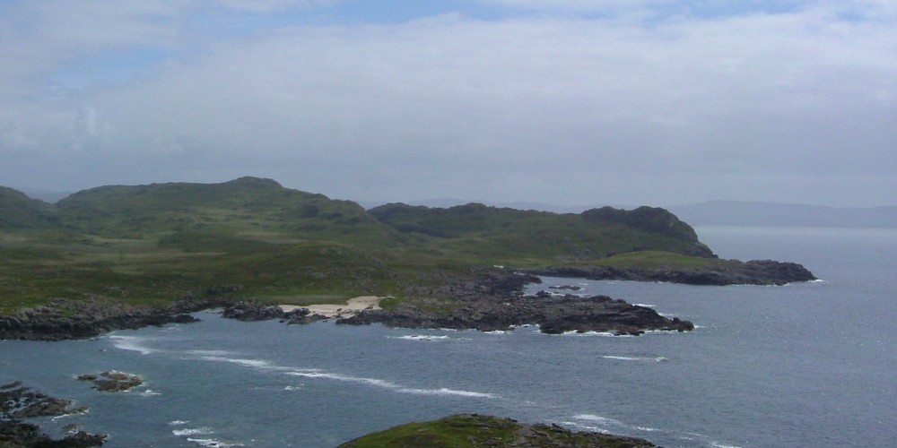
 Knapdale scenery
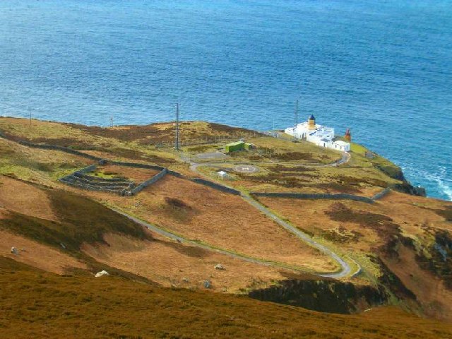
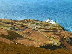 Mull of Kintyre lighthouse
 Loch Riddon
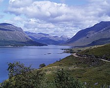 Loch Etive looking NE from Sron nam Feannag
 Glen Coe, with the Three Sisters of Bidean nam Bian
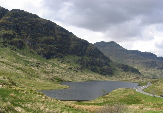
 Loch Restil
 Davaar island


Inner Hebrides
Argyllshire contains the majority of the Inner Hebrides group, with the notable exceptions of Skye and Eigg (both in Inverness-shire). The islands are too geographically diverse to be summarised here; further details can be found on the individual pages below.
List of islands
- Am Fraoch Eilean
- An Dubh Sgeir
- An Stèidh
- Bach Island
- Balach Rocks
- Belnahua
- Bernera Island
- Brosdale Island
- Calve Island
- Canna
- Cara Island
- Carraig an Daimh
- Carsaig Island
- Coiresa
- Coll
- Colonsay
- Craro Island
- Island of Danna
- Dubh Artach
- Dubh Sgeir
- Eagamol
- Eag na Maoile
- Easdale
- Eilean a' Chalmain
- Eilean a' Chùirn
- Eilean a' Mhadaidh
- Eilean Àird nan Uan
- Eilean an Aodaich
- Eilean an Fhuarain
- Eileach an Naoimh
- Eilean Annraidh
- Eilean an Righ
- Eilean Arsa
- Eilean Ascaoineach
- Eilean Balnagowan
- Eilean Bàn
- Eilean Bhrìde
- Eilean Coltair
- Eilean Craobhach
- Eilean dà Ghallagain
- Eilean dà Mhèinn
- Eilean Dioghlum
- Eilean Dùin
- Eilean Fraoich
- Eilean Gainimh
- Eilean Garbh
- Eilean Ghòmain
- Eilean Ghreasamuill
- Eilean Imersay
- Eilean Inshaig
- Eilean Loain
- Eilean Loch Oscair
- Eilean Mhartan
- Eilean Mhic Chrion
- Eilean Mhic Coinnich
- Eilean Mòr
- Eilean Musdile
- Eilean na Cloiche
- Eilean na Cille
- Eilean na Creiche
- Eilean na h-Eairne
- Eilean na h-Uamha
- Eilean na Seamair
- Eilean nam Ban
- Eilean nam Muc
- Eilean nan Caorach
- Eilean nan Coinean
- Eilean nan Each
- Eilean nan Gamhna
- Eilean Odhar
- Eilean Ona
- Eilean Ornsay
- Eilean Ramsay
- Eilean Reilean
- Eilean Righ
- Eilean Tràighe
- Eileanan Glasa
- Eileanan na h-Aoran
- Eorsa
- Erisgeir
- Eriska
- Erraid
- Fladda
- Frenchman's Rocks
- Gamhna Gigha
- Gamhnach Mhòr
- Garbh Rèisa
- Garbh Sgeir
- Garvellachs
- Gigalum Island
- Gigha
- Gòdag
- Gometra
- Guirasdeal
- Hàslam
- Humla
- Inch Kenneth
- Inn Island
- Insh Island
- Iona
- Island Macaskin
- Islay
- Hough Skerries
- Hyskeir (in Gaelic, Oigh-Sgeir)
- Jura
- Kerrera
- Lady's Rock
- Liath Sgeir
- Lismore
- Little Colonsay
- Luing
- Lunga
- MacCormaig Isles
- Maisgeir
- Muck
- Na Sgeiran Mòra
- Nave Island
- Ormsa
- Oronsay
- Orsay
- Rèidh Eilean
- Rèisa an t-Struith
- Rèisa Mhic Phaidean
- Ruadh Sgeir
- Rùm
- Samalan Island
- Sanday
- Scarba
- Scoul Eilean
- Seil
- Sgeir a' Mhàim-àrd
- Sgeir a' Phuirt
- Sgeir an Ròin
- Sgeiran Mòra
- Sgeir Mhòr
- Sgeir na Caillich
- Sgeir nan Gobhar
- Sgeir nan Sgarbh
- Sgeir Shealg
- Sgeir Tràighe
- Shian Island
- Shuna, Slate Islands
- Shuna Island, Loch Linnhe
- Skerryvore
- Small Isles
- Soa, near Coll
- Soa, Tiree
- Soa, near Mull
- Staffa
- Taynish Island
- Sùil Ghorm
- Texa
- Tiree
- Torran Rocks
- Torsa
- Treshnish Isles
- Ulva
 Calve Island
 Cliffs at Iorcail on Canna
 Cara
Cara Eorsa from Mull
 Iona Abbey
 Dun Nosebridge on Islay
 Gylen Castle on Kerrera
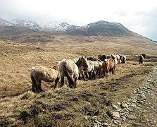 Ponies on Rum
 Coastal waterfall on Rum
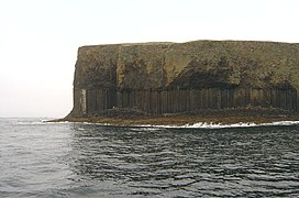 Basalt columns on Staffa
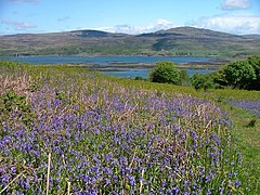 Bluebell field on Ulva


Shire, county and district
| Year | Pop. | ±% |
|---|---|---|
| 1801 | 81,277 | — |
| 1811 | 86,541 | +6.5% |
| 1821 | 97,316 | +12.5% |
| 1831 | 100,973 | +3.8% |
| 1841 | 97,371 | −3.6% |
| 1851 | 89,298 | −8.3% |
| 1901 | 73,642 | −17.5% |
| 1911 | 70,902 | −3.7% |
| 1921 | 76,862 | +8.4% |
| 1931 | 63,050 | −18.0% |
| 1951 | 63,361 | +0.5% |
| Source: [2] | ||
Historically, the term shire is somewhat misleading, as it must not be confused with an English county. In medieval Latin, the latter was referred to as a comitatus, which prior to 1889 a Scottish shire had never been. In Scotland, the comitatus was in fact the region controlled as a Lordship (as opposed, for example, to a Lairdship), such as a mormaerdom, or an early earldom, and typically survived as a regality (though this is a broader term encompassing also more junior authority). Shire instead came into use, in Scotland, to refer to the region in which a particular sheriff operated; in Scottish medieval Latin this was sometimes called the vice-comitatus.
Following the transfer of the Hebrides and adjacent mainland coast from Norway to Scotland, by the 1266 Treaty of Perth, Argyll was served by the sheriff of Perth. However, in 1293, king John Balliol established the post of sheriff of Kintyre. In 1326,[3] Dougall Campbell, son of Neil Campbell, was rewarded for Campbell support of Robert the Bruce; Dougall was grandson of the baron of Innis Chonnell, at the centre of the Argyll region, so he was created Sheriff of Argyll. However, the sheriffdom had only been created to oversee the forfeited MacDougall territory of Lorn (including Mull), the southern parts of Argyll remained part of the quasi-independent Lordship of the Isles until the late 15th century.
In 1476, John MacDonald, the Lord of the Isles, quitclaimed Kintyre and Knapdale (including the region between Loch Awe and Loch Fyne) to Scotland, and initially Knapdale was served by the Sheriff of Perth. However, in 1481, it was placed under the control of Tarbertshire – an expanded sheriffdom of Kintyre.
The Scottish Reformation coincidentally followed the fall of the Lordship of the Isles, but the MacDonalds – former lords – were strong supporters of the former religious regime. The Campbells by contrast were strong supporters of the reforms, so at the start of the 17th century, under instruction from James VI, the Campbells were sent to Islay and Jura – MacDonald territory – to subdue the MacDonalds. The sheriffdom of Argyll was an inherited position, and had remained in the Campbell family, and now it was extended to include Islay and Jura. Campbell pressure at this time also lead to the sheriff court for Tarbertshire being moved to Inverary, where the Campbells held the court for the sheriff of Argyll. Somewhat inevitably, in 1633, Tarbertshire was abolished, in favour of the sheriff of Argyll.
David II had restored MacDougall authority over Lorn in 1357, but John MacDougall (head of the MacDougalls) had already renounced claims to Mull (in 1354) in favour of the MacDonalds, to avoid potential conflict. The MacLeans were an ancient family based in Lorn (including Mull), and following the quitclaim, they no longer had a Laird in Mull, so themselves became Mull's Lairds. Unlike the MacDonalds, they were fervent supporters of the Reformation, even supporting acts of civil disobedience against king Charles II's repudiation of the Solemn League and Covenant. Archibald Campbell (Earl of Argyll) was instructed by the privy council to seize Mull, and suppress the non-conformist behaviour; by 1680 he gained possession of the island, and transferred shrieval authority to the sheriff of Argyll.
In 1746, following Jacobite insurrections, the Heritable Jurisdictions Act abolished regality, and forbade the position of sheriff from being inherited. Local governance was brought into line with that of the rest of Great Britain. Boards for health, water, education, the poor law, and so on, were established for each sheriffdom, akin to the way counties were now governed in England. In 1889, counties were at last formally created in Scotland, by a dedicated Local Government Act; they were to use the same boundaries as sheriffdoms.
Argyll thus gained a county council, which lasted until 1975. Argyll's neighbouring counties were Inverness-shire, Perthshire, Dunbartonshire, Renfrewshire, Ayrshire and Bute. Renfrewshire and Ayrshire are on the other side of the Firth of Clyde, while Bute was a county comprising the islands in the firth.
The county town of Argyll was historically Inveraray, which is still the seat of the Duke of Argyll. Lochgilphead later claimed to be the county town, as the seat of local government for the county from the 19th century. Neither town was the largest settlement geographically, nor in terms of population, however. Argyll's largest towns were (and are) Oban, Dunoon and Campbeltown. Argyll County Council was officially based at the County Clerk's Offices in Lochgilphead.[4] However, it appears that there was "no recognised headquarters for the accommodation of all the chief officials for the meetings of the county council."[5]
The Small Isles of Muck or Muick, Rhum or Rùm, Canna and Sanday were part of the county until they were transferred to Inverness-shire in 1891 by the boundary commission appointed under the Local Government (Scotland) Act 1889. The island of Egg or Eigg was already in Inverness-shire.
The concept of a County of Argyll ceased for local government purposes in 1975, with its area being split between Highland and Strathclyde Regions. A local government district called Argyll and Bute was formed in the Strathclyde region, including most of Argyll and the adjacent Isle of Bute (the former County of Bute was more extensive). The Ardnamurchan, Ardgour, Ballachulish, Duror, Glencoe, Kinlochleven and Morvern areas of Argyll were detached to become parts of Lochaber District, in Highland. They remained in Highland following the 1996 revision.

In 1996 a new unitary council area of Argyll and Bute was created, with a change in boundaries to include part of the former Strathclyde district of Dumbarton.
Constituency
Starting in 1590, as one of the measures that followed the Scottish reformation, each sheriffdom elected commissioners to the Parliament of Scotland. As well as the commissioner representing Argyll, at least one was sent to represent Tarbertshire, Sir Lachlan Maclean of Morvern.[6][7][8] In the 1630 parliamentary session, Sir Coll Lamont, laird of Lamont, was the commissioner for "Argyll and Tarbert".[9]
There was an Argyllshire constituency of the Parliament of Great Britain from 1708 to 1801, and of the Parliament of the United Kingdom from 1801 to 1983 (renamed Argyll in 1950). The Argyll and Bute constituency was created when the Argyll constituency was abolished.
Civil parishes
Civil parishes are still used for some statistical purposes, and separate census figures are published for them. As their areas have been largely unchanged since the 19th century, this allows for comparison of population figures over an extended period of time.
- Ardchattan and Muckairn
- Ardgour
- Ardrishaig
- Ardnamurchan
- Campbeltown
- Coll
- Colonsay and Oronsay
- Craignish
- Dunoon and Kilmun
- Gigha and Cara Island
- Glassary
- Glen Orchy and Inishail
- Inveraray
- Inverchaolain
- Jura
- Kilbrandon and Kilchattan
- Kilcalmonell
- Kilchoman
- Kilchrenan and Dalavich
- Kildalton
- Kilfinan
- Kilfinichen and Kilvickeon
- Killarow and Kilmeny
- Killean and Kilchenzie
- Kilmallie (part)
- Kilmartin
- Kilmodan
- Kilmore and Kilbride
- Kilninian and Kilmore
- Kilninver and Kilmelford
- Lismore and Appin
- Lochgilphead
- Lochgoilhead and Kilmorich
- Morvern
- North Knapdale
- Saddell and Skipness
- South Knapdale
- Southend
- Strachur
- Strathlachlan
- Tiree
- Torosay, Mull
Settlements
Mainland (north)

- Acharacle
- Achaphubuil
- Ardery
- Ardgour
- Ardtoe
- Banavie
- Blaich
- Bonnavoulin
- Caol
- Clovullin
- Corpach
- Corran
- Duisky
- Fassfern
- Glenborrodale
- Kentra
- Kilchoan
- Kilmory
- Kinlocheil
- Laga
- Lochaline
- Melfort
- Newton of Ardtoe
- Ockle
- Polloch
- Portuairk
- Resipole
- Salen
- South Garvan
- Stronchreggan
- Strontian
- Trislaig
Mainland (south)


- Achahoish
- Achinhoan
- Achnamara
- Ardentinny
- Ardgartan
- Ardnadam
- Ardrishaig
- Ardtaraig
- Ardulaine
- Arrochar
- Ballachulish
- Barcaldine
- Bellochantuy
- Benderloch
- Blairmore
- Cairndow
- Campbeltown
- Carradale
- Carrick Castle
- Clachaig
- Clachan
- Clachan of Glendaruel
- Claonaig
- Colintraive
- Connel
- Coylet
- Craobh Haven
- Crinan
- Dalavich
- Dalmally
- Dippen
- Drumlemble
- Dumbeg
- Dunoon
- Duror
- Ford
- Furnace
- Glenbarr
- Glenbranter
- Glencoe
- Glendaruel
- Grogport
- Hunters Quay
- Innellan
- Inveraray
- Inverchaolain
- Invercreran
- Kames
- Kennacraig
- Kentallen
- Kilberry
- Kilchenzie
- Kilkerran
- Kilmanshenachan
- Kilmelford
- Kilmore
- Kilmun
- Kinlochleven
- Kirn
- Knipoch
- Largiemore
- Lochgair
- Lochgilphead
- Lochgoilhead
- Machrihanish
- Millhouse
- Muasdale
- North Connel
- Oban
- Ormsary
- Otter Ferry
- Peninver
- Port Ann
- Port Appin
- Portavadie
- Rashfield
- St Catherines
- Saddell
- Sandbank
- Skipness
- Southend
- Stewarton
- Strachur
- Strone
- Succoth
- Tarbert
- Tayinloan
- Taynuilt
- Tayvallich
- Tighnabruaich
- Torinturk
- Torrisdale
- Tullochgorm
- Whistlefield
- Whitehouse
Inner Hebrides
- Ardbeg (Islay)
- Ardfernal (Jura)
- Ardilistry (Islay)
- Ardmenish (Jura)
- Ardtalla (Islay)
- Ardtun (Mull)
- Arinagour (Coll)
- Ballygrant (Islay)
- Bowmore (Islay)
- Bridgend (Islay)
- Bruichladdich (Islay)
- Bunessan (Mull)
- Bunnahabhain (Islay)
- Calgary (Mull)
- Craighouse (Jura)
- Craignure (Mull)
- Dervaig (Mull)
- Feolin (Jura)
- Fionnphort (Mull)
- Fishnish (Mull)
- Kilchoman (Islay)
- Kinloch (Rùm)
- Kintra (Mull)
- Knockan (Mull)
- Lagavulin (Islay)
- Laphroaig (Islay)
- Lochbuie (Mull)
- Nerabus (Islay)
- Pennyghael (Mull)
- Port Askaig (Islay)
- Port Charlotte (Islay)
- Port Ellen (Islay)
- Port Mòr (Muck)
- Portnahaven (Islay)
- Port Wemyss (Islay)
- Salen (Mull)
- Scalasaig (Colonsay)
- Scarinish (Tiree)
- Tiroran (Mull)
- Tobermory (Mull)
- Uisken (Mull)
- Ulva Ferry (Mull)
 Bowmore Round Church, Islay
 Craighouse, Jura
 Port Mòr, Muck


Transport

The West Highland railway runs through the far north of the county, stopping at Locheilside, Loch Eil Outward Bound, Corpach and Banavie, before carrying on to Mallaig in Inverness-shire. A branch of the line also goes to Oban, calling at Dalmally, Loch Awe, Falls of Cruachan, Taynuilt and Connel Ferry.
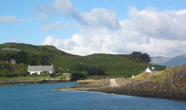
Numerous ferries link the islands of the Inner Hebrides to each other and the Scottish mainland. Many of the islands also contain small airstrips enabling travel by air. A fairly extensive bus network links the larger towns of the area, with bus transport also available on the islands of Islay, Jura and Mull.[10]
The county contains a number of small airports which serve the region and Edinburgh/Glasgow: Oban, Tiree, Coll, Colonsay, Campbeltown and Islay.
Kintyre has been one of the mooted locations for a proposed British-Irish bridge; as the closest point to Ireland at first glance it appears to be the most obvious route, however Kintyre is hampered by its remoteness from the main centres of Scotland's population.
Residents
Clans
- Clan Campbell was the main clan of this region. The Campbell clan hosted the long line of the Dukes of Argyll.
- Clan MacIntyre historically held lands in this region and had close ties with Clan Campbell.
- Clan Gregor historically held a great deal of lands in this region prior to the proscription of their name in April 1603, the result of a power struggle with the Campbells.
- Clan Lamont historically both allied and feuded with the Campbell clan, culminating in the Dunoon Massacre. In the 19th century, theclan chief sold his lands and relocated to Australia, where the current chief lives.
- Clan McCorquodale held lands around Loch Awe from the early medieval period until the early 18th century. Their seat was a castle on Loch Tromlee.
- Clan MacMillan held lands in Argyll, notably in knapdale (viz. "MacMillan of Knap")
- Clan Malcolm Also known as MacCallum. The Malcolm clan seat is Duntrune Castle on the banks of Loch Crinan
- Clan MacLean Historically held lands on the Isle of Mull with its seat at Duart Castle
- Clan MacLachlan historically feuded with the Campbells, and espoused Jacobitism. Held lands on both sides of Loch Fyne, with its seat in Strathlachlan
- Clan MacEwan historically feuded with the Campbells, cousins of MacLachlans. Held lands in Kilfinan.
Other notable residents
- Patrick MacKellar, (1717–1778), born in Argyll, military engineer, achieved his reputation on projects in the United States of America.[11]
- Baron Robertson of Port Ellen KT, GCMG, FRSA, FRSE, PC (born 12 April 1946, George Islay MacNeill Robertson), British Labour politician and tenth Secretary General of the North Atlantic Treaty Organisation
- Eric Blair, better known as George Orwell, who resided in the northernmost part of Jura, during the final years of his life (1946-1950). During this period, he wrote Nineteen Eighty-Four.
- Karen Matheson, folk singer, grew up in Taynuilt.
- Frances Ruth Shand Kydd (née Roche; 20 January 1936 – 3 June 2004) was the mother of Diana, Princess of Wales. She was resident at Ardencaple House on the Island of Seil. She was buried in Pennyfuir Cemetery on the outskirts of Oban.
In fiction
- Rosemary Sutcliff's novel The Mark of the Horse Lord (1965) is set in Earra Gael, i.e. the Coast of the Gael, wherein the Dal Riada undergo an internal struggle for control of royal succession, and an external conflict to defend their frontiers against the Caledones.
- The highlands above the village of Lochgilphead were used for a scene in the 1963 film From Russia with Love, starring Sean Connery as James Bond. He killed two villains in a helicopter by firing gunshots at them.
- The main focus of the song "The Queen of Argyll" is that of a beautiful woman, from Argyll. The song was sung by the band Silly Wizard and covered by Fiddler's Green in 2000.
- The 1985 Scottish movie Restless Natives used Lochgoilhead to film a chase scene, as well as some roads just outside the village.
- The housekeeper Elsie Carson in Julian Fellowes' television drama Downton Abbey is from Argyll.
- In Harry Potter and the Prisoner of Azkaban, after being attacked by Sirius Black, the Fat Lady is found hiding in a map of Argyllshire that is located on the second floor in Hogwarts
See also
- Argyle pattern
- Medieval Diocese of Argyll
- Duke of Argyll
- List of counties of Scotland 1890–1975
Notes
- Woolf, Alex. "The Age of the Sea-Kings: 900–1300" in Omand (2006) pp. 94–95
- Vision of Britain
- MacNair, Peter (1914). Argyllshire and Buteshire. Cambridge County Geographies. London: Cambridge University Press. pp. 1, 69.
- "No. 18320". The Edinburgh Gazette. 29 January 1965. p. 71.
- Giarchi, George Giacinto (1980). "Between McAlpine and Polaris" (PDF). Glasgow University. p. 232. Retrieved 18 July 2021.
- "RPS, 1633/6/14". Retrieved 4 July 2017.
- "Parliaments of Scotland, 1357–1707" (PDF). Return of the name of every member of the lower house of parliament of England, Scotland, and Ireland, with name of constituency represented, and date of return, from 1213 to 1874; Part II: Great Britain, United Kingdom, Scotland, Ireland. Command papers. Vol. C.69-I. HMSO. 11 August 1879. pp. 539–556. (shows blank pages in Firefox 73, open in Chrome, or download and open)
- Porritt, Edward; Porritt, Annie Gertrude (1903). "Part V: The Scotch Parliamentary System; Chapter XXXV: The Franchise in the Counties". The Unreformed House of Commons. Vol. 2: Scotland and Ireland. Cambridge University Press. p. 78.
- "RPS, A1630/7/1". Retrieved 4 July 2017.
- "Argyll & Bute Map and Guide" (PDF). 18 May 2018. Retrieved 8 June 2019.
- Who Was Who in America, Historical Volume, 1607–1896. Chicago: Marquis Who's Who. 1963.
References
- Omand, Donald (ed.) (2006). The Argyll Book. Edinburgh: Birlinn. ISBN 1-84158-480-0.
Further reading
- The Imperial gazetteer of Scotland Vol. I. page 78, by Rev. John Marius Wilson.
External links
- Map of Argyllshire on Wikishire
- "Filming locations", From Russia with Love (1963), IMDB
- Argyll.org – Argyll Independent Visitor Information
- Argyll and Argyle Visitor Information
- Visitor information for Inveraray, Tarbert, Knapdale, Crinan and Lochgilphead
| Authority control: National libraries |
|---|
Другой контент может иметь иную лицензию. Перед использованием материалов сайта WikiSort.org внимательно изучите правила лицензирования конкретных элементов наполнения сайта.
WikiSort.org - проект по пересортировке и дополнению контента Википедии