world.wikisort.org - United_Kingdom
Stewarton (Scottish Gaelic: Baile nan Stiùbhartach, pronounced [ˈpalə nəɲ ˈʃtʲuː.ərˠʃt̪əx]) is a hamlet on the junction of the B842 and B843 roads, in Kintyre, Argyll and Bute, Scotland, located around 1.5 miles (2.4 km) west of Campbeltown.[1]
Stewarton
| |
|---|---|
 Stewarton | |
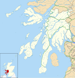 Stewarton Location within Argyll and Bute | |
| OS grid reference | NR696198 |
| Council area |
|
| Lieutenancy area |
|
| Country | Scotland |
| Sovereign state | United Kingdom |
| Post town | CAMPBELTOWN |
| Postcode district | PA28 |
| Police | Scotland |
| Fire | Scottish |
| Ambulance | Scottish |
| UK Parliament | |
| Scottish Parliament |
|
Plantation Halt was a nearby station on the Campbeltown and Machrihanish Light Railway that opened in 1906 and closed in 1932.
References
- "Stewarton". Gazetteer for Scotland. Retrieved 29 August 2020.
Wikimedia Commons has media related to Stewarton, Argyll and Bute.
This Argyll and Bute location article is a stub. You can help Wikipedia by expanding it. |
Текст в блоке "Читать" взят с сайта "Википедия" и доступен по лицензии Creative Commons Attribution-ShareAlike; в отдельных случаях могут действовать дополнительные условия.
Другой контент может иметь иную лицензию. Перед использованием материалов сайта WikiSort.org внимательно изучите правила лицензирования конкретных элементов наполнения сайта.
Другой контент может иметь иную лицензию. Перед использованием материалов сайта WikiSort.org внимательно изучите правила лицензирования конкретных элементов наполнения сайта.
2019-2026
WikiSort.org - проект по пересортировке и дополнению контента Википедии
WikiSort.org - проект по пересортировке и дополнению контента Википедии