world.wikisort.org - United_Kingdom
Lanarkshire, also called the County of Lanark (Scottish Gaelic: Siorrachd Lannraig; Scots: Lanrikshire), is a historic county, lieutenancy area and registration county in the central Lowlands of Scotland.
Lanarkshire | |
|---|---|
Historic county | |
 Rolling Lanarkshire countryside near Lanark town | |
 | |
| Sovereign state | |
| Country | |
| County town | Lanark (historic) Hamilton (modern) |
| Area | |
| • Total | 879 sq mi (2,277 km2) |
| Ranked 11th of 34 | |
| Chapman code | LKS |
Lanarkshire is the most populous county in Scotland, as it contains most of Glasgow and the surrounding conurbation. In earlier times it had considerably greater boundaries, including neighbouring Renfrewshire until 1402.[1] Lanarkshire is bounded to the north by the counties of Stirlingshire and Dunbartonshire (this boundary is split into two sections owing to Dunbartonshire's Cumbernauld exclave), to the northeast by West Lothian and Mid Lothian, to the east by Peeblesshire, to the south by Dumfriesshire, and to the west by Ayrshire and Renfrewshire.[2]
Administrative history

Lanarkshire was historically divided between two administrative areas. In the mid-18th century it was divided again into three wards: the upper, middle and lower wards with their administrative centres at Lanark, Hamilton and Glasgow, respectively, and remained this way until the Local Government Act of 1889. Other significant settlements include Coatbridge, East Kilbride, Motherwell, Airdrie, Blantyre, Cambuslang, Rutherglen, Wishaw, Bellshill, Strathaven and Carluke.[3] The Local Government (Scotland) Act 1889 established a uniform system of county councils in Scotland and realigned the boundaries of many of Scotland's counties. Subsequently, Lanark County Council was created in 1890. The county council was initially based at County Buildings in Wilson Street in Glasgow but, from 1930, it was located at Lanarkshire House in Ingram Street in Glasgow.[4][5] Lanark County Council relocated to Lanark County Buildings in Hamilton in 1964.[6][7]
In 1975, the county council was abolished and the area absorbed into the larger Strathclyde region, which itself was abolished when new council areas for Scotland were introduced in 1996. The old area of Lanarkshire is now occupied by the council areas of:
- Clydesdale (district), East Kilbride (district), City of Glasgow (1975–1996), Hamilton (district), Monklands (district), Motherwell (district) (1975–1996)
- East Dunbartonshire, Glasgow City Council, North Lanarkshire, South Lanarkshire (1996–present)
North Lanarkshire and South Lanarkshire have a joint board for valuation and electoral registration. There is also a joint health board, which does not cover Rutherglen and the surrounding area in South Lanarkshire. Without the northern portion of North Lanarkshire, this is also a lieutenancy area.
Coat of arms

Lanarkshire was granted a coat of arms by the Lord Lyon on 24 December 1886. The arms is: Party per chevron gules and argent, two cinquefoils pierced in chief ermine, and in base a man's heart counter-changed. The cinquefoils come from the arms of the Clan Hamilton, and the heart from the arms of the Clan Douglas, the two main local families. The crest is a demi-eagle displayed with two heads, sable beaked gules. The motto is VIGILANTIA.[8]
Geography

Lanarkshire occupies the valley of the river Clyde, which crosses the county from the north-west to south-east. It is predominantly flat and agricultural, rising to the south with the Lowther Hills of the Southern Uplands, with Culter Fell on the border with Peeblesshire being the highest point at 748 m (2,454 ft). In the east a small portion of the Pentland Hills lie in the county, in the vicinity of Tarbrax and Dunsyre. In the far south lies the Daer Reservoir. Northern Lanarkshire is dominated by the Glasgow conurbation, Scotland's largest city, though some small bodies of water can be found such as the Roughrigg Reservoir, Lilly Loch, Hillend Reservoir, Forrestburn Reservoir and Black Loch.
Rivers
- North Medwin River
- South Medwin River
- River Clyde
- River Avon
- South Calder Water
Mining industry
From the mid-eighteenth century to the early twentieth century Lanarkshire profited from its rich seams of coal in places such as Glenboig.[2] As the coal industry developed around Glasgow in the 1700s the price of coal to the city rose under the control of a cartel of coal owners.[9] The solution was to carve out a canal to take advantage of the good (and uncontrolled) coal deposits of the Monklands area. By 1793, the Monklands canal was completed and the Lanarkshire coal industry thrived.[10] The resulting boom lasted for over 100 years but reached its peak by the second decade of the twentieth century and even two world wars failed to halt the contraction. Output in the county continued to fall and the National Coal Board concentrated investment in Ayrshire, Fife and the Lothians. By 1970 there were only four collieries left in Lanarkshire and the closure of Cardowan in 1983 brought the long decline to an end.[11]
Transport
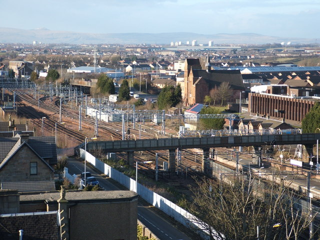
The M74 motorway links Glasgow with Carlisle and points further south, with the M8 linking the city to Edinburgh. Glasgow and the surrounding areas are well served by numerous roads and train lines. The West Coast Main Line cuts north–south across the county and connects Glasgow with Manchester, Birmingham and London. Glasgow is also served by the Glasgow Subway.
Events
Lanarkshire hosted the International Children's Games in August 2011.[12] A total of 1,300 competitors and coaches, along with administrators and delegates, representing 77 cities from 33 countries worldwide attended.
Civil parishes

- Barony (Glasgow)
- Bothwell
- Blantyre
- Biggar
- Cadder
- Carmunnock
- Cambusnethan
- Carluke
- Carstairs
- Carnwath
- Covington
- Carmichael
- Crawfordjohn
- Crawford
- Coulter
- Dalziel
- Dalserf
- Dunsyre
- Dolphinton
- Douglas
- Govan
- Gorbals
- Glasgow
- Hamilton
- East Kilbride
- Lesmahagow
- Lanark
- Libberton
- Lamington
- New Monkland, Airdrie
- Old Monkland
- Pettinain
- Royalty
- Rutherglen
- Shotts
- Strathaven
- Stonehouse
- Symington
- Wilston
- Wiston and Roberton
Settlements
- Abington
- Airdrie
- Allanton
- Anderston
- Annathill
- Ashgill
- Auchengray
- Auchenheath
- Auchenshuggle
- Auldhouse
- Baillieston
- Balornock
- Bargeddie
- Barlanark
- Barmulloch
- Bellahouston
- Bellshill
- Biggar
- Birkenshaw
- Birniehill
- Bishopbriggs
- Blackhill
- Blackwood
- Blantyre
- Blythswood Hill
- Bogside
- Bonkle
- Bothwell
- Braehead
- Braidfauld
- Braidwood
- Bridgeton
- Broomhill
- Broomhouse
- Budhill
- Burnbank
- Burnside
- Busby
- Cadder
- Calderbank
- Caldercruix
- Caldermill
- Calderwood
- Calton
- Cambuslang
- Camlachie
- Carnwath
- Cardowan
- Carfin
- Carluke
- Carmichael
- Carmunnock
- Carmyle
- Carnbroe
- Carntyne
- Carstairs
- Carstairs Junction
- Cartland
- Castlemilk
- Cessnock
- Chapelhall
- Chapelton
- Chryston
- Cleghorn
- Cleland
- Coalburn
- Coatbridge
- College Milton
- Colston
- Coulter
- Cowcaddens
- Cowlairs
- Craigend
- Craigton
- Cranhill
- Crawford
- Crawfordjohn
- Croftfoot
- Crossford
- Crutherland
- Dalmarnock
- Dalserf
- Dennistoun
- Dolphinton,
- Douglas
- Dowanhill
- Drumoyne
- Drumsagard
- Dumbreck
- Dunsyre
- East Crindledyke
- Eastfield
- East Kilbride
- East Mains
- Easterhouse
- Easthall
- Elsrickle
- Fernhill
- Ferniegair
- Finnieston
- Forrestfield
- Forth
- Gallowgate
- Gardenhall
- Garnethill
- Garnkirk
- Garrion Bridge
- Garrowhill
- Gartcosh
- Gartloch
- Garthamlock
- Germiston
- Gilshochill
- Glasgow
- Glasgow Harbour
- Glassford
- Glenboig
- Glenmavis
- Glespin
- Gorbals
- Govan
- Govanhill
- Greenfield
- Greengairs
- Greenhills
- Haghill
- Hairmyres
- Halfwayhouse
- Hamilton
- Hamiltonhill
- Harthope
- Harthill
- Hartwood
- Hillhead
- Hillhouse
- Hogganfield
- Holytown
- Hutchesontown
- Hyndland
- Ibrox
- Jackton
- Kelvin
- Kelvinbridge
- Kelvindale
- Kelvinside
- Kilncadzow
- King's Park
- Kinning Park
- Kingston
- Kirkfieldbank
- Kirkhill
- Kirkmuirhill
- Lambhill
- Lamington
- Lanark
- Larkhall
- Laurieston
- Law
- Leadhills
- Lesmahagow
- Lightburn
- Lilybank
- Lindsayfield
- Linthouse
- Longriggend
- Luggiebank
- Maryhill
- Maryhill Park
- Millerston
- Milton
- Mollinsburn
- Morningside
- Moodiesburn
- Mossend
- Mossneuk
- Motherwell
- Mount Vernon
- Muirhead
- The Murray
- Nemphlar
- Nerston
- Netherburn
- New Lanark
- New Stevenston
- Newarthill
- Newbank
- Newbigging
- Newhouse
- Newlandsmuir
- Newmains
- Newton
- North Kelvinside
- Oatlands
- Overtown
- Park District
- Parkhead
- Parkhouse
- Partick
- Partickhill
- Peel Park
- Pettinain
- Philipshill
- Plains
- Plantation
- Port Dundas
- Possilpark
- Provanhall
- Provanmill
- Quarter
- Queenslie
- Quothquan
- Ravenscraig
- Ravenstruther
- Riddrie
- Rigside
- Robertson
- Robroyston
- Rosebank
- Royston
- Ruchazie
- Ruchill
- Rutherglen
- St Leonards
- Salsburgh
- Sandford
- Sandyhills
- Shettleston
- Shieldhall
- Shotts
- Sighthill
- South Busby
- Springboig
- Springburn
- Springhill
- Stand
- Stepps
- Stewartfield
- Stonehouse
- Strathaven
- Summerston
- Swinton
- Symington
- Tannochside
- Tarbrax
- Thankerton
- Thorntonhall
- Thornwood
- Tillietudlem
- Tollcross
- Toryglen
- Townhead
- Tradeston
- Uddingston
- Viewpark
- The Village
- Wattston
- Wellhouse
- Westburn
- West Mains
- Westwood
- Westwoodhill
- Whitehills
- Whiteinch
- Whitlawburn
- Wilsontown
- Wishaw
- Wiston
- Woodlands
- Woolfords
- Yieldshields
- Yorkhill
 Airdrie
 Carluke
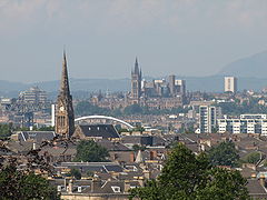 Glasgow
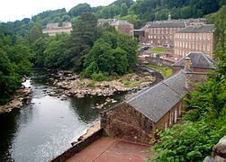 New Lanark


Maps
Digitised historic and modern maps of Lanarkshire are available from National Library of Scotland including:
- Glasgow and the county of Lanark manuscript map drawn by Scottish cartographer Timothy Pont sometime between 1583 and 1596
- The nether ward of Clyds-dail and Glasco from the Blaeu Atlas of Scotland by Dutch cartographer Joan Blaeu published in 1654
- A mape of the west of Scotland containing Clydsdail, Nithsdail, Ranfrew, Shyre of Ayre, & Galloway manuscript map drawn by the Scottish surveyor and map maker John Adair in about 1685
- Map of the town of Glasgow & country seven miles around by Scottish cartographer Thomas Richardson published in 1795
- Ainslie's Map of the Southern Part of Scotland by Scottish cartographer John Ainslie published in 1821
- North and south of Lanarkshire from John Thomson's Atlas of Scotland published in 1832
References
![]() Media related to Lanarkshire at Wikimedia Commons
Media related to Lanarkshire at Wikimedia Commons
- "Historical perspective for Old County of Lanarkshire". Scottish-places.info. Retrieved 12 November 2012.
- "Lanarkshire Scotland". A Vision of Britain through Time. Retrieved 15 August 2018 – via University of Portsmouth.
- Association of British Counties Archived 24 September 2012 at the Wayback Machine
- Historic Environment Scotland. "Corinthian Club (former Sheriff Court and Justice of the Peace Court), 191 Ingram Street, Glasgow (LB32735)". Retrieved 18 July 2021.
- "No. 18108". The Edinburgh Gazette. 25 January 1963. p. 65.
- "Lanark County Buildings". Dictionary of Scottish Architects. Retrieved 11 November 2021.
- "No. 18940". The Edinburgh Gazette. 8 December 1970. p. 1060.
- "Lanarkshire". Heraldry of the World. Retrieved 17 December 2017.
- Hutton, Guthrie (2012). Lanarkshire's Mining Legacy. Catrine: Stenlake Publishing. p. 3. ISBN 9781840336061.
- Hutton, Guthrie (2012). Lanarkshire's Mining Legacy. Catrine: Stenlake Publishing. p. 3. ISBN 9781840336061.
- Hutton, Guthrie (2012). Lanarkshire's Mining Legacy. Catrine: Stenlake Publishing. pp. 3, 4. ISBN 9781840336061.
- "International Children's Games Lanarkshire 2011". Icg-lanarkshire2011.com. Retrieved 12 November 2012.
Другой контент может иметь иную лицензию. Перед использованием материалов сайта WikiSort.org внимательно изучите правила лицензирования конкретных элементов наполнения сайта.
WikiSort.org - проект по пересортировке и дополнению контента Википедии