world.wikisort.org - United_Kingdom
Thorntonhall (Scots: Thorntounhauch, Scottish Gaelic: Dail Bhaile Dhealgaiche)[3] is an affluent village in South Lanarkshire, Scotland, lying around 6 miles (10 km) to the south of Glasgow, and around 2+1⁄2 miles (4 km) west of East Kilbride. The village lies just east of the boundary of East Renfrewshire, close to Waterfoot and Jackton.
This article needs additional citations for verification. (January 2012) |
Thorntonhall
| |
|---|---|
 | |
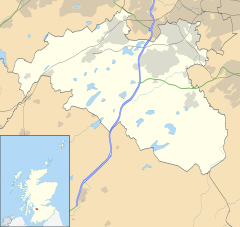 Thorntonhall  Thorntonhall Location within South Lanarkshire 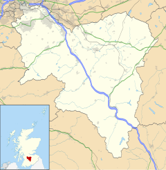 Thorntonhall Thorntonhall (South Lanarkshire) | |
| Area | 0.72 km2 (0.28 sq mi) [1] |
| Population | 660 (mid-2020 est.)[2] |
| • Density | 917/km2 (2,380/sq mi) |
| OS grid reference | NS5898755186 |
| Council area |
|
| Lieutenancy area | |
| Country | Scotland |
| Sovereign state | United Kingdom |
| Post town | Glasgow |
| Postcode district | G74 |
| Dialling code | 0141 |
| Police | Scotland |
| Fire | Scottish |
| Ambulance | Scottish |
| UK Parliament |
|
| Scottish Parliament |
|
In 2011, a street in Thorntonhall (Bowmore Crescent) was identified as having one of the most expensive average house prices within the Scottish property market, with an average house price of £908,000. [4]
History
Thorntonhall has a history reflecting the social changes of the last 400 years and in particular the last 120 years. It was originally just a farm that had added to it some major buildings. The then 'hall' was bought and greatly improved by a grocer called Cooper who had shops throughout the west of Scotland. Another grand house was built at Ravenscroft, again on a small hilltop. These two and the railway station were probably the catalyst for a great plan to build a mini-Edinburgh-style suburb of crescents and avenues. Only three houses were completed before the outbreak of World War I halted further development.[citation needed]
Before and during World War II Thorntonhall was one of the sites selected for relocation of government departments to avoid bombing raids.[citation needed] After the war it became part of the East Kilbride New town and this led to the construction of a large number of individual houses in this free standing village. That relative isolation led to an Upper Class housing development on a small scale throughout the period 1970 to 2000.
Demographics
The population of Thorntonhall is estimated, as of 2016, at 590.[1] The majority of Thortonhall's residents own their own property, and annual incomes are well above average. [citation needed]
Country Club
Thorntonhall has a country club which is located in the centre of the village. The clubhouse itself has catering facilities, a dining room and a members' lounge.[citation needed]
Transport
Road
The A727 bypasses the village.
Rail
The village is served by Thorntonhall railway station, which has hourly services to East Kilbride and Glasgow Central.
Notable residents
- Andy Cameron, comedian[5]
- Fred MacAulay, comedian[6]
- Peter Lawwell, chief executive of Celtic F.C.[7]
- Peter Løvenkrands, former footballer and coach for Rangers F.C.[8]
- Aiden McGeady, footballer[9]
- Michelle Mone, founder of Ultimo[10]
- Chris Sutton, footballer[6]
References
- "Thorntonhall (South Lanarkshire, Scotland, United Kingdom) - Population Statistics, Charts, Map, Location, Weather and Web Information". www.citypopulation.de. Retrieved 6 April 2019.
- "Mid-2020 Population Estimates for Settlements and Localities in Scotland". National Records of Scotland. 31 March 2022. Retrieved 31 March 2022.
- "List of railway station names". Newsnetscotland.com. 19 August 2011. Retrieved 10 April 2012.
- "Revealed: Scotland's most expensive street". HeraldScotland.com. 29 November 2011. Retrieved 25 September 2012.
- "Andy cashes in. - Free Online Library". thefreelibrary.com. 14 January 1996. Retrieved 30 January 2012.
- "THE RICHEST PLACE IN SCOTLAND; Stars' village tops list. - Free Online Library". Thefreelibrary.com. 7 January 2002. Retrieved 30 January 2012.
- THOMAS SMITH (19 August 2007). "pounds 35M ANGIE SET ON WAG ESTATE; EXCLUSIVE ..next to fellow Lot to winner. - Free Online Library". thefreelibrary.com. Retrieved 30 January 2012.
- "Ex-Gers star wins pounds 52k in house fight. - Free Online Library". thefreelibrary.com. 2 November 2008. Retrieved 30 January 2012.
- Thomson, Gordon (29 December 2011). "City misses out on rich homes - Evening Times | News". Evening Times. Retrieved 30 January 2012.
- David Wynn (20 January 2010). "Michelle Mone's mansion plans fall foul of elderly neighbour". East Kilbride News. Retrieved 30 January 2012.
External links
![]() Media related to Thorntonhall at Wikimedia Commons
Media related to Thorntonhall at Wikimedia Commons
Другой контент может иметь иную лицензию. Перед использованием материалов сайта WikiSort.org внимательно изучите правила лицензирования конкретных элементов наполнения сайта.
WikiSort.org - проект по пересортировке и дополнению контента Википедии