world.wikisort.org - United_Kingdom
Thankerton is a small village in South Lanarkshire, Scotland, United Kingdom. It is located between Biggar and Lanark, and situated between Quothquan Law and Tinto (two local hills).
This article needs additional citations for verification. (March 2013) |
| Thankerton | |
|---|---|
 Thankerton from the air | |
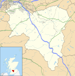 Thankerton Location within South Lanarkshire | |
| OS grid reference | NS972379 |
| Council area |
|
| Lieutenancy area | |
| Country | Scotland |
| Sovereign state | United Kingdom |
| Post town | BIGGAR |
| Postcode district | ML12 |
| Police | Scotland |
| Fire | Scottish |
| Ambulance | Scottish |
| UK Parliament | |
| Scottish Parliament |
|
Thankerton's name derives from an early feudal lord called Thancard the Fleming, and means Thancard's enclosure. Ton is Old English for an enclosed settlement, and evolved into the modern English word town. Thancard was probably one of the Flemish knights who accompanied David I to Scotland to claim the Scottish throne and as such was rewarded with grants of land in Scotland.
To the west of Thankerton is a hamlet called Eastend, on the south edge of the Carmichael Estate, whose main house, Eastend House, was used by the Polish Army between August 1940 and May 1941. A stone in the house, with the Polish eagle on it, commemorates the event.[1]
References
- "Outbreak of War and Arrival in Scotland". www.makers.org.uk. Retrieved 12 June 2012.
Settlements in South Lanarkshire | ||
|---|---|---|
| Towns |
|  |
| Villages and hamlets |
| |
List of places in South Lanarkshire | ||
Authority control | |
|---|---|
| General |
|
| National libraries | |
This South Lanarkshire location article is a stub. You can help Wikipedia by expanding it. |
На других языках
[de] Thankerton
Thankerton ist eine Ortschaft im Osten der schottischen Council Area South Lanarkshire beziehungsweise in der traditionellen Grafschaft Lanarkshire. Sie liegt rund zehn Kilometer südöstlich von Lanark am linken Clyde-Ufer.[1]- [en] Thankerton
Другой контент может иметь иную лицензию. Перед использованием материалов сайта WikiSort.org внимательно изучите правила лицензирования конкретных элементов наполнения сайта.
WikiSort.org - проект по пересортировке и дополнению контента Википедии