world.wikisort.org - Ukraine
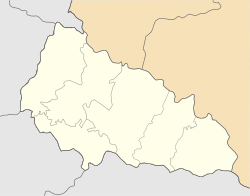
Uzhhorod (Ukrainian: У́жгород, pronounced [ˈuʒɦorod], Hungarian: Ungvár; German: Ungwar) is a city and municipality on the river Uzh in western Ukraine, at the border with Slovakia and near the border with Hungary. The city is approximately equidistant from the Baltic, the Adriatic and the Black Sea (650–690 km) making it the most inland city in this part of Europe. It is the administrative center of Zakarpattia Oblast (region), as well as the administrative center of the Uzhhorod Raion (district) within the oblast.
Uzhhorod
Ужгород | |
|---|---|
City | |
      | |
 Flag  Coat of arms | |
 Uzhhorod Location of Uzhhorod  Uzhhorod Uzhhorod (Ukraine) | |
| Coordinates: 48°37′26″N 22°17′42″E | |
| Country | |
| Oblast | |
| Raion | Uzhhorod Raion |
| Founded | 9th century |
| Government | |
| • Mayor | Bohdan Andriiv[1] (self-nominated[1]) |
| Area | |
| • Total | 65 km2 (25 sq mi) |
| Elevation | 169 m (554 ft) |
| Population (2021) | |
| • Total | 115,542 |
| • Density | 3,662/km2 (9,480/sq mi) |
| Time zone | UTC+2 (EET) |
| • Summer (DST) | UTC+3 (EEST) |
| Postal code | 88000 |
| Area codes | +380-312 |
| Sister cities | Békéscsaba, Nyíregyháza, Krosno, Trogir, Pula, Corvallis, Darmstadt, Košice |
| Climate | Cfb |
| Website | rada-uzhgorod |

Name
The city's earliest known name is Ungvár, from Hungarian Ung (River Uzh) and vár "castle, fortress", originally referring to a castle outside the city (probably Nevytske Castle[2]).[3][4]
The name Uzhhorod was coined in early 19th century Slavophile circles as a literal translation of the name Ungvár.[3][4] The city officially adopted this name in the early 20th century, under Czechoslovak administration.
The names of the city also include: English: Uzhgorod (before 1996); Rusyn: Ужгород, romanized: Užhorod, Rusyn: Унґвар, romanized: Ungvar (historically); Yiddish: אונגווער, romanized: Ingver, Yiddish: אונגוואַר, romanized: Ungvar; Czech: Užhorod; Slovak: Užhorod; German: Ungwar, Ungarisch Burg or Ungstadt; Polish: Użhorod; Romanian: Ujgorod.
History
Hungary (Middle Ages-WW1)
Principality of Hungary 895–1000
Kingdom of Hungary 1000–1526
Kingdom of Hungary 1526–1804
Austro-Hungarian Empire 1867–1919
Czechoslovakia 1920–1938
Kingdom of Hungary 1938–1945
Ukrainian SSR (
Soviet Union) 1945–1991
Ukraine 1991–present
Early history
Slavic beginnings
The best known of the first city founders are early Slavs. One of their tribes – White Croats – settled the area of the modern Uzhhorod in the second half of the first millennium AD.[6] During the 9th century a fortified castle changed into a fortified early feudal town-settlement, which became the center of a new Slavic principality, at the head of which was a mythical prince Laborec, who was vassal of Great Moravia .[6] Great Moravia, according to historians and experts did not extend as far east as Uzhgorod, in fact, it was west of what is now the City of Bratislava, Slovakia. According to Gesta Hungarorum, the city was under the rule of Salan, the Bulgarian Prince.[7]
Magyar conquest (895)
Having been encouraged by Salan's men, Almos's Magyars who had arrived in the region from Kyiv (then known as Kevevara) stormed Ung fortress in 895 AD. They encountered no resistance from the original "Ungvarian" White-Croats under Laborec and, after capture, Laborec was beheaded on the banks of the Laborcy river that still carries his name. Having taken over the Ung-Var, Almos appointed his son Árpád as prince of Hunguaria and from Ung-Var all of his warriors were called Hungarians instead. [8]
10th–15th centuries
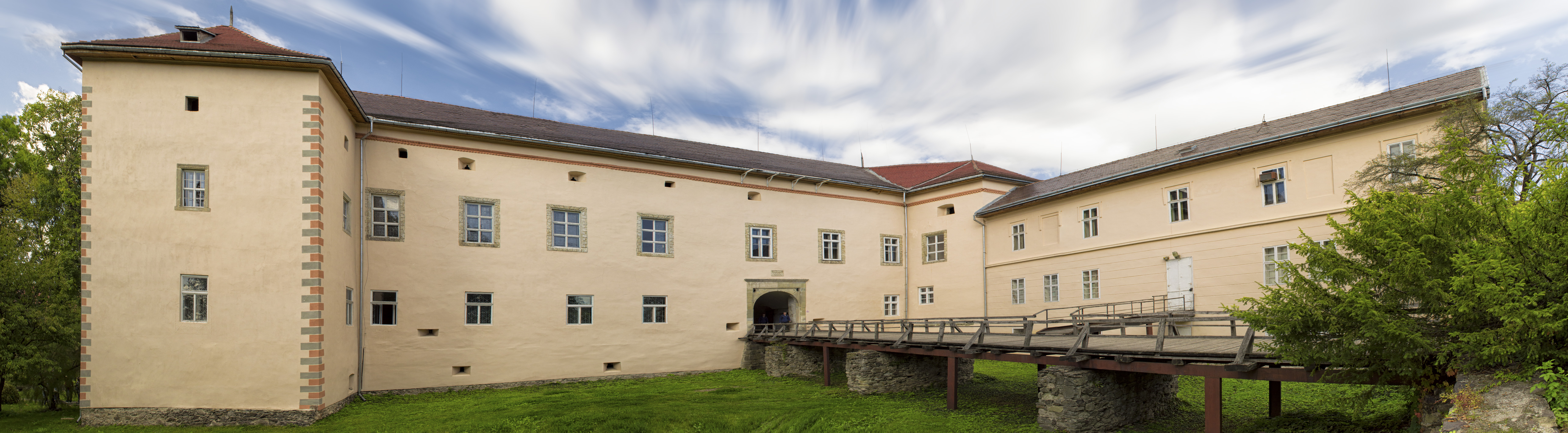
After the arrival of the Hungarians, the small town began to extend its borders. In 1241–1242 the Mongols of Batu Khan burnt the settlement. After, in 1248 the city was granted town privileges by the King Béla IV of Hungary. In the early 14th century, Uzhhorod showed strong resistance to the new Hungarian rulers of the Anjou dynasty. Although the majority of inhabitants were Hungarians, they wanted more freedom. From 1318 for 360 years, the Drugeths (Italian counts from the Kingdom of Naples) owned the town. During that period Philip Drugeth built Uzhhorod Castle. Together with the castle, the city began to grow. From 1430, Uzhhorod became a free royal town.
16th–18th centuries
During the 16–17th centuries there were many handicraft corporations in Uzhhorod. In this period the city was engaged in the religious fight between primarily Protestant Transylvania and Catholic Austria. In 1646 the Union of Ungvár was proclaimed and the Greek-Catholic church was established in Subcarpathia, in a ceremony held in the Ungvár castle by the Vatican Aegis. In 1707 Ungvár was the residence of Ferenc II Rákóczi, leader of the national liberation war of Hungarians against Vienna. From 1780 the city became the capital of the Greek Catholic Eparchy and from 1776 the center of a newly created school district.[9]

19th century

The beginning of the 19th century was characterized by economic changes, including the first factories in the city. The greatest influence on Ungvár among the political events of the 19th century was made by the Hungarian Revolution of 1848-1849, during which the native Hungarian nobility sought both to shake off the suzerainty of the Austrian Empire and to have authority over their own people. 27 March 1848 was officially celebrated in the city as the overthrow of the monarchy in Hungary. It is now celebrated in Hungary on 15 March.
In 1872 the first railway line opened, linking the city to the important railway junction of Chop, then known as Csap.
20th century
According to the 1910 census, the city had 16,919 inhabitants, of which 13,590 (80.3%) were Magyars, 1,219 (7.2%) Slovaks, 1,151 (6.8%) Germans, 641 (3.8%) Rusyns and 1.6% Czechs.[10] Since Jews were not counted as ethnicity (as defined by language), rather only religious group, this Austrian-Hungarian census does not specifically mention the Jewish population, which was significant, and represented about 31% of the total population in 1910.[11] At the same time, the municipal area of the city had a population composed of 10,541 (39.05%) Hungarians, 9,908 (36.71%) Slovaks, and 5,520 (20.45%) Rusyns.[12]
The First World War slowed down the tempo of city development. On 10 September 1919, Subcarpathia was officially allocated to the Republic of Czechoslovakia. Uzhhorod became the administrative center of the territory. During these years Uzhhorod developed into an architecturally modern city.[13]
After the First Vienna Award in 1938, Uzhhorod was given back to Hungary from which it was separated after WWI.
In 1941 the Jewish population reached 9,576.[citation needed] On 19 March 1944, Germans troops entered the city. They established a Judenrat (Jewish council) and set up two ghettos, at the Moskovitz brickyard and Gluck lumberyard. During May 1944, all Jews were deported to Auschwitz in five different transports and subsequently murdered. Only a few hundred Jews survived.[14]

On 27 October 1944, the city was captured by the troops of the 4th Ukrainian Front of the Red Army.[citation needed] Thousands of ethnic Hungarians were killed, expelled, or else taken to work in Soviet forced labor camps.[citation needed] The Hungarian majority population was decimated in order to strengthen the Soviet and Ukrainian right to the city.[citation needed]
This period brought significant changes. On the outskirts of Uzhhorod new enterprises were constructed and the old enterprises were renewed.[citation needed] On 29 June 1945, Subcarpathian Ukraine was annexed by the Soviet Union and became a westernmost part of the Ukrainian SSR. That year the Uzhhorod State University (now Uzhhorod National University) was also opened. Since January 1946 Uzhhorod was the center of newly formed Zakarpatska oblast.
Since 1991 Uzhhorod has become one of 24 regional capitals within Ukraine. Of these, Uzhhorod is the smallest and westernmost.
21st century
In 2002, a bust of Tomáš Masaryk, Czechoslovakia's first president, was unveiled in a main square of the city. A similar bust was unveiled in 1928 on the 10th anniversary of Czechoslovak independence, but was removed by the Hungarians when they took over the region in 1939.[15]
On 15 April 2022, as part of the derussification campaign that swept through Ukraine following the February 2022 Russian invasion of Ukraine, the Uzhhorod City Council decided to rename 58 streets connected to Russian figures.[16]
United States First Lady Jill Biden visited the city on 8 May 2022, which was not announced to the public until after the visit.[17]
Climate

Uzhhorod has a humid continental climate (Köppen: Dfb) with cool to cold winters and warm summers. The coldest month is January with an average temperature of −1.7 °C (28.9 °F) while the warmest month is July with an average temperature of 20.9 °C (69.6 °F).[18] The coldest temperature ever recorded is −28.2 °C (−18.8 °F) and the warmest temperature was 38.6 °C (101.5 °F). Average annual precipitation is 748 millimetres (29.4 in), which is evenly distributed throughout the year though the summer months have higher precipitation.[18] On average, Uzhhorod receives 2023 hours of sunshine per year.[19]
| Climate data for Uzhhorod (1991–2020, extremes 1947–present) | |||||||||||||
|---|---|---|---|---|---|---|---|---|---|---|---|---|---|
| Month | Jan | Feb | Mar | Apr | May | Jun | Jul | Aug | Sep | Oct | Nov | Dec | Year |
| Record high °C (°F) | 13.3 (55.9) |
17.2 (63.0) |
25.4 (77.7) |
29.7 (85.5) |
33.4 (92.1) |
35.0 (95.0) |
38.6 (101.5) |
38.4 (101.1) |
35.9 (96.6) |
26.1 (79.0) |
23.3 (73.9) |
15.6 (60.1) |
38.6 (101.5) |
| Average high °C (°F) | 1.7 (35.1) |
4.3 (39.7) |
10.4 (50.7) |
17.4 (63.3) |
22.1 (71.8) |
25.5 (77.9) |
27.6 (81.7) |
27.7 (81.9) |
21.9 (71.4) |
15.6 (60.1) |
9.2 (48.6) |
3.0 (37.4) |
15.5 (59.9) |
| Daily mean °C (°F) | −1.2 (29.8) |
0.6 (33.1) |
5.4 (41.7) |
11.5 (52.7) |
16.1 (61.0) |
19.6 (67.3) |
21.3 (70.3) |
21.1 (70.0) |
15.9 (60.6) |
10.5 (50.9) |
5.4 (41.7) |
0.3 (32.5) |
10.5 (50.9) |
| Average low °C (°F) | −4.2 (24.4) |
−3.0 (26.6) |
0.8 (33.4) |
5.6 (42.1) |
10.1 (50.2) |
13.7 (56.7) |
15.3 (59.5) |
14.9 (58.8) |
10.4 (50.7) |
5.9 (42.6) |
1.9 (35.4) |
−2.3 (27.9) |
5.8 (42.4) |
| Record low °C (°F) | −28.2 (−18.8) |
−26.3 (−15.3) |
−17.5 (0.5) |
−6.9 (19.6) |
−4.4 (24.1) |
1.5 (34.7) |
5.4 (41.7) |
4.4 (39.9) |
−2.2 (28.0) |
−9.3 (15.3) |
−21.8 (−7.2) |
−24.7 (−12.5) |
−28.2 (−18.8) |
| Average precipitation mm (inches) | 54 (2.1) |
53 (2.1) |
41 (1.6) |
45 (1.8) |
69 (2.7) |
68 (2.7) |
82 (3.2) |
67 (2.6) |
68 (2.7) |
62 (2.4) |
58 (2.3) |
64 (2.5) |
731 (28.8) |
| Average extreme snow depth cm (inches) | 7 (2.8) |
7 (2.8) |
1 (0.4) |
0 (0) |
0 (0) |
0 (0) |
0 (0) |
0 (0) |
0 (0) |
0 (0) |
0 (0) |
4 (1.6) |
7 (2.8) |
| Average rainy days | 11 | 10 | 13 | 15 | 16 | 16 | 15 | 13 | 13 | 13 | 14 | 13 | 162 |
| Average snowy days | 14 | 12 | 5 | 1 | 0.03 | 0 | 0 | 0 | 0 | 0.3 | 5 | 12 | 49 |
| Average relative humidity (%) | 82.6 | 76.2 | 67.4 | 61.4 | 65.2 | 68.0 | 67.4 | 68.6 | 72.8 | 76.0 | 80.1 | 83.3 | 72.4 |
| Mean monthly sunshine hours | 55.8 | 87.0 | 152.7 | 202.4 | 266.2 | 266.3 | 279.1 | 269.2 | 189.8 | 140.4 | 71.4 | 45.8 | 2,023.1 |
| Source 1: Pogoda.ru.net[18] | |||||||||||||
| Source 2: World Meteorological Organization (humidity and sun 1981–2010)[19] | |||||||||||||
Demographics
According to the Ukrainian 2001 census, the population of Uzhhorod included:[20]
- Ukrainians (77.8%)
- Russians (9.6%)
- Hungarians (6.9%)
- Slovaks (2.2%)
- Romani (1.5%)
Transportation

The city is served by Uzhhorod railway station and has railway connections with Chop and Lviv. It is also served by Uzhhorod International Airport.[21]
Sport
The city was home to the SC Rusj Užhorod football club from 1925. Contemporary side FC Hoverla Uzhhorod made their debut in the Ukrainian Premier League in 2001, but dissolved in 2016 due to money issues.[22]
In 2020 professional football matches at the highest levels of Ukraine returned to Uzhhorod since the 2020–21 season FC Mynai plays its home matches in the Avanhard Stadium.[23] FC Uzhhorod currently in Ukrainian Second League also plays its matches at Avanhard Stadium.
International relations
Uzhhorod is currently twinned with:
 Békéscsaba, Hungary
- Nyíregyháza, Hungary
- Szombathely, Hungary
 Trogir, Croatia
- Pula, Croatia
 Corvallis, Oregon, US
 Darmstadt, Germany, since 1992[24]
 Košice, Slovakia, since 1993[25]
 Krosno, Poland, since 2008[26]
- Jarosław, Poland, since 2002[27]
- Česká Lípa, Czech Republic
 Satu Mare, Romania[28]
- Târgu Mureș, Romania
Notable people


- Arieh Atzmoni (1926–2005) an Israeli soldier rewarded with the Hero of Israel
- János Erdélyi (1814 in Veľké Kapušany – 1868) Hungarian poet, critic, author and philosopher.[29]
- Renée Firestone (born 1924), Holocaust survivor, fashion designer
- Lisa Fittko (1909–2005) author and helper to many escaping Nazi-occupied France during WWII.
- Wilem Frischmann (born 1931) WWII refugee, became a leading British engineer
- Shlomo Ganzfried (1804–1886), an Orthodox rabbi of Ungvar and posek
- József Gáti (1885-1945) an ethnic Hungarian communist politician from Subcarpathian Rus
- Jenő Janovics (1872–1945) a Hungarian film director, screenwriter and actor of the silent era.
- Józef Kasparek (1915 in Broumov - 2002), a Polish lawyer, historian and political scientist in the US; carried out covert operations in Carpathian Rus 1938/39.
- Mikhail Kopelman (born 1947), a Russian-American violinist, first violin in the Kopelman Quartet
- Joseph L. Kun (1882–1961), emigrated to the US aged 4, became a judge in Pennsylvania
- Serhiy Kvit (born 1965), a Ukrainian literary critic, journalist, educator and social activist.
- Samuel Lipschütz (1863–1905), a chess player and author
- Nil Lushchak (born 1973) a Ruthenian Catholic hierarch for Mukachevo.
- Jonathan Markovitch (born 1967) a Ukrainian rabbi and the Chief rabbi of Kyiv
- József Örmény (born 1960), a Ukrainian pianist of Hungarian origin.
- Ilka Pálmay (1859–1945), a Hungarian-born singer and actress.
- Dezső Pattantyús-Ábrahám (1875–1973) a Hungarian politician from an ancient and noble family
- Serhiy Ratushniak (born 1961) former long-term Mayor of Uzhhorod, 1994–2002 & 2006–2010
- Lika Roman (born 1985), a Ukrainian model, charity worker and Miss Ukraine, 2007
- Zsuzsanna Sirokay (born 1941) a Hungarian pianist, she lives in Switzerland.
- Avgustyn Voloshyn (1874 in Kelechyn – 1945), a Subcarpathian politician, teacher and priest
- Yolka (born 1982), singer, songwriter, recording artist, presenter and actress.
- Anatoly Zatin (born 1954), a Mexican composer, pianist and orchestral conductor
- Gregory Zatkovich (1886 in Holubyne – 1967), an American lawyer and first governor of Carpathian Ruthenia
- Paul Zatkovich (1852—1916) newspaper editor and cultural activist for Rusyns in the US.
Sport
- Matviy Bobal (born 1984) a Ukrainian football forward with ca. 300 club caps
- Juraj Demeč (born 1945) a Czechoslovak former track and field athlete who competed at the 1972 Summer Olympics
- Vladimir Koman (born 1989), a footballer with nearly 300 club caps and 36 for Hungary
- Vladyslav Mykulyak (born 1984) a Ukrainian retired footballer with 320 club caps.
- Yozhef Sabo (born 1940), a former football player with 347 club caps and 76 for the Soviet Union
- György Sándor (born 1984) a Carpathian Ruthenian footballer with 370 club caps and 9 for Hungary
- István Sándor (born 1986) an Hungarian footballer with 380 club caps
- Daria Shestakova (born 1996) a Russian rugby sevens player.
- Tetyana Trehubová (born 1989) a Ukrainian-born Slovak handball player.
See also
- Bridges in Uzhhorod
- Uzhgorod Synagogue
- Zakarpattia Oblast
References
- National parties lose out to local candidates in Ukraine’s 2020 municipal elections UkraineAlert by Brian Mefford, Atlantic Council (12 December 2020)
CEC names winners of mayoral elections in Uzhgorod, Berdiansk, Sloviansk, Interfax-Ukraine (23 November 2020) - Németh, Péter (2007). "Álom és valóság: Ung vára" (PDF). Castrum. 6: 5–10. ISSN 1787-1093.
- Sebestyén, Zsolt (2020). "Ungvár, Ужгород". Kárpátalja helységnevei [The Placenames of Transcarpathia] (PDF) (in Hungarian). Nyíregyháza. pp. 457–459. ISBN 978-973-0-31294-2.
- Галас, Кирило (2002). "«Словник українських топонімів Закарпаття» (фрагменти)". Сучасні проблеми мовознавства та літературознавства. 6: 365–376.
- 'The Great Experiment: The Story of Ancient Empires, Modern States, and the Quest for a Global Nation' by Strobe Talbott, 2008 (page 243)
- Magocsi, Paul R. (30 July 2005). Our people: Carpatho-Rusyns and their descendants in North America. Bolchazy-Carducci Publishers. p. 5. ISBN 9780865166110.
- Mészáros, Károly (1861). Ungvár Története. Ráth Mór. p. 9.
- Deeds of the Hungarians by Anonymous, Chapter 13
- A 1777 évi Ratio educationis. 1913.
- Atlas and Gazetteer of Historic Hungary 1914, Talma Kiadó Archived 14 January 2017 at the Wayback Machine
- KATZ, Marshall J. "Uzhhorod (Ungvár), Ukraine KehilaLink". kehilalinks.jewishgen.org. Retrieved 8 May 2017.
- "Ung County". Genealogy Online. Retrieved 17 March 2007.
- "Uzhhorod Modernism". am.umodernism.com. Retrieved 28 June 2019.
- "Uzhorod". Kehilalinks. Retrieved 22 March 2017.
- PRECLÍK, Vratislav: "Profesor Masaryk a Podkarpatská Rus právě před sto lety" (Professor Masaryk and Subcarpatian Russia just hundred years ago), in Čas: časopis Masarykova demokratického hnutí, leden - březen 2019, roč.XXVII. čís. 125. ISSN 1210-1648, str.18 – 23
- ROMAN PETRENKO (15 April 2022). "Uzhhorod is totally derusified". Ukrayinska Pravda (in Ukrainian). Retrieved 1 November 2022.
- "First lady Jill Biden makes unannounced trip to Ukraine". CNN. 8 May 2022.
- "Pogoda.ru.net". Weather and Climate for Uzhhorod (in Russian). Archived from the original on 14 December 2019. Retrieved 8 November 2021.
- "World Meteorological Organization Climate Normals for 1981–2010". World Meteorological Organization. Archived from the original on 17 July 2021. Retrieved 17 July 2021.
- "Zakarpattia Region". Ukrainian 2001 census. Archived from the original on 11 September 2007. Retrieved 17 March 2007.
- Flights to resume at Uzhgorod Airport as Ukraine, Slovakia reportedly settle border issues, UNIAN (19 August 2020)
- "Велика пихатість маленького клубу. Як команда-привид збирала зірок" [The great pomp of the little club. How the ghost team collected stars]. UA-Football. 2 April 2018. Retrieved 7 April 2018.
- "Minai will play home matches of the Premier League at Avangard Stadium in Uzhhorod". PMG.ua (in Ukrainian). Retrieved 19 August 2020.
- "Städtepartnerschaften und Internationales". Büro für Städtepartnerschaften und internationale Beziehungen (in German). Archived from the original on 23 July 2013. Retrieved 26 July 2013.
- "Twin cities of the City of Kosice". Magistrát mesta Košice, Tr. Retrieved 27 July 2013.
- "Krosno Official Website – Partner Cities" (in Polish). Urząd Miasta Krosna. Retrieved 23 October 2008.
- "Jarosław Official Website – Partner Cities" (in Polish). Urząd Miasta Jarosław. Ul. Rynek 1, 37–500 Jarosław. Retrieved 23 October 2008.
- "Protocol de colaborare Ujgorod-Satu Mare" (in Romanian). www.satu-mare.ro. Retrieved 27 June 2009.
- . Encyclopædia Britannica. Vol. 9 (11th ed.). 1911. p. 734.
Further reading
- Rampley, Matthew (2019). "Uzhhorod Modernism" (2019). https://craace.com/2019/05/09/uzhhorod-modernism/
- Véghseő, Tamás (2015). "Reflections on the Background to the Union of Uzhhorod / Ungvár (1646)" (PDF). Eastern Theological Journal. 1 (1): 147–181.
External links
 Definitions from Wiktionary
 Media from Commons
 News from Wikinews
 Quotations from Wikiquote
 Texts from Wikisource
 Textbooks from Wikibooks
 Travel information from Wikivoyage
 Resources from Wikiversity
- Official website of the City
- Official website of Uzhhorod National University
- Uzhhorod in old postcards
- Uzhhorod Modernism Architectural Manual
Administrative center: Uzhhorod | ||
| Raions | ||
| Hromadas | ||
| Cities | ||
| Urban-type settlements | ||
Capital: Kyiv | |
| Oblasts | |
| Cities with special status | |
| Autonomous republic |
|
| Administrative centers |
|
1Claimed and controlled by Russia as the Republic of Crimea and the Federal City of Sevastopol 2Partly under military occupation and controlled by Russia | |
Authority control | |
|---|---|
| General |
|
| National libraries | |
| Other |
|
На других языках
[de] Uschhorod
Uschhorod (ukrainisch Ужгород, Aussprache: .mw-parser-output .IPA a{text-decoration:none}[ˈuʒɦɔrɔd] ; russisch Ужгород .mw-parser-output .Latn{font-family:"Akzidenz Grotesk","Arial","Avant Garde Gothic","Calibri","Futura","Geneva","Gill Sans","Helvetica","Lucida Grande","Lucida Sans Unicode","Lucida Grande","Stone Sans","Tahoma","Trebuchet","Univers","Verdana"}Uschgorod, ungarisch Ungvár, deutsch Ungwar, russinisch Уґоград Ugohrad, tschechisch und slowakisch Užhorod) ist die Hauptstadt der Oblast Transkarpatien in der Ukraine und Sitz des Verwaltungszentrums für den Rajon Uschhorod. Sie liegt im Dreiländereck zwischen Ungarn, der Slowakei und der Ukraine, direkt an der slowakischen Grenze. Sie zählt 117.300 Einwohner (Volkszählung 2001) und ist Sitz eines griechisch-katholischen Bistums (Oberhaupt der ruthenischen Kirche).- [en] Uzhhorod
[es] Úzhgorod
Úzhgorod (en ucraniano: У́жгород; TR: Ùzhhorod [ˈuʒɦorod] ( escuchar)) es una ciudad de importancia regional situada en el oeste de Ucrania, en la frontera con Eslovaquia y cerca de la frontera con Hungría. Es la capital de la óblast de Transcarpatia y del raión de Úzhgorod, si bien no pertenece a este último.[ru] Ужгород
У́жгород (укр. Ужгород, венг. Ungvár, чеш. и словацк. Užhorod, рум. Ujgorod, нем. Uschgorod, идиш וזשגאָראָד) — город на западе Украины. Административный центр Закарпатской области и Ужгородского района. Центр Ужгородско-Мукачевской агломерации. Составляет Ужгородскую городскую общину. Является крупнейшим городом Закарпатья.Другой контент может иметь иную лицензию. Перед использованием материалов сайта WikiSort.org внимательно изучите правила лицензирования конкретных элементов наполнения сайта.
WikiSort.org - проект по пересортировке и дополнению контента Википедии