world.wikisort.org - Ukraine
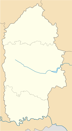
Khmelnytskyi (Ukrainian: Хмельни́цький, romanized: Khmelnytskyi, pronounced [xmelʲˈnɪtsʲkɪj] IPA: [xmeʎˈn̪ɪt͡sʲkɪi̯] (![]() listen)), until 1954 Proskuriv (Ukrainian: Проску́рів [proˈskur⁽ʲ⁾iu̯]), is a city in western Ukraine, the administrative center for Khmelnytskyi Oblast (region) and Khmelnytskyi Raion (district). It hosts the administration of the Khmelnytskyi urban hromada.[2] Khmelnytskyi is located in the historic region of Podolia on the banks of the Buh River. The city received its current local government designation in 1941. The current city's population is estimated 274,582 (2021 est.)[3], making it the second largest city of the former, archaic Podolia region after Vinnytsia and the largest city of the western part of the region.
listen)), until 1954 Proskuriv (Ukrainian: Проску́рів [proˈskur⁽ʲ⁾iu̯]), is a city in western Ukraine, the administrative center for Khmelnytskyi Oblast (region) and Khmelnytskyi Raion (district). It hosts the administration of the Khmelnytskyi urban hromada.[2] Khmelnytskyi is located in the historic region of Podolia on the banks of the Buh River. The city received its current local government designation in 1941. The current city's population is estimated 274,582 (2021 est.)[3], making it the second largest city of the former, archaic Podolia region after Vinnytsia and the largest city of the western part of the region.
This article may be expanded with text translated from the corresponding article in Ukrainian. (July 2022) Click [show] for important translation instructions.
|
Khmelnytskyi
Хмельницький | |
|---|---|
City | |
      | |
 Flag  Coat of arms | |
 Khmelnytskyi Location of Khmelnytskyi in Ukraine  Khmelnytskyi Khmelnytskyi (Ukraine) | |
| Coordinates: 49°25′0″N 27°00′0″E | |
| Country | |
| Oblast | |
| Raion | Khmelnytskyi Raion |
| First mentioned | 1431 |
| City rights | September 22, 1937 |
| Government | |
| • Mayor | Oleksandr Symсhyshyn[1] (Svoboda[1]) |
| Area | |
| • Total | 90 km2 (30 sq mi) |
| Population (2021) | |
| • Total | 274,582 |
| • Density | 2,822/km2 (7,310/sq mi) |
| Postal code | 29000 |
| Area code | +380 382 |
| Website | http://www.khmelnytsky.com |
History

This section needs expansion. You can help by adding to it. (August 2013) |
The city foundation date is uncertain. The territory, where Khmelnytskyi is situated, has been inhabited for a very long time. Many archaeological discoveries have been made in the city suburbs. For example, to the East of Lezneve district, there was a settlement from the Bronze Age 2000 B.C., and from Scythian times from 7–3 century B.C.[4] The first mention of the city was written with Cyrillic alphabet. The earliest known mention in historical sources was in 1431,[5] when it was known as Płoskirów (Ploskirov, Плоскиров) and was part of the Kingdom of Poland. It was a royal city.
Polish rule was briefly interrupted by Ottoman one between 1672 and 1699. During this period, it was nahiya centre in Mejibuji sanjak in Podolia Eyalet as Poloskiruf.[6] After the Second Partition of Poland in 1793, the city was annexed by the Russian Empire and was renamed Proskurov (Проскурoв). According to the Russian census of 1897, Proskurov with a population of 22,855 was the fifth largest city of Podolia after Kamianets-Podilskyi, Uman, Vinnytsia and Balta. In 1920 it became part of Soviet Ukraine. In 1954 the city was finally renamed Khmelnytskyi (Хмельницький) in the honor of the 300th anniversary of a treaty negotiated by Bohdan Khmelnytsky.
After new archival sources presented at the 2006 conference City of Khmelnytskyi in the Context of Ukrainian History post-dated the city’s earliest mention from 1493 to 1431, it changed its official 513th anniversary commemoration to its 575th.[7]
Pogroms
A series of anti-Jewish pogroms have been carried out in the region, known together as the Proskurov pogrom. According to Vinnytsia's city archives, the pogrom was conducted on the Friday night of February 15, 1919, by one of the otamans (generals) of the Ukrainian People's Army, Otaman Semysenko (also rendered as Semesenko). Estimates vary as to the number of victims, some putting the death toll at 1,500 Jews in Proskurov alone, with 600 more killed in nearby Filshtein.[8]
The Chief Otaman Petliura had been appointed head of state just two days prior to the tragedy, on February the 13th. Petliura issued Order 131 in which he mentioned the fact that numerous Jewish parties in Ukraine (Bund, Poale Zion, Folks-Partei, Unificationists) rose to defend the sovereignty of the Ukrainian Republic and were cooperating with the Ukrainian government. He condemned such pogroms, calling those initiating them deserters and enemies of the State that must be liquidated. The order was co-signed by the Chief of Staff, Otaman Yunakiv. The order was published in the Ukraina newspaper on February 20 (March 4, old style). Later, Petliura issued a special order to execute Semysenko for being the pogrom initiator. According to sources the order was carried out[9] on March 20, 1920.[citation needed] Other sources claim that he was released.[9]
During the Schwartzbard trial, at the end of which Petliura's assassin was pardoned on the grounds of self-trail (revenge), the main argument of the defense was that Schwartzbard had acted as an avenger of the Jews killed in pogroms perpetrated during Petliura's rule.
World War II

The town was occupied by the German Army from July 8, 1941 to March 25, 1944. On November 4, 1941, 5300 Jewish inhabitants of the town and surrounding villages were shot by an Einsatzgruppe.[10] A ghetto was formed on December 14, 1941, where all surviving Jewish inhabitants had to resettle and were subjected to forced labor. They were subsequently killed in the fall of 1942. More than 9500 Jews were killed in the town in total.[11]
After World War II
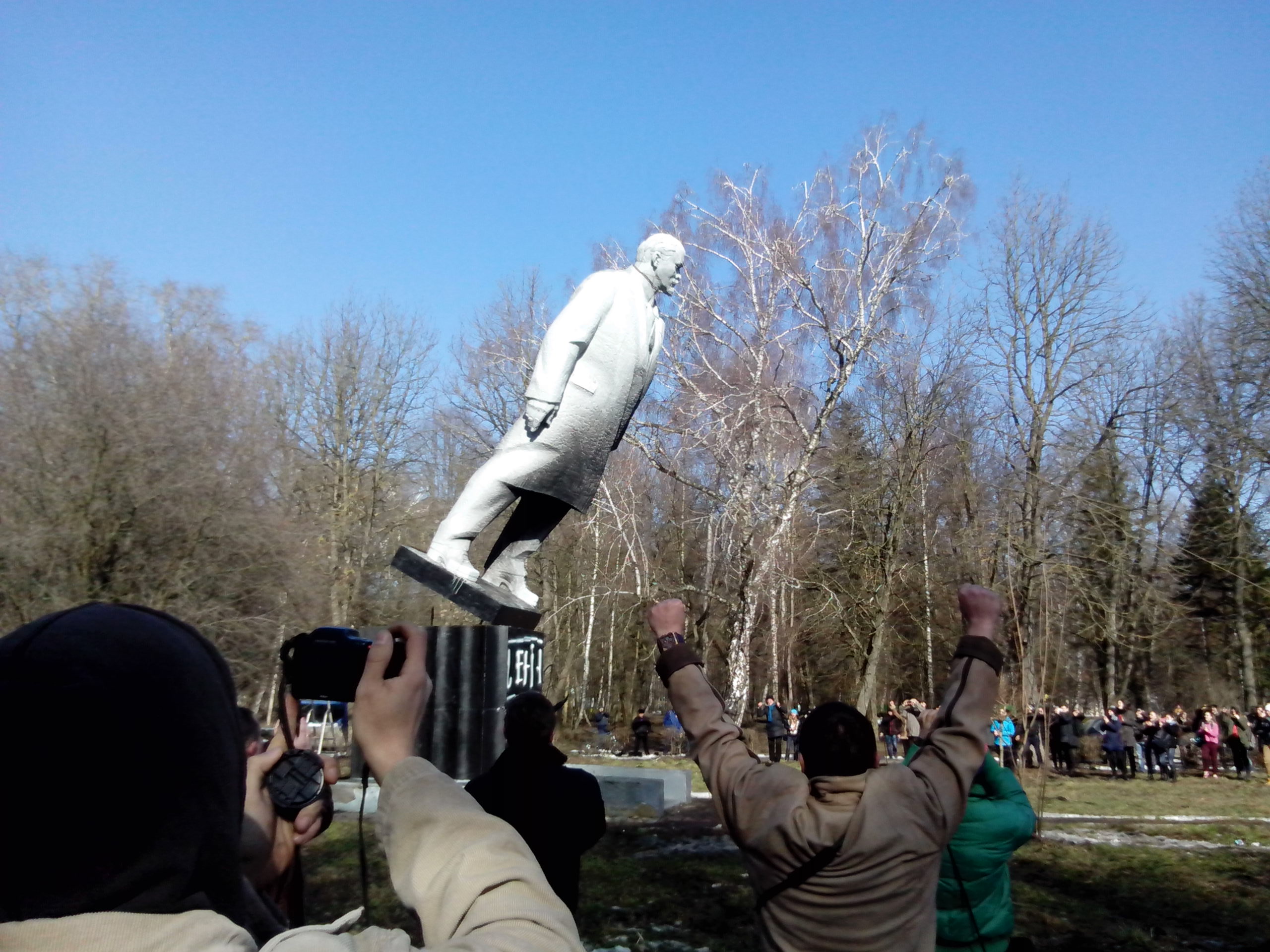
Khmelnytskyi was home to the 19th Division of the 43rd Rocket Army of the Soviet Strategic Rocket Forces during the Cold War.[12] The intercontinental ballistic missile silos of the division that were housed there were removed and destroyed, partially with U.S. Cooperative Threat Reduction funding, during the 1990s.
Until 18 July 2020, Khmelnytskyi was incorporated as a city of oblast significance and served as the administrative center of Khmelnytskyi Raion though it did not belong to the raion. In July 2020, as part of the administrative reform of Ukraine, which reduced the number of raions of Khmelnytskyi Oblast to three, the city of Khmelnytskyi was merged into Khmelnytskyi Raion.[13][14]
2022 Russian Invasion of Ukraine
Main articles: 2022 Russian Invasion of Ukraine and 10 October 2022 missile strikes on Ukraine
The Russian forces did not attack Khmelnitskyi during the first 7 months of the war. On 10 October 2022 however, the city has been targeted by Russian cruise missiles, causing a blackout and limiting water supply.[15]
Geography and natural resources

Khmelnytskyi is the regional center of the Khmelnytskyi region which is located in the western part of Ukraine in the middle of Podillia, its total area makes up 8,624 ha (21,310 acres). Khmelnytskyi has a favorable geographical position. Khmelnytskyi is crossed by one of the longest rivers of Ukraine – the Southern Bug. Coincidentally, through the western portion of the city flows the small river Ploska.
The climate of Khmelnytskyi is moderately continental. The average temperature of Khmelnytskyi in its warmest month (July) is 20 to 22 °C (68 to 72 °F), and the average temperature in the coldest month (January) is −5 to −6 °C (23 to 21 °F). The maximum temperatures in the summer on average reaches 36 to 38 °C (97 to 100 °F), and the minimum temperatures in the winter on average is −24 to −30 °C (−11 to −22 °F). Khmelnytskyi's average annual temperature is 7 to 8 °C (45 to 46 °F). Khmelnytskyi's average annual precipitation is 510 to 580 mm (20.08 to 22.83 in).
The most abundant make up for the ground in Khmelnytskyi are layers of the following overburden: loess and loess-type rocks. The ground-climatic conditions of Khmelnytskyi are favorable for the cultivation of winter wheat and rye, sugar beet, potato and other crops. Khmelnytskyi is also ideal for the development of gardening and vegetable growing. In the territory of Khmelnytskyi there are the vegetations of two geobotanical zones of Ukraine: Polissya and forest-steppe. Khmelnytskyi and its greater region supplies many rock products, particularly building materials such as limestone, plaster, chalk, tripoli powder, crystal layers (granites, gneisses), sand, sandstones, and also graphite, saponite, kaolin, phosphorite, lithographic stone, and roofing slate. There are also deposits of peat, bitumen, shale, and oil.
| Climate data for Khmelnytskyi (1981–2010, extremes 1955-2011) | |||||||||||||
|---|---|---|---|---|---|---|---|---|---|---|---|---|---|
| Month | Jan | Feb | Mar | Apr | May | Jun | Jul | Aug | Sep | Oct | Nov | Dec | Year |
| Record high °C (°F) | 12.0 (53.6) |
17.1 (62.8) |
23.0 (73.4) |
26.5 (79.7) |
31.7 (89.1) |
33.9 (93.0) |
35.5 (95.9) |
34.0 (93.2) |
30.4 (86.7) |
26.6 (79.9) |
20.0 (68.0) |
12.8 (55.0) |
35.5 (95.9) |
| Average high °C (°F) | −1.4 (29.5) |
−0.2 (31.6) |
5.1 (41.2) |
13.4 (56.1) |
19.8 (67.6) |
22.1 (71.8) |
24.2 (75.6) |
23.8 (74.8) |
18.4 (65.1) |
12.3 (54.1) |
4.7 (40.5) |
−0.4 (31.3) |
11.8 (53.2) |
| Daily mean °C (°F) | −4.0 (24.8) |
−3.2 (26.2) |
1.1 (34.0) |
8.2 (46.8) |
14.2 (57.6) |
16.9 (62.4) |
18.8 (65.8) |
18.2 (64.8) |
13.2 (55.8) |
7.7 (45.9) |
1.7 (35.1) |
−2.8 (27.0) |
7.5 (45.5) |
| Average low °C (°F) | −6.7 (19.9) |
−6.1 (21.0) |
−2.2 (28.0) |
3.5 (38.3) |
9.0 (48.2) |
12.1 (53.8) |
14.0 (57.2) |
13.2 (55.8) |
8.9 (48.0) |
4.0 (39.2) |
−0.8 (30.6) |
−5.3 (22.5) |
3.6 (38.5) |
| Record low °C (°F) | −30.5 (−22.9) |
−27.0 (−16.6) |
−23.6 (−10.5) |
−7.2 (19.0) |
−2.8 (27.0) |
2.2 (36.0) |
3.6 (38.5) |
2.1 (35.8) |
−5.0 (23.0) |
−11.4 (11.5) |
−17.8 (0.0) |
−25.4 (−13.7) |
−30.5 (−22.9) |
| Average precipitation mm (inches) | 31.1 (1.22) |
31.5 (1.24) |
31.9 (1.26) |
45.5 (1.79) |
58.5 (2.30) |
96.6 (3.80) |
106.9 (4.21) |
71.3 (2.81) |
58.8 (2.31) |
37.1 (1.46) |
38.8 (1.53) |
37.8 (1.49) |
645.8 (25.43) |
| Average precipitation days (≥ 1.0 mm) | 8.2 | 7.9 | 7.7 | 8.0 | 8.9 | 10.9 | 10.8 | 7.9 | 8.3 | 7.0 | 8.0 | 9.2 | 102.8 |
| Average relative humidity (%) | 87.0 | 84.4 | 79.5 | 69.5 | 67.9 | 73.4 | 74.5 | 73.1 | 77.5 | 81.2 | 87.5 | 88.3 | 78.7 |
| Source 1: World Meteorological Organization[16] | |||||||||||||
| Source 2: Climatebase.ru (extremes)[17] | |||||||||||||
Demographics
According to a 2017 survey, 84% of the population are ethnic Ukrainians and 13% are Russians.[18]
The average life expectancy of its inhabitants is 65 years for men, and 75 years for women.[when?]
Education
Khmelnytskyi hosts 6 universities, 2 academies, 3 institutes, 12 colleges, 4 technical schools and 15 representative offices of other Ukrainian HEIs.[19][20]
Transport

Khmelnytskyi has infrastructure for transportation connections with Moscow, Prague, Bratislava, Warsaw, Budapest, Belgrade and all major Ukrainian cities. The distance from Khmelnytskyi to Kyiv by railway is estimated to be 366 km (227 mi), by highway it is estimated to be 384 km (239 mi). The highways Kyiv-Lviv, Odessa-Lviv and Chernivtsi-Kyiv pass through Khmelnytskyi. The city is served by the Khmelnytskyi Ruzhychna Airport. Khmelnytskyi's airport has a 2,200 m (7,217.85 ft) concrete runway; at the airport there is a check point for crossing the state border of Ukraine.
Sports

Khmelnytskyi is home to the competitive football team FC Dynamo Khmelnytskyi.
Points of interest
- Proskurivska street, a modern central pedestrian street of the city, preserved buildings of the end of the 19th - the beginnings of 20th century in the styles of modernist, eclecticisms, Baroque, stone (characteristic only for Proskuriv).
- The house of the former Oleksiyivske real school (now it is the building of the City Executive Committee)
- The house of O. Brusilov (now is the House of Ceremonial events)
- The church of Nativity of the Virgin (the first stone construction in the city)
- The Protection cathedral
- St. George church
- Andriy Pervozvannyi church in "Dubovo" district
Notable people


- Nellie Casman (1896–1984) an actress and singer in Yiddish theatre in New York.
- Ariel Durant (1898–1981) an American author and historian
- Svyatoslav Fyodorov (1927–2000) a Russian ophthalmologist, politician and professor
- Alberto Gerchunoff (1883–1950), Argentine author and journalist
- Max Husmann (1888–1965), Swiss peacemaker, helped Operation Sunrise in WWII
- Anatoly Kashpirovsky (born 1939, Russian psychotherapist and psychic healer
- Harry A. Marmer (1885–1953), American mathematician and oceanographer
- Jack Liebowitz (1900–2000), an American accountant and co-owner of what became DC Comics
- Mischa Mischakoff (1895–1981), American violinist, teacher, and conductor
- Oleksandr Ponomaryov (born 1973), Ukrainian singer
- Oksana Shachko (1987–2018), Ukrainian artist and activist with FEMEN
- Alexandra Shevchenko (born 1988), FEMEN activist
- Mikhail Tsekhanovsky (1889—1965) artist, animation director, book illustrator, screenwriter and sculptor.
- Natalia Valevska (born 1981), Ukrainian pop and dance singer
- Alla Zahaikevych (born 1966) composer of contemporary classical music and performance artist.
- Klemens Zamoyski (1738–1767) a Polish nobleman and 8th Ordynat of Zamość estate
- Tomasz Józef Zamoyski (1678–1725) a Polish nobleman and the 5th Ordynat of Zamość estate.

Sport
- Vitaliy Balytskyi (1978–2018) a Ukrainian football player with 297 club caps
- Dmytro Bezotosnyi (born 1983) a Ukrainian football goalkeeper with over 300 club caps.
- Lyudmyla Holovchenko (born 1978) a retired amateur Ukrainian freestyle wrestler
- Dmytro Ianchuk (born 1992) sprint canoeist and bronze medallist at the 2016 Summer Olympics
- Andriy Kirlik (born 1974) footballer with over 350 club caps and an ordained deacon
- Ruslan Kostyshyn (born 1977) a Ukrainian retired footballer with 547 club caps
- Leonid Krupnik (born 1979) an American-Israeli former soccer player with over 300 club caps, and current coach.
- Oksana Masters (born 1989), American Paralympic rower and cross-country skier
- Serhei Nahorny (born 1956) sprint canoeist, silver and gold medallist at the 1976 Summer Olympics
- Vita Palamar (born 1977) a female high jumper from Ukraine.
- Serhiy Petrenko (born 1956) sprint canoeist, twice gold medallist at the 1976 Summer Olympics
- Olga Polyuk (born 1987), freestyle skier, specializing in aerials, three time Olympian.
- Bohdan Shershun (born 1981), footballer with over 330 club caps and 4 for Ukraine
International relations
Twin towns — Sister cities
Khmelnytskyi is twinned with:
In January 2016 the Khmelnytskyi city council terminated its twinned relations with the Russian cities Tver and Ivanovo due to the Russian military intervention in Ukraine (2014–present).[21]
Gallery
 Panas Myrny St
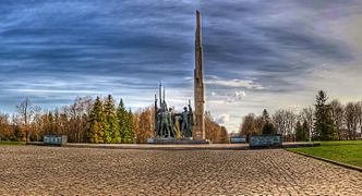 Arboretum
 Main square
 Old building
 Old town of Khmelnytsky
 Bank building
 Saint George Cathedral
 St. Andrew (Andriy Pervozvannyi) church
 Protection Cathedral in Khmelnytsky
 Monument to John Paul II
 Podil'ska St
 Proskurivska street
 Church of St. Anne in Khmelnytsky


See also
- List of cities in Ukraine
Notes
References
- Small biography on Oleksandr Symсhyshyn, Civil movement "Chesno" (in Ukrainian)
- "Хмельницкая громада" (in Russian). Портал об'єднаних громад України.
- Чисельність наявного населення України на 1 січня 2021 [Number of Present Population of Ukraine, as of January 1, 2021] (PDF) (in Ukrainian and English). Kyiv: State Statistics Service of Ukraine.
- ЮНЕСКО", Опубліковано Євроклуб "Кур'єри. "Волонтерська турбота про духовні скарби Хмельниччини: Участь європейського клубу "Кур'єри ЮНЕСКО" гімназії №2 м. Хмельницького зі статусом "Асоційована школа ЮНЕСКО" у проекті "Волонтерська турбота про духовні скарби Хмельниччини"". Retrieved 2016-05-03.
- Mykhailovskyi, Vitalii (2004), "Source References about Proskuriv in the 15th Century", in Pavlo Sokhanʹ (ed.), Ukrainian Archeographic Yearbook, new series (in Ukrainian), Kyiv, New York City: Institute of Ukrainian Archeography, pp. 771–2, Wikidata Q12164093
- http://i.piccy.info/i9/50c7ec080439bb1790d77fec4b180a08/1437042927/139143/831035/The_Eyalet_of_Kamanice.jpg Map of Podolia Eyalet
- "За п'ятнадцять років Хмельницький постаршав на 63 роки - vsim.ua". Новини Хмельницького за сьогодні (in Ukrainian). 2006-03-12. Retrieved 2021-06-30.
{{cite web}}: CS1 maint: url-status (link) - David B. Green (15 February 2016). "1919: Cossacks Start Pogrom in Ukraine, Killing Jews but Sparing Property". Haaretz. This Day in Jewish History. Tel Aviv. Retrieved 31 January 2021.
- (in Ukrainian) Proskurivsky pogrom. Petliura's fault? by Henry Abramson, Ukrayinska Pravda (25 February 2019)
- Husson, Edouard (11 November 2008). "L'Ukraine et le début de la " solution finale de la question juive en Europe " - Le meurtre des Juifs d'Ukraine par les nazis et leurs collaborateurs - Introduction historique". Centre Européen de Recherche et d'Enseignement sur la Shoah à l'Est. Archived from the original on 13 February 2015. Retrieved 13 February 2015.
- "До 70-річчя останнього розстрілу в'язнів проскурівського гетто". biznes.km.ua. 30 November 2012. Retrieved 13 February 2015.
- Feskov, V.I.; Kalashnikov, K.A.; Golikov, V.I. (2004). The Soviet Army in the Years of the Cold War 1945–91. Tomsk: Tomsk University Publishing House. p. 133. ISBN 5-7511-1819-7.
- "Про утворення та ліквідацію районів. Постанова Верховної Ради України № 807-ІХ". Голос України (in Ukrainian). 2020-07-18. Retrieved 2020-10-03.
- "Нові райони: карти + склад" (in Ukrainian). Міністерство розвитку громад та територій України.
- "Новини Хмельницького "Є"". 10 October 2022.
- "World Meteorological Organization Climate Normals for 1981–2010". World Meteorological Organization. Archived from the original on 17 July 2021. Retrieved 17 July 2021.
- "Khmelnytskyi, Ukraine Climate Data". Climatebase. Retrieved November 25, 2013.
- "Public Opinion Survey of Residents of UkraineJune 9 – July 7, 2017" (PDF). iri.org. August 2017. p. 83. Archived from the original (PDF) on August 22, 2017.
- "Higher education institutions raiting (Khmelnytskyi)". Retrieved 2017-02-05.
- "List of higher education institutions in Khmelnytskyi". Retrieved 2017-02-05.
- (in Ukrainian) Chernivtsi decided to terminate the relationship with twin two Russian cities, The Ukrainian Week (February 27, 2016)
External links
 Khmelnytskyi travel guide from Wikivoyage
- khmelnytsky.com Archived 2018-03-29 at the Wayback Machine - Khmelnytskyi City Rada website
- Photos of Khmelnytskyi
- Khmelnytskyi Sights and Streets
- The murder of the Jews of Khmelnytskyi during World War II, at Yad Vashem website.
- . Encyclopædia Britannica. Vol. 22 (11th ed.). 1911. p. 457.
- Khmelnytskyy, Ukraine at JewishGen
Administrative center: Khmelnytskyi, Ukraine | ||
| Raions | ||
| Hromadas | ||
| Cities | ||
| Urban-type settlements |
| |
Capital: Kyiv | |
| Oblasts | |
| Cities with special status | |
| Autonomous republic |
|
| Administrative centers |
|
1Claimed and controlled by Russia as the Republic of Crimea and the Federal City of Sevastopol 2Partly under military occupation and controlled by Russia | |
Authority control | |
|---|---|
| General | |
| National libraries | |
| Other |
|
На других языках
[de] Chmelnyzkyj
Chmelnyzkyj (ukrainisch Хмельницький anhören?/i; russisch Хмельницкий .mw-parser-output .Latn{font-family:"Akzidenz Grotesk","Arial","Avant Garde Gothic","Calibri","Futura","Geneva","Gill Sans","Helvetica","Lucida Grande","Lucida Sans Unicode","Lucida Grande","Stone Sans","Tahoma","Trebuchet","Univers","Verdana"}Chmelnizki; ursprünglich Плоскиривцы / Ploskiriwzy; vom 18. Jahrhundert bis 1954 ukrainisch Проскурів / Proskuriw, russisch Proskurow, polnisch Płoskirów) ist die Hauptstadt der gleichnamigen Oblast in der Ukraine mit etwa 267.000 Einwohnern, Industriestadt, kultureller Mittelpunkt der Oblast mit Theater, Philharmonie, Hochschule und Fachschulen.- [en] Khmelnytskyi, Ukraine
[ru] Хмельницкий (город)
Хмельни́цкий (укр. Хмельни́цький; до 1795 года — Плоски́ров, до 1954 года — Проску́ров[4]) — город на западе Украины, административный центр Хмельницкой области, Хмельницкого района и Хмельницкой городской общины. Промышленный, торговый и культурный центр Подолья. Расположен на реке Южный Буг.Другой контент может иметь иную лицензию. Перед использованием материалов сайта WikiSort.org внимательно изучите правила лицензирования конкретных элементов наполнения сайта.
WikiSort.org - проект по пересортировке и дополнению контента Википедии