world.wikisort.org - Russia
Yevpatoria (Ukrainian: Євпаторія, romanized: Yevpatoriia; Russian: Евпатория, romanized: Yevpatoriya; Crimean Tatar: Kezlev, Кезлев, Greek: Ευπατορία) is a city of regional significance in Western Crimea, north of Kalamita Bay. Yevpatoria serves as the administrative center of Yevpatoria Municipality, one of the districts (raions) into which Crimea is divided. It had a population of 105,719 (2014 Census).[1]
This article may be expanded with text translated from the corresponding article in Ukrainian. (July 2022) Click [show] for important translation instructions.
|
Yevpatoria
| |
|---|---|
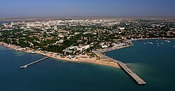 Yevpatoria panorama | |
 Flag  Coat of arms | |
 Yevpatoria Location of Yevpatoria within Crimea  Yevpatoria Yevpatoria (Ukraine) | |
| Coordinates: 45°11′38″N 33°22′5″E | |
| Country | Disputed:
|
| Region | Crimea |
| Area | |
| • Total | 120 km2 (50 sq mi) |
| Elevation | 10 m (30 ft) |
| Population (2014) | 105,719 |
| • Density | 1,618.37/km2 (4,191.6/sq mi) |
| Time zone | UTC+3 (MSK) |
| Postal code | 97400 — 97490 |
| Area code | +7-36569 |
| Climate | Cfa |
| Website | my-evp |
History
Greek settlement
The first recorded settlement in the area, called Kerkinitis (Κερκινίτις), was built by Greek colonists around 500 BCE. Along with the rest of the Crimea, Kerkinitis formed part of the dominions of King Mithridates VI Eupator (r. 120–63 BCE), from whose nickname, Eupator "of noble father" the city's modern name derives.
Khanate period
From roughly the 7th through the 10th centuries, Yevpatoria was a Khazar settlement; its name in Khazar language was probably Güzliev (literally "beautiful house").[2] It was later subject to the Cumans (Kipchaks), the Mongols and the Crimean Khanate. During this period the city was called Kezlev by Crimean Tatars and Gözleve by Ottoman Turks. The Russian medieval name Kozlov is a Russification of the Crimean Tatar name. For a short period between 1478 and 1485, the city was administrated by the Ottoman Empire. Afterwards, it became an important urban center of the Crimean Khanate.
The 400-year-old Juma-Jami Mosque is one of the many designed by the Ottoman architect Mimar Sinan. It was built from 1552 until 1564. 35-metre minarets rose on the flanks of the building. The mosque was of great state significance. It was here that a ceremony of the declaration of rights of the Crimean Khans was held at their enthronement. Only after that they went to their capital, the city of Bakhchysarai.

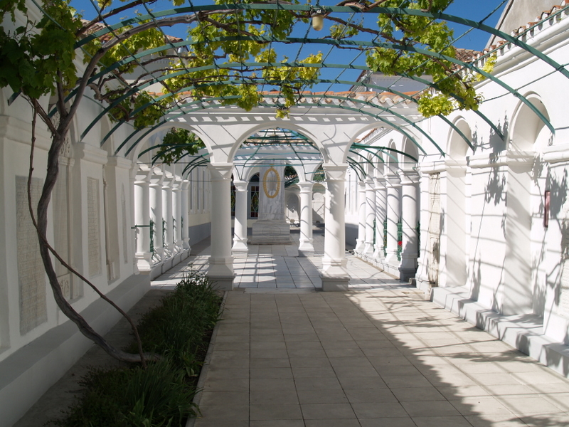
Yevpatoria became a residence of the spiritual ruler of the Crimean Karaites, the Ḥakham. In this connection here, a complex of two praying houses was built under the supervision of the Rabovich brothers, in which forms of the Renaissance and Muslim architecture entwined in a most unusual manner. The ensemble organically incorporates three courtyards. The entrance to it is marked by the gates, built in 1900, which look like a refined triumphal arch.
Russian rule

In 1783, along with the rest of the Crimea, Kezlev was captured by the Russian Empire. Its name was officially changed to Yevpatoriya in 1784. This spelling of the city name came to the French, German, Spanish and English languages at the end of the 18th сentury.
Polish poet Adam Mickiewicz visited the town in 1825 and wrote one of his Crimean Sonnets here; it was later translated into Russian by Mikhail Lermontov.
The city was occupied in September 1854 by British, French and Turkish troops during the Crimean War prior to the Allied landing in Kalamita Bay, after which the Battle of the Alma south of the bay followed. It became a garrison of Ottoman troops later during the war and was the site of the Battle of Eupatoria in February 1855, which was the largest military clash in the Crimean theatre outside the Sevastopol area.
Since 1930s

In 1930s it was a question about the medical profile resort of Yevpatoria. Natural factors create excellent conditions for the treatment of osteo-articular tuberculosis and other children's diseases. In 1933, at a scientific conference in Yalta, it was agreed that among the Soviet resort towns Yevpatoria, Odessa, Anapa, or one of the South Coast of Crimea - the most suitable for the organization of children's resort is Yevpatoria. In Yevpatoria there is a perfect combination of climatic and balneological factors contributing to the healing of the most serious diseases of this time like tuberculosis [citation needed]. An additional positive factor is the lack of mosquitoes in Yevpatoria, as on the southern coast of Crimea, or mosquitoes as in Anapa.
In 1936, the government decided to determine the place of construction of the All-Union children's resort in Yevpatoria. In 1938, the approved plan of general reconstruction of the city. During World War II, sanatoriums were used as military hospitals. By July 1, 1945 in Yevpatoria operated 14 sanatoriums, have taken 2,885 people. By 1980s, in city operated 78 sanatoriums for 33 thousand people. About one million vacationers visited Yevpatoria in summer time without the purpose of treatment.
Today Yevpatoria is a major Black Sea port, a rail hub, and resort town. The population swells greatly during the summer months, with many residents of northern cities visiting for beach recreation. As such, local residents are heavily employed during summer months but are often underemployed during the winter. The main industries include fishing, food processing, wine making, limestone quarrying, weaving, and the manufacture of building materials, machinery, furniture manufacturing and tourism.
Yevpatoria has spas of mineral water, salt and mud lakes. These resorts belong to a vast area with curative facilities where the main health-improving factors are the sunshine and sea, air and sand, brine and mud of the salt lakes, as well as the mineral water of the hot springs. The population of the town is sure to have known about the curative qualities of the local mud that can be found here from time immemorial, which is witnessed by the manuscripts of Pliny the Elder, a Roman scholar (ca. 80 BC).
On December 24, 2008 a blast destroyed a five-story building in the town. 27 people were killed. President of Ukraine Viktor Yushchenko declared December 26 to be a day of national mourning.[3][4][5][6][7]
Two beaches in Yevpatoria have been Blue Flag beaches since May 2010, these were the first beaches (with two beaches in Yalta) to be awarded a Blue Flag in a CIS member state.[8]
In 2014 due to the military operation of Russian Armed forces, the city of Yevpatoria was annexed by the Russia with the entire Crimean peninsula. The UN General Assembly condemned Russian operation and considered annexation the temporary occupation of part of the territory of Ukraine—the Autonomous Republic of Crimea and the City of Sevastopol.[9]
Economy and Industry

- Industry, Engineering
- Agriculture
- AO Vympel NPO (MicroElectronics and Electronics, circuits microchips IC, Electrical parts, connectors, optoelectronics television and other devices and machinery, metallurgy engineering technology)
- Eupatoria Aircraft Plant and Repair EupAZ EARZ (An, Mi, Ka, Su, MiG, Yak, Il, Be, Tu; An-22, Su-25, MiG-31, Yak-38, Be-12, transport aircraft and amphibious)
- Construction, Building
Education
- Institute of Social Sciences (Branch), Crimean Federal University
Demographics
Ethnic composition of Yevpatoria in 2001 according to the Ukrainian census:
- Russians: 64,9%
- Ukrainians: 23,3%
- Crimean Tatars: 6,9%
- Belarusians: 1,5%
- Armenians: 0,5%
- Jews: 0,4%
- Tatars (excluding Crimean Tatars): 0,2%
- Poles: 0,2%
- Moldovans: 0,2%
- Azerbaijanis: 0,2%
Climate
Yevpatoria has a humid subtropical climate (Cfa) under the Köppen climate classification with cool winters and warm to hot summers.
| Climate data for Yevpatoria (1981–2010) | |||||||||||||
|---|---|---|---|---|---|---|---|---|---|---|---|---|---|
| Month | Jan | Feb | Mar | Apr | May | Jun | Jul | Aug | Sep | Oct | Nov | Dec | Year |
| Average high °C (°F) | 4.4 (39.9) |
4.9 (40.8) |
8.3 (46.9) |
14.6 (58.3) |
20.7 (69.3) |
25.7 (78.3) |
28.9 (84.0) |
28.8 (83.8) |
23.1 (73.6) |
16.9 (62.4) |
10.5 (50.9) |
6.1 (43.0) |
16.1 (61.0) |
| Daily mean °C (°F) | 1.5 (34.7) |
1.6 (34.9) |
4.6 (40.3) |
10.3 (50.5) |
15.9 (60.6) |
21.0 (69.8) |
23.9 (75.0) |
23.6 (74.5) |
18.4 (65.1) |
12.7 (54.9) |
7.0 (44.6) |
3.2 (37.8) |
12.0 (53.6) |
| Average low °C (°F) | −1.1 (30.0) |
−1.3 (29.7) |
1.7 (35.1) |
6.8 (44.2) |
12.0 (53.6) |
17.0 (62.6) |
19.5 (67.1) |
19.0 (66.2) |
14.2 (57.6) |
9.0 (48.2) |
4.1 (39.4) |
0.6 (33.1) |
8.5 (47.3) |
| Average precipitation mm (inches) | 30.5 (1.20) |
31.1 (1.22) |
28.9 (1.14) |
29.3 (1.15) |
25.1 (0.99) |
39.7 (1.56) |
31.1 (1.22) |
41.4 (1.63) |
46.4 (1.83) |
33.6 (1.32) |
38.8 (1.53) |
37.5 (1.48) |
413.4 (16.28) |
| Average precipitation days (≥ 1.0 mm) | 6.5 | 6.3 | 6.4 | 4.7 | 5.0 | 5.2 | 3.5 | 4.1 | 5.2 | 4.8 | 6.7 | 6.6 | 65.0 |
| Average relative humidity (%) | 83.4 | 80.8 | 78.2 | 74.1 | 71.8 | 70.2 | 64.8 | 63.9 | 70.2 | 76.8 | 81.9 | 83.3 | 75.0 |
| Source: World Meteorological Organization[10] | |||||||||||||
Area attractions
Famous attractions within or near Yevpatoria are:
- Juma-Jami Mosque
- Eupatorian Kenassas
- St. Nicholas' the Miracle Worker Cathedral
- Tekie Dervishes
Famous people from Yevpatoria
- Lyudmila Alexeyeva — Soviet and Russian human rights activist
- Simeon Ezravic Douvan — City Mayor and Duma Deputy 1905-1919[11]
- Maria Gorokhovskaya — Russian-born Soviet gymnast
- Nikolaos Himonas (Nikolai Khimona) - painter of Greek descent
- Zula Pogorzelska — Polish cabaret and film actress
- Kseniya Simonova — Ukrainian sand animator and YouTube sensation
- Sergei Sokolov — Russian-born Soviet Marshal
- Ruslana Taran — Ukrainian sailor
- Vitya Vronsky — pianist
Names of asteroid number 6489 and number 24648
Asteroid number 6489 has a name Golevka, which has a complicated origin. In 1995, Golevka was studied simultaneously by three radar observatories across the world: Goldstone in California, Eupatoria RT-70 radio telescope (Yevpatoriya is sometimes romanized as Evpatoria or Eupatoria (Russian origin)) and Kashima in Japan. 'Gol-Ev-Ka' comes from the first few letters of each observatory's name; it was proposed by the discoverer following a suggestion by Alexander L. Zaitsev.
Asteroid 24648 Evpatoria was discovered 1985 Sept. 19 by Nikolai Chernykh and Lyudmila Chernykh at the Crimean Astrophysical Observatory, and named in honor of Evpatoria (transliteration from Russian to English, thus Yevpatoriya). The minor planet marked the occasion of the 2500th anniversary of the town in 2003.[12]
Twin towns – sister cities
| Arms | City | Nation | Since |
|---|---|---|---|
| Ioannina | 1989 | ||
| Figueira da Foz | 1989 | ||
| Ludwigsburg | 1992 | ||
| Zakynthos | 2002 | ||
| Ostrowiec Świętokrzyski | 2004 | ||
| Krasnogorsky District | 2006 | ||
| Lambie | 2009 | ||
| Belgorod | 2010 |
Gallery
 Hydro-massage on Lake Moynaki
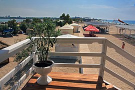 Lake Moinaki left, right Black Sea
 Odun-Bazar-Kapusu - reconstructed tower of the medieval Kezlev
 The Juma-Jami Mosque designed in 1552 by Mimar Sinan
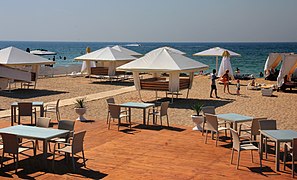 Vacation on the Black Sea coast in Yevpatoria
 The port of Yevpatoria
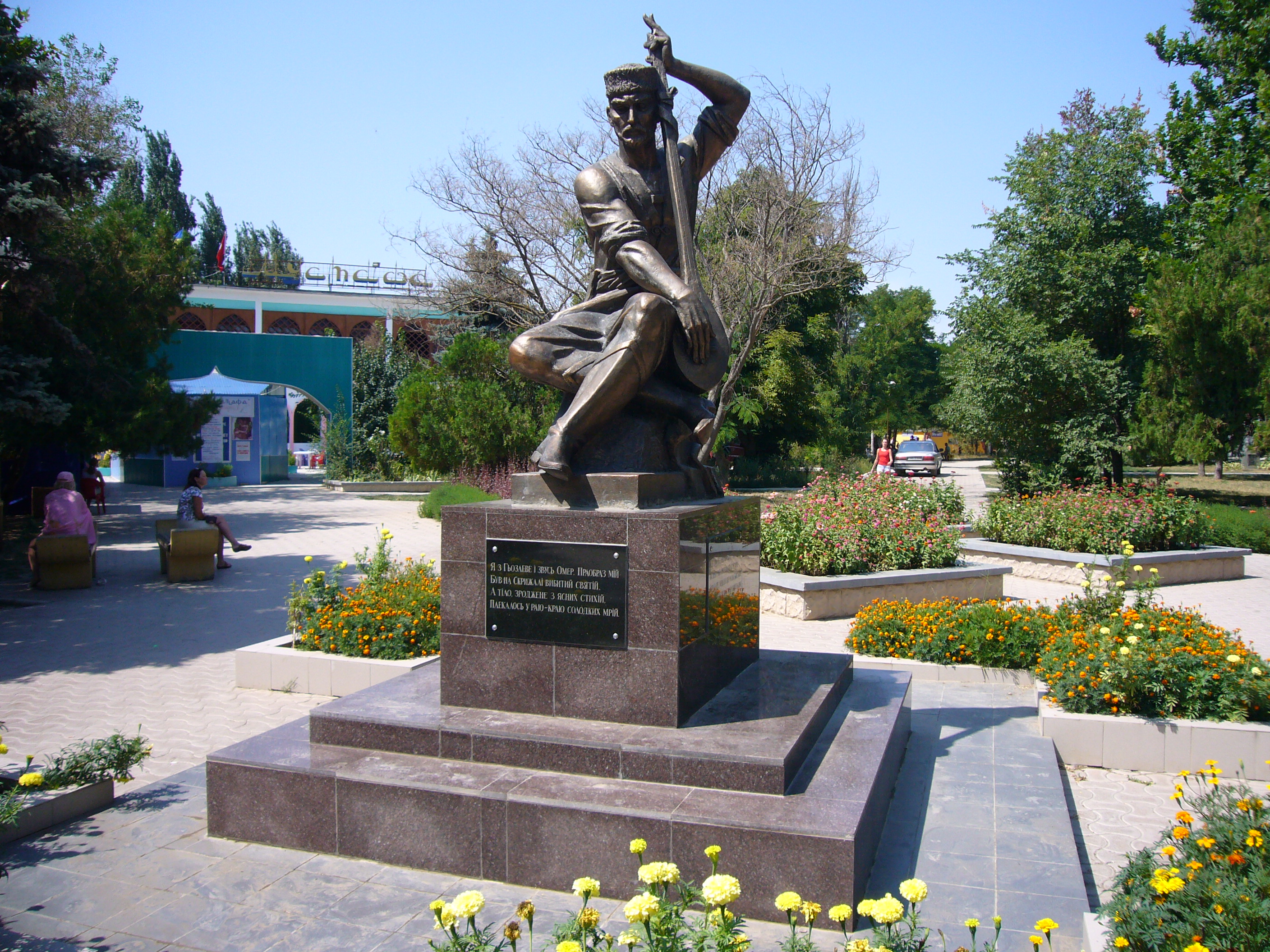
 Monument to Crimean Tatar poet Omer Gezlevi
 Golden beach of the Black Sea coast
 Holiday by Lake Moinaki
 Healing Lake Moinaki
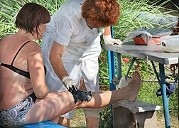 Therapeutic mud
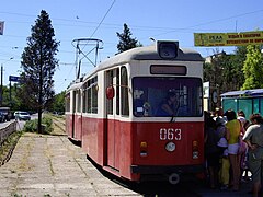 Tramway


See also
- Battle of Eupatoria
- Yevpatoria assault
- The Evpatoria Report
References
- Russian Federal State Statistics Service (2014). "Таблица 1.3. Численность населения Крымского федерального округа, городских округов, муниципальных районов, городских и сельских поселений" [Table 1.3. Population of Crimean Federal District, Its Urban Okrugs, Municipal Districts, Urban and Rural Settlements]. Федеральное статистическое наблюдение «Перепись населения в Крымском федеральном округе». ("Population Census in Crimean Federal District" Federal Statistical Examination) (in Russian). Federal State Statistics Service. Retrieved 4 January 2016.
- Brutzkus, Julius (1944). "The Khazar Origin of Ancient Kiev", Slavonic and East European Review, p. 118
- UPDATE: 26 Killed, 5 Hospitalized After Crimea House Blast[permanent dead link], Ukrainian News Agency (December 26, 2008)
- Death toll of Crimean blast reaches 27, says Emergencies Ministry Archived 2008-12-29 at the Wayback Machine, Interfax-Ukraine (December 26, 2008)
- Friday Declared Mourning Day In Ukraine For Victims Of Yevpatoriya Gas Explosion Archived 2012-09-13 at archive.today, Ukrainian News Agency (December 26, 2008)
- Ukraine mourns Crimea blast dead, BBC News (December 26, 2008)
- 27 dead after Ukrainian apartment blast, CNN (December 26, 2008)
- Four beaches in Crimea receive international certificates of cleanliness, Kyiv Post (May 12, 2010)
- "A/RES/71/205 – E – A/RES/71/205". undocs.org.
- "World Meteorological Organization Climate Normals for 1981–2010". World Meteorological Organization. Archived from the original on 17 July 2021. Retrieved 17 July 2021.
- fr:Sémion Ezrovitch Douvan
- JPL Small-Body Database, NASA
External links
- http://evpatoriya-history.info/
- https://evp.rk.gov.ru/ru/index
- Yevpatoriya Photo gallery Archived 2010-04-13 at the Wayback Machine - (in Russian)
- The murder of the Jews of Yevpatoria during World War II, at Yad Vashem website.
- https://www.bloomberg.com/news/articles/2015-12-07/biden-says-illegal-russian-occupation-of-crimea-must-end
- http://www.kalamit.info/ Archived 21 March 2015 at the Wayback Machine
Administrative center: Yevpatoria | ||
| Cities |  | |
| Settlements |
| |
Capital: Simferopol | |||||
| Raions |
| ||||
| Municipalities |
| ||||
| Cities |
| ||||
| |||||
Ancient Greece | |||||||||||||||||||||||||
|---|---|---|---|---|---|---|---|---|---|---|---|---|---|---|---|---|---|---|---|---|---|---|---|---|---|
| |||||||||||||||||||||||||
| |||||||||||||||||||||||||
| |||||||||||||||||||||||||
| |||||||||||||||||||||||||
| |||||||||||||||||||||||||
| |||||||||||||||||||||||||
| |||||||||||||||||||||||||
| |||||||||||||||||||||||||

Authority control | |
|---|---|
| General |
|
| National libraries | |
На других языках
[de] Jewpatorija
Jewpatorija oder auch Eupatoria[1] (ukrainisch Євпаторія; russisch Евпатория, krimtatarisch Kezlev, altgriechisch Κερκινίτις .mw-parser-output .Latn{font-family:"Akzidenz Grotesk","Arial","Avant Garde Gothic","Calibri","Futura","Geneva","Gill Sans","Helvetica","Lucida Grande","Lucida Sans Unicode","Lucida Grande","Stone Sans","Tahoma","Trebuchet","Univers","Verdana"}Kerkinitis, armenisch Եվպատորիա) ist eine Küstenstadt in der Autonomen Republik Krim mit etwa 120.000 Einwohnern.[2]- [en] Yevpatoria
[ru] Евпатория
Евпато́рия (ранее также Керкинити́да, Гезлёв, Гёзлев, Гёзлёв[6][7]; укр. Євпаторія, крымскотат. Kezlev, Кезлев) — город-курорт на западе Крыма. Административный центр городского округа Евпатория Республики Крым[2] (Евпаторийского горсовета Автономной Республики Крым[3]).Другой контент может иметь иную лицензию. Перед использованием материалов сайта WikiSort.org внимательно изучите правила лицензирования конкретных элементов наполнения сайта.
WikiSort.org - проект по пересортировке и дополнению контента Википедии