world.wikisort.org - Spain
Perales de Tajuña is a town and municipality of Spain located in the Community of Madrid. It is about 40 km to the southeast of Madrid in the area known as the Comarca de Las Vegas. The municipality covers 48.92 km,2 and it has a population of 2,738 inhabitants and a population density of 55.97 inhabitants/km2. To the north it borders with Arganda del Rey and Campo Real, to the east with Tielmes, to the south with Villarejo de Salvanés, and to the west with Morata de Tajuña and Valdelaguna.
This article needs additional citations for verification. (May 2009) |
Perales de Tajuña | |
|---|---|
Municipality | |
 | |
 Flag  Coat of arms | |
 Perales de Tajuña 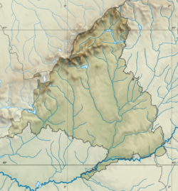 Perales de Tajuña | |
| Coordinates: 40°14′N 3°21′W | |
| Country | Spain |
| Region | Community of Madrid |
| Government | |
| • Mayor | Yolanda Cuenca Redondo (Since 2012) (PP) |
| Area | |
| • Total | 48.92 km2 (18.89 sq mi) |
| Elevation | 595 m (1,952 ft) |
| Population (2018)[1] | |
| • Total | 2,831 |
| • Density | 58/km2 (150/sq mi) |
| Demonym(s) | Peraleño,-a |
| Province code | 28 |
| Website | www |
Demographics
| Year | Pop. | ±% |
|---|---|---|
| 1991 | 1,961 | — |
| 1996 | 1,991 | +1.5% |
| 2001 | 2,089 | +4.9% |
| 2004 | 2,358 | +12.9% |
| 2008 | 2,738 | +16.1% |
Education
In Perales de Tajuña there is one public nursery school and one infant and primary school, also public.
Architecture
Religious
- Parish church of Our Lady of the Castle
- Hermitage of San Isidro
Historical
- Town Hall
- Remains of watchtown and walls
- Ruins of Hermitage of San Sebastián
- Ruins of old hermitage of San Isidro
- Telegraph Tower-Fortress
Nature
- Risco de las Cuevas (Cliff caves)
- Prado de Arriba (Top field)
Fountains
- Mariblanca fountain
- Round fountain
- Barracks fountain
- Lagasca fountain
- Butrera fountain
Festivities
- San Blas, third of February
- Our Lady of the Castle, first Sunday of May
- San Isidro, fifteenth of May
- Town festival, month of August
Communications
Perales de Tajuña is well connected by road to Madrid and all the surrounding towns.
- From Madrid: R-3 (toll motorway) or A-3 (dual carriageway); Exits 33A, 35 or 41
- From Arganda del Rey: the old N-III
- From Campo Real: M-220
- From Morata de Tajuña: M-302
- From Tielmes, Carabaña, Orusco, Ambite: M-204
- From Valdelaguna: M-317
- From Villarejo de Salvanés: A-3, Exit 41
References
- Municipal Register of Spain 2018. National Statistics Institute.
External links
 Media related to Perales de Tajuña at Wikimedia Commons
- Official webpage of Perales de Tajuña Town Council in Spanish
- Madrid Region Statistical Office in Spanish
| Authority control |
|
|---|
This article about a location in the Community of Madrid, Spain is a stub. You can help Wikipedia by expanding it. |
На других языках
[de] Perales de Tajuña
Perales de Tajuña bezeichnet einen zentralspanischen Ort und eine Gemeinde (municipio) mit 2935 Einwohnern (Stand 1. Januar 2019) im Südosten der Autonomen Gemeinschaft Madrid. Die katholische Kirchengemeinde gehört zum Bistum Alcalá de Henares.- [en] Perales de Tajuña
[es] Perales de Tajuña
Perales de Tajuña es un municipio y localidad de España del sureste de la Comunidad de Madrid, en la comarca de Las Vegas. Tiene una superficie de 48,92 km² con una población de 2990 habitantes (INE, 2020) y una densidad de 55,97 hab/km².[ru] Пералес-де-Тахунья
Пералес-де-Тахунья (исп. Perales de Tajuña) — город и муниципалитет в Испании, входит в провинцию Мадрид в составе автономного сообщества Мадрид. Муниципалитет находится в составе района (комарки) Лас-Вегас. Занимает площадь 48,92 км². Население — 2894 человека (на 2010 год).Другой контент может иметь иную лицензию. Перед использованием материалов сайта WikiSort.org внимательно изучите правила лицензирования конкретных элементов наполнения сайта.
WikiSort.org - проект по пересортировке и дополнению контента Википедии