world.wikisort.org - Spain
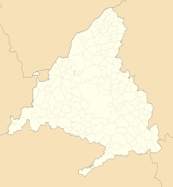
Torrelaguna (Spanish pronunciation: [torelaˈɣuna]) is a municipality in the Community of Madrid, Spain. It covers an area of 43.40 km2.[2] As of 2018[update], it has a population of 4,724.
This article may be expanded with text translated from the corresponding article in Spanish. (July 2009) Click [show] for important translation instructions.
|
Torrelaguna | |
|---|---|
Municipality | |
 | |
 Flag Seal | |
 | |
 Torrelaguna  Torrelaguna | |
| Coordinates: 40°49′34″N 3°32′20″W | |
| Country | Spain |
| Region | Community of Madrid |
| Government | |
| • Mayor | Miguel Santos Pérez |
| Area | |
| • Total | 43.4 km2 (16.8 sq mi) |
| Elevation | 744 m (2,441 ft) |
| Population (2018)[1] | |
| • Total | 4,724 |
| • Density | 110/km2 (280/sq mi) |
| Time zone | UTC+1 (CET) |
| • Summer (DST) | UTC+2 (CEST) |
| Postal code | 28180 |
History
This section is empty. You can help by adding to it. (April 2010) |
Public transport
Torrelaguna has three line buses. They are:
Line 197: Torrelaguna - Madrid (Plaza de Castilla)
Line 197D: Torrelaguna - El Vellón - El Molar
Line 913: Torrelaguna - El Atazar
Main sights

The parish church of La Magdalena (started in the 14th century, inaugurated in the 18th century) is one of the best examples of Gothic architecture in the community of Madrid.
Other sights include:
- Abbey of the Concepcionistas Descalzas. The chapel has a Plateresque façade from the 16th century, attributed to Juan Gil de Hontañón.
- Hermitage of Nuestra Señora de la Soledad (14th century).
- Ancient market place
- Palacio de Salinas, a Renaissance building.
- Town Hall (1515)
- Remains of the city walls.
Notable people
- Saint Isidore the Farmer, a pious agricultural laborer of the twelfth century prayed to for rain. He and his wife Maria were canonized in 1622.
- Francisco Jiménez de Cisneros (1436–1517), cardinal and statesman
References
- Municipal Register of Spain 2018. National Statistics Institute.
- "Municipios". Datos del Registro de Entidades Locales. Ministerio de Hacienda y Administraciones Públicas.
На других языках
[de] Torrelaguna
Torrelaguna ist eine Kleinstadt und eine Gemeinde (municipio) mit insgesamt 4.760 Einwohnern (Stand 1. Januar 2019) in der Autonomen Gemeinschaft Madrid im Zentrum Spaniens. Seit dem Jahr 1974 ist das historische Stadtzentrum als Nationales Kulturgut (Bien de Interés Cultural) in der Kategorie Conjunto histórico-artístico anerkannt.- [en] Torrelaguna
[es] Torrelaguna
Torrelaguna es un municipio y villa española de la Comunidad de Madrid. Cuenta con una población de 4897 habitantes (INE 2021).[ru] Торрелагуна
Торрелагуна (исп. Torrelaguna) — муниципалитет в Испании, входит в провинцию Мадрид в составе автономного сообщества Мадрид. Занимает площадь 16,83 км². Население — 4928 человек (на 2010 год). Расстояние до административного центра провинции — 58 км.Текст в блоке "Читать" взят с сайта "Википедия" и доступен по лицензии Creative Commons Attribution-ShareAlike; в отдельных случаях могут действовать дополнительные условия.
Другой контент может иметь иную лицензию. Перед использованием материалов сайта WikiSort.org внимательно изучите правила лицензирования конкретных элементов наполнения сайта.
Другой контент может иметь иную лицензию. Перед использованием материалов сайта WikiSort.org внимательно изучите правила лицензирования конкретных элементов наполнения сайта.
2019-2025
WikiSort.org - проект по пересортировке и дополнению контента Википедии
WikiSort.org - проект по пересортировке и дополнению контента Википедии